June 21, 2026

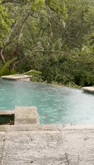
Good morning Bay Islands. Our photo of the day is raindrops in Megan Mitchell’s pool in Sandy Bay. Most of us across Roatan have received around a tenth of an inch of rain as of 7 a.m., but the big winner is Guanaja, where Lisa Garcia has received 1.36 inches, her first measurable rain in 62 DAYS! That is probably true for most of us.
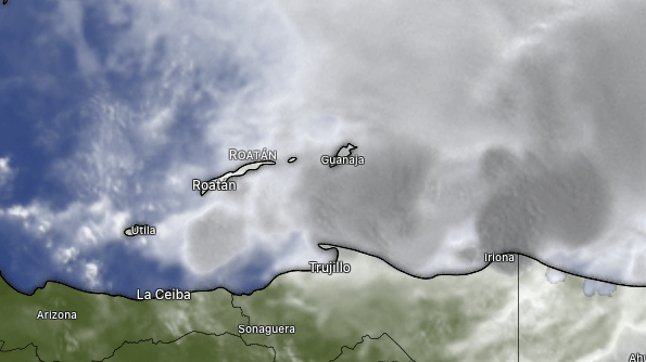
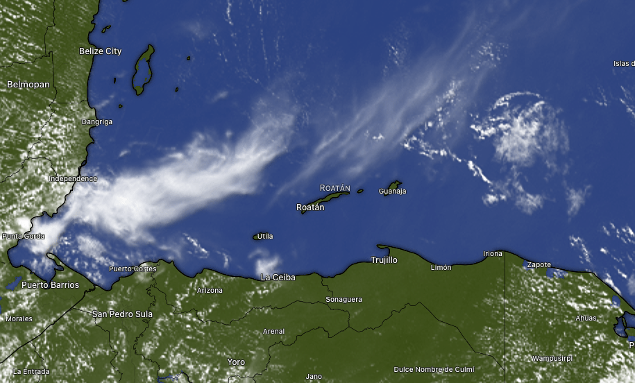
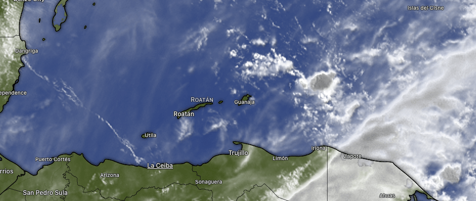
Here is our satellite at 7 a.m. and you can see why Guanaja got most of the rain. Unfortunately, Utila has hardly gotten any (I found one location that got .01 last night). As is typical, this rain should decrease through the morning and we should have partly cloudy skies by afternoon.

This is a forecast of moisture in the atmosphere. Right now we are getting a wave of moisture (red) that has spurred these showers. Tomorrow the atmosphere will have more yellow (drier air) so the rain chance is very low. Tuesday morning we have another wave so we have another chance of a morning shower. This isn’t a pattern change, so we will be more dry than wet going forward. We will continue to have strong east winds and seas 3-5 feet.

We are in the midst of World Cup season and however your team is doing (can you believe the US is 2-0?) get great meats for a cookout celebration at Carniceria Rosita when they reopen tomorrow.

Lowest tide is 9:15 a.m. Have a great Sunday!

BTW, welcome to the longest day of the year, with 13 hours and 6 minutes of sun.

June 19, 2026

Good morning Bay Islands. Our photo of the day comes from Erin Edney in Guanaja and shows a diver swimming with a nurse shark. I love horrifying North Americans by telling them how much I love swimming with the sharks. Most people don’t realize how calm most sharks are. They are truly great creations.
Our weather continues to be hot, dry and windy. That won’t change anytime soon, so I want to talk about the coral the shark is swimming over.

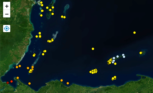
This is a map showing the heat warning status at buoys in the southwest Caribbean. You will notice in shallower waters toward the west, one location is in Level 1 heat stress, which indicates the likelihood of active coral bleaching, and other locations are in a warning state. We are in a heat watch on the west side and still OK on the east side, likely due to somewhat cooler ocean current to the east. Our surface temperatures are around 84F (28.7C). We are still a bit under our historic max temperature around 85 and bleaching begins around 89 degrees. It is still worrisome this early in the season. Late July and early August are key periods for coral bleaching and our best hope for avoiding it is a mild, but rainy, tropical storm to churn the water and cool things down.

Coral bleaching is a concern, but right now the coral is live and vibrant and Jolly Roger Roatan will take you to the most spectacular locations around the island.

Low tide is 7:30 p.m. Have a great Friday!

June 15, 2026

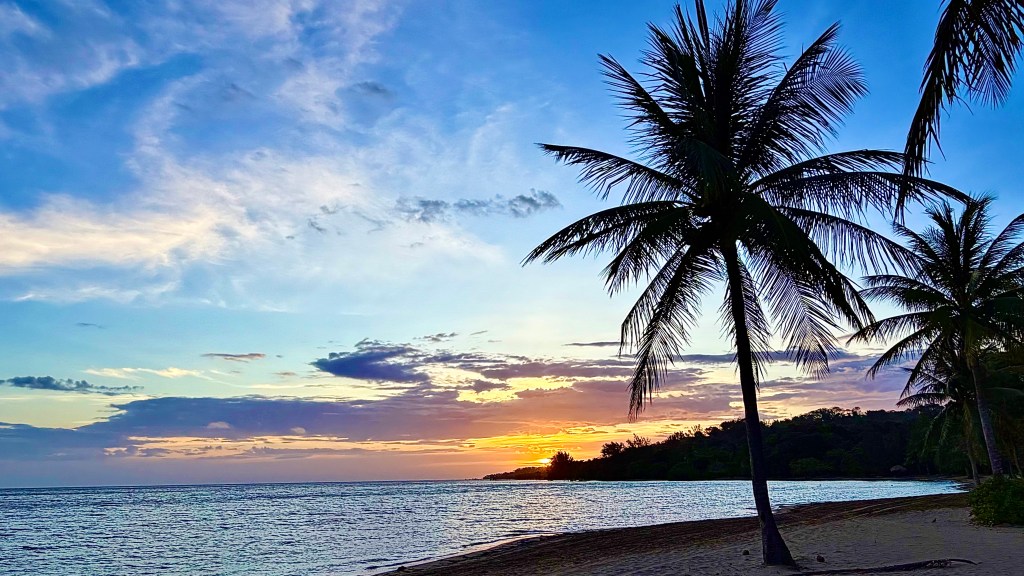
Good morning Bay Islands. Our photo of the day comes from Bob Jacobs in Palmetto Bay.
It’s been plenty hot. The high at the airport yesterday 91 (33C) with a heat index of 110 (43C). Over the next few days there isn’t any relief in sight, with mostly sunny skies and very little to no chance for rain. This time of year there is hope of a return of some squalls

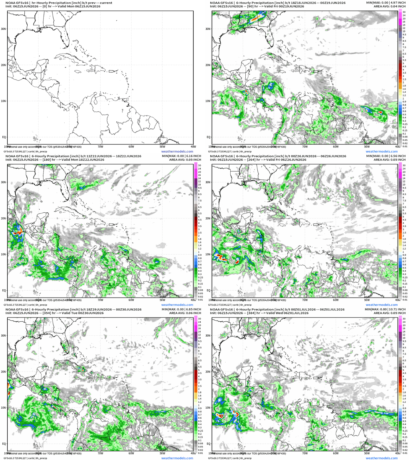
Here’s the US GFS forecast for the next two weeks. From now until about the 20th it keeps us dry. As we get toward the end of the month it’s trying to pull in more rain from the Caribbean, but I will warn that long range forecasts are not very reliable and there is nothing major that would change our weather pattern right now. The only thing cooling us off are our continuing strong easterly trade winds that also show no sign of calming.

I’ve received some inquiries about the cause of major floods in San Pedro Sula on June 12. Here is the satellite from that day, and you can indeed see a storm develop in the evening hours of that day. The highest rain reading I could find for that day was 2 inches (the airport south of the city reported no rain at all). But for the previous week, the city had been averaging about half an inch a day. We are in a low pressure system called the Central American Gyre that has been causing tropical storms on the Pacific side of Honduras and SPS has been picking up storms on the periphery. My guess is that those previous rains had cause drainage to be clogged with garbage and two, maybe three inches in places, was enough to cause severe flooding in areas of poor drainage.

Roatan Radio is now available on Amazon!
A wild Caribbean story of music, mayhem, island life, and the unforgettable characters who helped shape a one-of-a-kind radio station. This is the story of the station’s evolution — from its birth on Roatan to the voice you hear today as 101.1 Blue Wave Radio. Funny, chaotic, heartfelt, and full of tropical adventure.

Scan the QR code to order your copy on Amazon.

It’s new moon and low tides will be much lower than normal around 3 p.m. Have a great week!

June 11, 2026

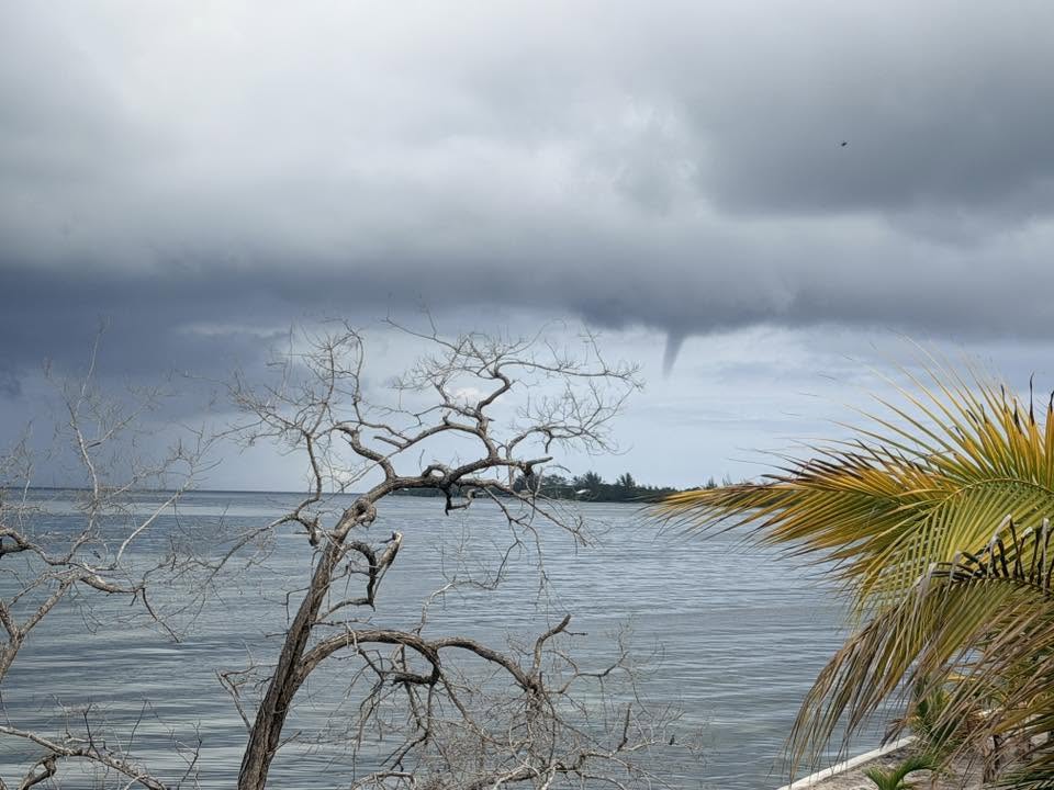
Good morning Bay Islands. Our photo of the day comes from Travis Flowers who caught a small water spout forming west of Utila. Utila finally got a shower yesterday evening, good for a quarter of an inch. West Bay got a measly .01. Utila is being teased by rain to the west again.

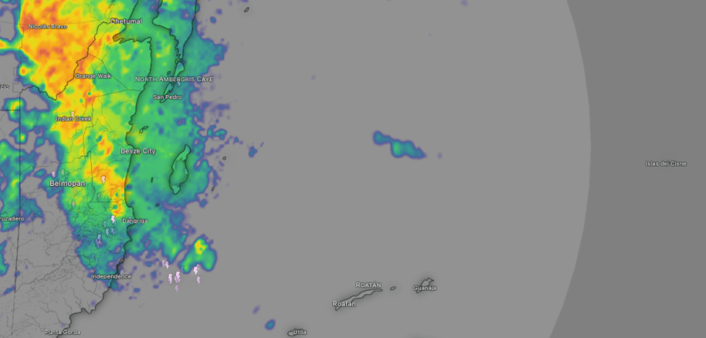
Look at all that rain over Belize. That is the moisture that gave us a chance of showers the last 24 hours, but it decided to be west of us, and that is probably where it will stay. We will stay partly cloudy, windy and wavy. We will again have a chance of an evening shower and again a morning shower tomorrow, but chances will remain low. The trend is also drier as we move into the weekend, with clearer skies and less rain chances.

World Cup season is upon us. Get your fresh cookout meats at Carniceria Rosita in French Harbour and Coxen Hole!

Low tide is 11:40 a.m. Have a great Thursday!

June 8, 2026

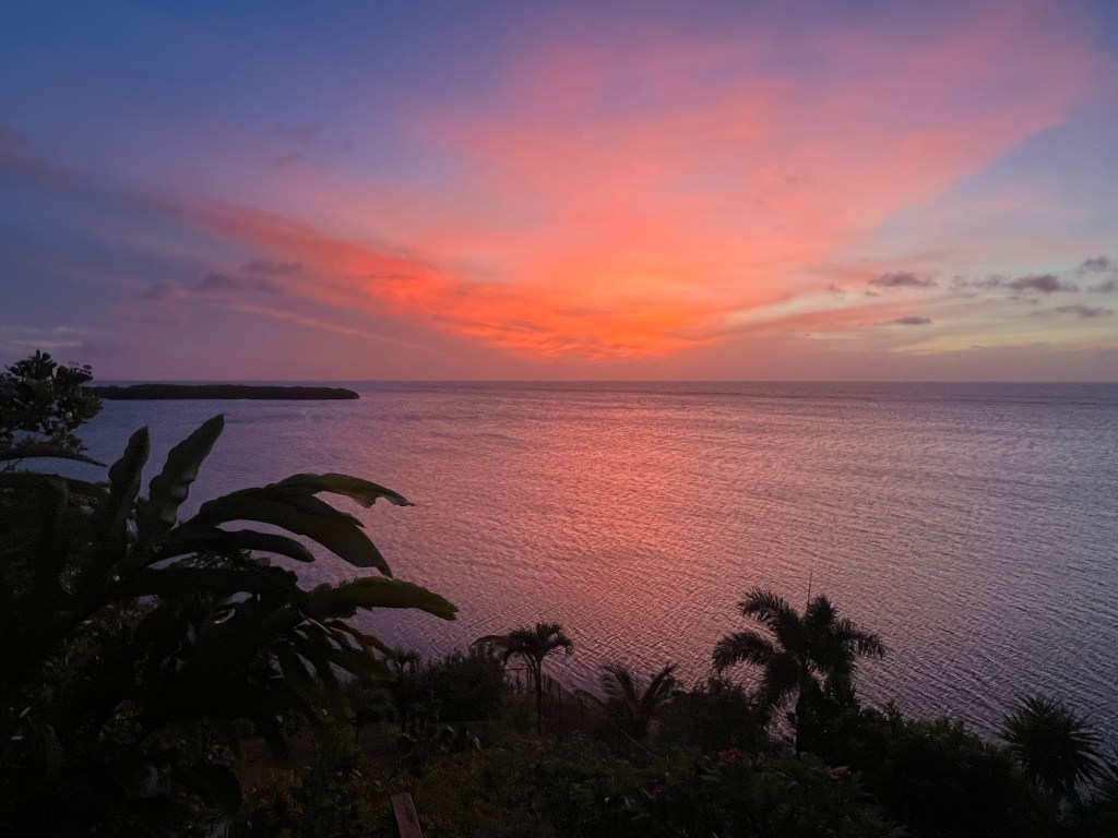
Good morning Bay Islands. Our photo of the day comes from Chris Avron in Politilly.

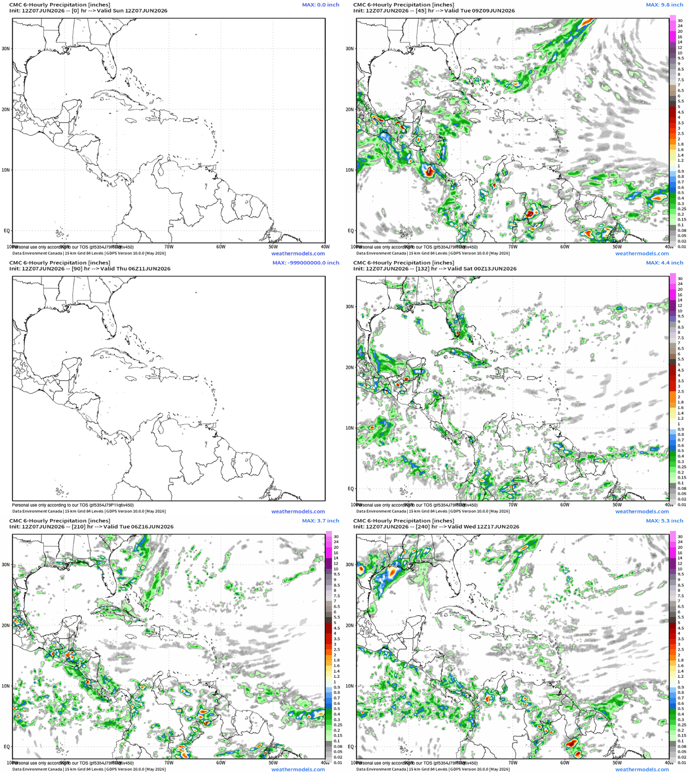
We are going to have an interesting week ahead in our forecast. We will have more moisture coming in from the Caribbean, but as we have learned, that is no guarantee of rain.

This is the forecast from the Canadian weather model. You can see there is rain around us during the week ahead, but not necessarily over us. Rain chances will be low this week, but there is a chance we get a shower sometime this week. It will be hard to predict when. We were also hoping that more rain would calm our winds a bit, but right now that doesn’t look like it’s happening. Strong east winds and seas 3-5 feet are in the forecast for the week.

Explore Roatan real estate with the island’s top experts at Roatan Life Real Estate. Serving clients since 2001, we offer personalized guidance in buying and selling properties. Trust our dedicated team for unparalleled local knowledge. Start your journey at www.roatanlife.com


A mild low tide will be at 9:20 a.m. Have a great week!

Rainfall for April and May 2026

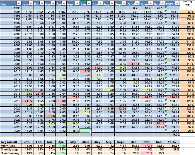
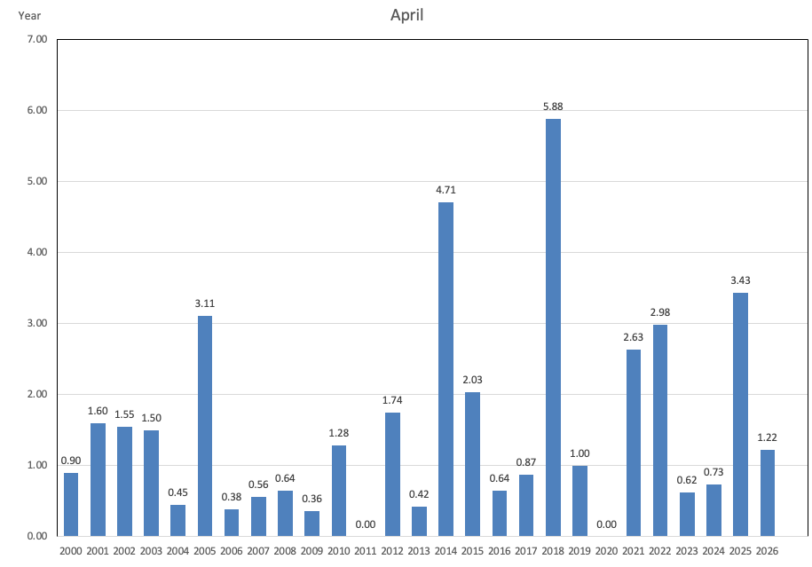
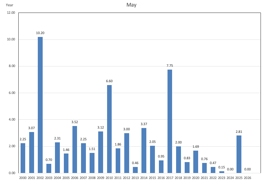
My apologies for failing to get up April 2026 rainfall. We recorded 1.22 inches, about average for the month. Rainfall was clustered in early April and again in mid-April. Rainfall for May was — not surprisingly — zero. A few locations recorded .01 or .02, but no one got significant rainfall. It was our first completely dry month in exactly two years.

Here’s the April trend line and we were very average for April, though we have had a few outlier wet Aprils.


May is our driest month of the year, though last year we had an unusually wet month with almost 3 inches.


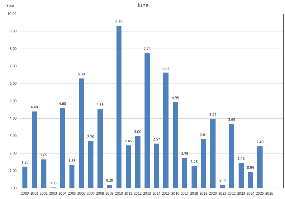
Typically in June we start to see a few squalls, though we have had a few months with less than half an inch for the month. We are starting out quite dry and very unfortunate, with rain in the vicinity but no rain on our islands. The long range forecast looks mostly dry, though there is activity, especially on the Pacific side of Honduras. Let’s home we get wet at some point.


June 3, 2026

Good morning Bay Islands. At 9 a.m. we likely don’t have rain anywhere in the southern Caribbean, only some high clouds that aren’t going to keep our temperature away from 90 (32C). We will continue to have strong east winds and seas around 4 feet Southside.

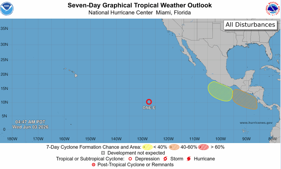
Here’s the NOAA NWS National Hurricane Center outlook for the next week in the eastern Pacific. You will notice a 40 to 60 percent chance of a tropical cyclone forming off the southern coast of mainland Honduras. This is where storms often form this time of year and bring rain to the Pacific Coast, not our coast.


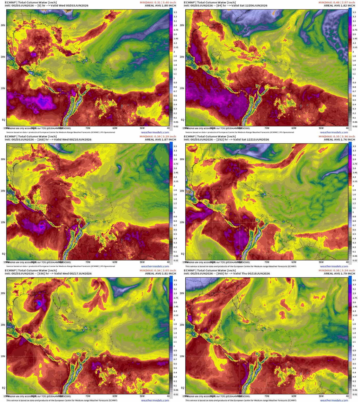
Here is the Euro forecast for moisture in the upper atmosphere. Currently we are in the dry yellow, and over the next few day we will get into the even dryer greens, so very little chance of rain this week. As we get into next week we will see an increase in moisture and better chances of June squalls. You will also note that at the end of this loop, something that looks like a tropical cyclone forms in the Gulf that lies between the US and Mexico. This is another area that often gets June tropical development. Right now, nothing in the short- or long-range forecast threatening our islands, but we’ll keep an eye on it. Have a great Wednesday!


May 31, 2026

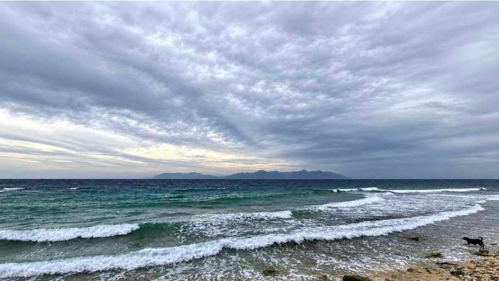
Good morning Bay Islands. Our photo of the day comes from Brad Ryon in Utila. Our surf on the Southside is back to 3 feet after a couple of days of a bit calmer winds. We start the day with east winds 15 mph and seas 3 feet. We will stay right around there today, with winds tonight around 20 mph and seas 4 feet. That cycle will continue for the next few days.

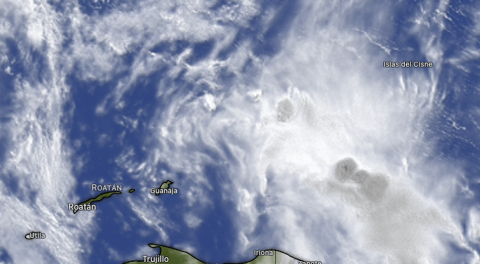
Like most mornings recently, there is rain on the satellite. This time it is well to our east and won’t make it here. We should remain partly cloudy and in the days ahead we will keep very small morning rain chances.

We aren’t too far away from World Cup season. Time to start planning your cookouts with Carniceria Rosita‘s fresh meats!

Low tide is 2:40 p.m. Have a great Sunday!


May 27, 2026

Good morning Bay Islands. at 7:45 a.m. we have a storm about 50 miles east of Guanaja, but it is nearly stationary, so I don’t expect it to move our way. We’re still seeing increasing clouds, but rain is unlikely today. We have a little better chance tomorrow morning, maybe 30 percent. Friday through Sunday is our best chance of rain. Tomorrow morning winds should be calmer at 15 mph, though afternoon winds will get back up to 20-25 mph. Friday morning a little calmer still at 10-15 mph and 15-20 mph in the afternoon. Much calmer conditions for the weekend, though seas will still be 2-3 feet. Have a great Wednesday!

May 26, 2026

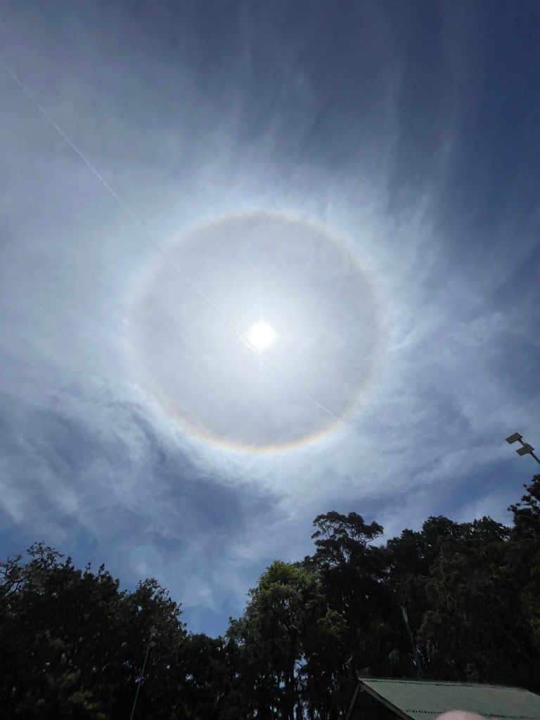
Good morning Bay Islands. Our photo of the day comes from Jim Kaltenbacher, who captured this sun halo. Halos like this are caused by ice crystals in high cirrus clouds, such as what we are experiencing now. There are some cumulus clouds to our northeast this morning, but they are moving away from us. But we have calmer weather and rain chances in the forecast.

If there are any swans on Swan Island, they got wet this morning, as a thunderstorm moved over the island, but that storm is moving away from us and we have partly cloudy to mostly cloudy skies. We will keep high clouds around but should stay dry today and tomorrow, with east winds still around 15-20 mph daytimes and 22-27 mph nighttimes will keep our seas around 4 feet.
Thursday we get a bit calmer around 12-17 mph winds and 3 foot seas and our first, small chance at a morning shower. Rain chances are better Friday and Saturday mornings, and winds should be calmer, 5-10 mph and will be from variable directions, but swell (winds out to sea causing waves) will keep our waves around 3 feet Friday and Saturday. We’re not looking for a lot of rain and some of us may miss out completely, but there will be more clouds and rain in the area Friday and Saturday. Starting Sunday our rain chances go down, but east winds stay manageable, around 15 mph.

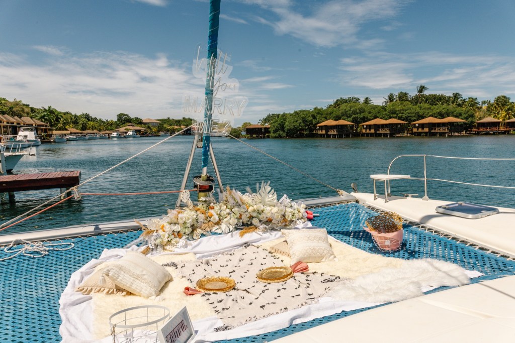
Book your next event (wedding, graduation party, anniversary celebration) on a luxurious catamaran and island outing from Jolly Roger Roatan.

Low tide is around noon. Have a great Tuesday!