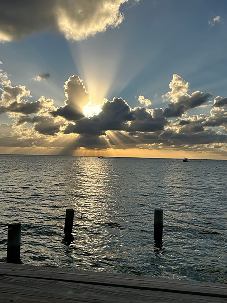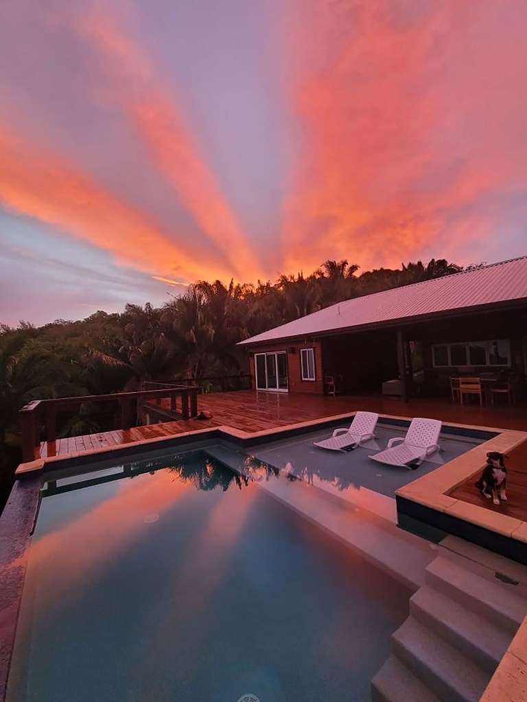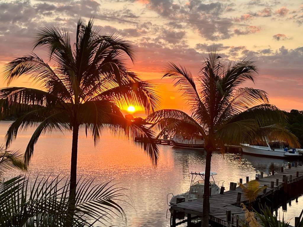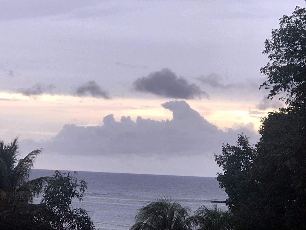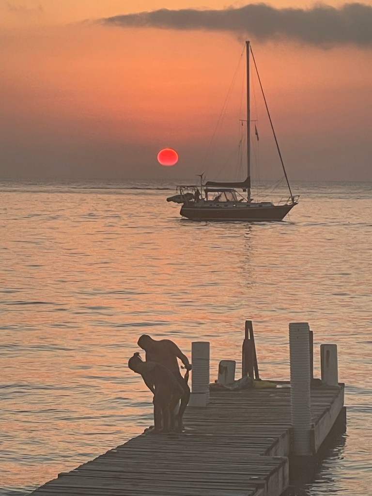
Good morning Bay Islands. Our photo of the day comes from Jeff Kittleson and shows a couple definitely enjoying our Roatan sunset. We start the day at a very warm 80 degrees (26.7C). It’s the first time in awhile many of us didn’t even get into the 70s for a low and a sign of the warm weather ahead, though a few clouds may bring a little relief Sunday through Tuesday.
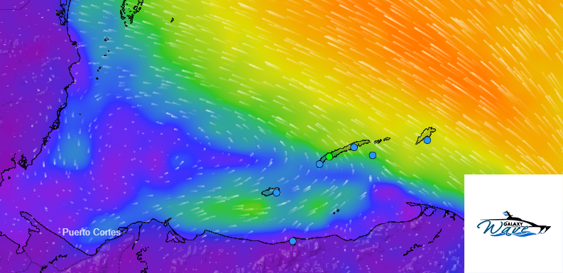
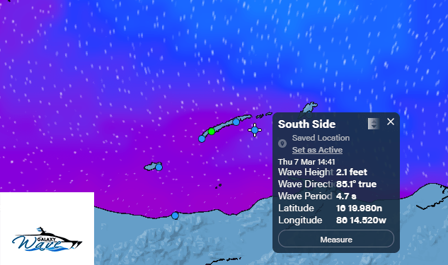
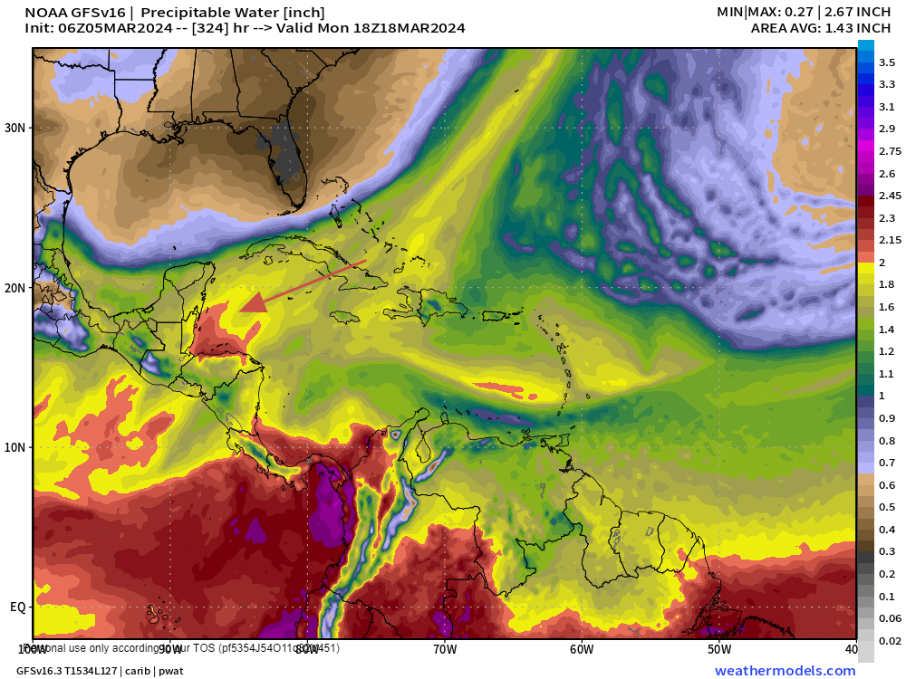
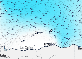
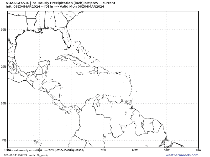
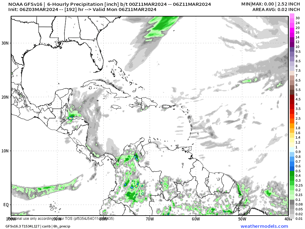
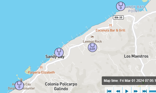
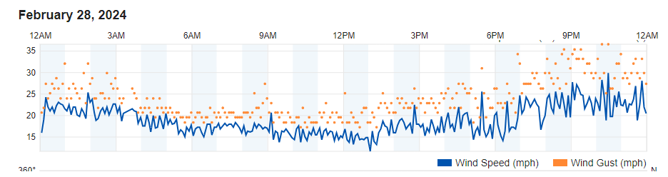
After a couple of calmer days we are back to 20 mph east winds this morning with seas 3 feet on the south side. Those conditions will continue through today and we will have a windy night tonight, with east winds 20-30 mph and seas 4-5 feet on the southside. Things get a bit calmer again Saturday, but something very interesting happens Saturday night into Sunday. In this video Euro wind forecast we can see a very small low pressure system setting up that may give us decent northwest winds Sunday morning. But since our swell (waves coming into our area from winds further away) is still from the east, our waves Sunday and Monday should be pretty calm. Late next week into next weekend looks windy again.
We will be dry today. Tomorrow is the Music Festival for the Angels at Sol y Mar and concertgoers will have clear skies and warm (OK, hot) temperatures. So take plenty of water.

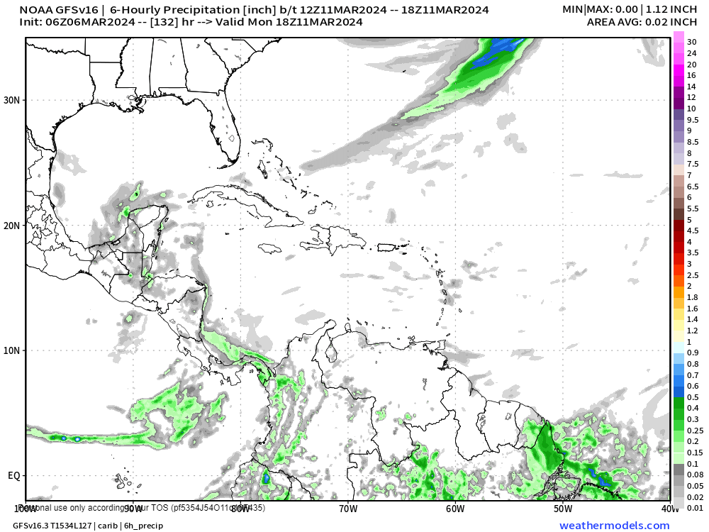
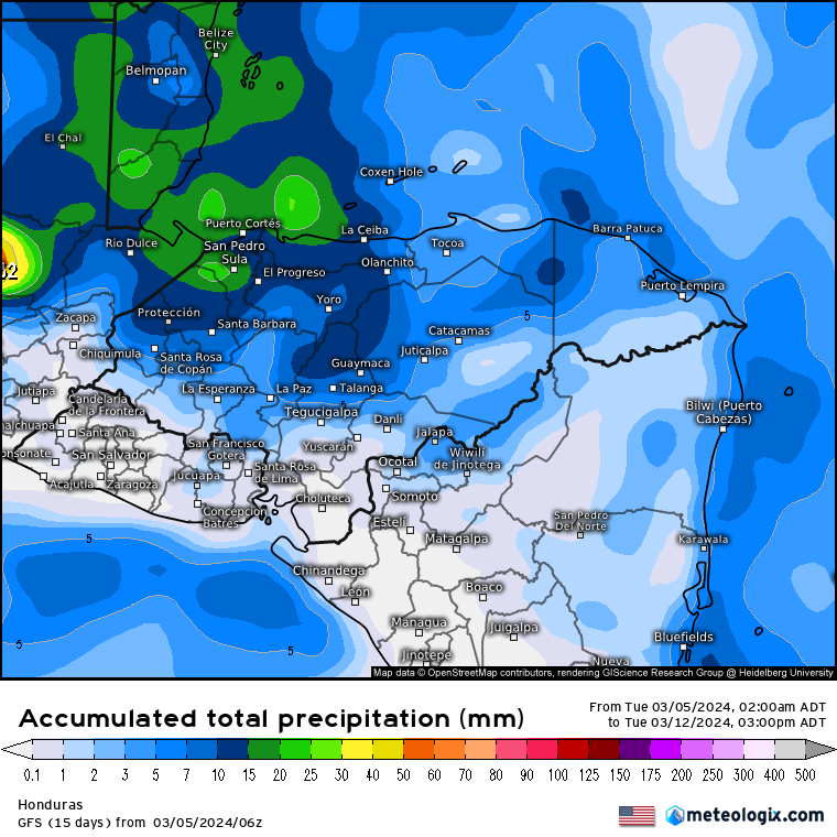
Sunday we will have partly to mostly cloudy skies and a chance of a passing shower, but best rain chances will be Sunday night into Monday morning and then again Monday night into Tuesday morning. Most models only give us a tenth of an inch to a quarter of an inch of rain, but when you get a nice shower, it is always possible someone might get half an inch. Others of us will probably get nothing. Let’s hope for the best.
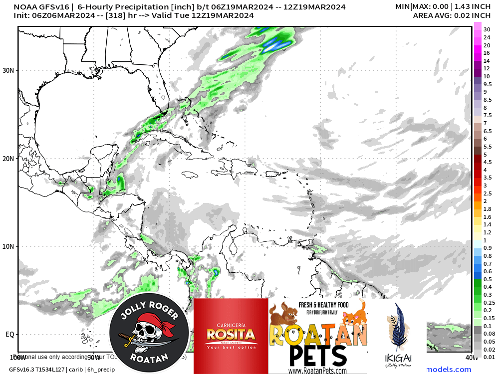
In our long range forecast we are still looking for a stronger rain system, that now looks like it might come March 20-21.

Don’t forget that this month’s Photo of the Month winner gets $50 in pet food from Roatan Pets. If the winner doesn’t have a pet, the winnings can be donated to Roatan Operation Animal Rescue.
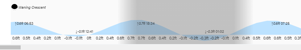
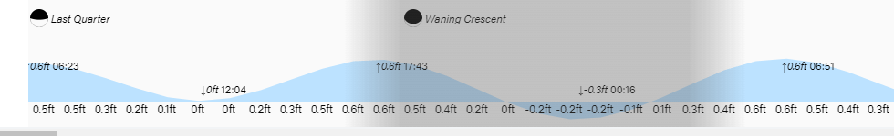
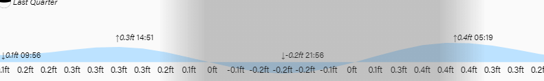
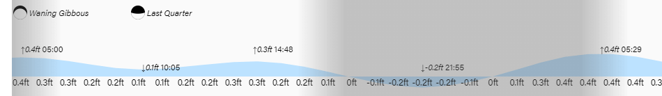
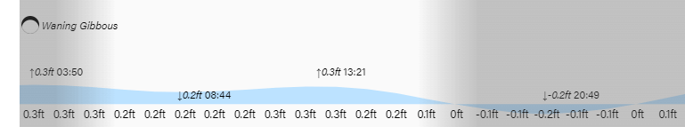
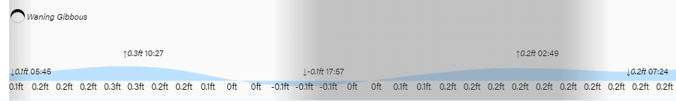
Low tides are 1:30 p.m. and 1:30 a.m. Have a great Friday!