March 24, 2024

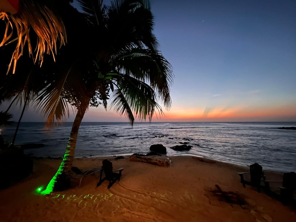
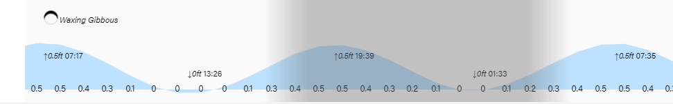
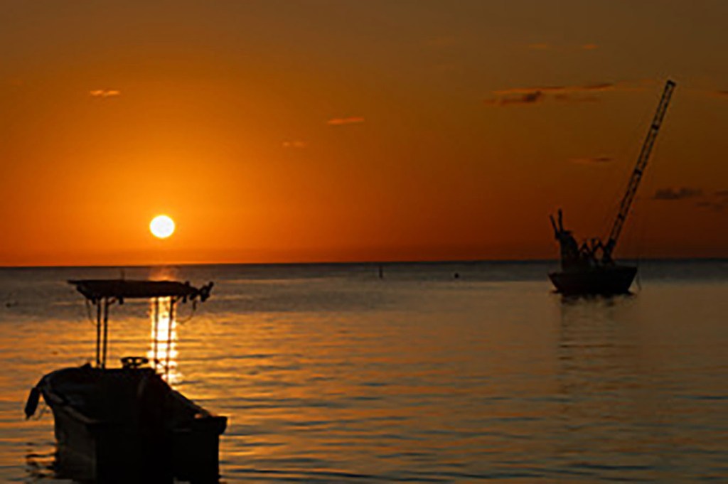
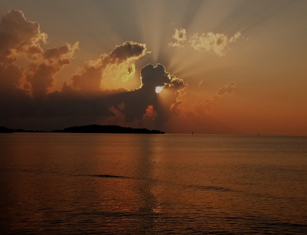
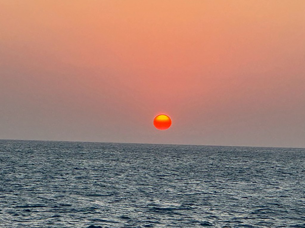
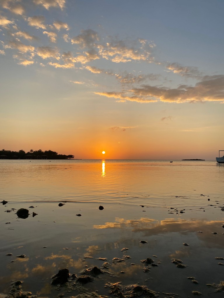
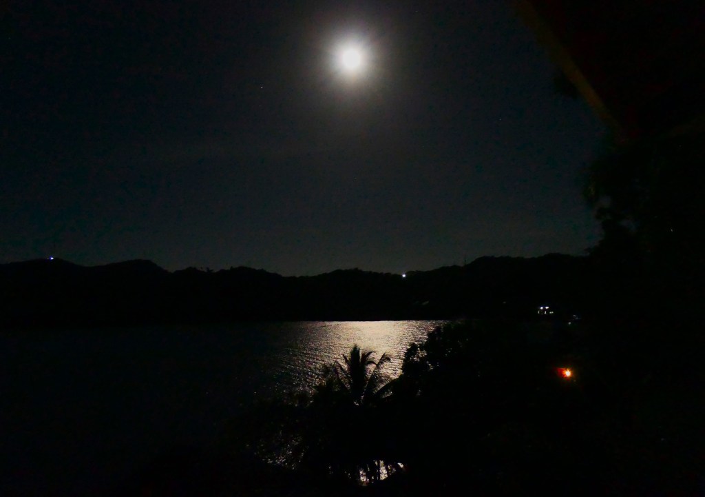
Good morning Bay Islands. Our photo of the day comes from Phil Sikora in Caribe Bight and reminds us that the moon becomes full tonight. Those of you who know me know this is a very special night for me. I also know it kicks off a very special week for many of you. So let’s get to the forecast.

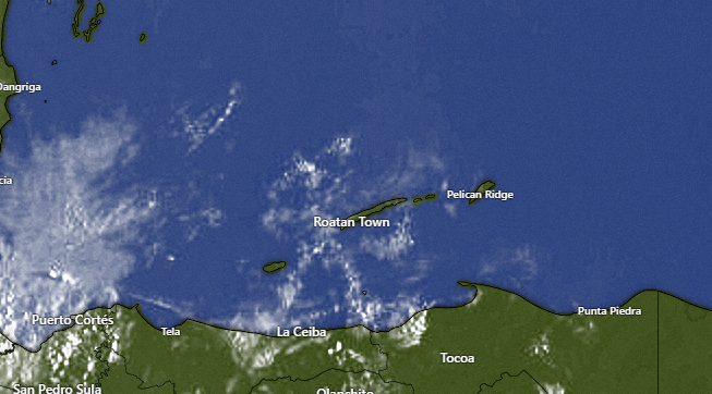
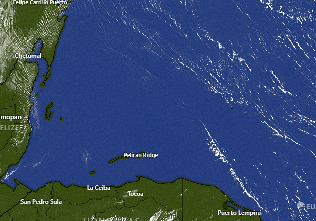
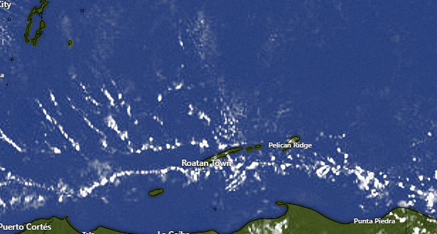
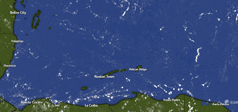
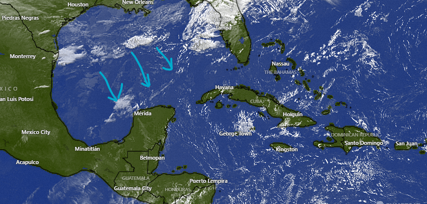
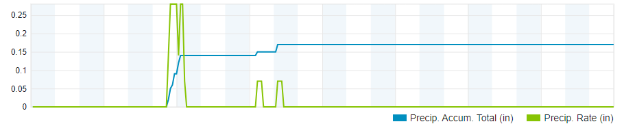
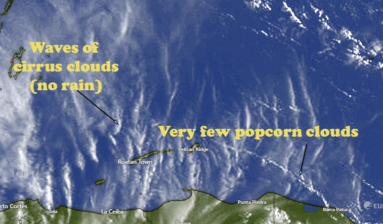
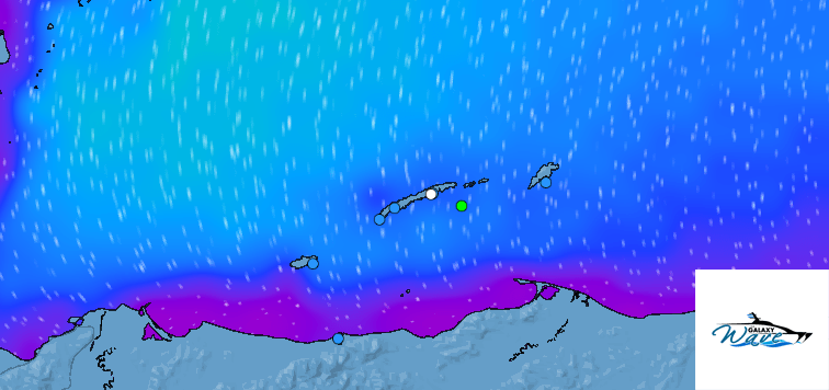
On our satellite at 6:50 a.m. we see a storm that has had some thunder in it just to the southwest of Utila. I imagine some folks, especially on the west side of the island, might have seen a little rain out of this, though most of the rain seems to be falling just to the west of La Ceiba. We have a few clouds toward Guanaja, but overall this morning looks dry for most of us unfortunately. Winds start out from the northeast 5-10 mph and seas 1-2 feet but should increase to 10-15 mph by midday and by afternoon turn to the east, giving us 2-3 foot waves coming from the northeast. Tonight we will have east winds around 20 mph.

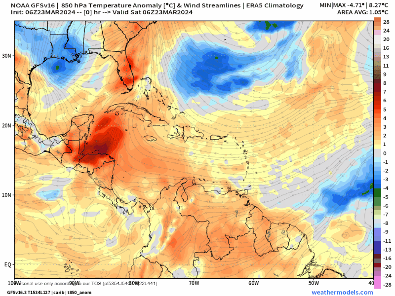
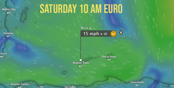
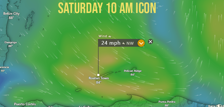
The wind forecast for Semana Santa is already looking a bit complicated.
Monday: Moderate east winds 15 mph day, 25 mph night, seas 2-3 feet southside.
Tuesday: Probably the calmest day of the week with east/northeast winds 5-10 mph and seas 2 feet.
Wednesday: West/southwest winds 10-15 mph and seas 2-3 feet esp. north and west sides.
Thursday: Starts off quite calm in the morning but gets windy from the west in the afternoon.
Friday: Windiest day of the week with north winds around 20 mph and seas around 5 feet north side.
Thursday evening into Friday morning looks like the best chance at rain right now, though it seems many of these late season storm disappoint us when it comes to rain, so I’m not guaranteeing that we’ll get a lot.
Until Thursday we will stay hot and dry, but when the north wind gets here we should cool off for Friday and Saturday.

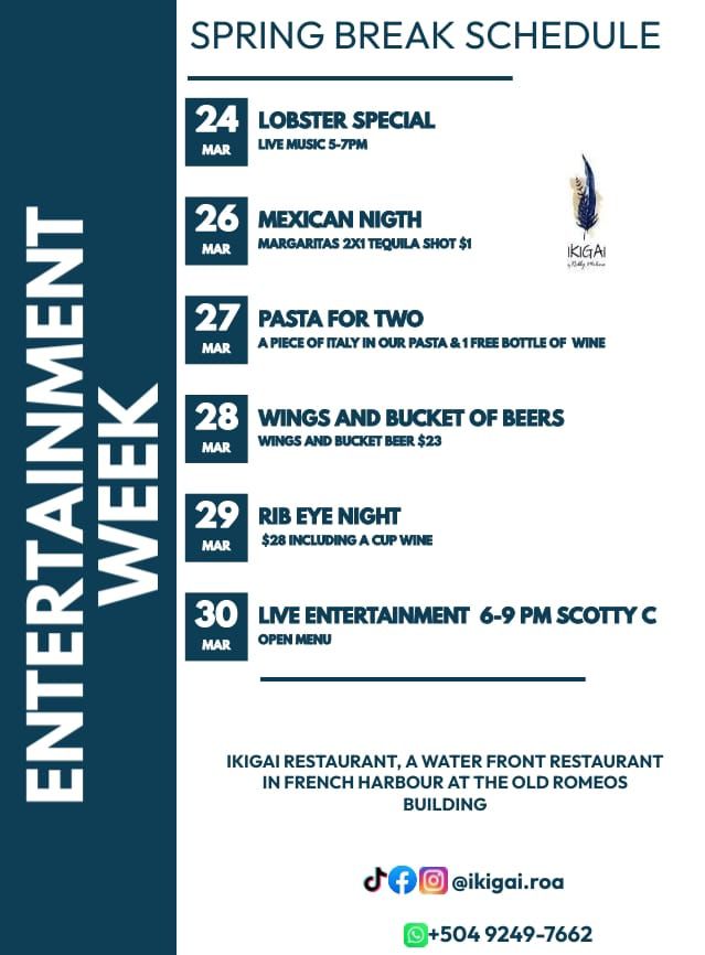
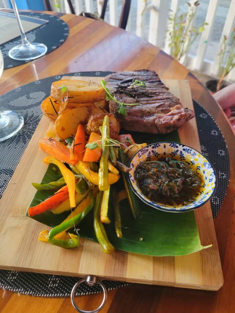
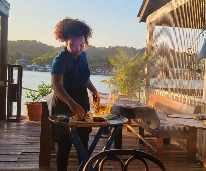
Semana Santa will be a big week at Ikigai by Robby Molina. Aside from Monday when they are closed, every day has something amazing to choose from, starting with Lobster Special today. I had it last Sunday and it was outstanding!

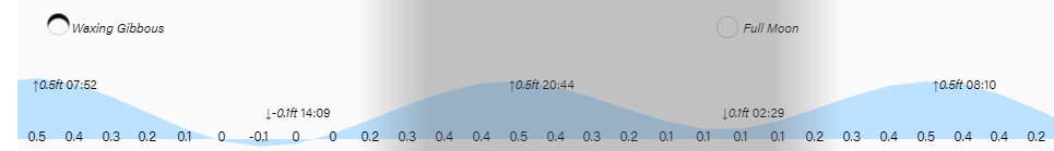
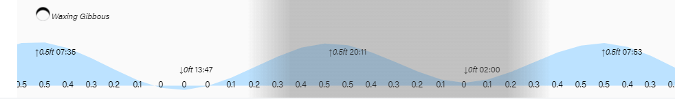
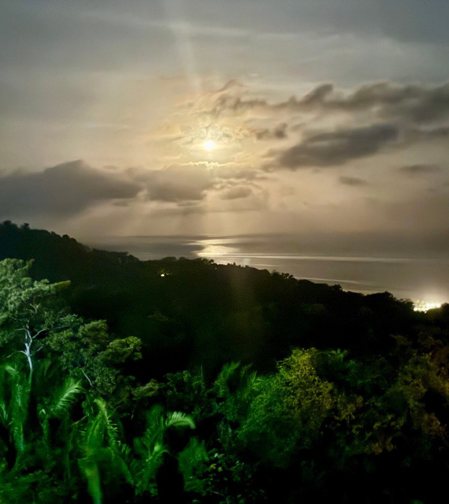
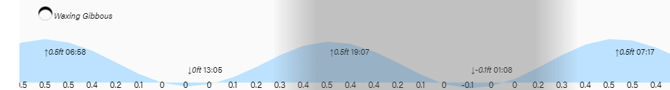
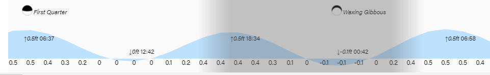
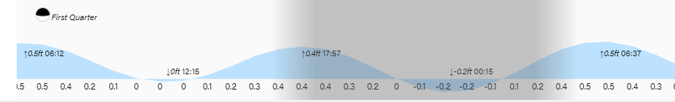
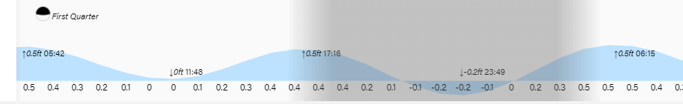
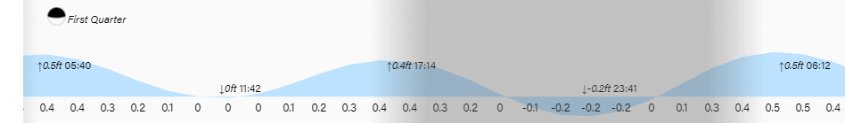
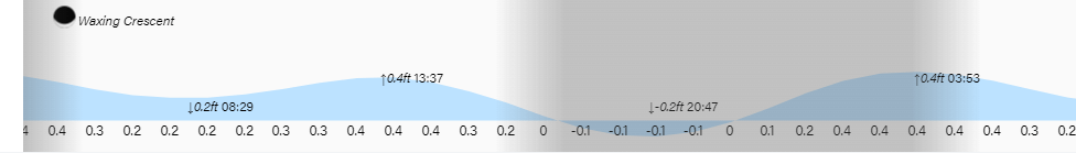
Low tides are 2:10 p.m and 2:30 a.m. As you can see, we enter full moon phase tonight, which means that at Kingdom Halls around the world, we will be observing the Memorial of Jesus’ Death. If anyone out there wants more information about attending any of the nine observances across our islands, please message me or text me at 9475-4406. Otherwise I will be offline until tomorrow morning. Have a great Sunday!

March 23, 2024

Our photo of the day comes from Julie Elpus at the far western tip of West Bay at dusk. If you’re at West Bay Beach this morning you’re seeing an unusual sight — waves caused by a west wind. We have a chance of rain tomorrow morning and a better chance of rain for Good Friday, along with some cooler temperatures.

Let’s start with what we’re seeing this morning. There are a few popcorn clouds out there and radar is showing a shower north of Guanaja that doesn’t seem to be moving much. We will keep a small chance of rain today under partly cloudy skies.

As you can see from this screenshot of a webcam, waves are hitting West Bay Beach because of 15 mph west winds this morning. We will have those winds through midday, but they will start to die down and the overnight will be quite calm. Tomorrow we will have north/northeast winds 10-15 mph and seas 3 feet on the north side, along with a 30 percent chance of a morning shower. Skies should be clear and light winds turning back to the east for the Memorial of Christ’s Death tomorrow night. Monday looks like a day with strong east winds, but Tuesday winds look milder and Wednesday winds turn back to the west in advance of the cold front coming at the end of the week.

Rainfall projections give us 1-2 inches by the end of the week. The cold front is still almost a week away, so this can change, but some rain Thursday night into Friday is looking quite likely.

I know the idea of getting rain this Friday is disappointing to a lot of folks, but on the bright side it will mean cooler temperatures, especially for Friday and Saturday. We’ve been quite a bit above average with highs 88-90 degrees (31-32C). When we get the cold front on Friday we should get knocked down to lows in the low 70s (22-23C) and highs around 81 (27C), which will feel very refreshing.

Just a quick reminder of the special ferry schedule for Semana Santa. Lots of opportunities to visit friends and relatives over the holiday week.

Low tides are 1:50 p.m. and 2 a.m. Have a great weekend!

March 22, 2024

ood morning Bay Islands. Melanie Wood sends us this morning’s Photo of the Day, taken at sunset from inside the Galaxy Wave as it goes through Port Royal on its way to Guanaja. Fortunately Melanie was comfortably protected from the seaspray by the Galaxy Wave’s comfortable interior space. We’ve had a windy morning, but the weekend and week ahead hold a couple of chance of rain.

Our satellite is quite clear this morning. Unlike yesterday, when we had a few clouds around and a few folks got a shower. We got a report of a downpour in Coxen Hole, though unfortunately we don’t have a rain gauge in Coxen Hole. Most other locations got only a trace to a hundredth of an inch. So hardly enough to wet the ground.

Our morning southeast winds of 20-25 mph and 4 foot southside seas, will calm by midday to 10-15 mph northeast winds and seas 2-3 feet. Winds will stay right around there overnight, we we will be calmer tonight than we were last night.

Saturday we will have a west winds in the morning right around 15 mph that will give us 2-3 foot seas on the north side. Saturday night winds will be light and variable, and Sunday we will have northeast winds 10-15 mph. Sunday morning we will have a 30 percent chance of a morning shower, the first of two chances for rain in our forecast. We will be dry Monday and Tuesday. Wednesday we will have another west wind followed by a decent chance of rain Thursday into Friday morning. I know lots of folks are hoping for dry conditions for the beach Friday, and whatever rain we get won’t be enough to ruin the day, just a shower or two here or there.

My wife, Miss Susan, couldn’t stop raving about the tender ribeye served up at Ikigai by Robby Molina. It can be a challenge to find a good steak on the island, and Ikigai doesn’t disappoint. And at $26 it is a bargain, compared to many other restaurants on the island that charge $35-$45 for a comparable cut.

Low tides are 1:30 p.m. and 1:30 a.m. Have a great Friday!

March 21, 2024

Good morning Bay Islands. This morning’s picture of the day comes from Judy Donie, taken at sunset at the top of Milton Bight of our waxing moon. Sunday night begins full moon for this month, the first full moon after spring starts.

Let’s start with our 7:15 a.m. satellite showing lots of popcorn clouds around and one of these might have a shower in it, though no weather station has picked up any rain as of 7:20. We will have these clouds around in the morning and then get clear for the afternoon. We will have mostly clear skies tomorrow and a few clouds around Saturday. We have a 20 percent chance of a morning shower on Sunday.

Wind and wave forecast: We start the morning with 10 mph east winds and 2 foot seas coming from the northeast so waves are similar on both sides of the island. Through the middle of the day winds and seas will stay the same, but as we get toward evening east winds will pick up to 20-25 mph and seas 3-4 feet on the south side. Tomorrow east winds will be 10-15 mph from the east and seas starting 2-3 feet and dropping to 1-2 feet by evening. We have a strange scenario with an east wind on Saturday morning. In the next three posts we will look at three different models and what they say about that wind.

We’ll start with the Euro which shows moderate west winds Saturday morning at 15 mph. A lot of boaters I talk to tend to prefer the Euro wind forecasts, but the accuracy of models can vary from day to day.

Here’s the GFS, the most commonly used model because it is provided for free from the US National Weather Service. It shows 18 mph winds from the west Saturday morning.

Finally here’s the ICON showing a bit windier morning on Saturday, but in general the ICON is one of the less accurate models for wind.

I know lots of folks are going to be buying lots of meats for grilling next week, and you can do no better than prime cuts of beef, chicken and pork from Carniceria Rosita.

Low tides are 1 p.m. and 1 a.m. Have a great Thursday.

March 20, 2024

Good morning Bay Islands. Our photo of the day comes from Amanda Anctil in Half Moon Bay-West End. Remember the five photos with the most likes compete March 31 for $50 in Roatan Pets food. Please send your photos to bookmybio@gmail.com with name and location. We have fairly calm conditions at sea and that will last at least through tomorrow morning.

We have a very few popcorn clouds on our satellite view, but not enough to worry about. We will be dry today. I will still keep in a 20 percent chance of a morning shower tomorrow morning. Other than that we should be dry until Sunday morning when we get another small chance of a morning shower. We reached 90 degrees again yesterday at the airport (32.2C) and nothing is changing as far as temperature goes, so upper 70s (26C) for lows and upper 80s to around 90 (31-32C) for highs.

Wind and wave forecast: We wake up to 10 mph winds from the northeast and seas around 1.5 feet on both sides of the islands. We will stay right around there for the rest of the week into the weekend with the exception of tomorrow night and Friday night, when we will see 20 mph east winds and 3 foot seas.

I know a lot of you are planning your trips for Semana Santa, so I have included the Galaxy Wave’s special expanded schedule for the week. Next week looks pretty good on the seas, with the waviest mornings being Tuesday morning and Wednesday morning, but even those morning we will only be at 4 foot seas, so all in all a great week for travel.

Low tides are 12:45 p.m. and 12:45 a.m. Have a great Wednesday!

March 19, 2024

Good morning Bay Islands. Our photo of the day comes from Deanna Jones in Turquoise Bay. Those beach chairs want people in them to watch the sunset. Our winds will be light over the next couple of days and we should see a few more clouds.

On our satellite view we can see more clouds as a very weak cold front moves into the Caribbean, but most of the moisture is well to the east of us. They are getting nice showers southeast of Cayman but that is not coming our way. Over the next two days we will see more periods of clouds, which should cool us off a couple of degrees. The airport actually got up to 90 degrees (32.2C) yesterday. If we can get a few clouds in here we should stay around 85 (29.4C). There will be a small chance of a shower somewhere, especially tomorrow morning, but the chance is only around 20 percent. We’re still watching a chance of a shower for Sunday morning, but we will be almost completely dry through the rest of the week.

Wind and wave forecast: We start out the day with mild east winds around 10 mph and seas 3 feet on the south side. Those will continue to calm. Winds this evening will be from the northeast at 7-12 mph and seas 2-3 feet and tomorrow winds will be light and variable and seas 1-2 feet, even on the southside. Thursday starts out with mild winds but will get windier from the east Thursday evening into Friday before a calmer weekend.

I had the opportunity to go to Ikigai by Robby Molina Sunday and I will be telling you a little about the wonderful experience I had there each day. Let’s start with the appetizers. Our server, Veronica, soaked a hunk of cheese in brandy and set it aflame, and let me tell you the results were out of this world. I had never heard of it, but it is now my go-to appetizer.

Don’t forget the surf and turf special for Honduran Father’s Day. Ikigai by Robby Molina is in the old Romeo’s building in French Harbour. Reservations are never required, but you can call ahead at 9343-3135.

Low tides are 12:15 p.m. and 12:15 a.m. under a quarter moon. Have a great Tuesday!

March 18, 2024

ood morning Bay Islands. Our photo of the day comes from Phil Sikora and shows the sunset over Maya Key from Coxen Hole. I picked this photo because this week we will see a few more clouds than last week. But the big headline is winds will be calmer.

On our satellite view we can see a very weak cold front moving into the Gulf of Mexico. By this time of year, whatever arrives down here can’t be called a cold front, but it will be a few more clouds, starting this evening and lasting through most of the week. This should cool us down a couple of degrees. Our high yesterday at the airport was 88 (31.1C). So starting this evening into Thursday we should be more like 84-86 for highs (28.9-30C). Starting tomorrow and especially Wednesday and Thursday morning, I expect A FEW popcorn clouds around and someone getting a small shower, at least enough to wet down all the dust, but most of us probably won’t see a shower.

Wind and wave forecast: If there was ever a week for a Galaxy Wave ferry ride, this will be it. We start the day with winds already calming at 7 a.m. to 15 mph from the southeast and seas at 3 feet on the south side. We will have southeast winds 10 mph and seas 2-3 feet for the middle part of the day, but the real change comes tonight when winds stay around 15 mph overnight, whereas previous nights we’ve been getting up to 25-30 mph. Tomorrow we will have east winds 10-15 mph before they turn to the northeast in the evening. Wednesday looks quite calm with light and variable winds and seas at 1 foot even on the south side.

With such a great week with calmer winds, you definitely need to check out Jolly Roger Roatan if you’re planning an excursion, either for an island visit by air or on a cruise. You just concentrate on having fun and they will take care of the rest.

Low tides are close to noon and midnight. Have a great week!

March 17, 2024

Good morning Bay Islands. This morning’s photo comes from Darlene Cresswell and shows what at first glance appears to be an alien planet, but is actually our sun setting amid all the haze. We haven’t had a good rain to wash out the atmosphere and we have some pollution and water vapor in the atmosphere creating these vivid sunrises and sunsets. Don’t forget the five photos with the most likes compete on March 31 for $50 in Roatan Pets food.

We start the day pretty windy on the main island with 25 mph east winds and 5 foot seas on the south side. Things are quite a bit calmer on Utila, where a light wind is coming from the southwest. Things should calm down quite a bit by midday as we get down to 10 mph east winds and seas 2-3 feet. We have another windy night tonight with winds around 20 mph and seas 3-4 feet, but things get a lot calmer Monday, with light and variable winds and seas around 2 feet. Tuesday we will have moderate winds around 10-15 mph from the east and Wednesday gets super calm again. All in all a very nice week ahead for your Galaxy Wave ferry ride.

Monday through Thursday morning of this week we will see a few more of those popcorn morning clouds and I suspect someone will get a shower good for a tenth of an inch or so, but most of us will probably stay dry, sadly.

Speaking of Roatan Pets, Mitch Cummins has produced his first batch of dog treats and I’m sure your best friend will tell you how tasty they are. Contact him for more info at 9801-7828.

We’re moving into half moon phase with low tides 11:40 a.m. and 11:40 p.m. Have a great Sunday!

March 16, 2024

Good morning Bay Islands. Our photo of the day comes from Debbie Aaron in Sandy Bay, and shows a sunset off a very calm sea. That won’t be the case this weekend, but next week will be much calmer and Wednesday will be close to dead calm. We start the day with east winds 20-25 mph and seas at 5 feet on the south side. That should calm to 15 mph and 3 feet by midday. Tonight we’ll get back up to 25 mph east winds and seas 4 feet but by mid morning we should be back down to 10 mph winds and 2-3 foot seas. Sunday night will be a bit windier, but as we get into Monday and into the week, we will see winds more in the 10-15 mph range and seas 2-3 feet, calming to 1 foot by Wednesday.
As for rain we will have more clouds Monday through Wednesday and a small chance (20-30 percent each day) of seeing a shower Monday evening through Wednesday morning. Have a great weekend!

If you want a great meal combined with soothing sounds, head out to Ikigai by Robby Molina in French Harbour for the musical stylings of Scotty C. Reservations are not required but you can definitely call ahead at 92497662.

Low tides are 10 a.m and 10 p.m.

March 15, 2024

Good morning Bay Islands! This morning’s photo fo the day comes from Debbie MacConnel in West Bay. I asked her about the ripple in the middle of the photo and she said she thought a turtle had peeked out from the water, but she wasn’t sure. Maybe he was peeking out to see if it will ever rain.

We start with good news from Guanaja, where Lisa Garcia near that island’s Sandy Bay registered .17 of an inch yesterday, by far the most we’ve seen around here in the last month. You can see that she had two strong downpours in the five o’clock hour, followed by two lighter showers around 10.

Sadly, we have fewer of those popcorn clouds that brought showers to Guanaja yesterday. We have waves of cirrus clouds, which make the sky hazy, but don’t have any rain in them. Rain chances are quite low until we get to the 20th, when we have maybe a 20 percent chance of morning showers. After that in the extended forecast we see two more waves of small chances of rain, the 24th and the 28th.

Wind and wave forecast: This morning we have 25 mph east winds and seas around 5 feet on the south side. Those will calm slightly toward midday at 20 mph and seas at 4 feet. This wave map shows that when you are on your Galaxy Wave ferry trip to La Ceiba, things calm nicely past the Cayos Cochinos, to 2 foot waves. The return trip is always to roughest as you are running into waves coming toward you as your return to Roatan. But the good news is today is the roughest day. Things calm a bit over the weekend, with 20 mph winds and 4 foot seas for overnight and early mornings, and 15 mph winds and 3 foot seas middays. Monday and into next week things get much calmer, with seas down to 1 foot by midweek.

If the man in your life likes great beef and great lobster, washed down with a cold beer after relaxing with a glass of wine, the special on Tuesday is just for him! Chef Robby and his amazing Team has created a Surf & Turf just for dad!

Ikigai by Robby Molina, located on the water front in the iconic Romeo’s building in French Harbor!

Hurry to make reservations!

+504 9249-7662 / 9606-1668

Lowest tide is around 9 p.m. Have a great Friday!