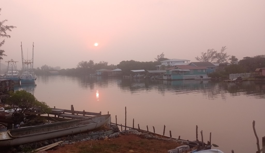
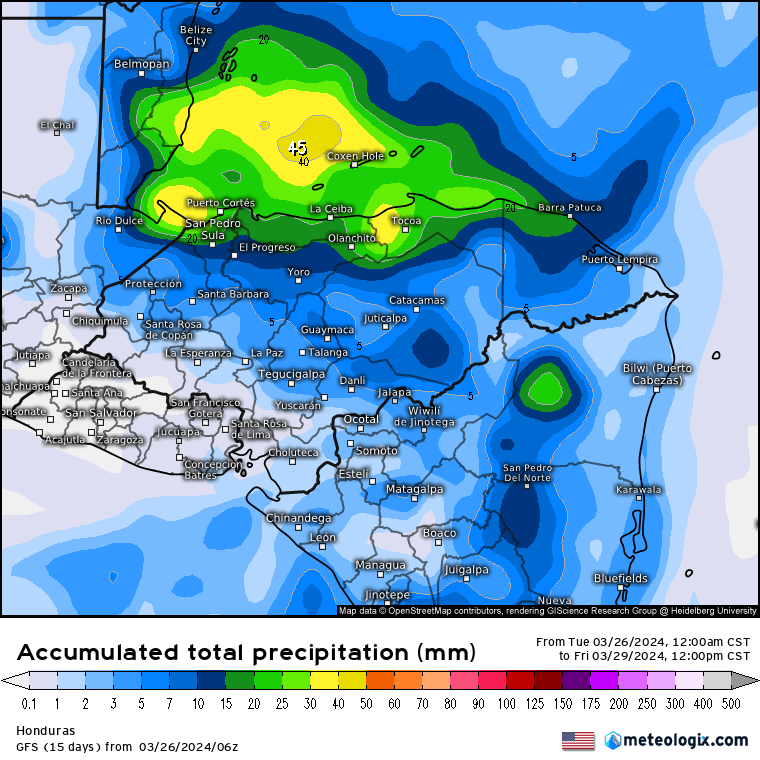
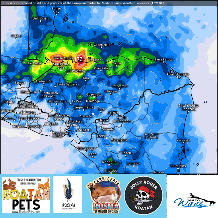
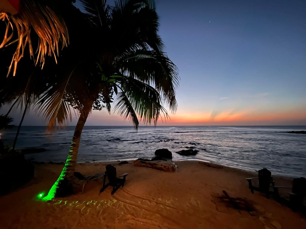
Good morning Bay Islands. Our photo of the day comes from Cathy Strine at Camp Bay Beach, where LOTS of folks are going to be this weekend. We have a storm over La Ceiba at 7:15 a.m. and the hope of rain today. The front is passing over us now.
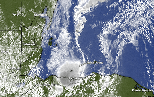
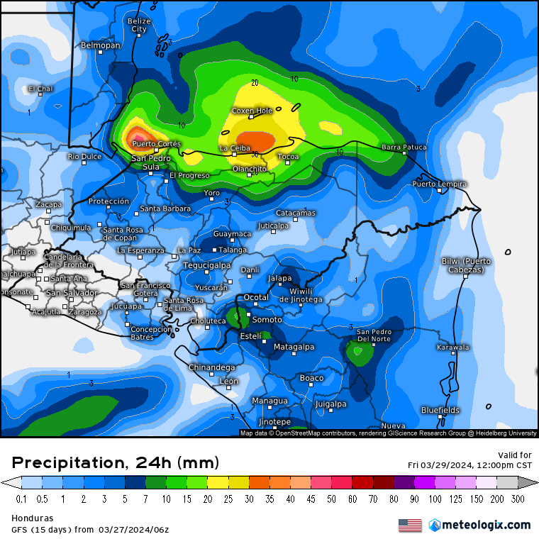
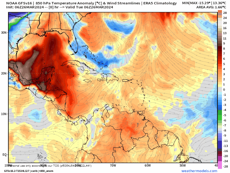
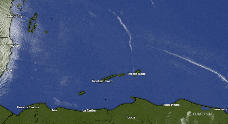
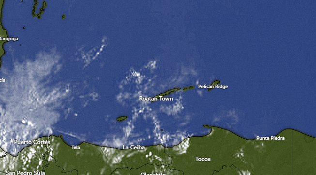
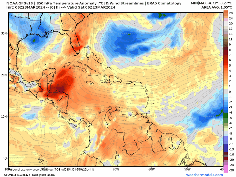
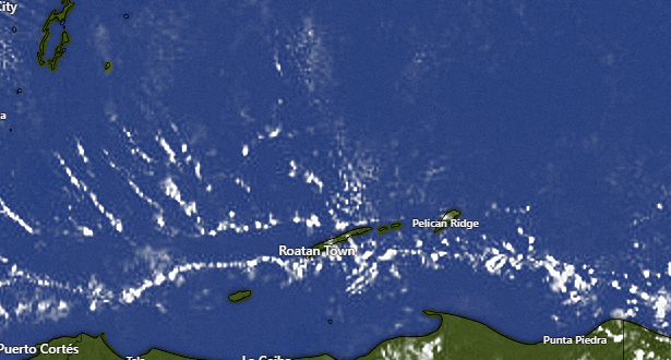
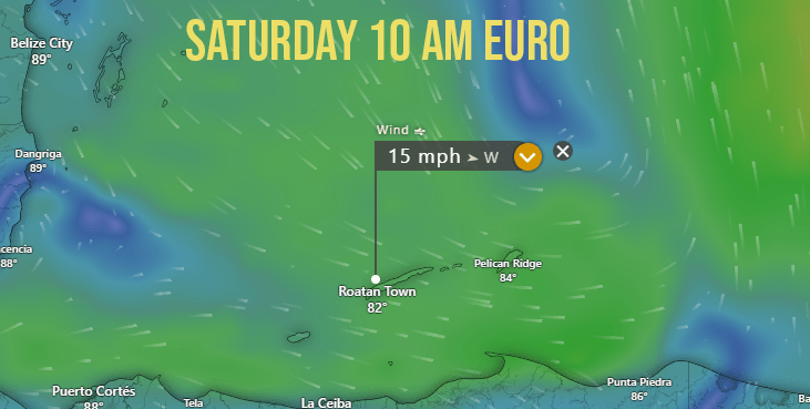
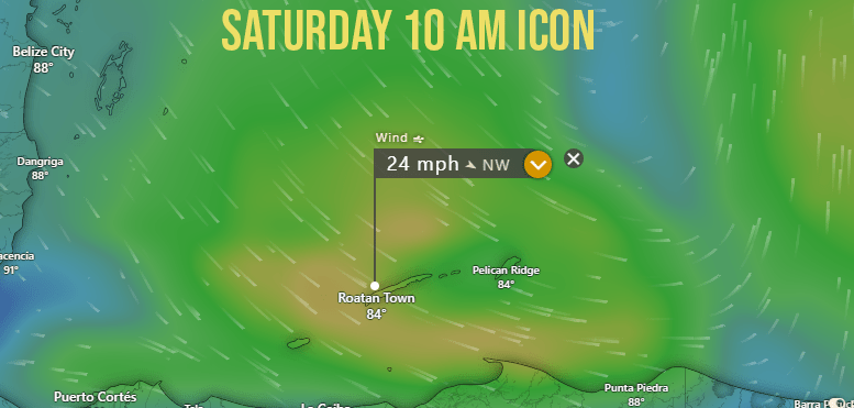
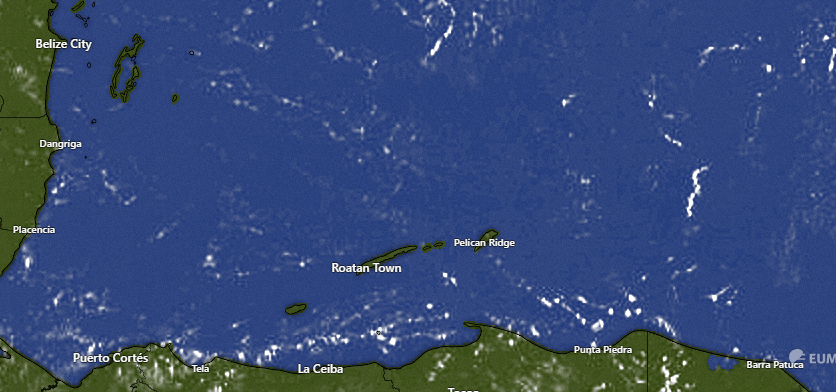
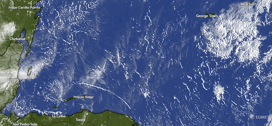
In the satellite you can see the front extending north to south. On the west side of the front we have gusty west/northwest winds around 20 mph. Those will continue most of the day today. Scattered showers will be around all day into tonight. Tomorrow we will have north winds at 20-25 mph giving us 5 foot seas on the north side. Any rain tomorrow morning will be light.In the satellite you can see the front extending north to south. On the west side of the front we have gusty west/northwest winds around 20 mph. Those will continue most of the day today. Scattered showers will be around all day into tonight. Tomorrow we will have north winds at 20-25 mph giving us 5 foot seas on the north side. Any rain tomorrow morning will be light.

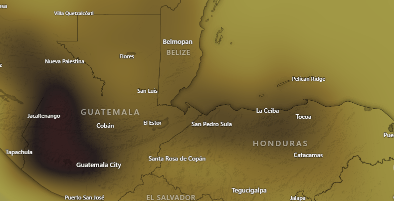
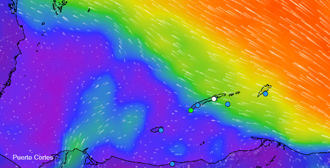
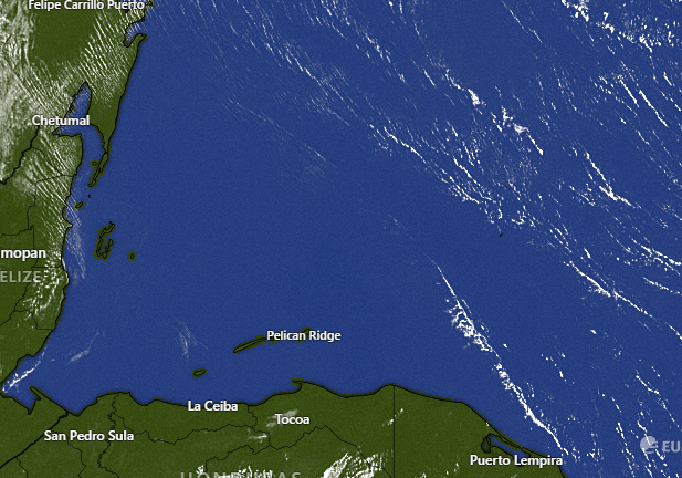
In the infrared satellite you can see that most of the rain is focused on the mainland, but there are clouds extending to Utila and west side of the big island
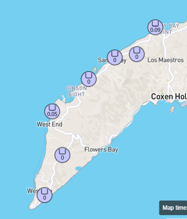
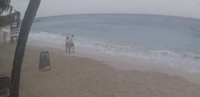
At 7:15 we have a few stations reporting rain in West End and near Mud Hole. If you see rain, let us know.

This is a big day for trips to and from the mainland, with four round trips on the Galaxy Wave!

And a big week at Ikigai by Robby Molina
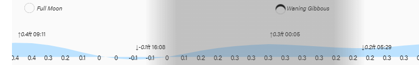
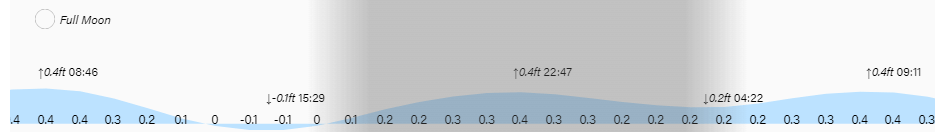
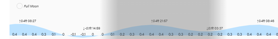
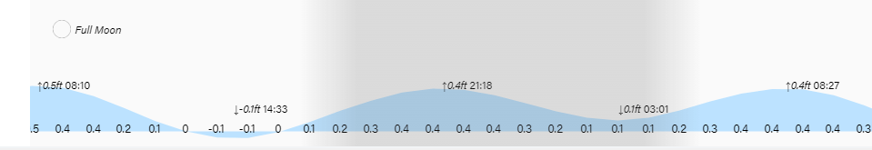
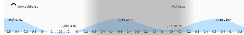
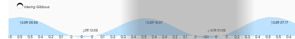
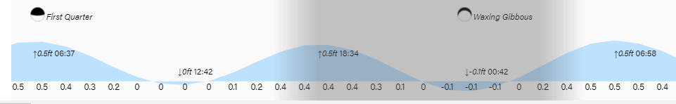
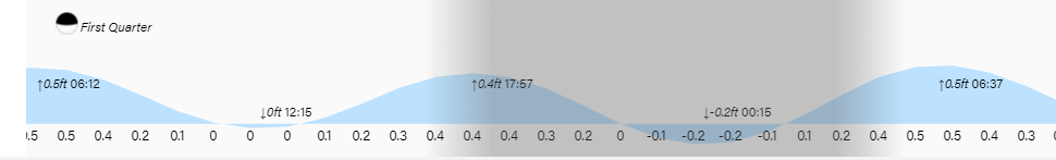
High tides are pretty low and low tide will be 4 p.m. Have a great Thursday!