May 6, 2024

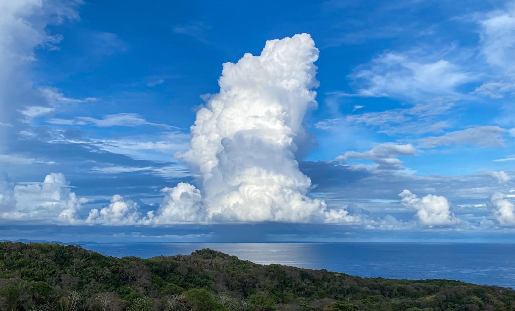
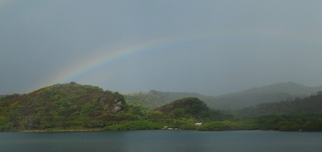
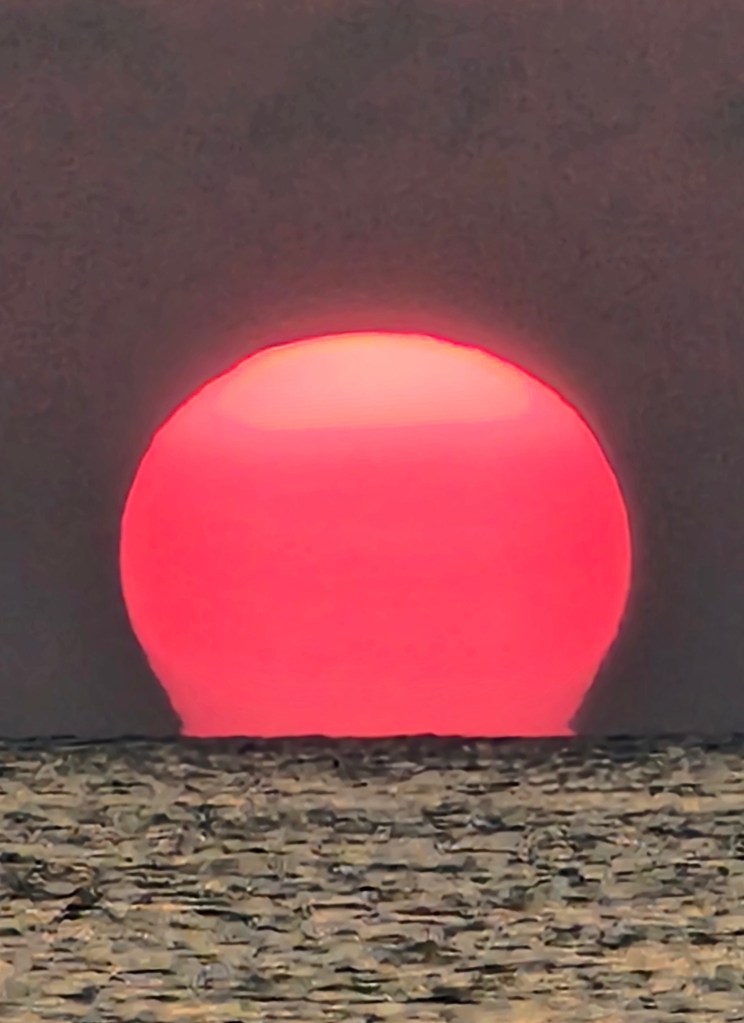
Good morning Bay Islands. Our photo of the day was taken by Loren White near Sundowner’s in West End. It was shot, well, right after the sun went down. I have good news and bad news. The bad news is that Saharan dust is on the way. The good news is that dust often makes for good sunrise and sunset photos.

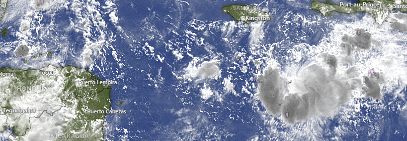
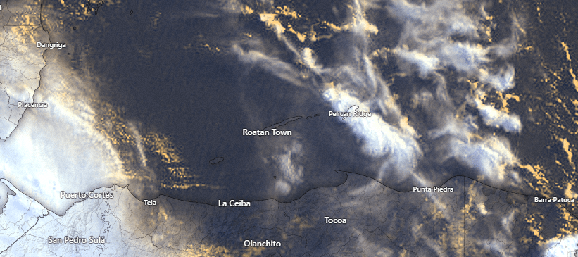
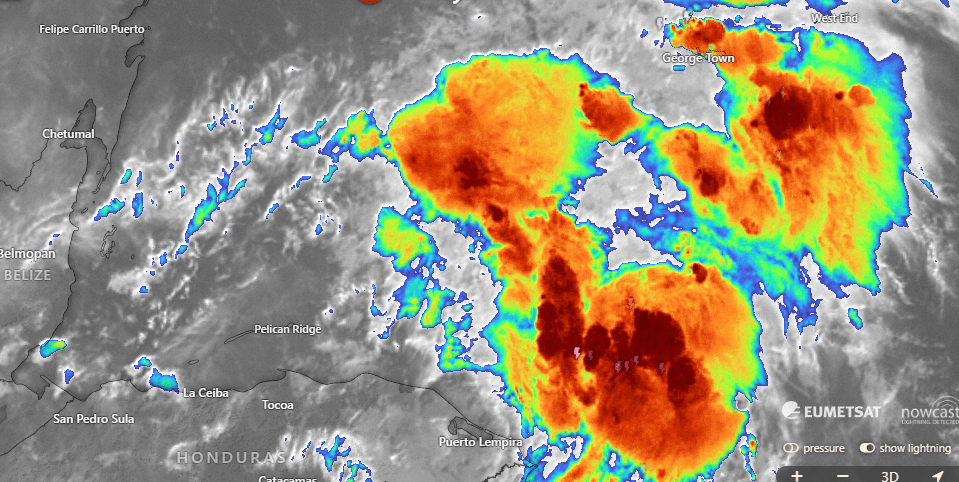
Let’s start with the satellite around 6:30 a.m. We can see a few popcorn clouds to the east of Guanaja. They are heading northwest and look like they will miss us, but there may be a light morning shower or two in these clouds. We will continue to have VERY slight chances of rain each morning.

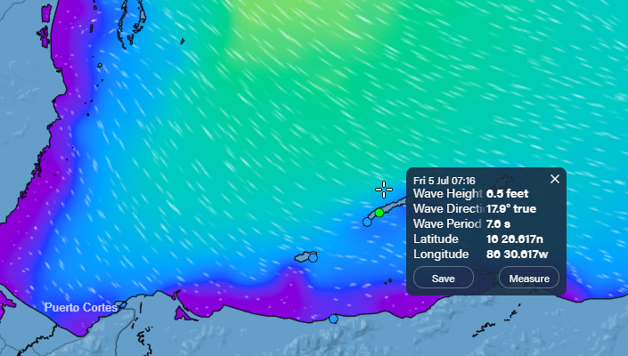
Wind and Galaxy Wave forecast: We wake up to east winds 20 mph and seas at 3 feet south side. Today and tomorrow we will continue to have winds mostly around 15 mph from the east daytime with 3 foot seas south side and 20 mph nighttime with 4 foot seas south side. Wednesday night things get a little winder with 25 mph winds and seas 4-5 feet south side.

Here’s the bad news about Saharan dust. It looks like it is coming starting Wednesday and setting in through the end of the week. At least we won’t have it as bad as the islands in the eastern Caribbean.

Mitch Cummins has come back from his tour of Mexico and Central America with some great ideas for Roatan Pets food. If you have a poochie, you owe to him/her and yourself to get in touch with him and see how he can tailor a recipe perfect for your good boy.

Low tide looks quite low around 1:30 p.m. Have a great week!

May 5, 2024

Good morning Bay Islands. Our super-cute photo of the day comes from Dee Martinez and features her grandson Ian running along the beach in West End. We may be tired of the dry conditions, but whenever people ask when to visit Roatan, May is one of the prime months I suggest. Brides are all the time trying to have beach weddings in December when there is a good chance they will be rained out. If anyone wants to have a beach wedding in early May I can almost guarantee you dry conditions.

On the satellite all of the popcorn clouds are well to our west. There are some high level cirrus clouds making the sky over Utila somewhat hazy. We will continue to have sunny, dry conditions. The airport got up to 90 degrees (32C).

Wind and Galaxy Wave forecast: We will continue to have east winds 15 mph during the day and 20 mph in the evening with 2-3 foot waves especially on the south side. The main change is that Wednesday and Thursday evening winds look a little stronger, to around 25 mph and seas to 4 feet. But not bad for this time of year on the seas mostly.

Today is a double treat at Ikigai by Robby Molina. We have the lobster special all day and Cinco de Mayo Mexican specialties at 6 p.m. See you there!

A couple of days ago the GFS was trying to push some moisture down into the Caribbean. This morning’s forecast pulls that away from us. They are forecasting the cold front to stall around the middle of Florida, as is common in mid-May. So for now things look dry as ever into mid-May. We’re just hoping for the return of some high level Caribbean moisture to bring back the morning showers. But that ain’t happening anytime soon.

Low tides are looking pretty low around 12:30 p.m. Have a great Sunday!

May 4, 2024

Good morning Bay Islands. Our photo of the day comes from Melanie Wood at Parque Nacional Port Royal. She says there is a guide there every day except Wednesday, which I did not know. On this particular day she saw more clouds than we’ve been used to seeing around here. Our sunny days aren’t going to end anytime soon.

This is my view this morning in Guanaja. Based on the satellite image, I’m seeing more clouds here than the rest of the Bay Islands, where there’s hardly a cloud in the sky at 6:15 a.m. We will continue to have sunny skies and no chance of rain. Our winds continue from the east around 15 mph, though starting tonight we will start getting a little windier at night, around 20-22 mph. When I get back to Roatan I’ll be posting a video of my amazing voyage on the Galaxy Wave.

Things are busy over at Ikigai by Robby Molina. Tomorrow is Lobster Day all day and Cinco de Mayo will feature Mexican specialties for dinner. Melissa is already taking reservations for Mother’s Day as well.

Low tide is just before noon. Have a great weekend!

May 3, 2024

Good morning Bay Islands. This morning’s photo of the day comes from Kimberley Harper showing sunrise on Camp Bay. Our forecast continues to be boring, with mostly sunny skies and 15 mph east winds and 2 foot seas, but I’ll try to give us some hope for the middle of May.

This is the GFS forecast for moisture in the atmosphere for the next 10 days. You can see it is predicting a pretty strong cold front to come across the US next week, and at the end of the loop it pushes some moisture toward us in the Caribbean. The Euro shows a cold front as well, but not as strong as the GFS. If this happens we would see more showers around May 12-15, but this far out it is not a sure thing. But it is fun to dream.

If you are coming to Roatan any time soon, be it by air or by sea, you will have just the right conditions, with moderate winds and no rain. Look up Jolly Roger Roatan to maximize your fun during your stay and the island and they guarantee to get you back to your boat in plenty of time.

Lowest tide is 11:10 a.m. Have a great Friday!

Rainfall for April 2024

We are putting .73 of an inch in the record books for May. That was the total in Sandy Bay and is representative of what was received islandwide. Guanaja got one big downpour that gave them 3.36 inches on the south side of the main island and 1.71 on the north side. Our .73 gives us half what a normal April would have, and April is the driest month of the year. We now head into May, the second driest month of the year with a 2.55 inch average. We are definitely starting the month dry, with no good rain chances in the first week-plus of the month. Let’s hope it picks up toward the end of the month.

May 2, 2024

Good morning Bay Islands. Our photo of the day comes from Lainee Hartsel Wood and shows a sort of parking lot for boats in Half Moon Bay in West End. This month, the five photos with the most likes will compete for $50 credit at Hangover Hut in West Bay. Send photos to bookmybio@gmail.com with name of photographer and location.

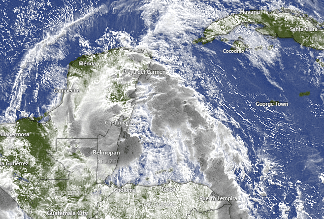
This morning at 7 a.m. we have a very small band of popcorn clouds over southern Guanaja, Barbarat and Morat. Very unlikely there is even a sprinkle in there. We will continue to have mostly sunny skies through the weekend and there’s nothing in the extended forecast that makes me think that is going to change much. We are stuck in a dry pattern with east winds 15 mph and seas 2-3 feet especially on the south side.

Cinco de Mayo is coming up and I’m pretty sure you won’t be surprised to learn that it falls on the fifth of May this year, which is Sunday. Ikigai by Robby Molina will be featuring your Mexican food favorites that evening at 6 p.m. Call ahead to make sure you get your table at 9249-7662.
Low tides are 10:30 a.m. and 11 p.m. Have a great Thursday.
Difference between El Niño and La Niña for Roatan hurricane chances

I thought we might take a look at the difference between hurricanes in La Niña years and El Niño years.

Last year was a major La Niña year and, just as this chart shows, we didn’t have to deal with a lot of hurricanes in the Caribbean. You will notice La Niña brings an increase in hurricanes in the eastern Pacific. This definitly happened last year. Who can forget Hurricane Otis slamming Acapulco or California actually getting hit by a tropical storm?

Here is the typical El Niño hurricane effect. We’re forecast to be in El Niño by late summer. Notice that the Atlantic and Caribbean have more hurricanes on average due to less wind shear. Wind shear is contrary wind that tends to break storms apart as they grow in height. It doesn’t necessarily mean we will have a hurricane in our neighborhood, but the chances definitely increase. Keep in mind our hurricane season typically runs from August to early November.

May 1, 2024

Good morning Bay Islands. Some of you have the day off because today is the International Day of the Worker in Honduras and around 160 other countries. Our photo of the day comes from Josée Massicotte in West Bay and shows a unique perspective on a sunset. She will be the first to be entered into the May contest for a $50 gift certificate to Hangover Hut. If you want to vote on the winner of the April contest, go to https://www.facebook.com/groups/1525570211701728/permalink/1568904830701599/

If you want to be jealous, take a look at the nice rains in the eastern Caribbean, in Jamaica, eastern Cuba, Hispanola and Puerto Rico. Unfortunately none of that is coming our way. It will move north, then northeast into the Atlantic. We will continue to have hot, hazy skies. Our high yesterday at the airport was 88 (31C) but our inland weather station in West Bay Hills got up to 91.5 (33C). We will have more of that for the week ahead with very little to no chance of rain.
Wind and Galaxy Wave forecast: Today is the day we start seeing winds get a bit calmer, though not completely calm. We start the day with east winds around 20 mph and seas 3 feet on the southside. That should calm to around 15 mph and seas 2-3 feet by midday. We’ll notice a big difference at night, when winds stay around 15 mph. Those conditions should last through the weekend.

Low tides are 9:40 a.m. and 10 p.m. Have a great Wednesday!

April 30, 2024

Good morning Bay Islands. Our photo of the day is from Glory Cone and shows a young man entering the water to hunt lionfish in Lucy Point. I have made the decision to do the photo contest on May 1, because doing it on the last day of the month confused some people. The top five-liked photos from April will compete tomorrow for a $50 gift certificate to Blue Bahia Beach Grill. Our new contest will start tomorrow.

We start the day with some high, hazy clouds but no rain clouds anywhere nearby. We will continue to have partly cloudy skies and our hope for morning showers has faded. We will probably stay dry the rest of the week. Winds will start getting a little calmer. Today we will have east winds 15-20 mph during the day and 20-25 mph at night, but starting tomorrow and through the rest of the week our east winds should be right around 15 mph and seas 2-3 feet southside day and night. It will be a typical, boring weather start to May.

One of the things that is worrisome about the upcoming hurricane season is that our sea temperatures are consistently running well above historical averages. That is true in the waters around Roatan as well. This is a chart of the one working buoy that records temperature around our islands. It is in a location on the northside called White Hole. You can find it here: https://aqualink.org/sites/3324. This buoy records the temperature at 1 meter deep and at 14 meters deep. You can see in the chart our sea temperature for the past year has run about 1 degree Celsius above our historical average. Of course, most of us remember what a hot summer we had last year, with sea temperatures peaking around 32 Celsius/90 Fahrenheit. This was a major coral bleaching event. The bad news is that we are running about half a degree Celsius above where we were last year. That doesn’t necessarily mean our seas will be hotter than last year, but it isn’t good. In future posts we will talk about sea temperatures across the Atlantic and what that can mean for hurricane season this year.

Lowest tide will be 9 p.m. Have a great Tuesday!

Effect of La Niña on hurricanes on Roatan and the Bay Islands

One of the big questions people want answered is “How likely is my vacation to the Bay Islands to be interrupted by a hurricane?” The answer is usually not very likely, but let’s take a look at how we might be impacted by La Niña, which is expected to cool the Pacific waters by late summer into early fall of this year, 2024. Here is a chart of the fluctuation between El Niño and La Niña. We are coming out of a strong El Niño that gave us scorching temperatures and hot waters last year, but no real hurricane threats. By contrast, strong La Niñas tend to cut down on the wind shear in the Atlantic, which gives storms a better chance to build. This chart shows our most recent strong La Niñas were 2007, 2010-11 and 2020. Keep in mind that we think we are headed for La Niña by late summer early fall, but we don’t know how strong it will be.

Now let’s take a look at recent La Niña years and the effect it has had on our rainfall. Except for 2020, I wasn’t here during these years, but if we got a lot of rain in August, September or early October, chances are good that we were affected by the remnants of a hurricane or tropical storm. We see that trend for recent strong La Niñas in 2007 and 2010-11. I was here in 2020 when our last hurricane season brought Eta and Iota that devastated the mainland and brought us some rains in November. Hurricane Nana also brought us good rains in August-September of that year. So the setup for a strong hurricane season in the south Atlantic/eastern Caribbean is there. We just have to wait and see how strong the La Niña is. Keep in mind our peak season for hurricanes runs late August into early November.