June 6, 2024

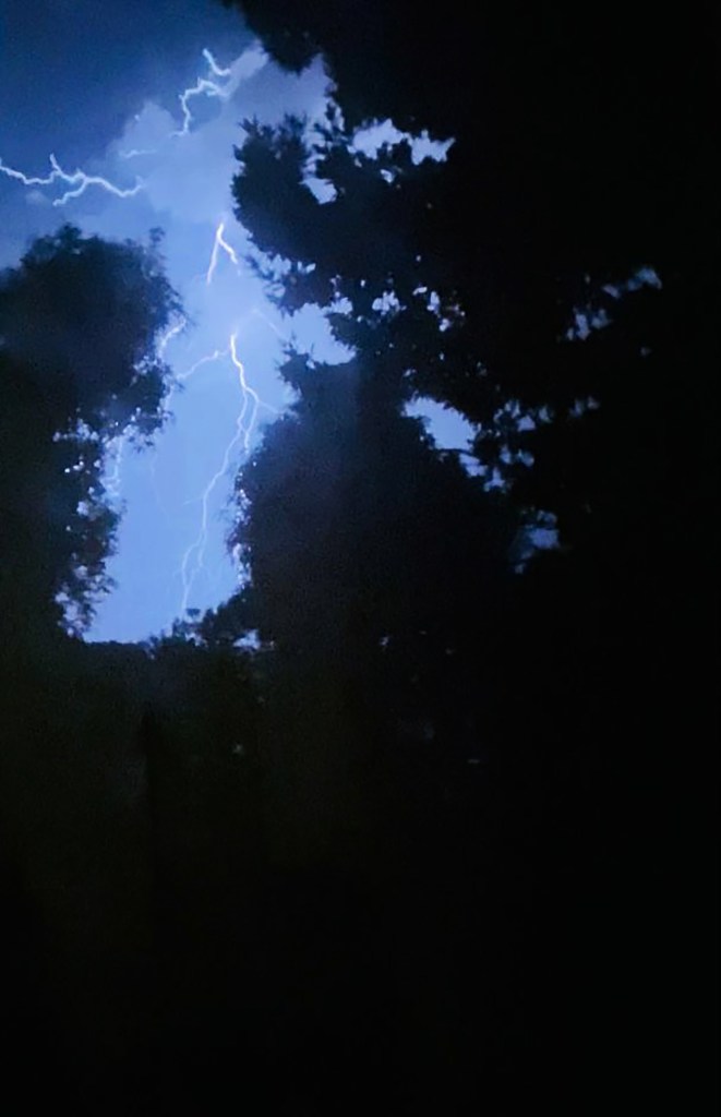
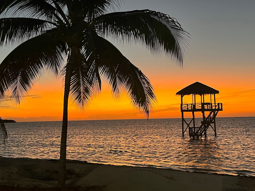
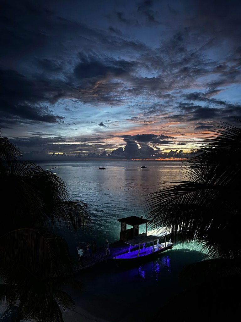
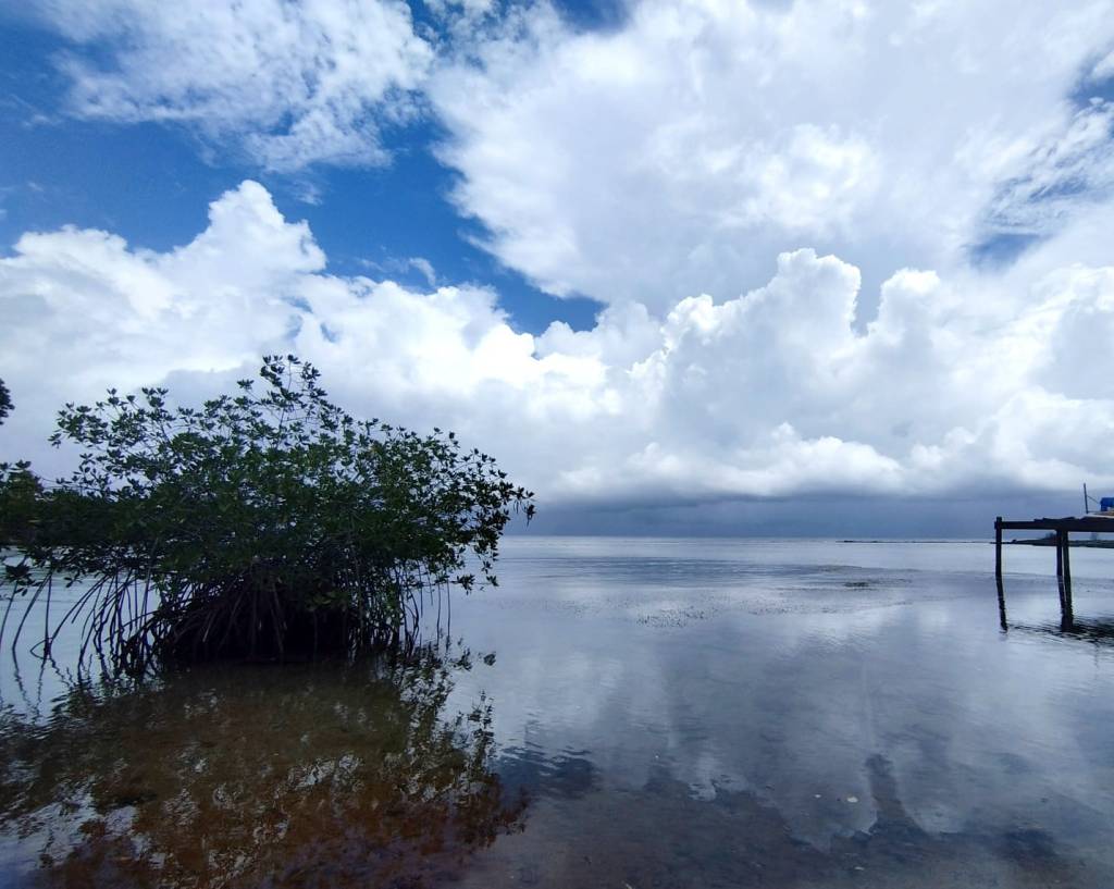
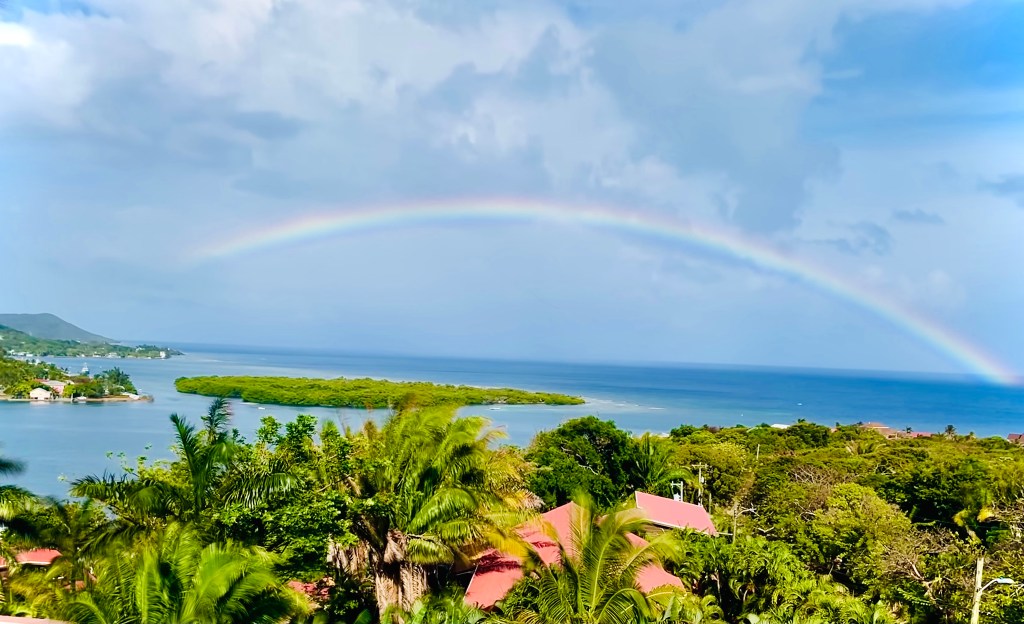
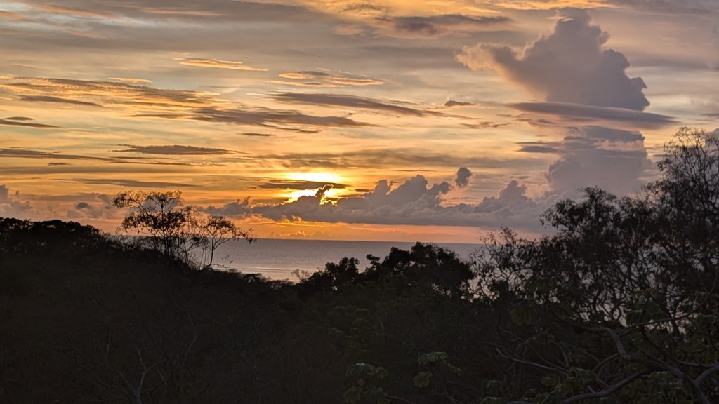
Good morning Bay Islands. Our photo of the day comes from Jill Haley Wood in Parrot Tree. Her photo shows some rain clouds teasing her and we have some rain clouds teasing us to the north this morning. That’s the problem with being small islands in the big sea. The rain doesn’t always fall in the right places.

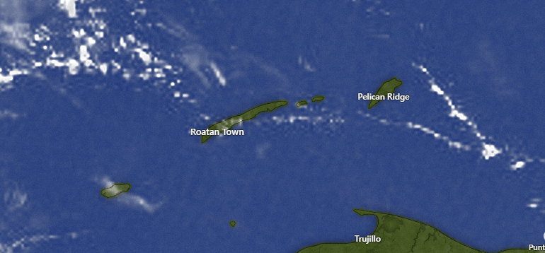
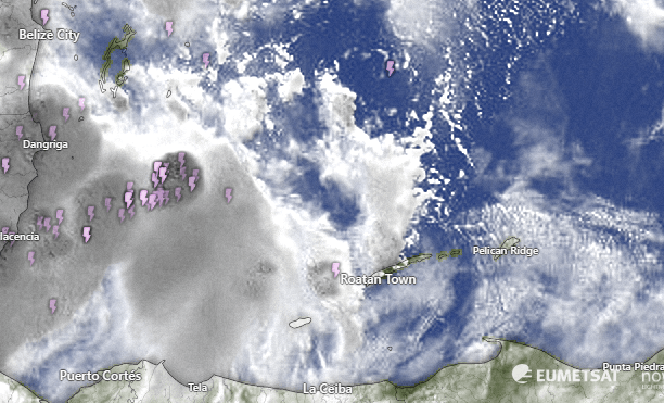
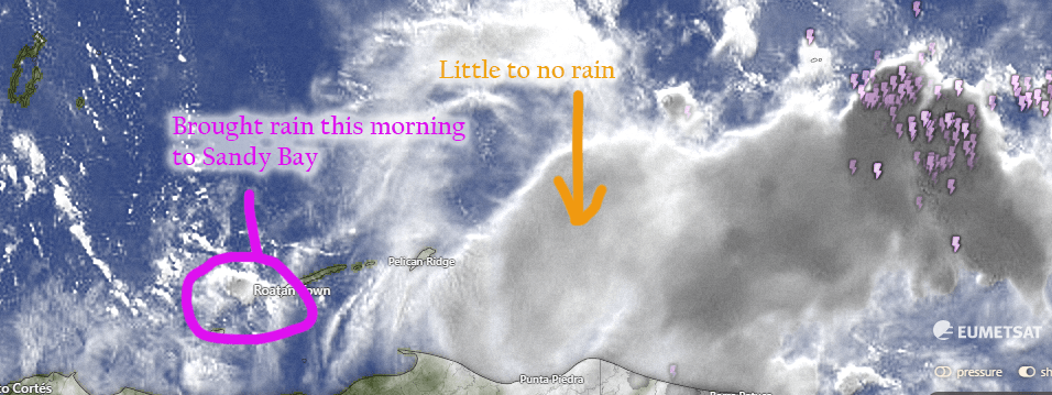
On our satellite this morning we see a bank of clouds, mostly to our north. There may be a shower or two in these clouds. We will have mostly cloudy skies this morning and more sun this afternoon. Through the weekend I’m hopeful for some showers across the islands. We will have a 30 percent chance each morning.
Wind and Galaxy Wave forecast: We awake to 10 mph east winds and seas 1-2 feet. We will calm to 5-10 mph and 1 foot seas this afternoon and will have great sea conditions through the weekend, mostly 1-2 feet southside. Next week we will have slightly higher seas, but only 2-3 feet, so overall a great time to be on the sea.

Lowest tide is 3 p.m. and we have new moon tonight. Have a great Thursday and I’ll see you on the island.

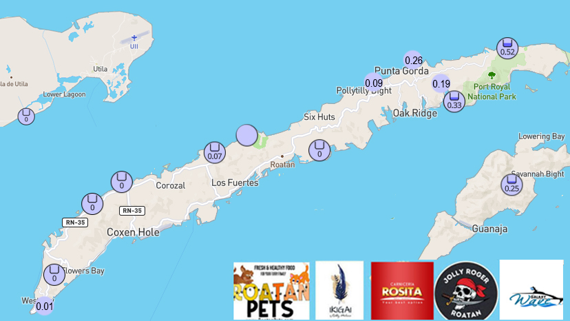
Rain (or lack thereof) for May 2024

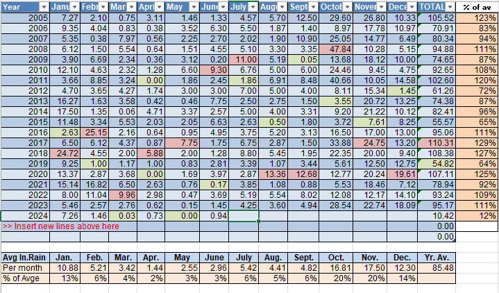
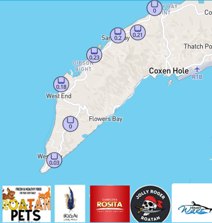
Rainfall (or lack of it) for May 2024. It will not surprise you to know that we are putting 0 inches of rain in the record books for the month of May. It is actually the first rainless May in our records going back to 1995. May 2024 will be one of the more memorable smoke seasons, with the airport closing several mornings due to visibility.

We have had less than an inch of rain recorded since the beginning of March. Looking forward into June, we normally pick up more squalls from the east with an average rainfall of over 3 inches. We have chances of rain, starting this weekend. Let’s hope they come through because the island is very thirsty.

June 4, 2024

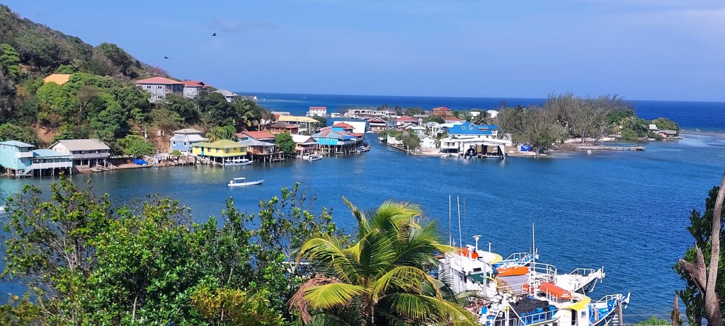
Good morning Bay Islands. This morning we have a photo from Kacee McDonald taken from Ipanema Bar and Grill in West End, a place that’s close to my heart, though I’ve never been there, because it includes the title of one of the best songs ever recorded.

On satellite this morning we can see those high, dry cirrus clouds coming from our west. There are only a few cumulus clouds around and, therefore, very little chance of rain today and tomorrow. As we get into Thursday and Friday we will see our chances of rain increase, but keep in mind, rain will not be likely on any day. Our chances this weekend will only increase from the current zero to about 30 percent.

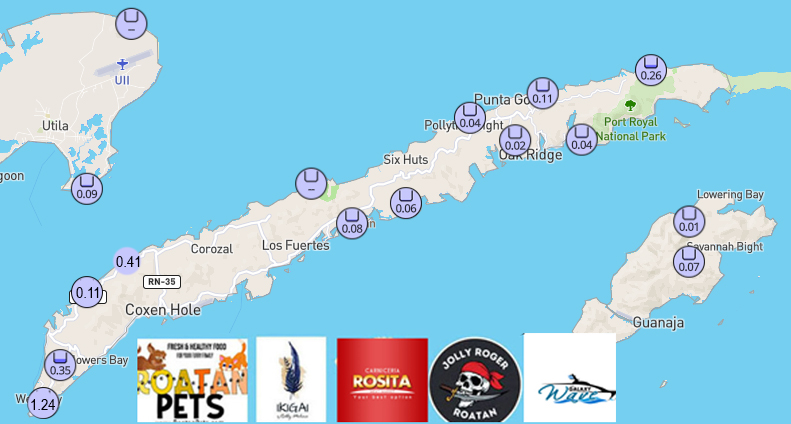
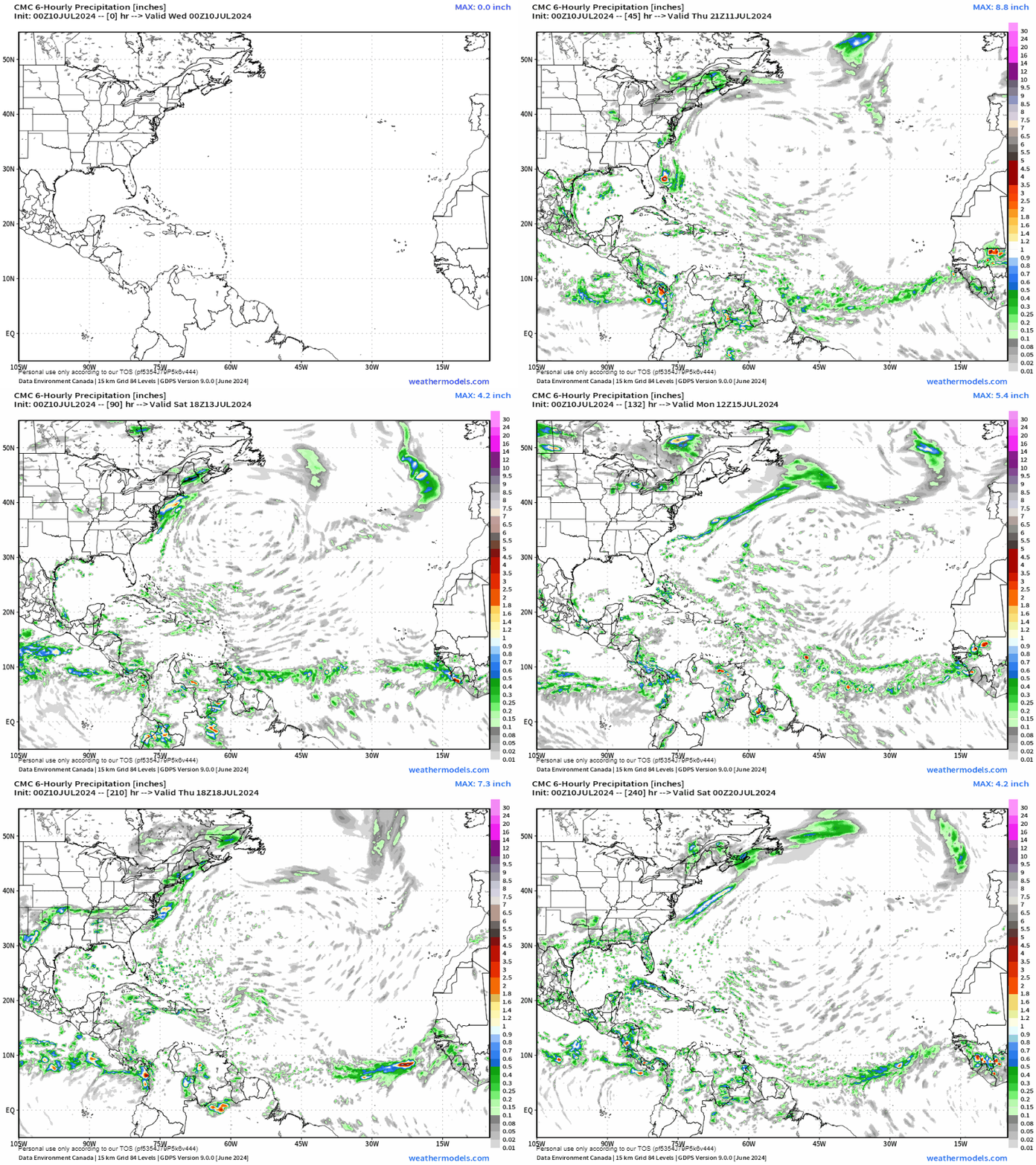
When talking about rain this time of year, we are talking about squalls coming from our east and, unfortunately, those squalls often die before they get here. Unlike our winter northerlies, when the wind hits the mountains on the mainland and create updraft for rain, we have no mountains to our west, and therefore no mechanism to create updraft. This forecast map from the Canadian model through the weekend shows a hole in the rainfall right over Coxen Hole. With rain showers around, we can still hope for some cooling rains somewhere, but there is no guarantee you will get any at your house. Yesterday we were 91 degrees (33C) at the airport. With rain nearby, I’m still hoping this weekend will be slightly cooler, maybe with a high around 87.

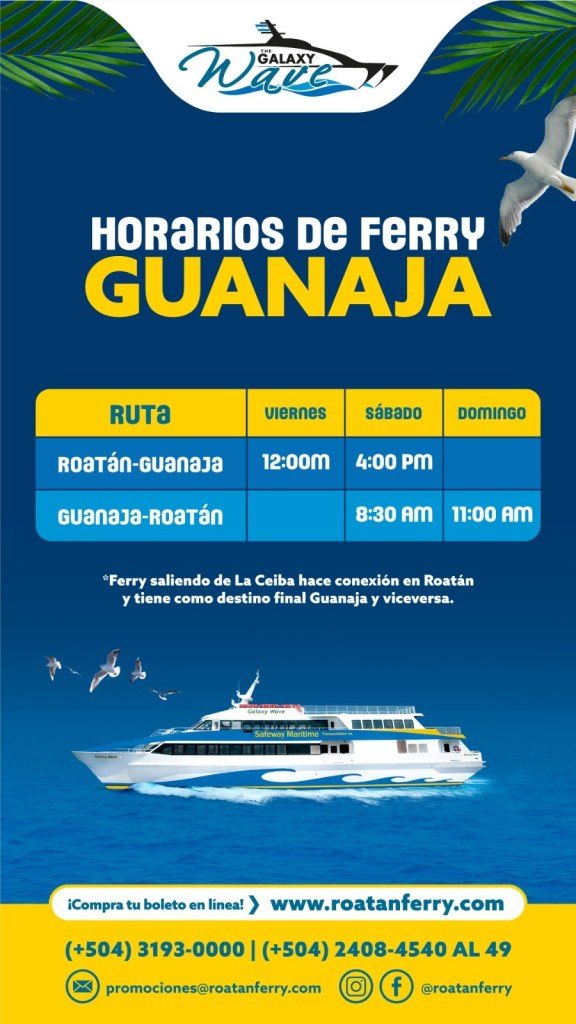
Wind and Galaxy Wave forecast: We wake up to winds around 10 mph from the east/northeast and seas at 2 feet. They will calm today to 1-2 feet and get even calmer as we get into the week. If you are someone who doesn’t llke a choppy sea, the next week will be the perfect time to hop aboard the Galaxy Wave to do some shopping in La Ceiba or make that weekend visit to Guanaja you’ve been promising yourself. It will definitely be smooth sailing (or ferrying) through the weekend.

Low tide is 1:15 p.m. Have a great Tuesday!

June 3, 2024

Good morning Bay Islands. Our photo of the day comes from Dawn Diamond on Water Cay in Utila and shows someone holding the sun in his hands. Watch out buddy, that things hot. We’ve been having too much sun and too little sky water. We have a little hope that may change this weekend.

Our satellite shows some clouds, but mostly the high, cirrus clouds that hold no rain moving from west to east. There are a very few popcorn clouds moving east to west that might give someone a shower, but the chances today are very low.

Chances of rain are pretty low this week until we get to Friday. Friday into the weekend the computers are wanting to give us a better chance of rain. This is the forecast from the Canadian model. I’ve noticed that the GFS is a little to optimistic about rain and the Canadian seems to have the right balance. But even the Canadian model is trying to give us a decent chance at rain Friday and Saturday. Let’s hope so.

Wind and Galaxy Wave forecast: We start the day with 15 mph east winds and seas 2-3 feet on the south side. By midday winds will be 10-15 mph and seas 1-2 feet. Today and tomorrow will be similar, but starting Wednesday we should have quite calm daytime winds and seas around 1 foot. A great time to plan your excursion with Jolly Roger Roatan if you will be visiting our island.

Low tide is 12:30 p.m. Have a great week.

June 2, 2024

Good morning Bay Islands. Our photo of the day comes from James Oden and shows a sun halo, which occurs when the sun peeks through ice crystals high in the atmosphere. It is a good reminder that no matter how hot it gets down here on the surfact, it is quite cold a few thousand feet up.

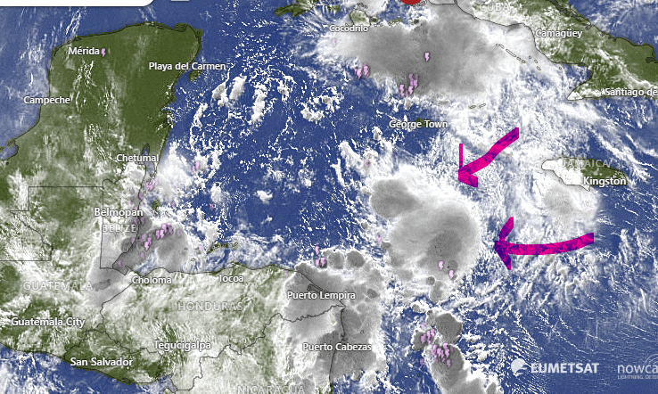
I had high hopes for morning showers today, but the rain formed just to our southeast, as shown by the red arrow. The majority of the moisture is well off to our east, shown with the green arrow. That mass of clouds will stay to our east, teasing us over the next few days. Every few mornings it may throw a little moisture our way, and the chances, though small, will be better the further east you go.

For as long as I can remember, the airport’s weather observations shut down at midnight and started back at 6 a.m. This weekend I’m noticing that the weather observation is 24 hours. Anyone know what’s changed?

Wind and Galaxy Wave forecast: We wake up to 15 mph east winds and seas 3 feet on the south side. Today will be much the same, but starting tomorrow, we will see things starting to calm down quite a bit with 10 mph east winds and seas 1-2 feet during the day. It will be a great week on the seas.

Just a reminder that Roa Fest sponsored by Galaxy Wave will be two weeks from today. It advertises a Rodeo, and living in Oklahoma so long that got me curious. I learned it isn’t barrel riding and calf roping, but an opportunity for the kids to ride ponies. Still sounds like fun and it benefits the public hospital.

Low tide will be 11:40 a.m. Have a great Sunday!
June 1, 2024

Good morning Bay Islands and welcome to June. Let’s hope our new month is wetter than our last one. It will almost certainly be clearer. Our photo of the day comes from Deena Kopetzky in Camp Bay. Deena is the first contestant of the month vying for a free dive at Sandy Bay Divers.

We start with our satellite photo and we again have some clouds to our east moving toward us. A light shower is possible but not likely for most of us. We’re really hoping for a morning shower for some of us tomorrow, which looks like the best day of the week for rain chances. Tomorrow’s rain chance is maybe 25 percent, while Monday through Thursday it is more like 10-15 percent. It should go up a little again next weekend.

Wind and Galaxy Wave forecast: Winds this morning are from the east at 15 mph and seas 2-3 feet south side. We will stay there today and tomorrow, but we will have noticeably calmer conditions starting Monday and through next week. It will be a great time to be on the sea.

Today is the official start of Hurricane Season, but there are no storms right now that are good suspects for a tropical storm. This map shows where June storms normally form. you will note the blue area dips close to us to our north, but keep in mind storms in our area typically move northwest and away from us, so a storm in June is highly unlikely for us. But never say never, especially with our strange climate these days.

Don’t forget tomorrow is Lobster Sunday, always a great day to enjoy a meal and a cocktail at Ikigai by Robby Molina in French Harbour.

Low tide will be 10:50 a.m. Have a great weekend!

May 31, 2024

Good morning Bay Islands. Our photo of the day comes from Joe Byrne in Punta Blanca and if I had to name it, I would call it “Hope on the Horizon.” We can see a line of rain-making cumulus clouds which means the return of rain to our parched islands. We aren’t going to get A LOT of rain, but we should, most of us, get some over the next several days. And there will be much more nearby, which means good things for the air, for the reef, and for temperatures.

On satellite this morning we see the storms over near the Mosquito Coast and clouds coming off of it, moving our way. This means some morning clouds, though not necessarily much rain. But a few of us might see a small shower. Over the next week we will be dealing with a lot of clouds, which will knock our temperatures back a couple of degrees. Most of our mornings should be around 80 (27C) and most of our afternoons should be around 87 (30.6C).

This is the Euro forecast for rainfall through Monday night, Tuesday morning at midnight. This is typical of the forecast models, with good rains to our east. This is what happens this time of year, when most of our rain sweeps in from the east, with the squalls dying as they move west. But hopefully enough of them last long enough to bring us a downpour.

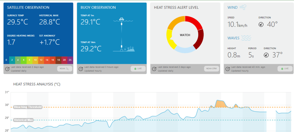
One of the effects of more clouds and rain around that we can already measure is reef temperature. Notice that the temp on the right side of the line graph has gone down about a third of a degree celsius. It was getting dangerously close to the bleaching line. I’m hoping the next week of clouds and occasional rain can push this temp down further.

Just a reminder that tomorrow is the day we vote for the Photo of the Month of May over in the Facebook group with the winner getting a $50 gift certificate to Hangover Hut. The five most liked photos will face off.

I know a few Huskies on the island who will be more than grateful for a little cooler weather. If you have a large dog, you know the challenge of getting him the proper nutrition with what is available on the island. Take him straight to the doggie dietician on the island, Mitch Cummins at Roatan Pets. And you’ll be helping the poorer pets on the island through his donations to Roatan Operation Animal Rescue.

Low tide is 10 a.m. Have a great Friday!

May 30, 2024

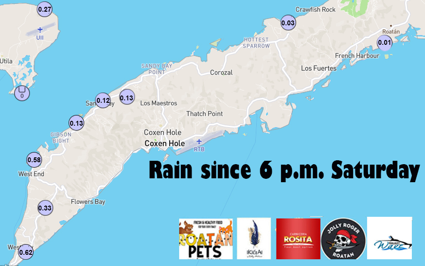
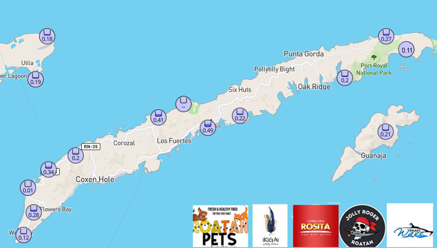
Good morning Bay Islands. Our photo of the day comes from Jason Farmer in Camp Bay and shows some rain on the horizon, especially on the right side of the photo. We had some reports of some sprinkles in Big Bight and Paiz Sloane picked up .15 of an inch on Guanaja. YAY!!!! This is hopefully previews of coming attractions. We have a storm system off the Nicaragua coast that may send some energy our way over the weekend. And we have unlimited visibility today. I think we are over the smoke for this year.

Just as proof that it really rained, here is the photo from Annette Huskin on Guanaja. With all the rain to our east, the further east you are, the better your chance of rain. Let’s hope we can get some more further west.

Wind and Galaxy Wave forecast: We start the day with 20 mph east winds and seas 3 feet southside. Midday winds will calm to 15 mph from the east/northeast. Through Saturday we will have similar winds, but starting Sunday and into next week we will see the winds calm a little each day until they are almost flat calm by the end of the week.

Here is the satellite today, and you can clearly see the strong storms near Nicaragua, but the arrow points to a small impulse of energy coming off the storms toward us. It is weakening and probably won’t be a lot of rain when it gets here, but at least there’s some hope. Rain chances will be best this weekend, with around a 25 percent chance of rain. After that we will still have chances of morning showers, around 15-20 percent each day next week.

With clearing skies, it is a great time to head over to Ikigai by Robby Molina for a meal on their back porch with a great view of French Harbour.

Lowest tide is 9:11 a.m. Have a great Thursday!

May 29, 2024

Good morning Bay Islands. This morning’s photo is from Regina Alpaugh at Half Moon Bay and I’m hoping it’s the last smoke photo we do. This morning we have 7000 meter visibility at the airport. That’s pretty good, though not as good as yesterday morning. Typically visibility will get a little worse midmorning before getting better in the afternoon.

On our satellite we have some high clouds near the islands and to our southwest, but the main feature is the storminess off the coast of southern Nicaragua. This moisture will generally move northwest over the next few days. We will have small rain chances, especially in the morning but the mainland will have better chances. That will mean fewer fires and maybe knock our temperature back a couple of degrees, from 90-91 (32-33C) to 88-89 (31-32C).

When you look at this forecast for rainfall through Sunday night, you don’t see a lot of rain for the islands, just a few millimeters (hundredths of an inch). But at least you see a chance for SOME rain, which is more than we’ve been able to say the past few week. Plus rain in eastern Honduras should help put out the rest of the fires.
Wind and Galaxy Wave forecast: For today, tomorrow and Saturday, we will have east winds 15-20 mph and 3 foot seas during the nights and 10-15 mph and 2 foot during the day. Starting Sunday winds calm a good bit, getting almost flat calm mid to late next week.

When I’m in the States one of the things I miss the most is Carniceria Rosita smoked pork chops. There’s nothing like them, even in the US.

Tides continue to be quite mild. Have a great Wednesday.

May 28, 2024

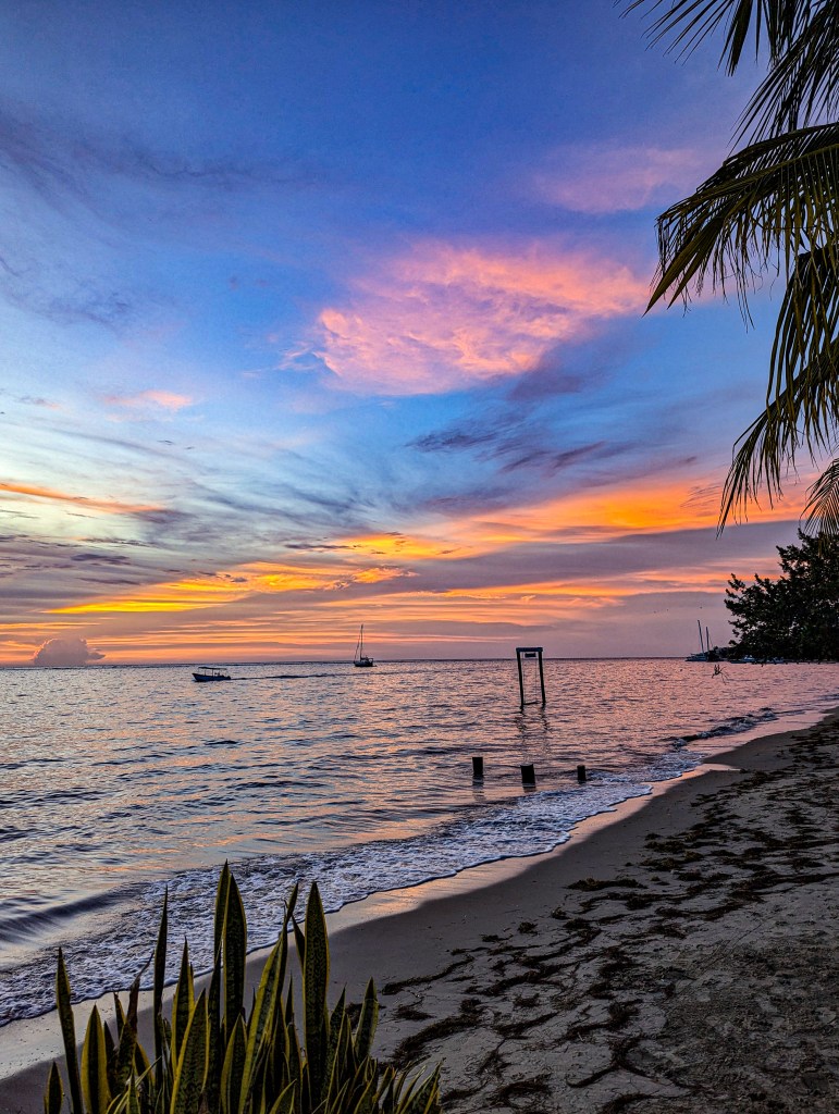
Good morning Bay Islands. Our photo of the day comes from Jeff Kuryk who gives us a panomaramic sunset at West Bay Beach. Remember we just have until Friday to enter to win $50 at Hangover Hut by sending me a photo at bookmybio@gmail.com with name and location. We have good news today, unfortunately it isn’t rain, but we do have near unlimited visibility in the morning for the first time in forever.

Here’s our closeup satellite and we can see the smoke plume is not as hevy as it has been in recent days and is off to the west of Roatan, so you folks on Utila are still dealing with a little smoke.

You can see there is some rain off to our east. This should push a little more moisture our way. It means that starting Wednesday, instead of a 0 percent chance of rain, we will start having like a 15-20 percent chance of a morning shower. It isn’t much but it is something. On the mainland the chances will be higher, which will be good for putting out the fires. The main storm will stay to our east before moving north and out of the area.

When it comes to the oppressive heat we’ve been experiencing, this is one of the better explanations I’ve seen. It comes from Jeff Berardelli, a forecaster for WFLA in Tampa, Florida. We had a heat index yesterday of 116 degrees (42C) at West Bay Hills, which is away from the beaches and therefore usually a tad hotter than it is right on the sea Being this hot this early is not good, but if we can get rain nearby, it will cool us off a few degrees.

With bluer skies returning to the island, if you’re planning your next cruise excursion your best bet is to look up the ones led by Jolly Roger Roatan. They will always give you the best island experience and get you back to your boat in good time.

High and low tides look fairly mild. Have a great Tuesday!