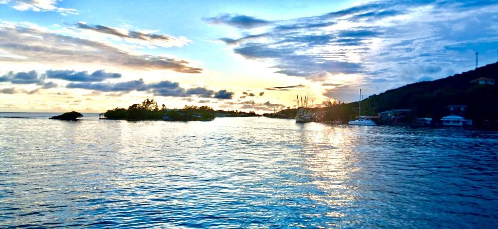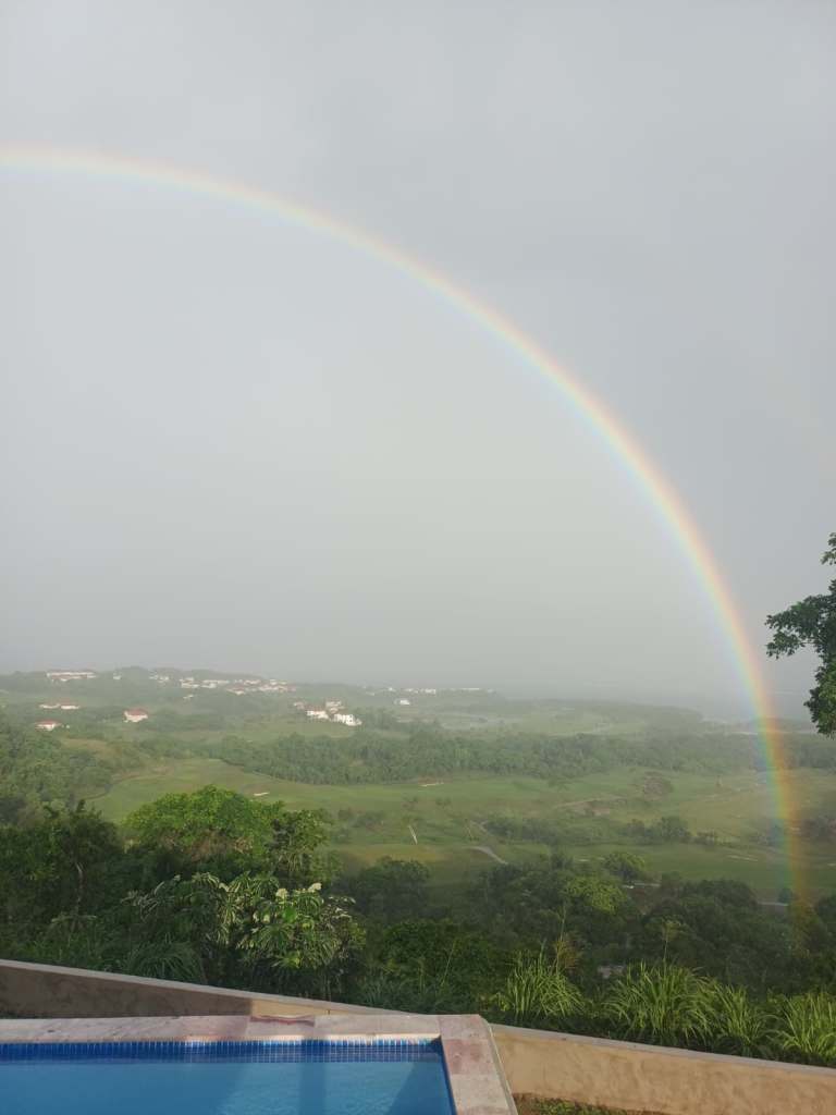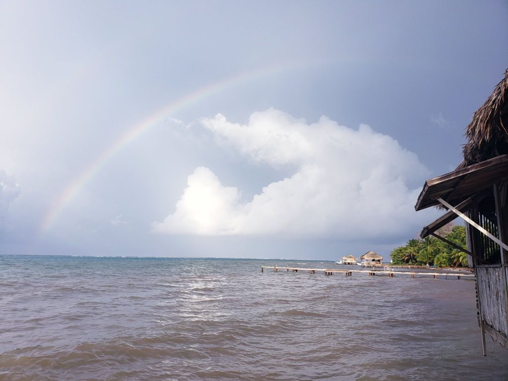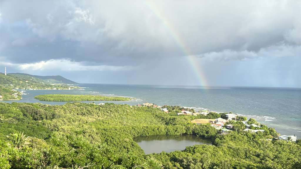
Good morning Bay Islands. Our photo of the day comes from Lois Hill and shows a rainbow in front of Jonesville Point with Oakridge on the left. I love how this photo shows the sheet of rain creating the rainbow.
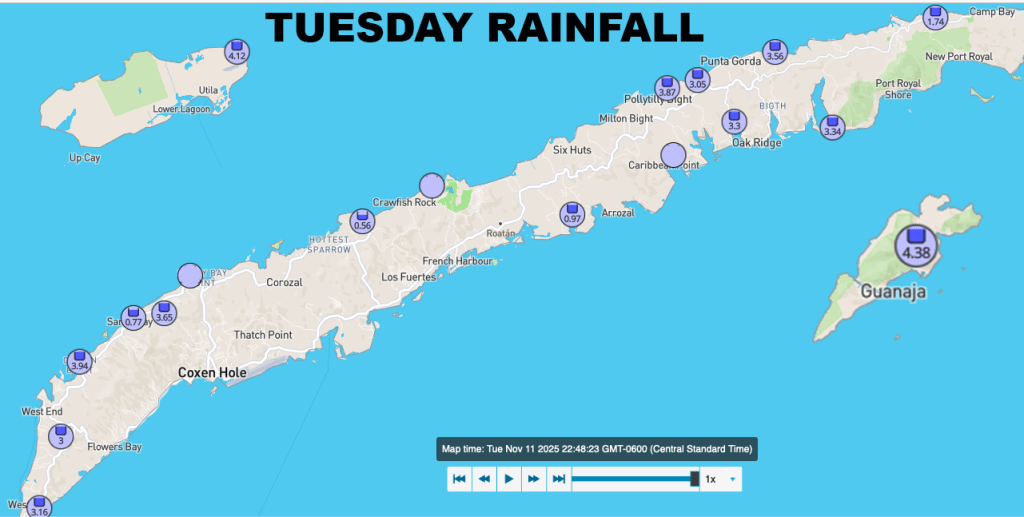
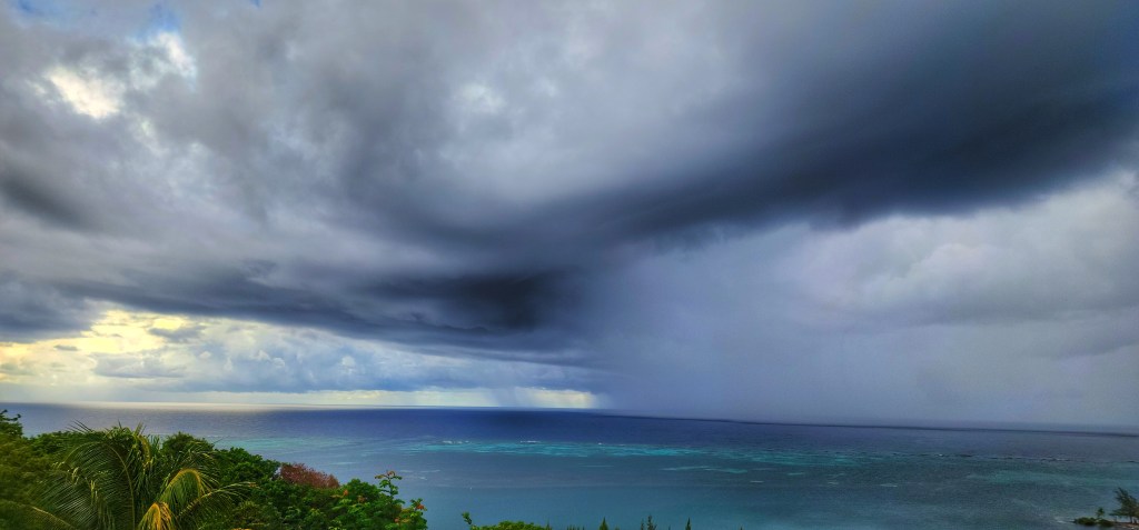
We’ve had about half an inch of rain in many places, though as of 7:30 a.m. our Utila stations hadn’t gotten rain. There’s a good chance of catching more showers this morning.
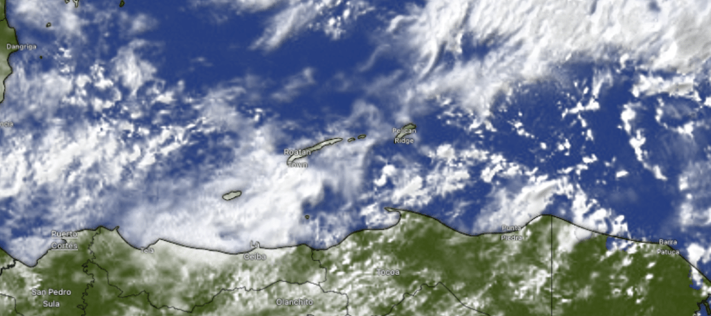
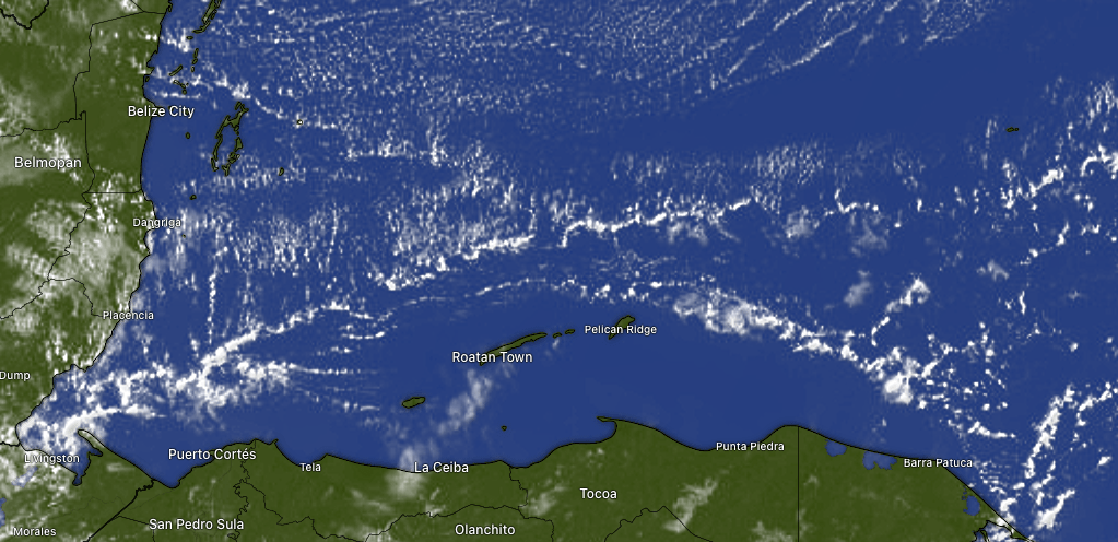
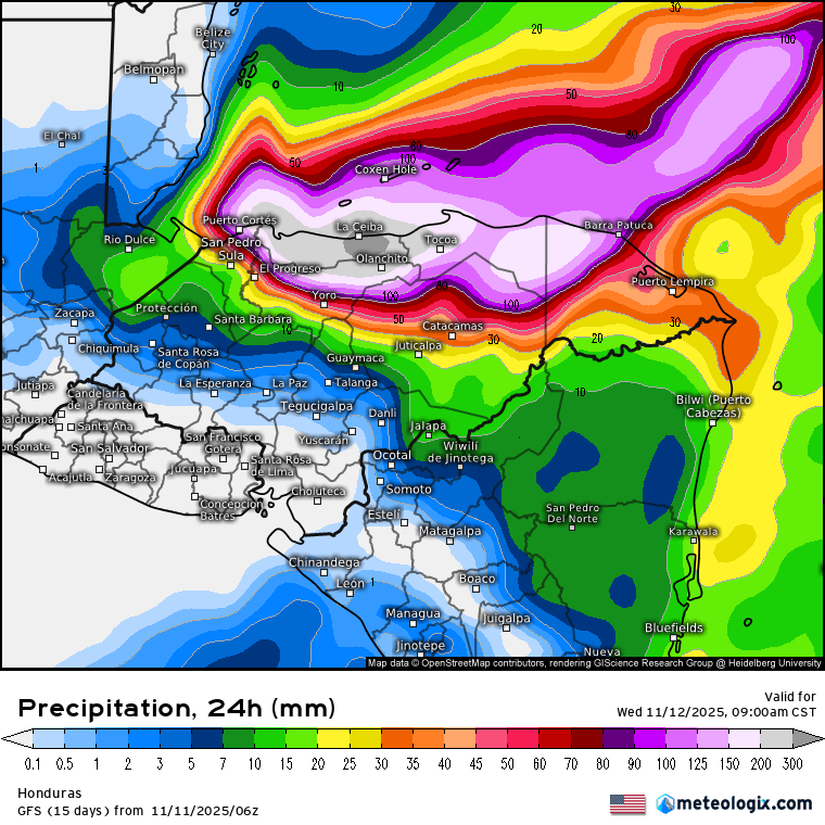
On satellite at 7:30 a.m. we see rain mostly on the east side of our islands, moving west. We will have a decent chance of more showers, especially through the morning. We can’t say there will be no rain in the afternoon, but there should be less. The same is true tomorrow. Friday the rain chances look a bit better throughout the day.
Wind and Galaxy Wave forecast: This morning West Bay picked up a wind gust of 30 mph. That’s a taste of what the wind is like a lot in April. This morning we’re back to east winds 15 mph and seas 3 feet, where we should stay most of today. Tomorrow should be calmer with east winds 5-10 mph and seas 2 feet. Friday into the weekend will be even calmer with seas 1-2 feet.

Lots of Americans will be shopping for meats. Before you go anywhere else, check out Carniceria Rosita, especially if you are seeking a ham.
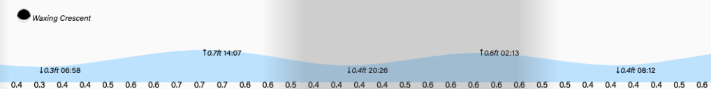
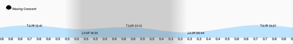
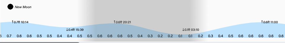
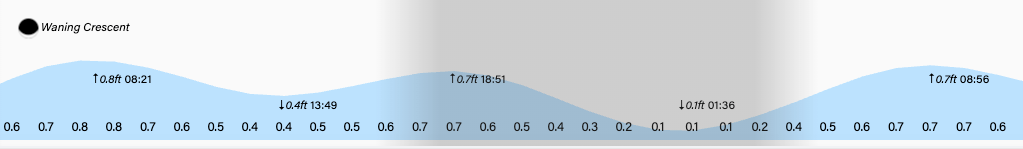
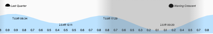
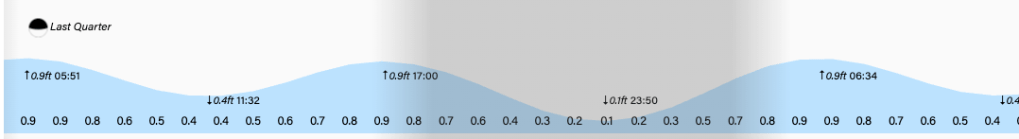
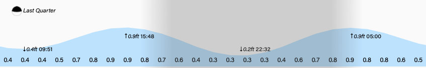
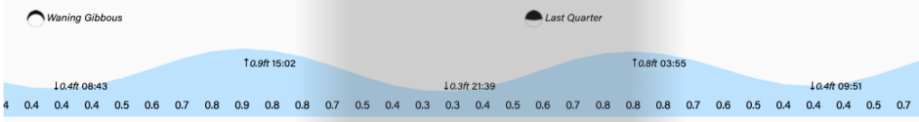
Tides remain quite mild. Have a great Wednesday!