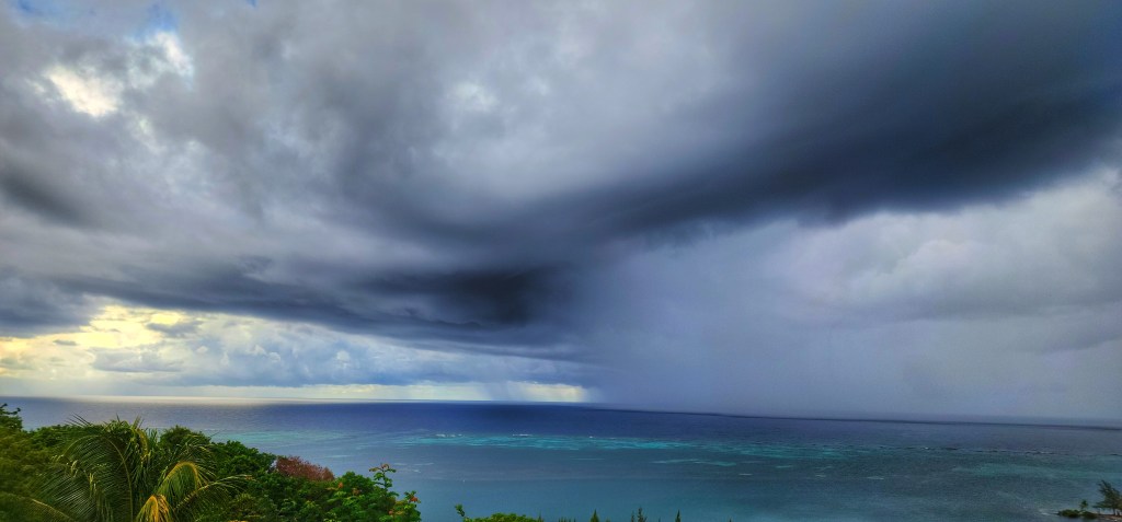
Good morning Bay Islands. Our photo of the day comes from Jackie Taylor who caught this storm rolling in to Milton Bight recently. We aren’t seeing storms rolling in because we are under a norther that will get stronger as the day goes on, but there is light at the end of the tunnel. As of 7:30 a.m. West Bay has had 2 inches and 3-5 inches have fallen on the east side. There is much more to come.
On satellite at 7:45 a.m. we can see a lot of rain, especially to our east and we can see the clearer, colder skies behind our cold front that are now reaching the northern Yucatan. This morning we are at 20 mph northeast winds near the islands with 4 foot seas, but to our north out to sea, buoys are showing 7 foot seas. Winds and seas will build through today to 25-30 mph north winds and seas 7-9 feet. In other words a day to stay off the beach and the seas.
At some point tomorrow winds will turn to the west around 20-25 mph and bring seas 6-7 feet.
Thursday continues to look a little better with rain mostly in the morning hours and maybe some dry midday and afternoon periods. Winds will be from the west 20 mph and seas 4-5 feet.
Friday, after some morning showers, looks nice and the weekend looks wonderful. Mostly dry with very mild winds and seas. There’s your light at the end of the tunnel.
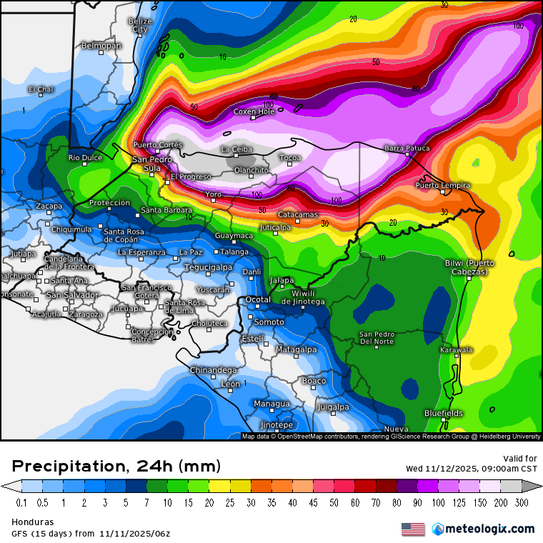
Here is the 24 hour precipitation from 9 a.m. today to 9 a.m. tomorrow. We are in the range of 4-5 additional inches of rain on top of what we’ve already received. Things look much worse for La Ceiba with up to a foot of additional rain just in the next 24 hours.

This is a good time to mention that next week looks MUCH BETTER than this week, with only a shower here and there, a lot of sun, and a return to our traditional trade winds from the east, only around 10-15 mph and seas 2-3 feet. Great conditions for visitors and Jolly Roger Roatan will find you a beautiful, calm piece of reef to snorkel.
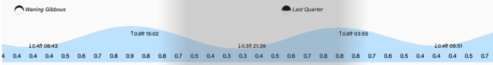
High tide is 3 p.m. which could increase beach erosion when the worst of the waves hit this afternoon. Stay safe out there!
