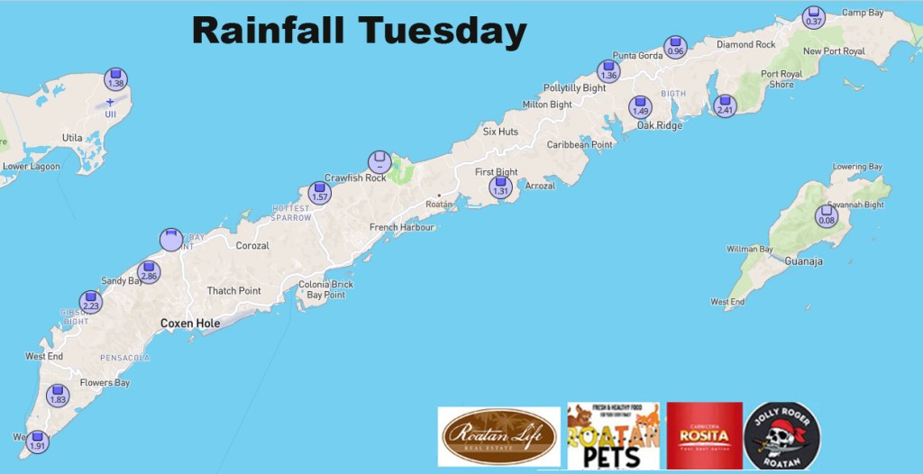
For the month of December we are continuing to go with Sandy Bay’s number of 13.77 inches, which was a bit above average and brought us to a close of 2025 only slightly below average with 83.52 inches of rain.
Looking ahead, January is the last month of rainy season and generally is the driest. Since we are starting the month on the dry side I think it may come in drier than normal, though the long range forecast shows more rain toward the middle of the month.
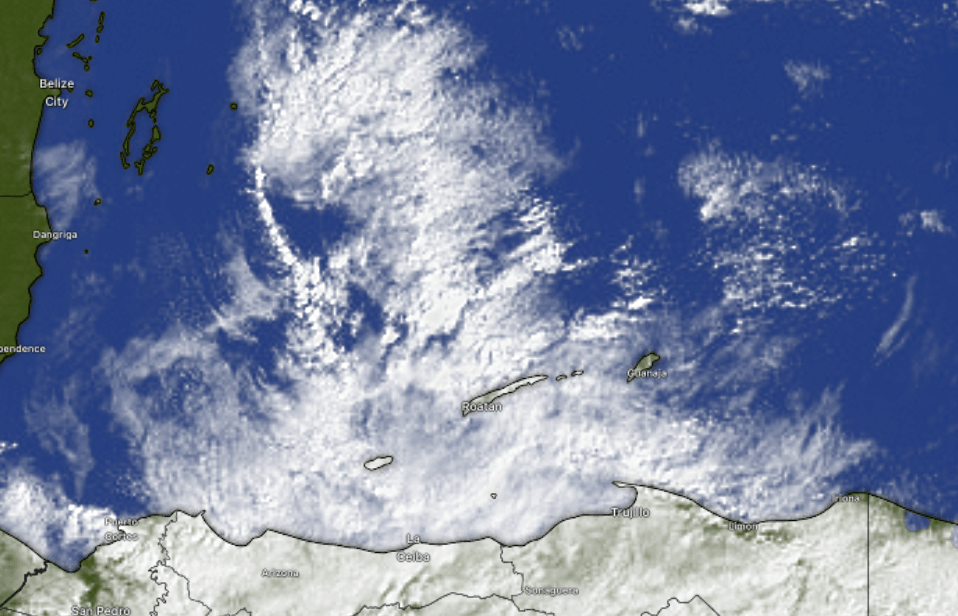
I had AI create a visualization of December 2025 rainfall reports across the islands. Here is what it came up with.
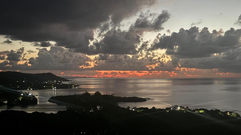
Good morning Bay Islands. Our photo of the day is the last sunrise of 2025 overlooking Jonesville Point and Oakridge from Alex Fleig. We ended 2025 on a cold and rainy note. Most of us on the islands got about an inch through between yesterday and today. Oakridge Bight actually got down to 66 yesterday morning (18.8C) and 68 this morning (19C). We have a moderate north wind and surf on the north side. Things will get calmer, warmer and drier from here.
At 9 a.m. we are still dealing with a lot of clouds and some rain from our mini-norther. We will slowly see the clouds and rain diminish this morning and we should be mostly dry this afternoon. After that we are looking at an extended period of dry conditions, unusual for January, and I bet by the end of it some of us will be wishing it would rain again. We will still have a morning shower here and there but for the next week, it won’t feel like rainy season.
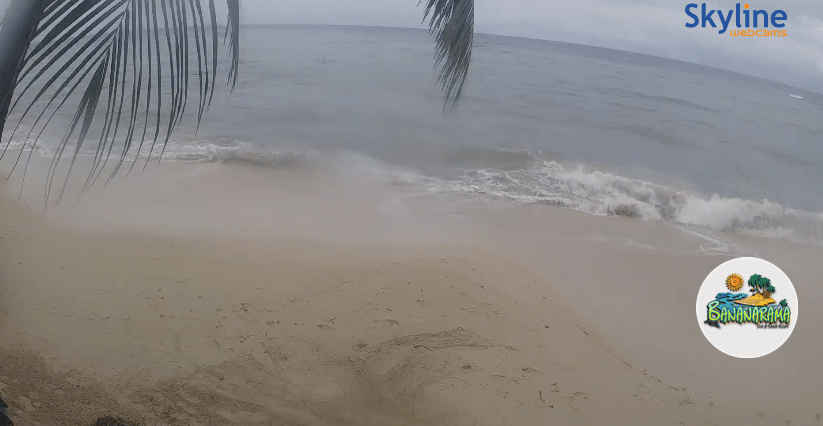
Wind and wave forecast: This is a screenshot from the Bananarama webcam on West Bay Beach. It shows something very rare on WBB, surf. West Bay is West Bay because it is the most protected beach on Roatan from prevailing winds and surf, but this morning the buoy at Turtling Bay shows 5 foot seas and 15 mph north winds. Those winds should diminish to 10 mph this afternoon and seas to 3-4 feet. Tomorrow and Saturday winds turn to the east/northeast 10 mph and seas 3 feet. Sunday through Tuesday, winds will be very light and variable and seas 1-2 feet. Those will be great days on the sea.
Many thanks to Jolly Roger Roatan for sponsoring the monthly photo contest and here’s to a successful 2026 for you and yours.
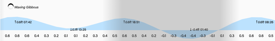
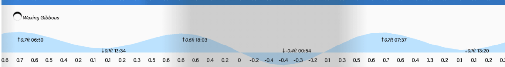
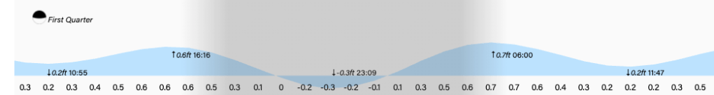
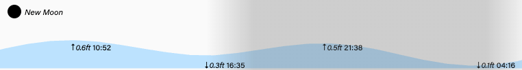
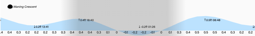
Tide will be quite low at 1:30 a.m. Have a great Thursday and Go Dawgs! (American College Football playoffs for those who don’t celebrate)
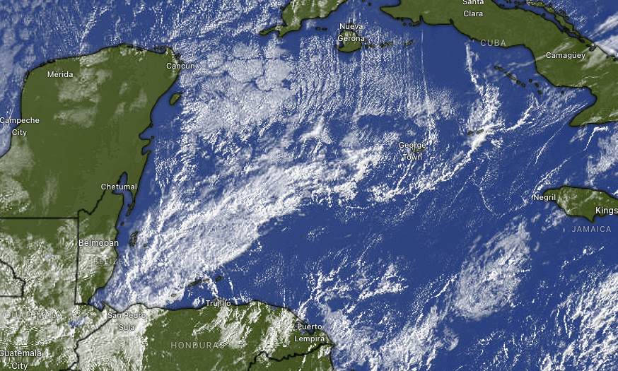
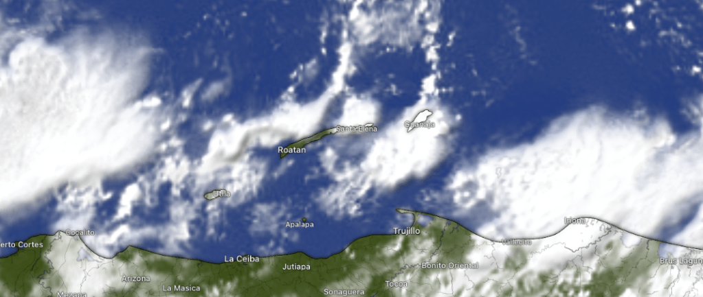
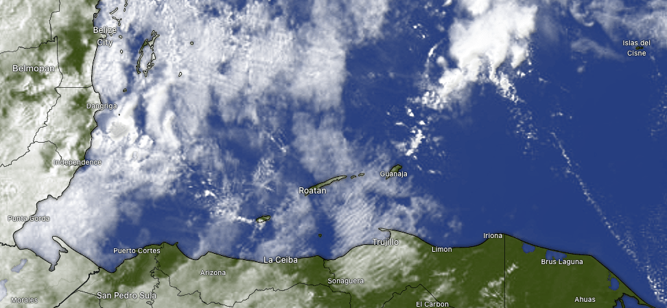
Good morning Bay Islands. Our satellite this morning shows the clouds from our mini-norther approaching our islands at 7:15 a.m., bringing winds from the northwest about 10 mph and cooler temperatures, right around 70 this morning (21C). I know everyone wants to know if it will be raining as you ring in the New Year.
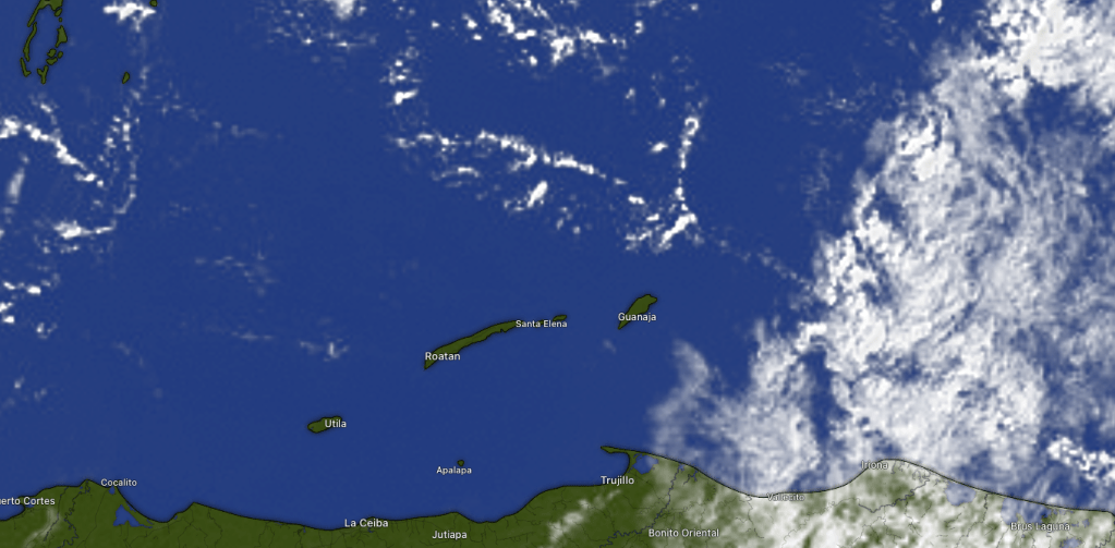
At 7:15 you can see some especially thick clouds coming in to Utila, giving them a nice shower. Some of these clouds may contain some rain, so there will be a chance of a shower here and there. Chances of rain increase through the afternoon. I think it is likely most of us will get rain at some point this afternoon through the overnight, but will it be raining on your New Year’s Eve party?
Here is the rain forecast for 10 p.m. to 4 a.m. from the German ICON. They think you might be OK, unless you’re on Utila.
Here is the GFS, which gives us a better chance at seeing some rain at some point 10 p.m. to 4 a.m. The point is, it is possible you will avoid the rain during your party, but there is also a good chance for a shower, so be prepared. We will also have quite fresh conditions the next two days and I fully expect to see some upper 60s (perhaps 19C) tomorrow morning. After tonight, the forecast starting tomorrow is quite dry for the week ahead.
Recently purchased a home or building in Roatan? Jungle Water offers interior design & decorating services, remodel work, custom locally-made furniture, trade furniture imported from US stores at great prices, and a home store full of beautiful rugs, lamps and other decorative items. Visit us in Coral Stone Plaza, M-F, 10am-5pm. WhatsApp: 9752-9940.
Wind and Wave forecast: We will see north winds increasing to about 15 mph this afternoon through tomorrow morning with waves 4-5 feet, especially north side. Winds will turn back to the east Friday and get quite calm over the weekend.
Lowest tide will be quite low at 1 a.m. Have a great last day of 2025!
Good morning Bay Islands on the penultimate day of the year. Our photo of the day is a wonderful sunset from Brad Ryon on Utila. At 2 a.m. a few locations mid-island and east side, as well as Utila, got a good rain. I know you’re wondering about tomorrow night.
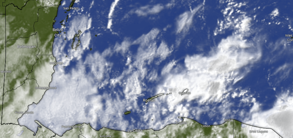
At 7:30 we see on satellite that most of the rain is to our west. There are a few showers to Roatan’s northeast, so a chance of a shower here or there this morning, but mostly sunny midday and afternoon. Our rain chances tomorrow morning are also pretty low. As for New Year’s Eve, rain chances will increase as we get toward midnight.
Here is the GFS (American model) forecast through Monday. You can see today’s morning rains pass through, followed by clearing this afternoon through tomorrow morning. As wave of rain energy passes through tomorrow night, but it is possible most of it may miss us to the west, keep our New Year’s revelers drier. I would say there is still a 60 or 70 percent chance you will see some rain at some point New Year’s Eve night into New Year’s morning. After that we look quite dry into next week.
Wind and wave forecast: We are quite calm this morning, but what winds we have are starting to turn to the northeast. We will have northeast winds today 5-10 mph and seas 2-3 feet. Tomorrow morning will start calm, but winds will increase in the afternoon from the north to 15-20 mph as we get toward tomorrow night into Thursday morning, with seas 4-5 feet. Friday winds turn back to the east.
If you want great meats for your holiday cookout, check out Carniceria Rosita in French Harbour or Coxen Hole. Keep in mind they will be closed on New Year’s Day.
The tide will be quite low at midnight tonight. Have a great Tuesday!
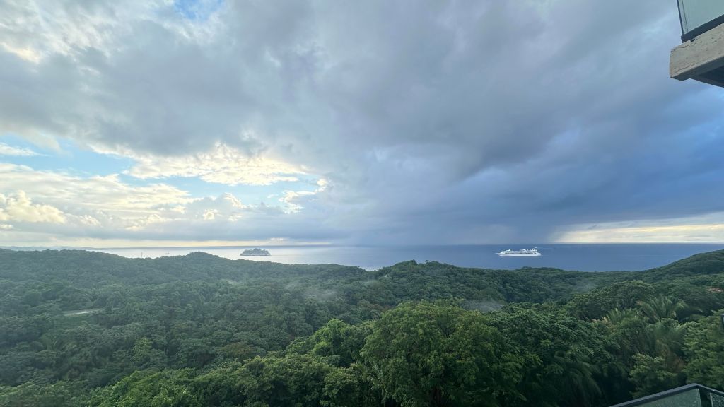
Good morning Bay Islands. Our photo of the day comes from Kam Kirkconnell and shows a couple of cruise ships in the foreground of a rain shower. Yesterday we had a rare December day with no stations reporting rain. As of 7:30 a.m. we have only had a few showers mid-island and east side for about a tenth of an inch. There is rain in the forecast, but a dry spell starting Friday.
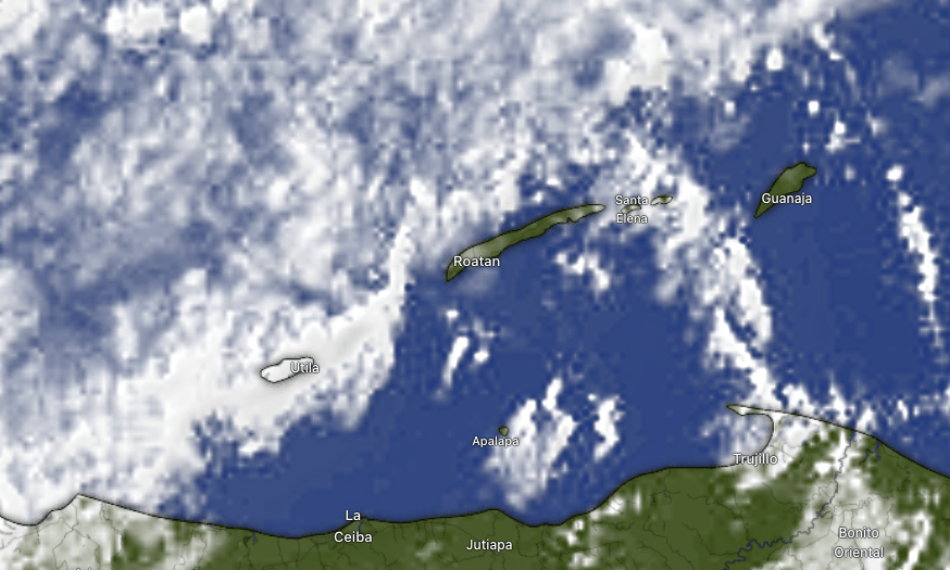
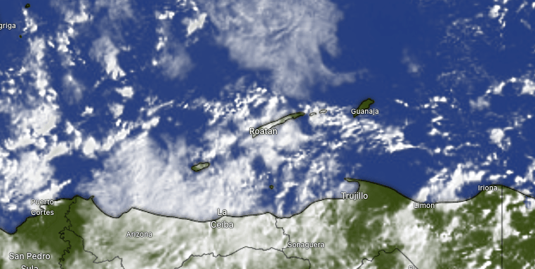
Here is our 7:30 a.m. satellite. There is a mass of clouds and rain to the east of Guanaja, but it doesn’t seem to be moving very fast and should decrease as the morning goes on. We will keep a chance of showers through the morning, probably drier midday, but as we get into the late afternoon and early evening, rain chances go up through tonight into tomorrow morning. We may get a little break tomorrow afternoon and through tomorrow night, but Wednesday into Thursday morning we will have a good chance of rain. The good news is that starting Friday and into the following week the forecast looks quite dry.
Wind and wave forecast: We start the day with east winds 10-15 mph and seas 2-3 feet. We should stay right around there today, but winds should decrease tomorrow to 5-10 mph but turn to the north. Waves will still be 2-3 feet. The windiest waviest period will be Wednesday evening into Thursday, when we get north winds gusting up to 20 mph and seas 3-5 feet, especially north side. Winds turn back to the east 15 mph and seas 2-3 feet Friday. Early next week looks like ideal weather, with calm winds and seas.
Explore Roatan real estate with the island’s top experts at Roatan Life Real Estate. Serving clients since 2001, we offer personalized guidance in buying and selling properties. Trust our dedicated team for unparalleled local knowledge. Start your journey at http://www.roatanlife.com.
Good morning Bay Islands. We are clear this morning with some broken clouds to the east. We may get more clouds as the day goes on, but we should stay dry. I can’t say the same for the rest of the week.
Our forecast for tomorrow has gotten a little wetter. We have a small chance of a morning shower, but the rain chances should increase through the afternoon tomorrow. Tuesday looks like the rainiest day of the week, but scattered showers will persist Wednesday and Thursday with our mini-norther. On the bright side, Saturday into the following week looks quite dry.
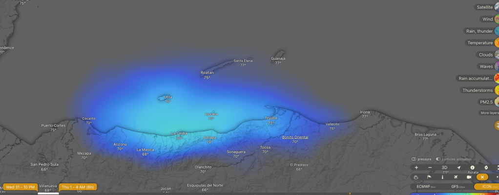
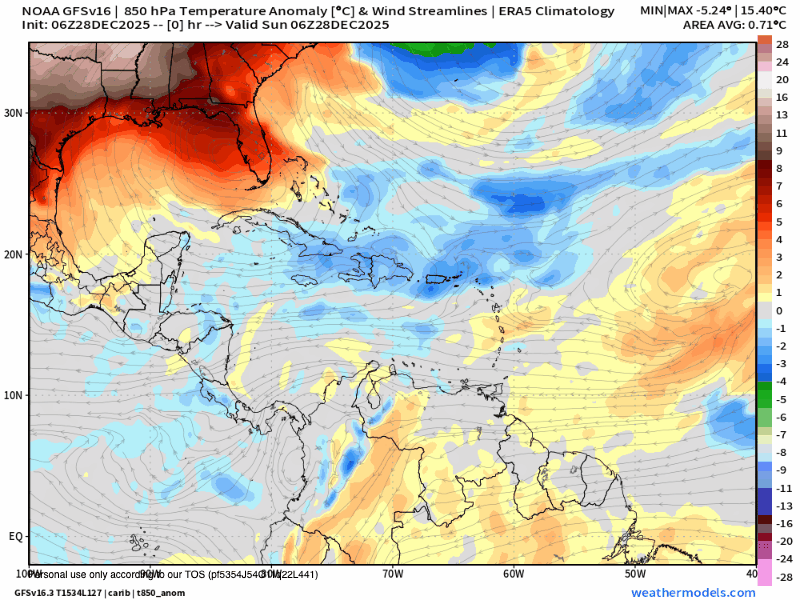
This is a mild norther, but we should get some fresher temperatures out of it. Here is the temperature anomaly forecast for the upper atmosphere. The blues are cooler temperatures. We are forecast for cooler conditions Wednesday through Friday, meaning we will mostly be in the 70s (low 20s C), with maybe a morning where a few of us get 68 or 69 (20C).
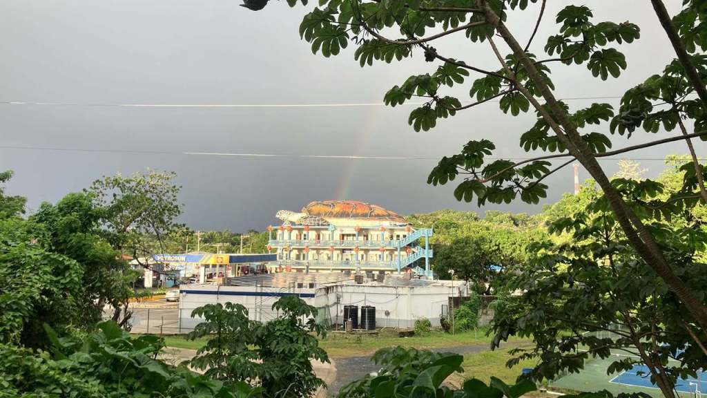
Our photo of the day comes from Scuba Merry and shows a rainbow coming out of the Big Turtle yesterday in West End. We had the right combination of rain and sun to get some rainbows. Today looks a lot like yesterday.
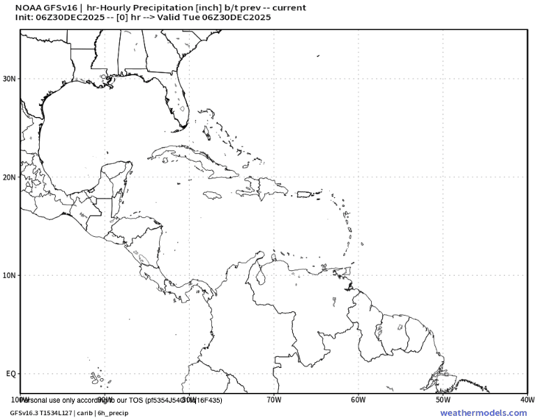
Screenshot
Here’s our rainfall for yesterday, around 2 inches west side, 1-2 inches most locations mid-island and east side.
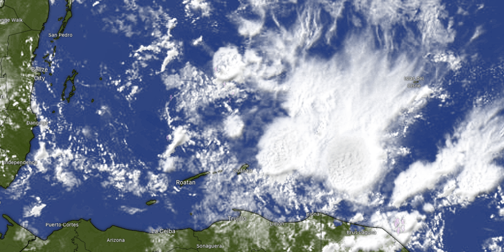
Here’s our 7:30 a.m. satellite. At this moment Guanaja is getting a good rain and those clouds are moving toward the west. We will have good chances of rain this morning and a mix of sun and clouds with a shower here and there this afternoon, much like yesterday. The forecast looks the same through Friday. Saturday after some morning showers we should get drier and that drier air should last through Sunday. We are still looking at the possibility of a very small norther on Tuesday.
Wind and wave forecast: We start the day with 15 mph east winds and seas 3 feet. We should stay right around there today and the rest of this week.
Tides continue to be quite mild. Have a great Wednesday!
Good morning Bay Islands. We wake up once again to scattered showers, but if you look to the east, there is a lot more clear sky, so after we get these morning showers out of here, I think we will see a mostly sunny afternoon. Starting tomorrow though, we will have more scattered showers, including a few middays and afternoons through the end of the week.
Wind and Wave forecast: We have moderate winds 10-15 mph from the east and they should calm in the afternoons to 5-10 mph, but we will be dealing with 3-4 foot waves from the northeast this week because of swell (waves caused by winds further away).
Carniceria Rosita has special hours for a special week. Go there for the best meats on the island!
Good morning Bay Islands. Our satellite at 8:30 a.m. shows high cirrus clouds that hold no rain. Today should be dry, with east winds 5-10 mph and seas 2 feet. Tomorrow our east winds get a little stronger at 15 mph and seas 2-3 feet with about a 30 percent chance of showers, mostly in the morning. Rain chances go up to 40 percent this weekend. Next week chances of showers go up, especially toward the end of the week while winds will be pretty mild, from the east 5-10 mph and seas 2-3 feet. Have a great Thursday!
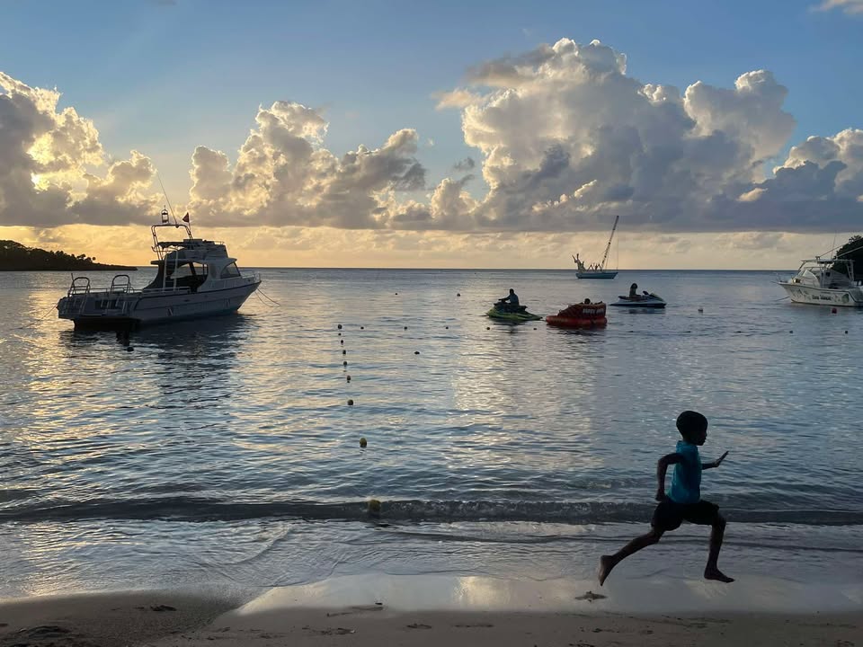
Good morning Bay Islands. Our photo of the day shows a young man running along West End Beach and comes from Michele Akel. This morning we have some showers over the east side and many of us got morning rain good for a tenth of an inch or so as of 8 a.m. Monday and Tuesday rain totaled 3-4 inches for most of us with 5 inches on Utila. The next two days will be MUCH drier before scattered showers return Friday into the weekend.
Our 8 a.m. satellite shows clouds, especially over the east end and Guanaja. These clouds aren’t moving much, but they should decrease as the morning goes along. Midday and afternoon we will be partly sunny with low chances of any passing showers. Tomorrow looks like the driest day of the week, with very low chances of any showers. Friday into the weekend we will have chances of morning showers each day, with rain totals probably not more than a third of an inch on any day.
Wind and wave forecast: Today we will have light and variable winds and seas 2 feet due to swell. Starting tomorrow into the weekend we will get 10-15 mph east winds and seas 2-3 feet, especially south side.
In any kind of weather, Jolly Roger Roatan offers a great excursion experience and promises to get you back to your destination safe and on time. Don’t forget, the photo of the month gets a free excursion valued at $100. Message your photos here or at bookmybio@gmail.com with name and location.