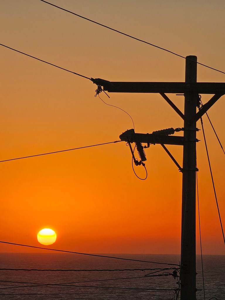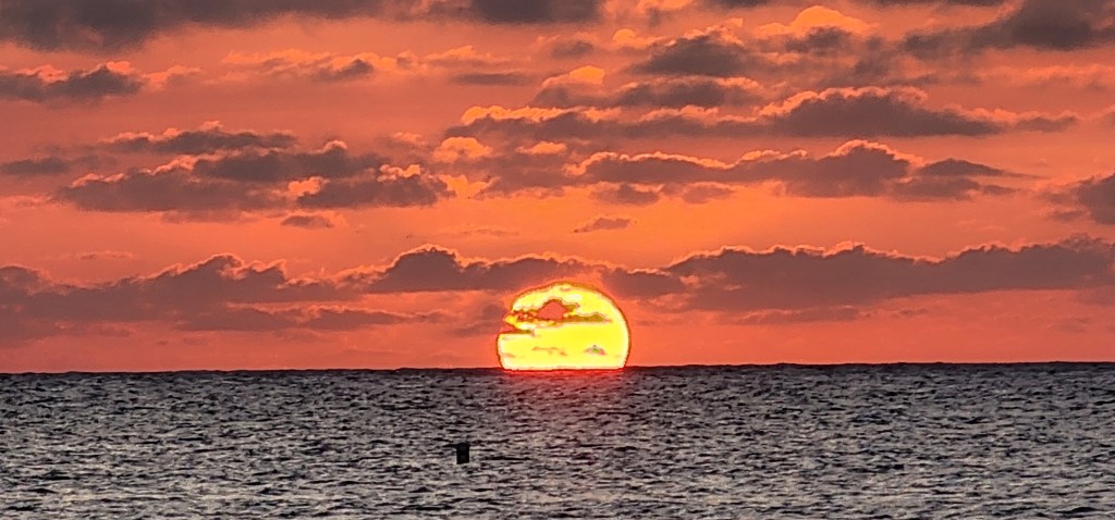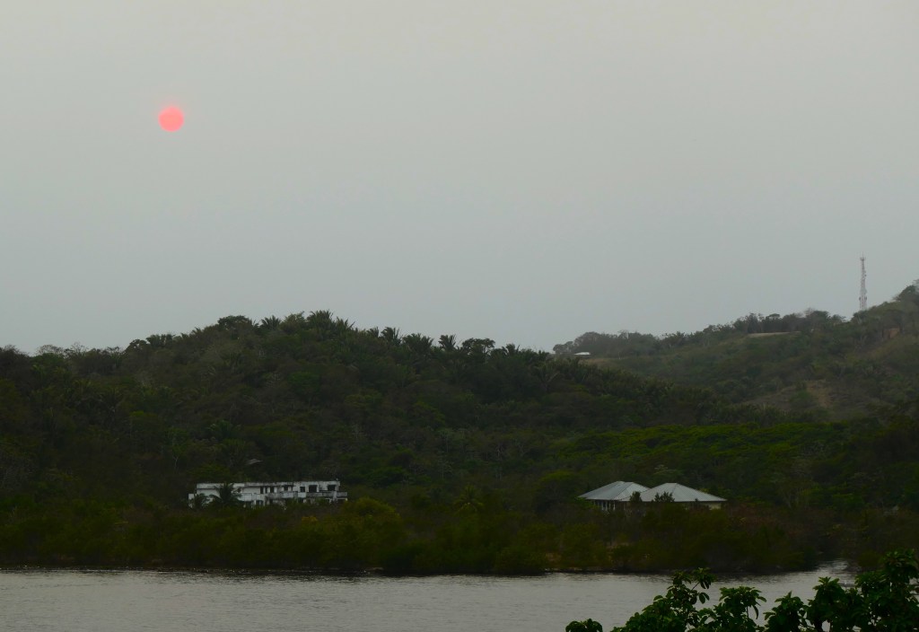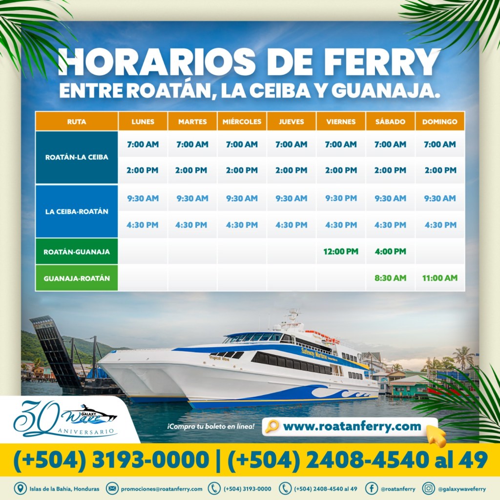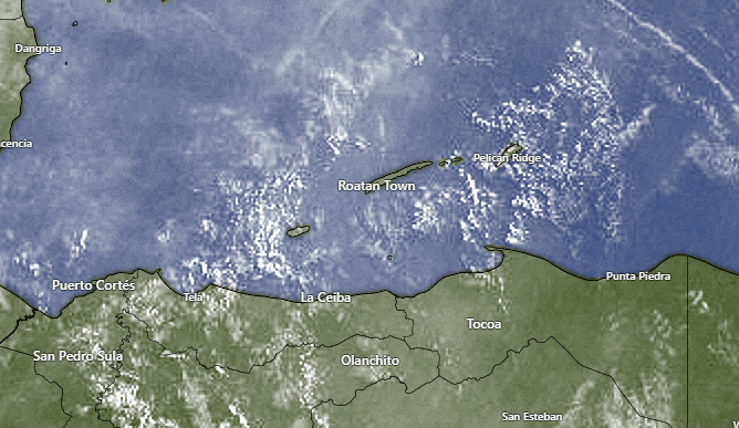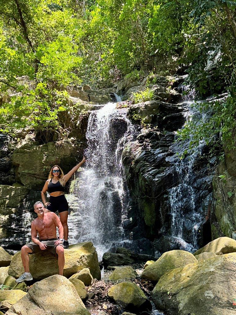
Good morning Bay Islands. Our photo this morning comes from Will Rutledge and shows him and his friend Tati Pereira at the waterfall coming off Michael Rock in Guanaja. It is a great reminder of all the fun things you can do when you hop on the Galaxy Wave ferry to Guanaja on a Friday or a Saturday. We seem to be in an endless cycle of morning smoke and afternoon heat.
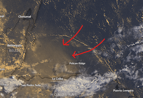
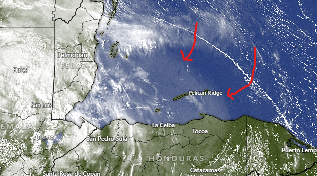
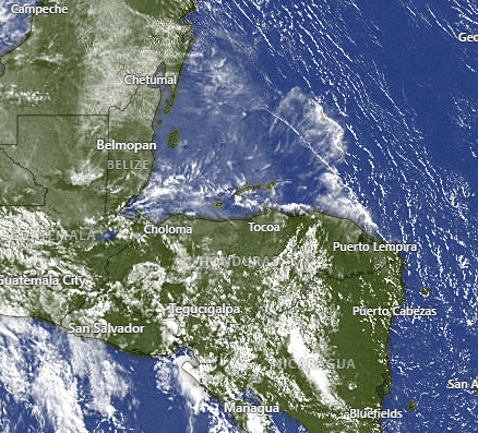
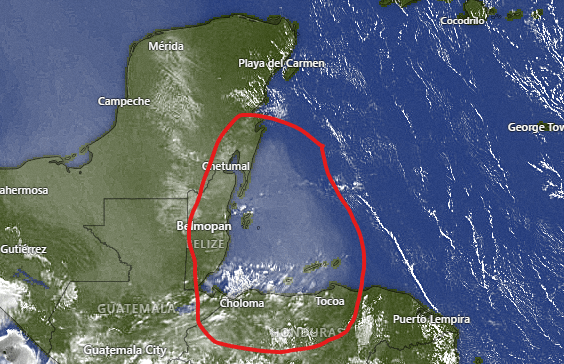
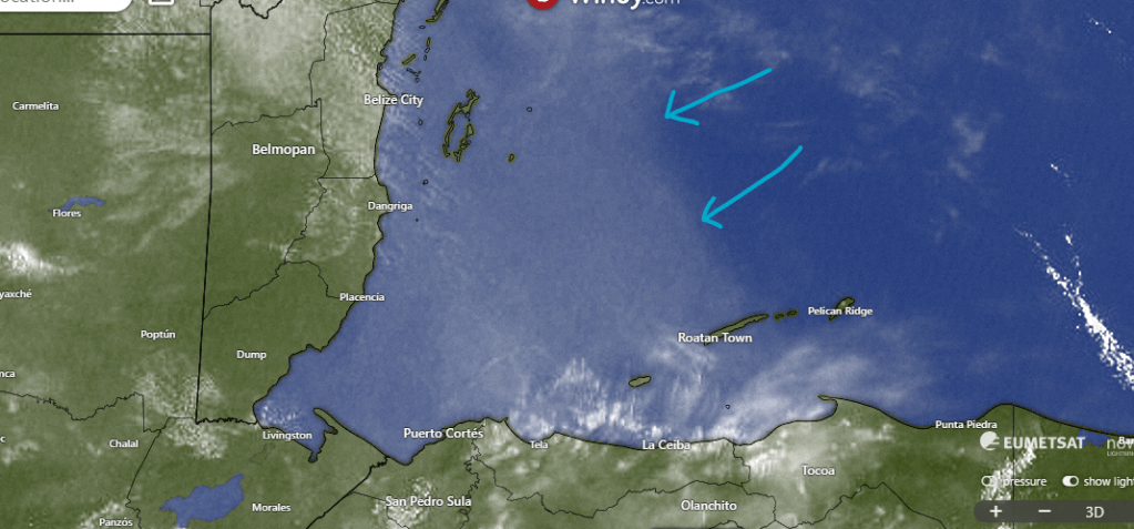
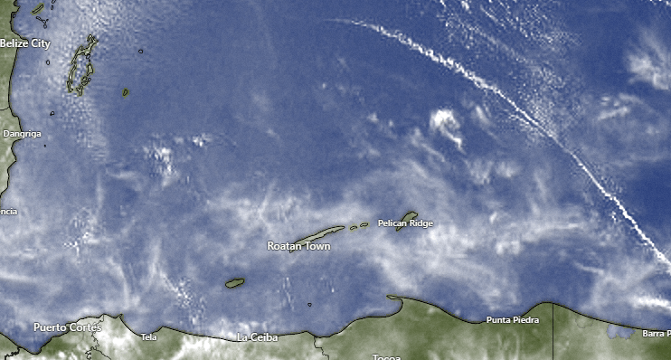
On our visible satellite image we can see the smoke plume over us. It looks like it gets better over toward Guanaja.
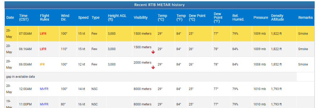
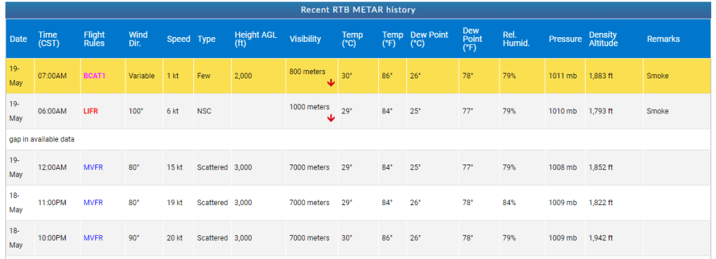
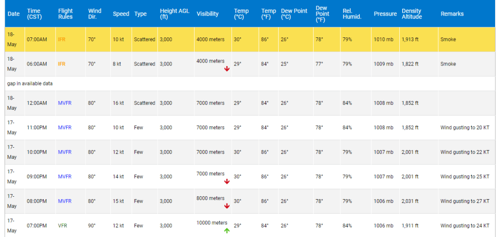
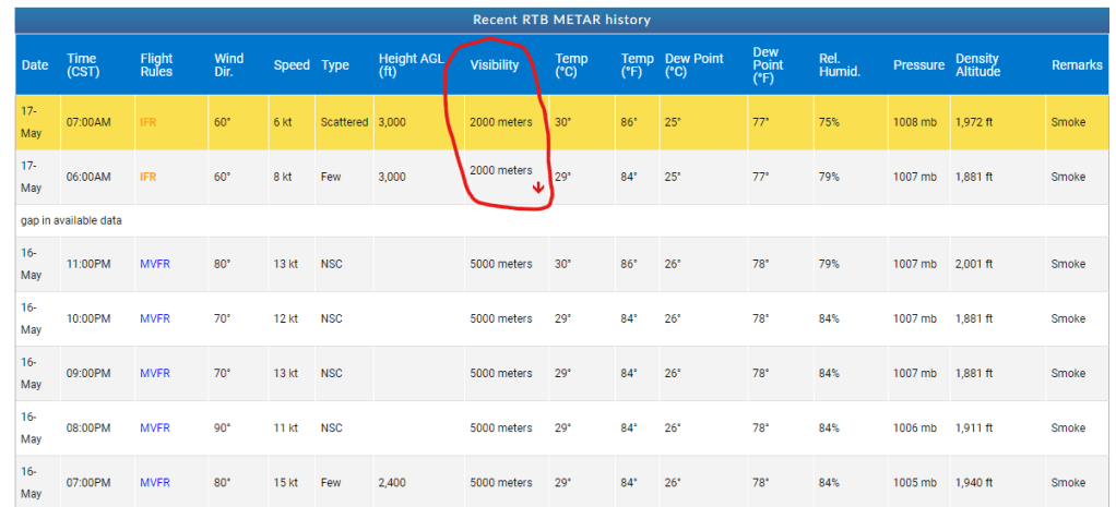
Our visibility is 1500 meters at 7 a.m. That’s not great and will probably mean a closure of the airport this morning, but it is better than yesterday. I would again expect the airport to be open by afternoon.
Wind and Galaxy Wave forecast. We start the day with east/southeast winds 20 mph and seas 4 feet on the south side. Winds for the week ahead should be slightly calmer than last week, with daytime winds 12-17 mph and seas 2-3 feet and nighttime winds 17-22 mph and seas 3-4 feet. We are also thinking winds will be more due east, and perhaps slightly northeast in the afternoons, which would be good for pushing back the smoke.
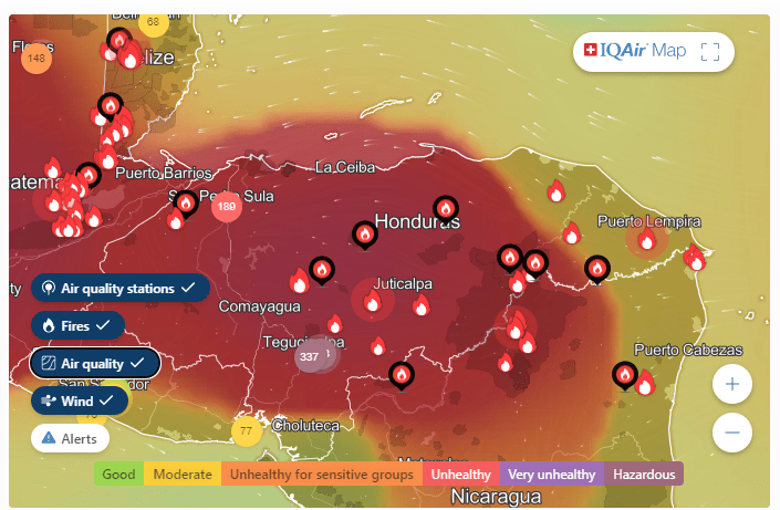
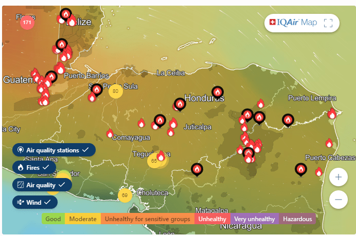
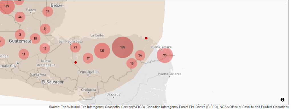
If you think our air is bad, take a look at San Pedro and especially Tegucigalpa. I don’t think I’ve seen air this bad the whole time we’ve been dealing with the fires. Air quality in Teguc is dangerous for healthy people with Air Quality numbers between 300-400. Visibility at Toncontin Airport is 500 meters!
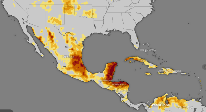
Miss Liz Riggs over in Politilly pointed my attention to the current drought map. You will notice that the Western Caribbean is one of the driest spots in North and South America. This is truly a devastating drought we’ve been through.
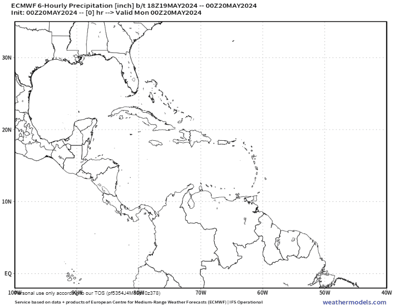
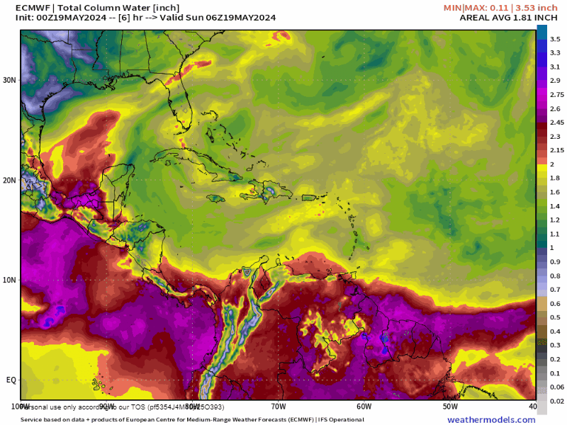
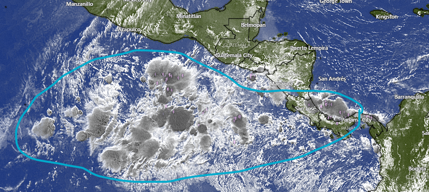
We’ve looked at the GFS forecast giving us hope for some rain end of the month into first of June. Here is the 10 day forecast from the Euro through May 30. You will note that the better chance of rain will be on the mainland. That will be good, because it will finally put out these fires. Less certain is rain up here on the islands. Our chances will be better, but rain is not certain.
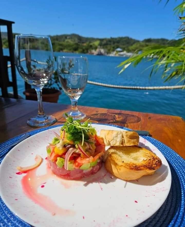
Ikigai by Robby Molina is now open on Mondays by popular demand! Go over and check out one of the best chefs in Central America!
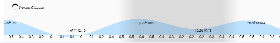
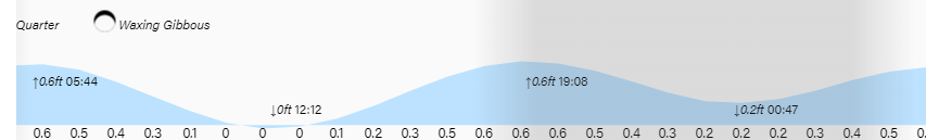
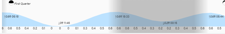
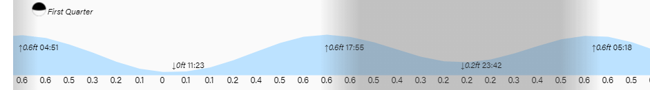
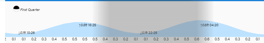
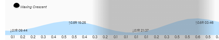
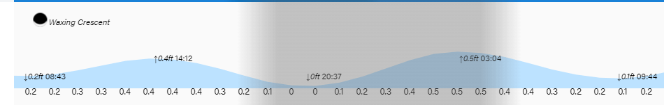
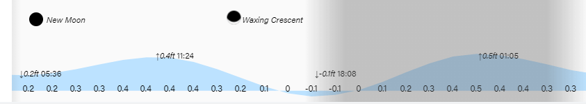
Low tide is 12:40 p.m. Have a great week!