January 28, 2026

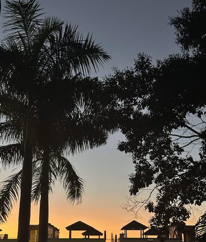
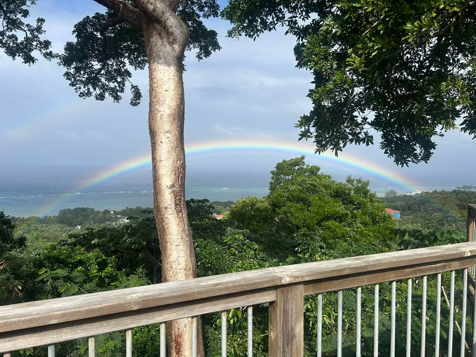
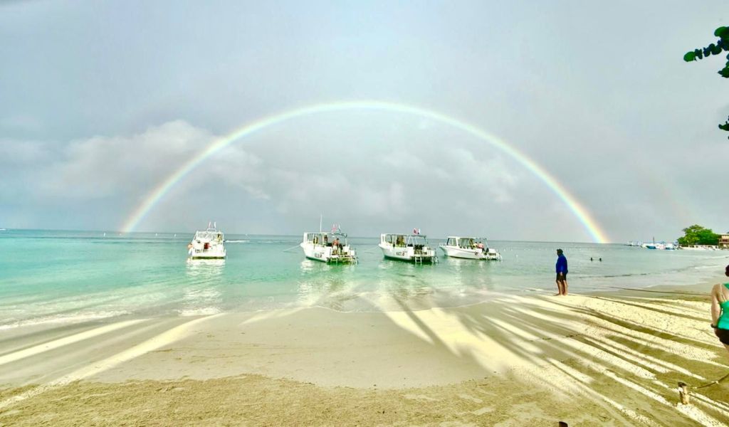
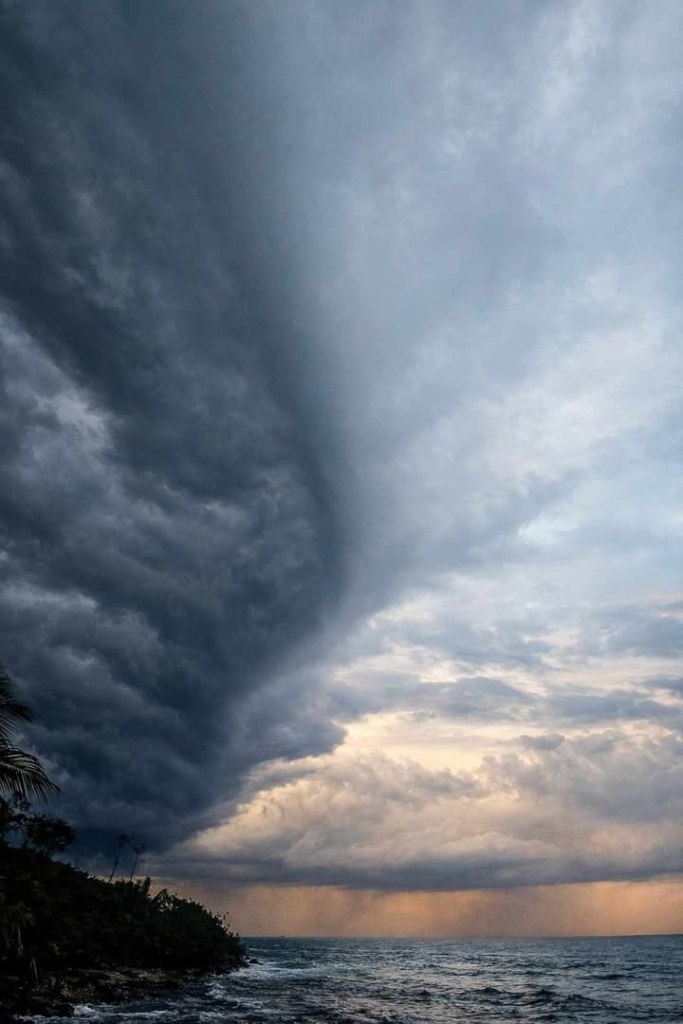
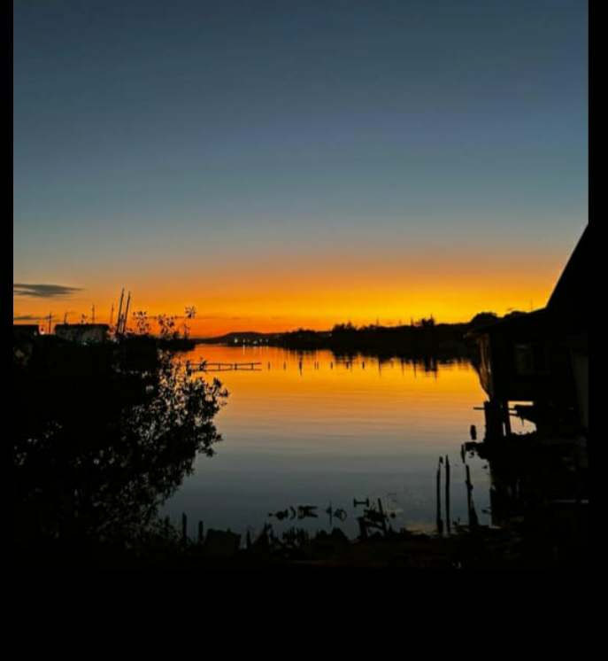
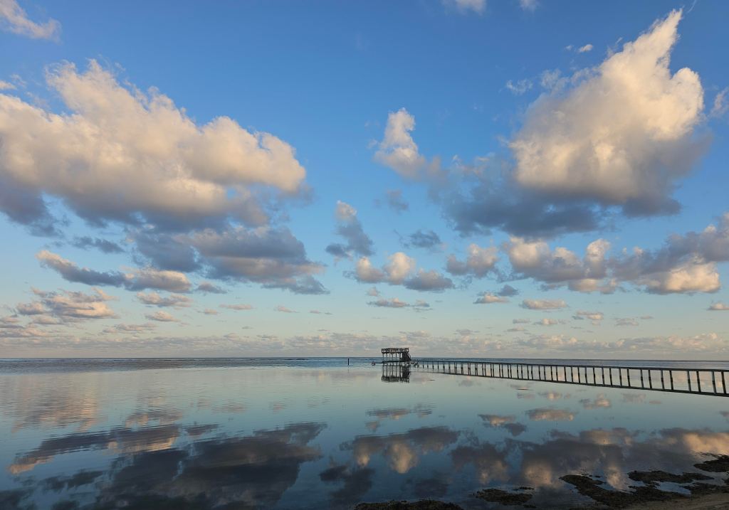
Good morning Bay Islands. Our photo of the day comes from Tony Lanoue in West End.

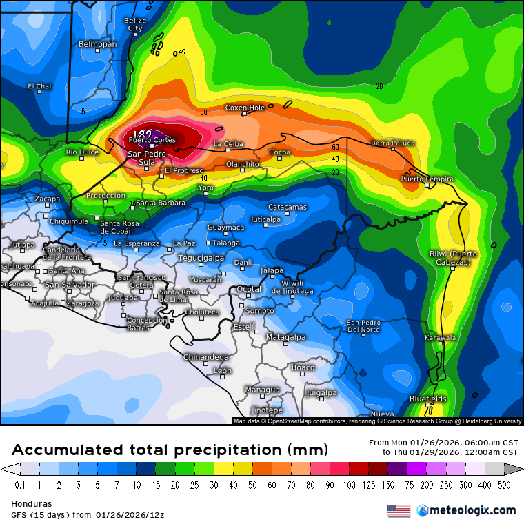
This morning as of 8 a.m. many of us have stayed dry since midnight after 1-2 inches yesterday. This has been a storm system that has been rainier the further west you go. Utila has half an inch as of 8 a.m. after 3 inches yesterday. Seas are quite high this morning.

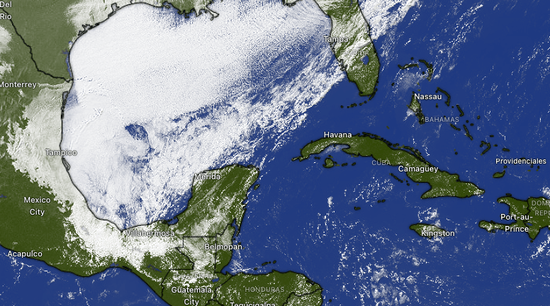
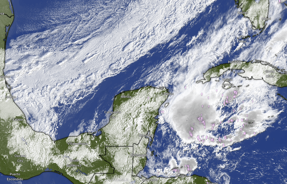
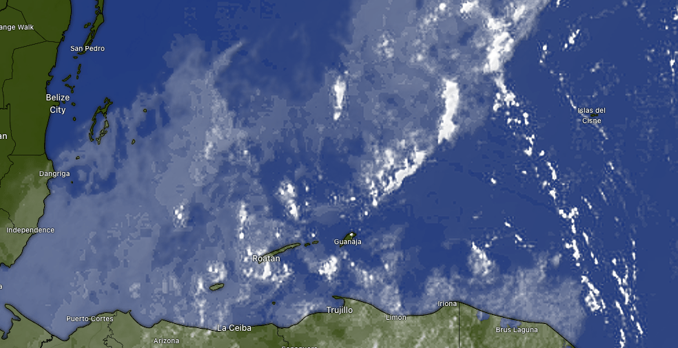
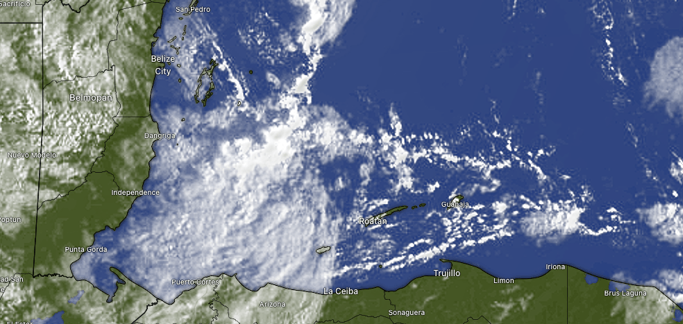
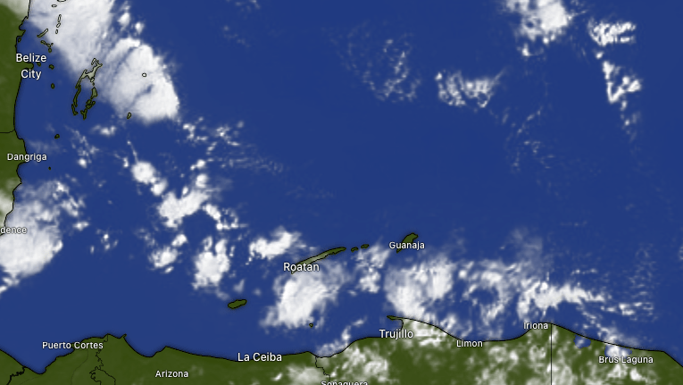
Here’s this morning’s satellite. You can readily see there’s even some clear sky just to the east of Guanaja at 8 a.m. We will continue to have scattered showers today, but some areas, especially to the east, should get less rain. The big story will be winds, with morning winds from the north 25 mph and seas 7-8 feet. Those conditions will last through today. Tomorrow morning winds 15-20 mph and 6 foot seas, should calm to 10-15 mph and 4 foot seas by evening. Friday and Saturday morning winds are from the north 5-10 mph and seas 2-3 feet in advance of the next norther Sunday into Monday. The next norther will be drier, with even cooler air than we are getting with this norther. I seriously expect some mid-60s (around 17-18C) for lows, especially Monday and Tuesday morning.

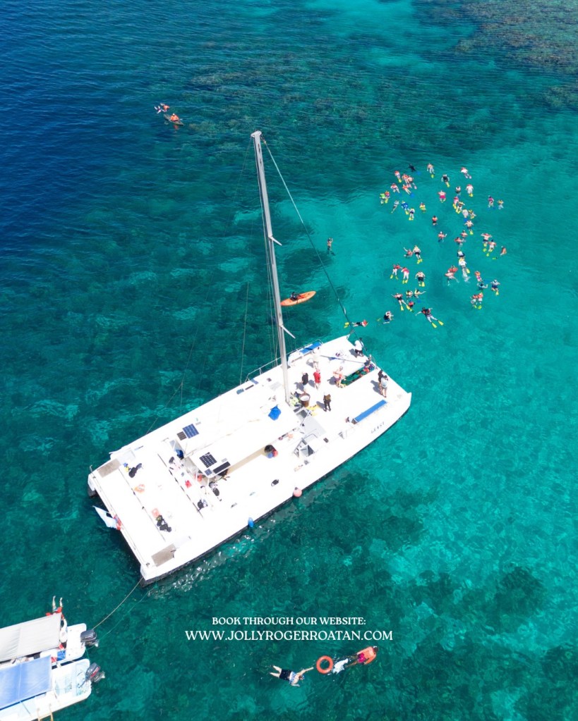
With all these north winds, it is important to remember Jolly Roger Roatancan find you some calm waters inside the reef on the south side and get you safely back to your boat on time. Check them out at Jollyrogerroatan.com.

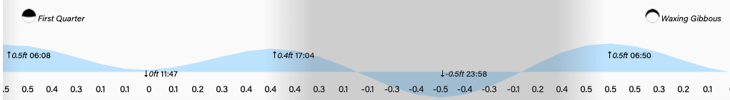
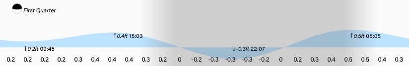
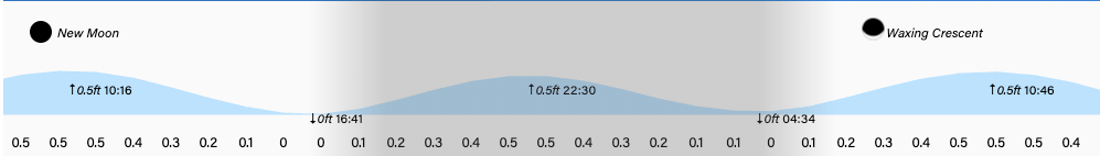
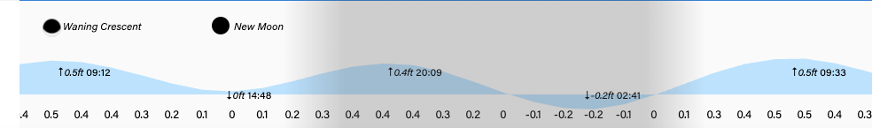
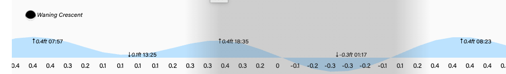
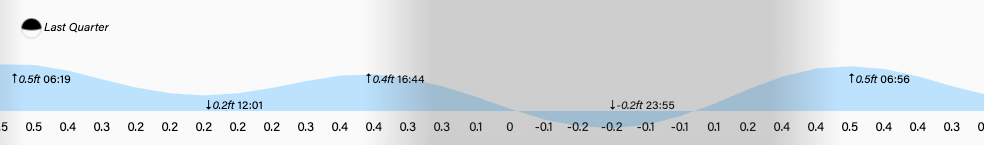
Lowest tide will be much below normal at midnight. Have a great Wednesday!


January 26, 2026

Good morning Bay Islands. Our photo of the day comes from Don Spicer in West Bay.

We have another day of great weather before the norther arrives. Tomorrow looks like it might be the rainier day and Wednesday the windiest.

We’re still quite clear on satellite, but we can see the cold front clearly running from the north Yucatan back into Florida. Winds will turn to the north this evening 10-15 mph with 3 foot seas. Chance of rain increases overnight and we will have periods of heavy rain tonight through Wednesday. Winds tomorrow will be from the north 12-17 mph and seas 4 feet in the morning building to 6 feet tomorrow evening. Wednesday north winds will be 17-22 mph gusting close to 30 by evening and seas 6-7 feet. Thursday things start to calm down.


Rain totals, like with many northers, should be higher toward the mainland, especially toward Puerto Cortes, but most models give us 2-3 inches over the whole period. Keep in mind that if you get under the wrong clouds you can get 2-3 inches in an hour, so local totals can be more.

The end of the week looks nicer but we have another norther coming on Sunday.

Explore Roatan real estate with the island’s top experts at Roatan Life Real Estate. Serving clients since 2001, we offer personalized guidance in buying and selling properties. Trust our dedicated team for unparalleled local knowledge. Start your journey at www.roatanlife.com.


Low tide is 10 p.m. Have a great week!


January 25, 2026

Good morning Bay Islands. Our photo of the day is a rainbow captured from the back deck of the Rum Company between West Bay and West End. The photographer has my favorite name since we’ve been doing these photos: Harmony Storms. She totally should be a TV meteorologist.
No rainbows today, as there is no rain, but we are still watching the next norther, that now looks like a Tuesday/Wednesday event.

For the first time in a long time we have a totally clear satellite view. This looks like April. Today will be sunny with an east winds 15 mph getting to 20 mph by evening and seas 3 feet getting close to 4 feet overnight.

Tomorrow we will have light and variable winds and seas 2 feet in advance of our norther, with increasing clouds and chances of rain toward tomorrow evening. Tuesday and Wednesday will be rainy with north winds. Tuesday will perhaps be the rainiest and Wednesday the windiest, with north winds 20-25 mph and seas 6 feet. Rain lingers into Thursday. Friday and Saturday looks drier and our next norther comes Feb. 1-2. Have a great Sunday!

January 21, 2026

Good morning Bay Islands. Our photo of the day comes from Brian Galbrysh, showing yoga practice on West End beach.

We should start seeing more sun in the days ahead after quite a bit of cloudiness and rain. This morning most of us have had a quarter to a third of an inch of rain. After this clears out we will discuss rain totals, most of which came from the very first day of rain on Sunday. Things look pretty good from this afternoon until Monday afternoon.

Here is the radar at 7:50 a.m. We have clouds and some showers around with a mild east wind. As the morning goes on we should see that wind turn to the west but it won’t be as strong as we once feared, only 10-15 mph and seas around 4 feet, but still wavy on West Bay Beach. Rain should get lighter and skies should get clearer as we get into the evening and tomorrow through Sunday rain chances will be low and what rain we get should be overnights and early mornings.


Wind and wave forecast: Winds will turn to the west this afternoon at 10-15 mph and seas around 4 feet. Tomorrow west winds will start at 10 mph and calm to 5 mph in the afternoon with seas going from 4 feet to 3 feet. Friday very light winds turn to the east with 2 foot seas. The weekend will have east winds 10-15 mph and seas 2-3 feet.

In the extended forecast we have another norther Monday evening into most of next week. It should be weaker than the one we’ve just had, with less rain and wind, but it will still turn winds to the north and give us scattered showers through most of next week.

One of the great things about snorkeling on an island is when we have north winds we can go on the Southside and when we have east winds (most of the year) we can go on the protected northwest side of the island. Jolly Roger Roatan has experts that will find the calmest cove for your snorkeling delight along with a pleasant boat ride and great food and drink.


Lowest tides are 4:30 p.m. and 4:30 a.m. Have a great Wednesday!


January 20, 2026

Good morning Bay Islands. There’s good news and bad news today. The good news is that so far we have escaped the worst of the rain. While La Ceiba has recorded 4.54 inches of midnight to 8 a.m., we have gotten less than half an inch at West Bay and only a few hundredths of an inch most of the rest of the island. The bad news is that this will be the worst day at sea, with buoys reporting 7-8 foot waves and 20-25 mph out of the north. We will have a chance of rain the remainder of the day and if you get under the wrong cloud it could add up quickly, so be watchful.

As far as rain goes, we have 24 more hours where we still have the possibility of heavy rains. The chances go down after midday tomorrow. Right now it looks like only maybe 1-2 inches more are likely, but if you get under the wrong storm, those numbers can go up and the hills are already very wet, so be careful.

Wind and wave forecast: Today will be the worst day on the seas with 7 foot waves only going down to 6 feet by this afternoon and winds around 20-25 mph from the north/northeast. We may see a brief period of calmer winds tomorrow morning with seas 4-5 feet, but around midday we will have a period of strong west winds around 20 mph and seas around 5 feet. Midday waves on West Bay Beach will be pretty strong. Thursday morning west winds 10-15 mph will turn to the east by evening and seas will calm from 4 feet in the morning to 3 feet by afternoon. A light east winds will give us 2 foot seas Friday.

In the extended forecast we are watching for another norther coming down and arriving perhaps by next Tuesday and lasting into the middle of next week. This is coming from a particularly strong winter storm in the U.S. South. We’ll keep an eye on it.

Explore Roatan real estate with the island’s top experts at Roatan Life Real Estate. Serving clients since 2001, we offer personalized guidance in buying and selling properties. Trust our dedicated team for unparalleled local knowledge. Start your journey at http://www.roatanlife.com

Low tides are 3 p.m. and 4 a.m. Have a great Tuesday!

January 18, 2026

Good morning Bay Islands. Our photo of the day comes from Cesar Gonzales in West Bay with a perfect rainbow. Over the next few days, it will be hard to find enough sun to create a rainbow. We are in for long periods of rain that will often be heavy and strong seas that will peak on Tuesday and perhaps last into Wednesday.

At 8:30 a.m. we can clearly see the cold front to our north as well as the storms over us this morning. We will have long periods of rain today through Tuesday, sometimes heavy. Rain should start to let up Wednesday and the end of next week looks pretty nice, with just regular morning chances of rain.


This is the GFS forecast for rain through Wednesday at noon. It forecasts 8-10 inches. Some other computer models show less, but none are much less than 5-6 inches. Get ready for lots of rain and be careful out there.

Winds will be from the north today around 10-15 mph and seas around 3-4 feet, perhaps 4-5 by evening. Tomorrow and Tuesday north winds will be 15-20 mph and some periods will gust to 25 mph and seas 6-7 feet, especially north side. Wednesday winds shift to the west and may still be quite gusty. Wednesday will be a day for big waves on West Bay Beach.

I wanted to mention that Mitch Cummins, a longtime friend of Roatan Weather, has announced he is retiring from the pet food business. Many thanks for your help. If you are interested in purchasing any of his equipment, you can contact him directly.


Low tides will be 2:40 p.m. and 2:40 a.m. Have a safe Sunday!


January 15, 2026

Good morning Bay Islands. Our photo of the day comes from Brad Ryon with a nice rainstorm on Utila. We will be seeing plenty of this over the coming days with a persistent north wind that will blow especially hard Sunday evening into Monday morning.

At 6:30 a.m. we have scattered clouds around the islands and a few showers out there. West Bay picked up nearly an inch overnight, while the east side stayed mostly dry. There will be a good chance of rain today and tomorrow. Our best chance for a nice day comes Saturday, with mild winds and a lower chance of rain. Winds and rain pick up Sunday and Monday.


Wind and wave forecast: We wake up to 15 mph northwest winds and seas 3 feet. Winds will turn more northerly today, still around 15 mph and seas 3-4 feet. They will stay right around there tomorrow morning before getting a little calmer in the afternoon. Saturday winds will be calmer, but seas will still be around 3 feet due to swell. Sunday afternoon through Tuesday morning is a period to be very careful on the seas, with north winds around 20 mph and seas around 5 feet. Winds start turning back to the east next Thursday.

With some fresh mornings coming up, it will be time for some warm meats to warm your insides and the best place to get that meat is Carniceria Rosita in French Harbour and Coxen Hole.


Lowest tide is 1:20 a.m. Have a great Thursday!


January 14, 2026

Good morning Bay Islands. Our photo of the day comes from Sherri Vieth, who calls herself a Missouri girl in West Bay. The photo shows a lot of clouds but not much rain. That should be what our day today is like. Today may not be completely dry, but it may be the driest day of the rest of the week.

On satellite at 7:20 a.m. we have lots of clouds over Utila and more spotty clouds over the big island and Guanaja. We have a west wind at 10 mph and seas 3 feet over at West Bay beach. We will keep those winds through the day and partly to mostly cloudy skies, but only about a 30 percent chance of rain. Those rain chances go up tomorrow through the weekend as our winds turn to the north 10-15 mph and seas 3-4 feet.

In the extended forecast Sunday through Tuesday we will have some strong north winds, especially Sunday afternoon into Monday morning, when north winds will be 17-22 mph and seas 5-6 feet, so be very careful on the seas and those waves will be strong north side. Rain could be heavy on Sunday, but should decrease Monday and Tuesday as we get a taste of cooler, drier air and perhaps some lows in the 60s.(around 20C).

Whatever the weather, you can count on Jolly Roger Roatan to find you the calmest coves on the island and get you back to your destination on time and safe.


Lowest tide is 1 a.m. Have a great Wednesday!


January 12, 2026

Good morning Bay Islands. Our photo of the day comes from Becky Frances who captured this twilight in French Harbour.

We had a few early morning showers good for up to a third of an inch around French Harbour and points east. We are in for lots of scattered showers this week and moderate winds from the north and west.

On satellite at 8:30 a.m. we see quite a bit of cloudiness. We will keep chances of scattered showers in the forecast today and into tomorrow morning. Tomorrow afternoon and Wednesday we may have a little lower chance of rain, but chances pick up Thursday into the weekend. Most of the models give us 2-3 inches through Friday. That means it won’t be raining all the time, but it could be raining at any time.


Wind and wave forecast: Our winds right now are only about 5 mph from the north, but seas are 3 feet this morning due to swell (waves from winds elsewhere). Tomorrow winds turn to the west 5-10 mph and 10-15 mph Wednesday. They turn back to the north Thursday into the weekend, getting up to around 15 mph by the weekend with 3-4 foot seas Saturday and Sunday and next Monday are looking quite windy and wavy right now, with north winds 15-25 mph and seas around 5 feet.

Explore Roatan real estate with the island’s top experts at Roatan Life Real Estate. Serving clients since 2001, we offer personalized guidance in buying and selling properties. Trust our dedicated team for unparalleled local knowledge. Start your journey at www.roatanlife.com.

Lowest tide is midnight. Have a great week!


January 6, 2026

Good morning Bay Islands. Congratulations to Jim Jaskunas, winner of the December photo contest and an excursion worth $100 from Jolly Roger Roatan on a normal cruise day. Jim gets our day kicked off the right way with this view of calm waters reflecting a blue sky in Sandy Bay. We will have plenty of this today and tomorrow.

On satellite at 9 a.m. we can see some clouds to the south/southwest of West Bay, but those are moving away from us. We will have partly cloudy skies and dry conditions the rest of the day and tomorrow, with only a slight chance of an overnight or early morning shower. Both those days we will have calm winds and seas 0-1 foot. 

Thursday afternoon through Sunday morning our trade winds kick up out of the east 15-20 mph giving us seas 3-4 feet, especially south side. Those days should also be mostly dry.

Sunday evening through Tuesday morning we have another weak norther with increased rain chances, but even that should not be a rain out.

Explore Roatan real estate with the island’s top experts at Roatan Life Real Estate. Serving clients since 2001, we offer personalized guidance in buying and selling properties. Trust our dedicated team for unparalleled local knowledge. Start your journey at www.roatanlife.com.

Low tide is 6 p.m. Have a great Tuesday!