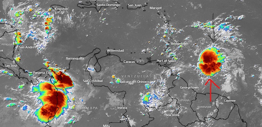
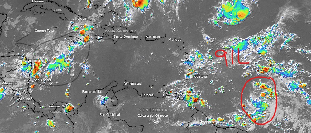
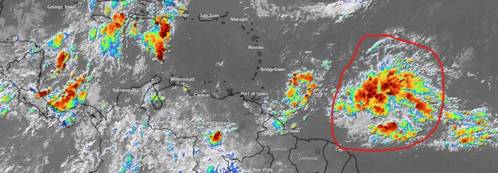
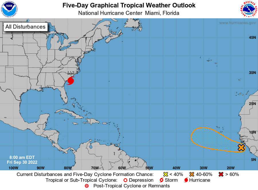
Aug. 31, 2022

Satellite image from 7 p.m. to 7 a.m. today

Aug. 31, 2022: Good morning, Roatan! Our tropical wave came close enough yesterday to give some of us a good downpour around midday. Coral View was the big winner with 1.15 inches. Politilly got a third of an inch as did one location in Sandy Bay. Punta Blanca got a tenth of an inch and here on Jonesville Point we only got .02 of an inch. West Bay and West End got no measureable rain.

As you can see in the satellite from 7 p.m. yesterday to 7 a.m. today, the tropical wave has shifted north toward Jamaica. That shift is away from us so I’m less optimistic about rain. I am optimistic about calm winds. The sea on the southside looks like a pond, a great day to go out on the water. We will keep a 40 percent chance of rain today and tomorrow morning. If we don’t get rain these two days, we may stay dry for awhile, because the forecast the next week or so after that has very low rain chances. Winds will come back up into the normal range of 12-17 mph during the day and 15-20 mph at night starting Friday. Have a great Wednesday!

Aug. 30, 2022

Satellite image around 7 a.m.

Aug. 30, 2022: Good morning, Roatan! The tropical wave we’ve been waiting for is finally in view. Some time between now and Friday there is a very good chance we will get some rain, but most models give us much less rain out of this than the mainland. Most of them predict around an inch for the whole week.

Pretty typical is the GFS map here that shows predicted rain through midnight Friday night. Winds and seas will be fairly calm unless you are in a squall. Rain chances will be around 40 percent today, 50 percent tomorrow and 60 percent Thursday and Friday. Skies will be partly to mostly cloudy. Have a great Tuesday!

Aug. 29, 2022

Satellite image as of 8 a.m.

Aug. 29, 2022: Good morning, Roatan! After a dry 24 hours, at 8 a.m. we have some storms and clouds moving in from the east. The question is will they hold together long enough to bring us a morning shower. These storms often fall apart as the day goes along, but they will at least bring us some clouds and a chance of rain during the morning.

Radar as of 8 a.m.

Here is this morning’s radar as of 8 a.m. You can see a large area of thundershowers moving in from the east. These storms often fall apart as the day goes along, but they will at least bring us some clouds and a chance of rain during the morning. We’ll see how well the hold together this morning.

Here is the latest tropical weather outlook. You’ll notice we still have a 20 percent chance of development over us. If it happens, it will be Thursday evening/Friday morning. The big red X is a potential hurricane that should get close to the Lesser Antilles. Right now models are turning it to the east before it has a chance to threaten the US.

Aug. 27, 2022

Aug. 27, 2022: Good morning, Roatan! Our weather has been fair for the last 24 hours and will continue to be that way until early to mid next week. The storm system we’ve been watching is now north of the ABC islands. The National Hurricane Center has lowered the possibility of tropical development to 20 percent. It has also adjusted the track to our north, and now we are no longer in the yellow predicted path. Our main question is whether it will bring rain Tuesday through Thursday of next week. The answer seems to be yes, but there is a big question of how much. We could get 2 to 3 inches or we could get none.

Until then winds will remain out of the east 12-17 mph and seas at 2-3 feet (.6 to 1 meter) on the southside. As the storm approaches, quite often the winds will calm a bit. We’ll keep an eye on it.

Aug. 26, 2022

Aug. 26, 2022: Good morning Roatan! The rain to our east fizzled out before it got here, so no rain on the island in the last 24 hours. Today there is a wave to our northeast so we will keep a small chance of a shower through the day today. Otherwise winds should be 5-10 mph and seas 1-2 feet.

Tomorrow through Monday look to be nice days with winds around 10 mph during the day and 15-20 mph at night and small chances of showers mostly at night.

The tropical wave is now just west of the Windward Islands and has a 30 percent chance of tropical development in the next five days. There is a lot of uncertainty about its exact movement. If it jogs a little to the north we could be mostly dry next week, but if it stays on course we will likely have times of heavy showers in the middle of next week, though it is unlikely to become a tropical storm by the time it gets here. We’ll keep an eye on it.

Tropical update for Aug. 25, 2022

Tropical update for Aug. 25, 2022: Well here we go. We have a National Hurricane Center forecast map that puts a tropical system in our neighborhood. But you will notice that the color is yellow, which means that there is only a 20 percent chance of tropical development over the next five days. Most of the current models either do nothing with this system or develop it as a tropical system after it passes north of here. In any case, it should bring some deep moisture and increased rain chances our way midweek next week.

Aug. 25, 2022

Satellite image from 8 a.m. today.

Aug. 25, 2022: Good morning, Roatan! No rain recorded on the island yesterday or this morning. This morning there are some clouds to our east, but as you can see on this satellite image from around 8 a.m., the clouds are diminishing as the morning goes along, which often happens with our overnight clouds and rain. We will look for partly cloudy skies today and perhaps a passing shower and winds 12-17 mph and seas 2-3 feet (.6 to 1 meter). Tonight we have a decent chance of seeing some rain.

Tomorrow winds should be fairly calm and seas 1-2 feet (.3 to .6 meters). Rain chances will be low.

This weekend winds come back to the 15 mph range with 2 to 3 foot seas. Rain chances will be low and mostly on Saturday night.

A tropical wave has a chance of giving us some rain toward the middle of next week. More on that in the tropical update.

Aug. 24, 2022

Aug. 24, 2022: Good morning, Roatan! Today is definitely a bit windier than yesterday, with 15 mph east winds and 2-3 foot seas (.6 to 1 meter) on the southside.

Today we’ll keep those 15 mph winds through the day and a good chance of a shower, especially toward evening.

Thursday and especially Friday look like relatively calm days with low chances of rain. The weekend looks nice as well, perhaps a bit windier on Sunday.

I want to make mention of the latest forecast from the National Hurricane Center. The disturbance I first mentioned yesterday is moving a little south of the forecast and a little more of concern for us. Right now most models show it heading toward Jamaica and Cuba as a weak storm and strengthening in the Gulf of Mexico, but at this point anything could happen. We’ll keep an eye on it. We’re about a week out from it being in the Western or Northern Caribbean. Have a great Wednesday!

Aug. 23, 2022

Aug. 23, 2022: Good morning, Roatan! Those stray showers got a few of us really wet, some of us a little wet and the rest of us dry if you don’t count the sweat. One rain bucket in Sandy Bay got .8 of an inch but another bucket in Sandy Bay got less than an inch. Coral View got half an inch and Politilly less than a tenth. Camp Bay picked up .04 yesterday and .11 about 4 a.m. today. Here on Jonesville Point and rain gauges in West Bay and West End recorded no rain the last 24 hours.

Today will be continued calm and hot, with seas right around 1 foot or less. Rain chances will be low, but there will still be the chance of a passing shower.

Tomorrow will be a little windier with east winds 10-15 mph and seas at 2 feet. Rain chances will be better, especially tomorrow night.

Thursday winds will be 7-15 mph and seas 1-2 feet. Rain chances will again be pretty good Thursday night.

Friday and Saturday winds should be fairly calm again. Scattered showers will continue to be mostly at night. Have a great Tuesday!

Aug. 22, 2022

Aug. 22, 2022: Good morning, Roatan! If you like the heat, this week will be for you. As I’ve often said, the temperature on the island doesn’t change much. What makes it hot is calm winds and few clouds. This week we’ll have both.

Today and tomorrow winds will be light and variable with seas at 1 foot (.3 meters). There are some cumulus clouds around, so I can’t rule out a stray shower, but very few of us will see any rain the next two days.

Wednesday and Thursday the winds pick up a bit to 12-17 mph and seas to 2 feet (.6 meters). If you’re looking for rain, best chances are Wednesday night, Thursday night and Friday night. Those nights will have a 40 percent chance of seeing a shower. Have a great week!