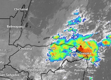
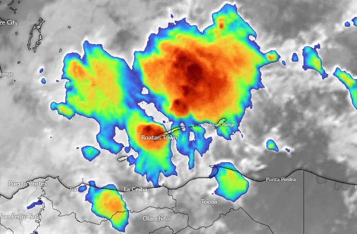
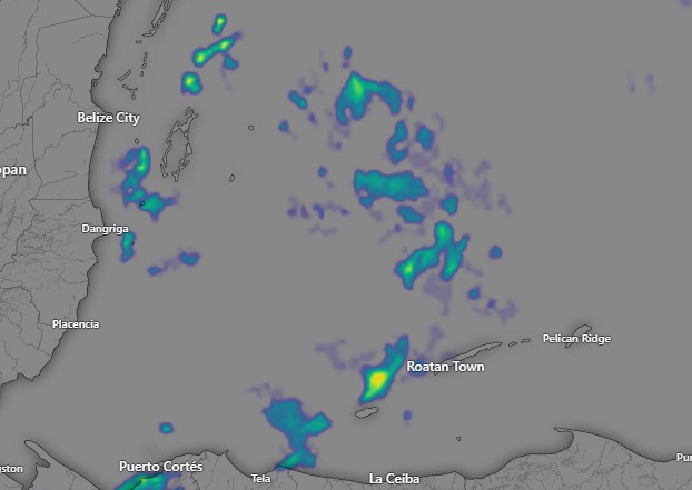
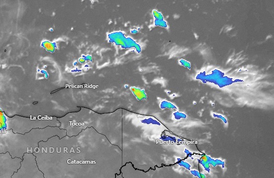
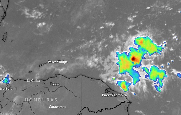
October 6, 2022

Oct. 6, 2022: Good morning, Roatan. Let’s start with the forecast for today into the weekend.

Satellite at 6 a.m.
Radar at 6 a.m.

As you can see from the 6 a.m. radar and satellite images, there is a lot of rain around. Today will be mostly cloudy with occasional rain, light winds and seas 1-2 feet (.3 to .6 meters). Rain should get lighter and we may see more sun this afternoon. Tomorrow rain is in the forecast, but also periods of sun, especially in the morning. Winds remain calm, but seas continue at 2 feet (.6 meters). Saturday and Sunday also look rainy. To summarize, today through Sunday, mostly cloudy with periods of sun, but also periods of torrential rains, calm winds except in squalls, and 2 foot seas. I’m worried about flooding in some areas, with 4 to 5 inches of rain possible BEFORE any effects of the storm (91L) arrive here. More on the storm in the tropical update.

Oct. 5, 2022

Oct. 5, 2022: Good morning, Roatan! I did another video update about Invest 91L. One main concern is the amount of rain we expect to get, especially starting tomorrow. We have a very good chance of getting a lot of rain Thursday through Saturday and that is before any effects from 91L get here. If the storm comes closer to us, this will make a bad situation worse. Right now most models show the storm headed toward the Nicaragua coast. If this happens we are still in danger of getting tropical storm force winds on the island anywhere between Monday and Wednesday. Keep in mind the track is still highly in doubt, so be prepared. patreon.com/roatanweather

Oct. 3, 2022

Oct. 3, 2022: Good morning, Roatan! We have two area to look at on our satellite image from 7 a.m. today. First, circled in black, is a disorganized area of showers and storms that should make the period Wednesday through Friday much rainier. Today and tomorrow we will have about a 40 percent chance of a passing shower, especially at night. Wednesday through Friday it looks more like 70 percent. Winds and seas will remain fairly calm, except in squalls. The area circled in red is now called 91L by the National Hurricane Center and given a 40 percent chance to become a tropical depression within five days.

The computers agree that this is coming toward Central America. Most of them, however, are not making it into a tropical storm, simply a wave of tropical moisture that would make the first part of next week quite rainy. One model, the Canadian, wants to make it a tropical storm and bring it our way. It is way too early to draw any conclusions. Just keep an eye on it. patreon.org/roatanweather

Oct. 2, 2022

Oct. 2, 2022: Good morning, Roatan. Last night around 5:30 or 6 p.m., a wave of rain brought most of us between a quarter and half an inch of rain.

Today we start a week of relatively calm winds and seas. Today we will have a west wind 5-10 mph and seas at 2 feet (.6 meters) and that is perhaps the windiest it will get (outside of squalls) for the next week. Today is also probably the lowest chance of rain for the week. We have a 30 percent chance today and a bit of a better chance tonight. Monday that rises to about 50 percent and for the rest of the week there is a good chance of getting a shower, perhaps a heavy one, each day. As mentioned in the tropical update, next weekend into the following week looks even rainier. Have a great Sunday!

Tropical update for Oct. 2, 2022

Tropical update for Oct. 2, 2022: Good morning Roatan! The National Hurricane Center has identified an area of concern that seems to be headed for the Caribbean. It has only a 20 percent chance of forming a tropical depression in the next five days. This is the same general area as where Ian first formed, but different from Ian, most computers bring it further south, closer to us. Right now, computer models do not see this turning into a strong tropical storm, but it has the potential to bring us a lot of rain around the middle of the month. And once it gets into the warm Caribbean waters, who knows what will happen. We’ll keep an eye on it. patreon.com/roatanweather

Rainfall for September 2022

Rainfall for September 2022: We’re putting 8.02 inches in the books for September, the vast majority of it coming in the last week of the month. West Bay got over 10 inches, helped along by 4.4 inches in one big day of rain. On the east side of the island we got more like 4 or 5 inches. Still, it was almost double our normal rainfall for September.

October is the month with the greatest variability of rain. It can be as dry as three inches and as wet as 34 inches (WOW!). This is because rainy season usually starts sometime WITHIN October. But this year, based on our forecast, it looks like rainy season is going to start right away and may have even started this past week. Keep your umbrellas handy.

Oct. 1, 2022

Oct. 1, 2022: Good morning, Roatan. Rainfall totals yesterday were generally between a quarter and a half inch, but midisland, Coral View got 1.19 inches and French Harbor got 1.37 inches.

This weekend definitely looks like a time for us to dry out. We’ll keep a 30 percent chance of a shower today and tomorrow under partly cloudy skies. Today we will keep a west/northwest breeze 10-15 mph and seas 2-3 feet on the northside, but those winds and seas get much calmer tomorrow. Enjoy this relatively dry weekend because starting Monday things start looking wetter for the upcoming week. For the most part, winds stay calm, except during squalls. Have a great weekend!

Tropical outlook for Sept. 30, 2022

Tropical update for Sept. 30, 2022: We should take note that there is an area coming off the coast of Africa with a 50 percent chance of development over five days. While this particular wave probably isn’t of concern to us, we should be concerned that in a week or so, the Caribbean will return to being a place where there is a decent chance of a tropical storm brewing.

This map shows an area in blue off the coast of Nicaragua with a 30 percent chance of hosting a tropical depression on Oct. 9. Obviously computer models this far out are not very accurate, but the fact remains that 10 days out we should keep an eye on disturbances in the southern part of the North Atlantic or entering the Caribbean that have potential for tropical development.

Sept. 30, 2022

Sept. 30, 2022: Good morning, Roatan! Yesteday West Bay picked up 4.42 inches of rain. That is the most picked up in one day in a long time around here. West End got 1.9 inches. Utila picked up 2 inches of rain yesterday. Sandy Bay got 1.5, Mud Hole 2 inches, Coral View 1 inch (they also half an inch from midnight to 6 a.m.). Almost all the rain we got in Politilly and Jonesville Point was before 6 a.m. yesterday. Yesterday looks like it was the coolest morning, with one location getting down to 71 degrees. BRRRR.

West winds are bringing up seas this morning, perhaps 2 feet on the north side, and that may get up to around 3-4 feet today with winds getting stronger, to around 20 mph. After we get rid of some of these morning showers, the afternoon should get clearer and we should have a lower chance of rain this afternoon through tonight. Saturday we still have west winds, though a bit calmer around 12-15 mph and seas at 3 feet (1 meter). Sunday will be quite calm and those calm conditions will last into next week. Rain chances will be around 50/50 over the weekend and next week looks like we will have good chances of rain each day, but we will also have peaks of sun. I’m afraid to say that next weekend is looking like another possibility of heavy rain. Have a great Friday!