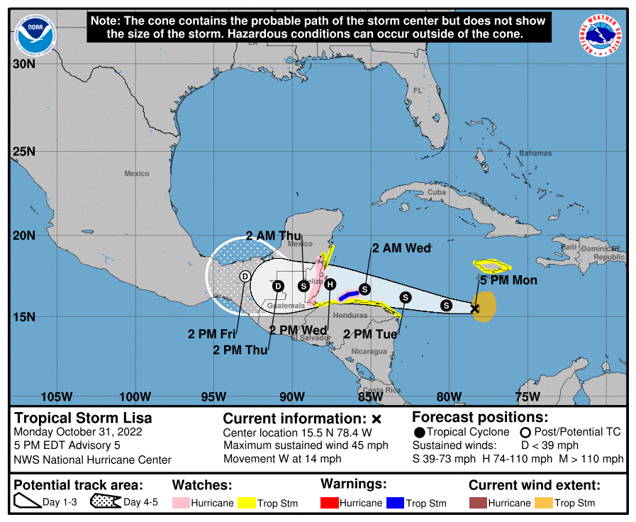
The National Hurricane Center has issued a Tropical Storm Warning for the Bay Islands. Separately the government of Honduras as issued a Hurricane Watch for the islands. We now have a 70-80 percent chance of seeing tropical storm force winds (39-73 mph). Hurricane force winds are not out of the question. The first winds should start Tuesday evening and last through Wednesday morning. The high pressure to our north has strengthened and that has pushed the forecast route a little further south. We don’t need to panic, but we need to be aware of the fact that 40 mph winds are now likely at some point and hurricane force winds around 75 mph, though unlikely, are not out of the question. If you are in a very low-lying area, be prepared for the possibility of a small storm surge in the 1-3 foot range.
Just to clarify the winds are a concern from sundown Tuesday into Wednesday around noon. Tuesday night winds will be from the northwest creating surf on the north side. Early Wednesday morning winds turn west then southwest in the 3-9 am time period. These will be the worst winds, probably 40 mph but perhaps a little worse. If we need to worry about a little surge on the south side this is the time period. Right now it doesn’t look worse and 1-3 feet but we’ll be watching it.

