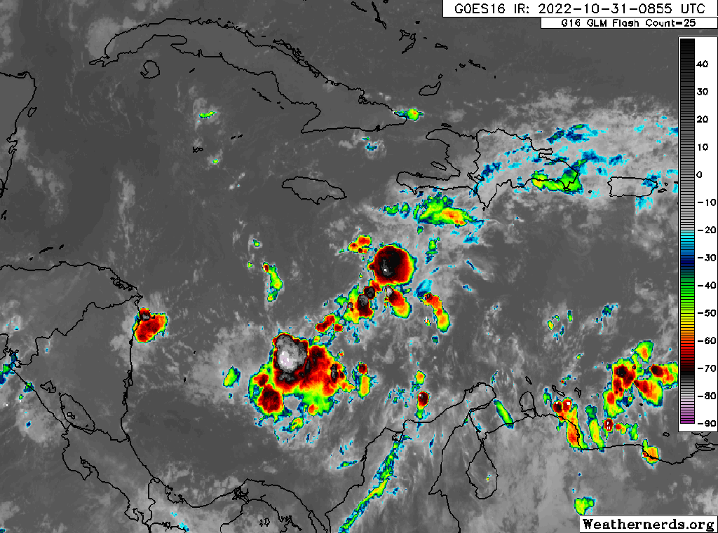
Oct. 31, 2022: Good morning, Roatan! Today should be a nice day with clear skies and calm winds and seas. Tomorrow morning should be sunny, but winds will start turning to the west and increase to around 15 mph in the afternoon with increasing clouds and the approach of what should be Tropical Storm Lisa. The center of the storm is on the northern end of the line of storms you see in this image.
Oct. 31, 2022: Good morning, Roatan! Today should be a nice day with clear skies and calm winds and seas. Tomorrow morning should be sunny, but winds will start turning to the west and increase to around 15 mph in the afternoon with increasing clouds and the approach of what should be Tropical Storm Lisa. The center of the storm is on the northern end of the line of storms you see in this image.
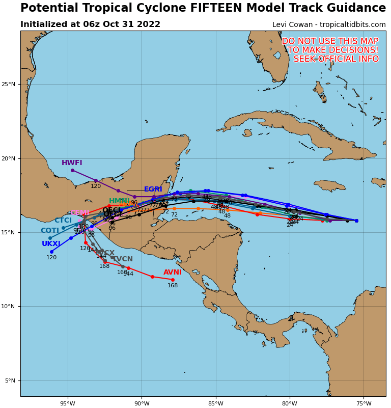
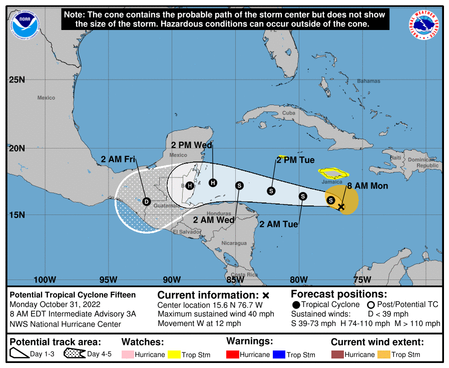
Most of the computer models agree that the center will go to our north, so that is a good sign.

As for how much rain we will get, the track of the storm will have a lot to do with that. Notice how we are on the edge of a lot of rain (7 or 8 inches) to our north and not much rain (an inch or two, or even less) to our south. The closer the storm is to us, the more rain we will get, but generally, the south sides of storms are less windy and rainy than the north sides, and chances are good we will be on the south side.
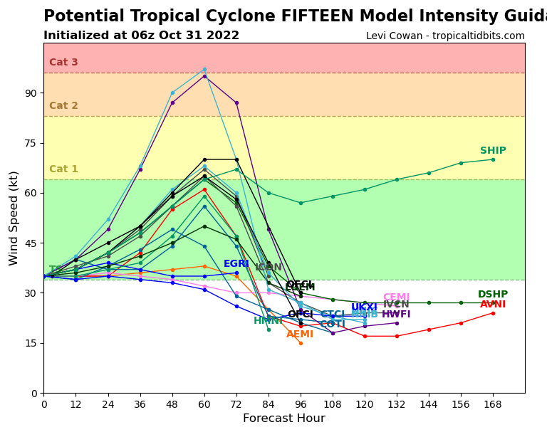
I’m still a little concerned we could see rapid intensification. You will notice that two computer models are forecasting a high-end category 2 storm, which would mean winds near the center at 100 mph or a little more. Most models keep this as a strong tropical storm or a low-end category 1 hurricane. Though it isn’t likely, a stronger hurricane is not out of the question. Make your preparations today. Though it is likely we will only get 30-40 mph winds and moderate rain and seas around 5-6 feet, any movement to the south and intensification would put us in danger and there won’t be much time to react. After the storm passes, there is a good chance of rain on Thursday, but Friday into the weekend look nice.
