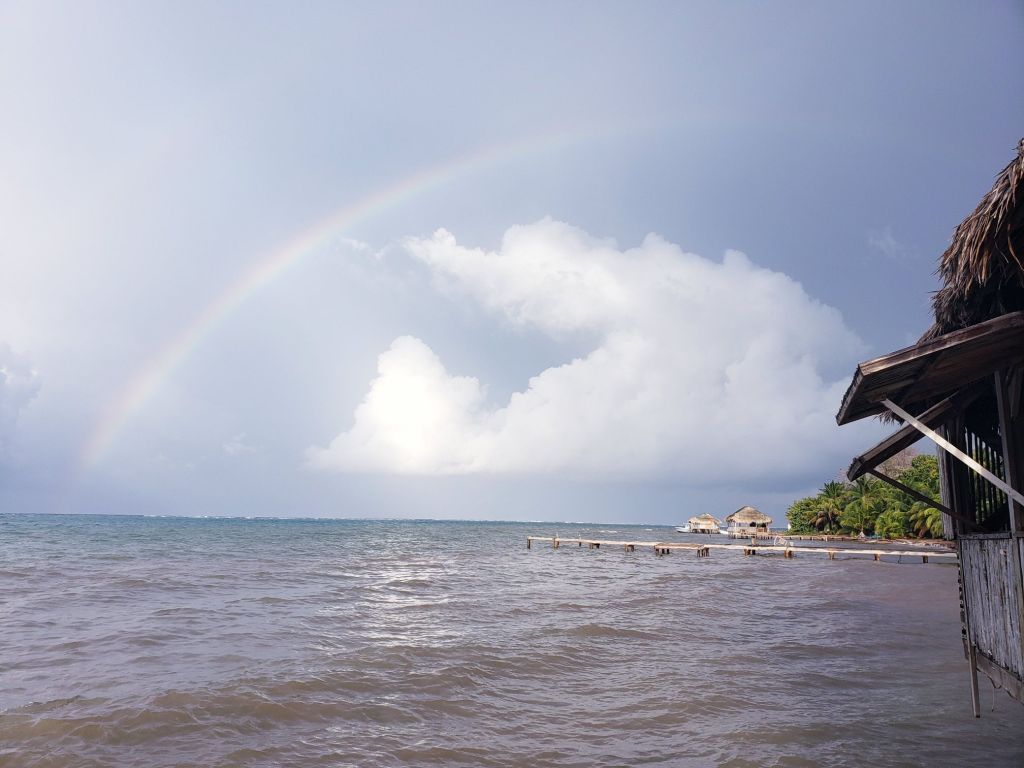
Our photo of the day comes from Jimmy Andrade showing a rainbow over Camp Bay on Monday. We may be in store for more rainbows as we hope to see more sun tomorrow and definitely Friday. Things are starting to look up.
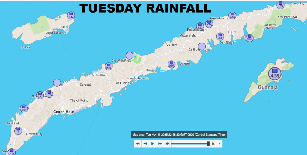
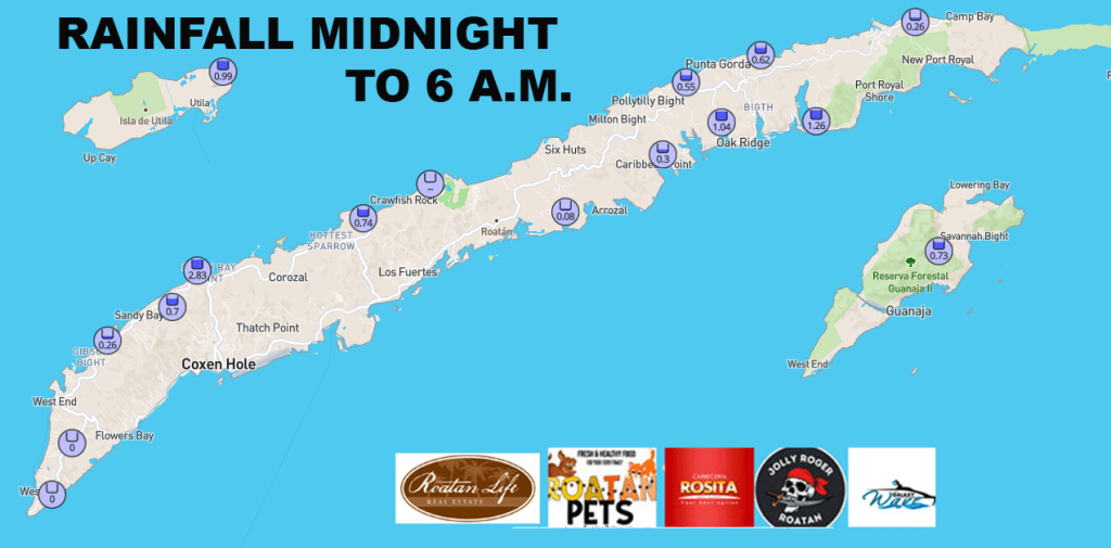
Here are yesterday’s rainfall totals. In some ways, not as much as we feared, but still a lot of rain. Certainly not as much as La Ceiba, which has already picked up 10-14 inches of rain according to the two weather stations there. This morning hasn’t been bad on Roatan or Guanaja yet, with only a quarter of an inch midnight to 8 a.m. Utila has picked up 2 additional inches and Cayos Cochinos 3 inches.
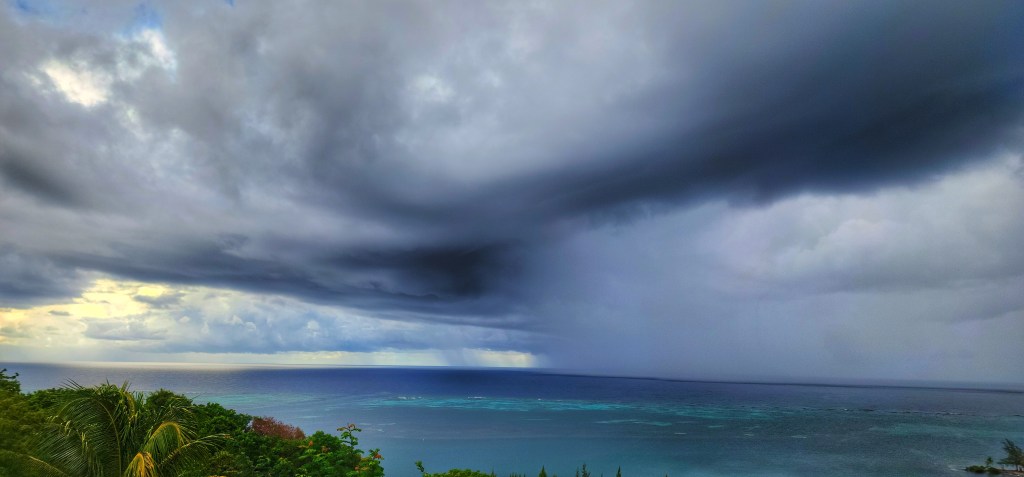
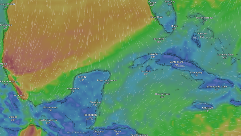
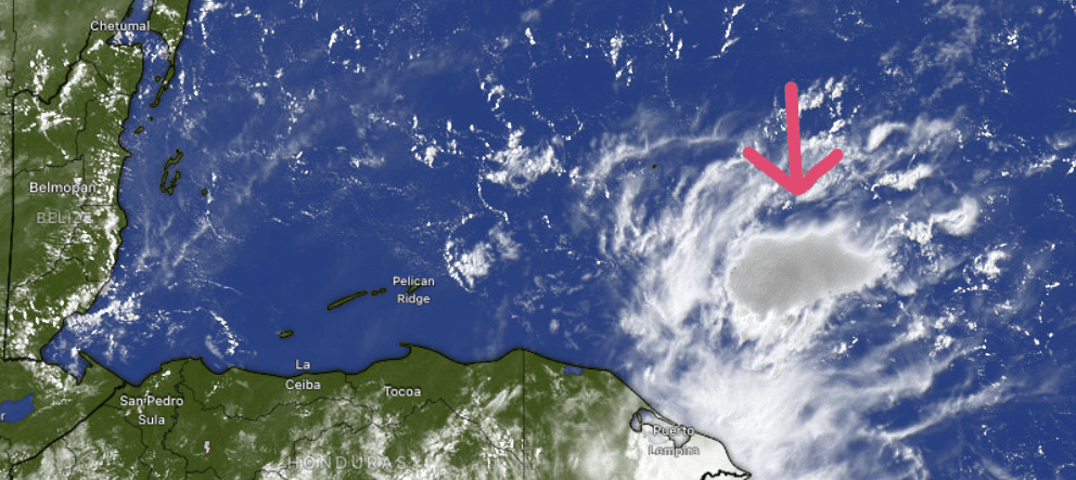
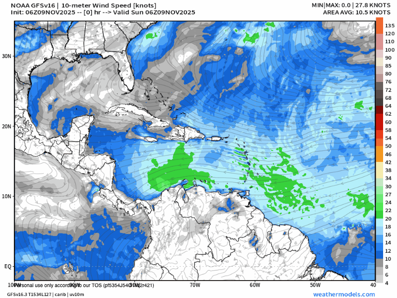
We can see the rain off to our east, in what I like to call our “rain factory”. This is a low pressure system that will move west today and bring us more rain and turn our winds to the west. How strong those winds are depend on where you are. I think Utila and maybe West Bay may get the worst of those west winds, with some gusts to 30 mph. Waves should get worse on West Bay beach midday to afternoon. Seas this morning are 6 feet from the northeast, but as the day goes on those 6 foot waves should start coming from the west. As we get into the evening those waves should start to lessen.
After that things really start to improve tomorrow with a lot of scattered showers, but the winds will calm to 15-20 mph west winds and seas 4-5 feet. Friday looks even better with a few showers, especially in the morning, and 10-15 mph west winds and seas 3-4 feet. The weekend still looks good, though I think there a good chance of a Saturday morning shower with west winds 5 mph and seas 2 feet through the weekend.
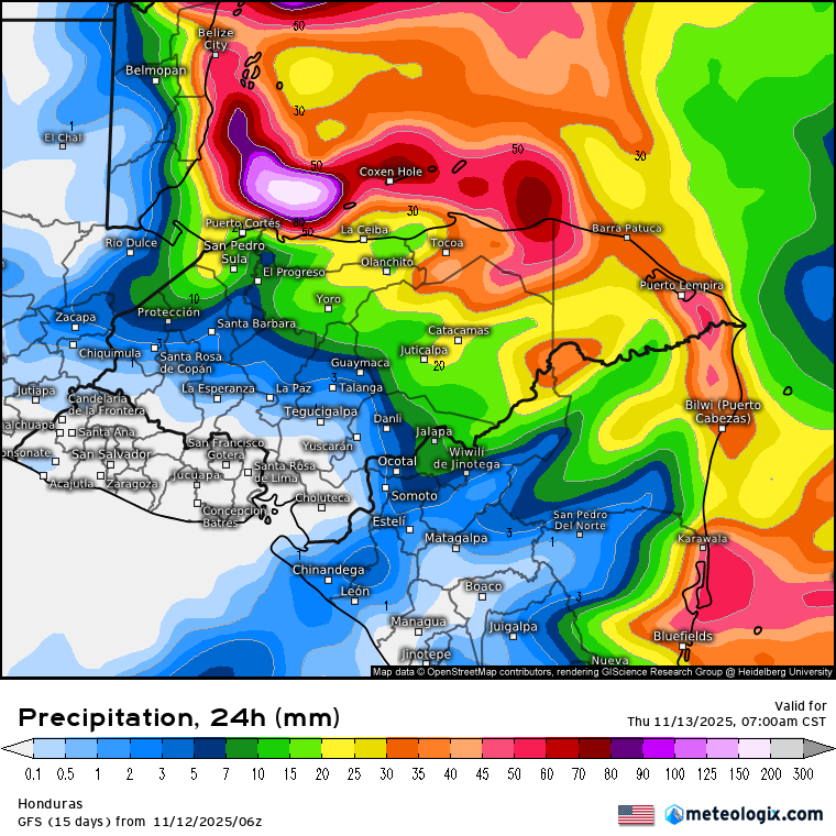
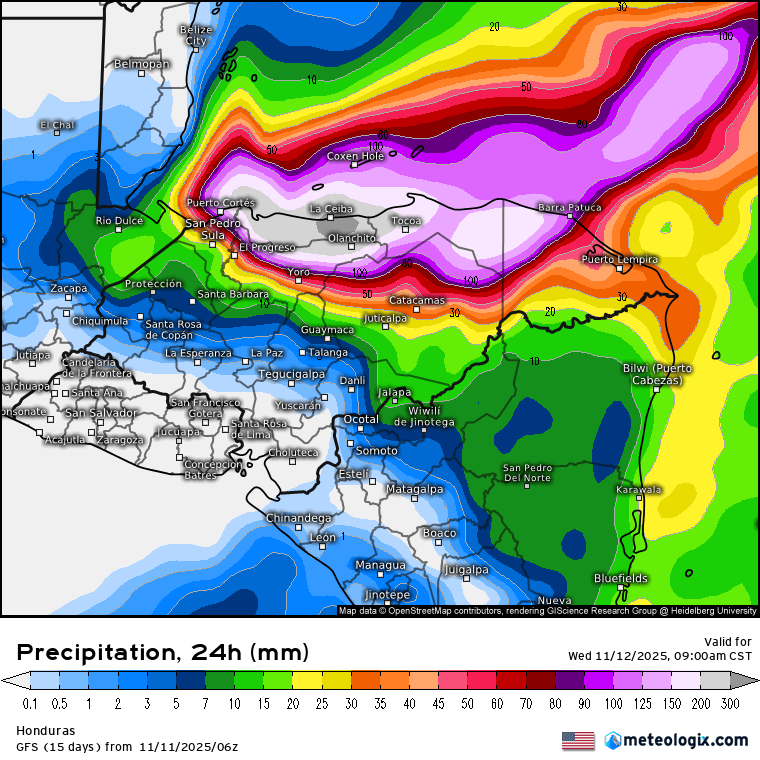
Here’s the forecast for rain over the next 24 hours. You can see the estimate for us is another 3-4 inches today.

The waves may have caused Roatan Ferry Galaxy Wave to cancel some morning trips, but rest assured they will get you around our islands the safest way possible. Download their app today!
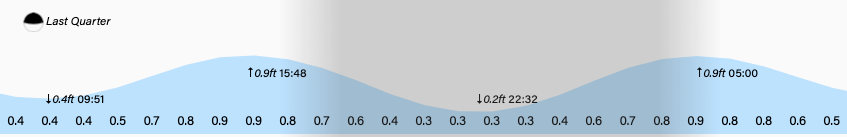
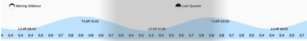
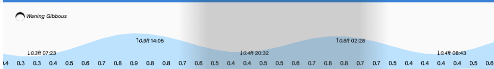
Watch out for 4 p.m. high tide, especiallly if the surf is still up on West Bay Beach. Have a great, and safe, Wednesday!