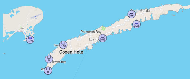
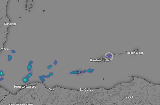
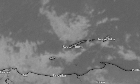
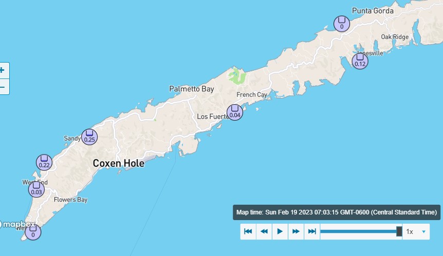
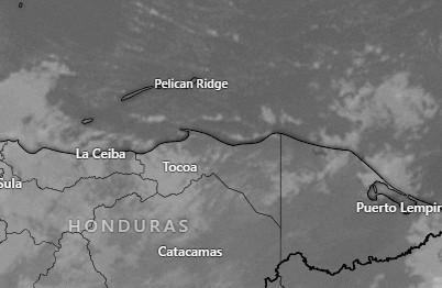
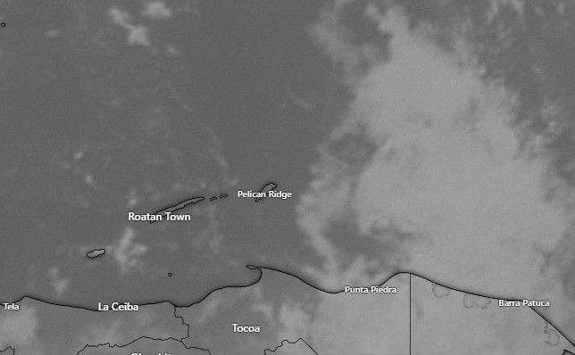
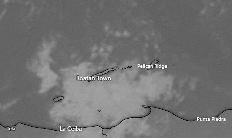
Feb. 14, 2023

Feb. 14, 2023: Good morning, Bay Islands! These are our three-day rain totals. Most of us on the big island got around 2 inches of rain, and Utila was the big winner with over 4 inches.

There are a few lingering clouds at 7 a.m. and there may be a sprinkle here or there for the next couple of hours, but today we will dry out and the fresh air will be with us, so enjoy! Winds wil start to pick up this afternoon to around 20 mph. We’re starting out with seas about 3 feet, and they will pick up to around 5 feet overnight. Wednesday and Thursday will be dry and windy, with daytime winds around 20 mph and 3 foot seas and nighttime winds around 30 mph and 5 foot seas. Friday the winds calm a bit to around 15 mph and the weekend looks calmer with scattered showers, though not as much rain as we had this past weekend. Have a great Tuesday!

Feb. 13, 2023

The number in the circle is rain since midnight. The number outside the circle is rain yesterday and today. Utila has a morning low of 69 (20.5 Celsius). The rest of us had lows of 70 or 71.

Feb. 13, 2023: Good morning, Bay Islands! We’re seeing some clearing over Guanaja and the east side. Today we will have a mix of sun and clouds, winds calming from where they are now, and a 50/50 chance of seeing another shower. Seas are about 4 feet on the north side and closer to 5 feet by Guanaja, but should calm to about 3 feet this afternoon. Tomorrow looks very nice, though the winds will start to pick up tomorrow night to 20 mph. Wednesday and Thursday are very windy and dry, with east winds 20 mph during the day and 30 mph at night with choppy seas. Winds calm on Friday and there’s a chance of rain Saturday. Have a great week!

Feb. 12, 2023

Good morning, Bay Islands. I did a video for the norther we are watching this morning.

If you like the video, please subscribe to my YouTube page.

If you prefer to read the forecast, a line of showers along the cold front is just to our west, moving in to Utila right now. Earlier this morning we got some light showers across the island.

We will have scattered showers today and tomorrow, giving most of us between an inch and three inches of rain.

Winds are turning to the north and should get to around 20 mph this evening, giving us choppy seas, especially on the north side, to around 4 feet (1.3 meters).

Temperatures on the coast of Belize are already cool, in the upper 60s (around 20 Celsius). I would be surprised if we get close to that here tomorrow morning.

Tuesday we will clear out and Tuesday night through Thursday we will be dry and windy, with winds 20 mph during the day and 30 mph at night. Next weekend looks calmer with a few scattered showers. Have a great Super Bowl Sunday!

Feb. 11, 2023

Good morning, Bay Islands. Last night most of the rain missed us to the north. There are a few clouds at 6:20 a.m. to our south that are moving west. They may give the west side and Utila a small chance of a shower during the morning hours, but most of today should be dry.

Here is the current location of our norther (cold front). It should arrive late this evening. The winds don’t look too bad. The highest winds from this cold front should be Sunday evening, but even then they should only be from the north 12-17 mph and seas around 4 feet, especially on the north side.

We will be partly cloudy Sunday and mostly cloudy Monday, with scattered showers both days (as well as Sunday night). This is the projected rain total from the European model through midnight Monday night. It keeps most of the rain to our west and gives Utila about two inches and Roatan about 1 inch.

This is the US GFS rain total. It gives Utila and the west side of Roatan about two inches and the east side and Guanaja about an inch. Expect more rain the further west you are.

Sunday evening into Monday morning we will have the freshest air, with temperatures in the lower 70s. Tuesday will be a fairly nice day with clearing skies. Tuesday night the east winds get gusty again through the middle of next week with dry conditions. Have a great weekend!

Feb. 10, 2023

Feb. 10, 2023: Good morning, Bay Islands! We wake up to 20 mph winds and 4-5 foot seas (1.3 to 1.6 meters) on the south side. Today we will have windy and dry conditions, but clouds will be increasing as our cold front gets closer and tonight into tomorrow morning we should have some scattered showers.
Tomorrow winds will be around 15 mph turning to the northeast and seas around 3 feet (1 meter). Tomorrow there will be scattered showers, especially in the evening. Sunday looks like a pretty rainy day. Winds should be around 15-20 mph and seas on the north side may get up to 5 feet. The chance of rain continues through Monday morning, after that we should dry out. Starting Tuesday we will have a week of strong east winds and dry conditions. Have a great Friday!

Feb. 9, 2023

Feb. 9, 2023: Good morning, Roatan! We had another windy night last night with winds to 30 mph. That gives us seas this morning of 4 feet on the southside (1.3 meters) and 3 feet (1 meter) on the northside.
Those windy, dry conditions continue today and tomorrow.
Saturday things start to calm, the winds shift to the northeast at 10-15 mph and our rain chances increase through the day into the night.

Sunday has the potential to be a rainy day. The map here shows cooler temperatures in blue (light blue for 2 degrees below normal, darker blue for 4 degrees below normal). Sunday, Sunday night and Monday morning should be quite fresh, with highs in the 70s (around 25C) and lows right around 70 (21C) on Monday morning.
Rain should end Monday morning and starting Tuesday we get strong east winds and dry conditions again. Have a great Thursday!

Feb. 8, 2023

Feb. 8, 2023: Good morning, Bay Islands! We definitely got our easterly winds back again! These winds are called “trade winds” and back in the days of sailing ships bringing cargo, winds like these brought ships from Europe and Africa toward Central America.
Last night we had sustained winds around 30 mph for several hours. This morning winds are back to around 20 mph and seas at 4 feet.
Today, tomorrow and Friday we will have daytime winds of 20 mph and seas 3-4 feet and nighttime winds of 25-30 mph and seas 4-5 feet. Skies will be mostly clear.
Saturday the winds calm as our norther approaches. Right now it looks like most of the effects of this norther will be Sunday, with rain and north winds. The rain may linger a bit into Monday morning, but it should clear out quickly and we will get our east wind and clear skies back starting Tuesday. Have a great Wednesday!

Feb. 7, 2023

Feb. 7, 2023: Good morning, Bay Islands. As of 8:20 a.m. you can see the rain totals we received this morning. The further east you went, the wetter you got. We still have some clouds around and we’ll keep a small chance of a shower through the morning, but we will be mostly dry, and clear out for the afternoon.
Winds this afternoon will be from the east 15-20 mph and seas to 3 feet. Overnight winds will be 20-25 mph and seas to 4 feet. Those conditions will continue for Wednesday, Thursday and Friday with little to no chance for rain.
Saturday our winds turn to the northeast at 10-15 mph and we have a good chance at showers, especially Saturday afternoon into Sunday morning. Rain chances continue through Tuesday morning, after which we get dry conditions and east winds again for next week. Have a great Tuesday!

Feb. 6, 2023

Feb. 6, 2023: Good morning, Bay Islands! No rain last night as the clouds and rain stayed well to our west, near Puerto Cortes and Tela. Today we will have one more day of relatively calm winds and seas, with winds 10 mph during the day and 15 mph at night and seas at 2 feet. There will be a better chance of a shower overnight tonight into early tomorrow morning.
Tuesday afternoon through Friday morning we will have windy and dry conditions with daytime winds near 20 mph and seas 3-4 feet and nighttime winds to 25 mph and seas 4-5 feet.
Friday winds calm a bit as the next norther get close. The best chance of rain still looks like Saturday into Sunday morning. We may get a north wind on Sunday morning. Have a great week!

Feb. 5, 2023

Feb. 5, 2023: Good morning, Bay Islands! The west side of the island got some rain between 5 and 7 a.m. The highest total was .15 of an inch in West Bay, but West End and Sandy Bay also got a little wet. Those clouds have moved off to the west but at 7:45 a.m. we have some rain, shown with the number 1, to our south that may give the west side a shower soon. There are also clouds (marked 2) that could give us a chance at a shower in about two hours if it holds together. So we will keep a chance of a shower through about lunchtime. After that we should have clear skies and mild breezes of about 10 mph and seas at 2 feet. Tonight and Monday morning the chance of rain is about 40 percent, after which Monday should be a nice day with continued mild winds and seas. Monday night and Tuesday morning there is a little better chance of a shower, about 50 percent, after which we should clear out and the winds will get stronger from the east, 15-20 mph during the day and 20-25 mph at night, with seas 3-4 feet during the day and 4-5 feet at night through Thursday.

Friday winds get a little calmer and start to turn to the north as we look for our next norther, which may bring rain and north winds, especially Saturday afternoon into Sunday morning. The timing and strength of the norther will change as we get closer, so we’ll keep an eye on it.

Have a great Sunday!