Today through Wednesday we will continue to have mild winds from the east 5-10 mph and seas 1-2 feet. Rain chances will be small and mostly at night or early morning.
Starting Thursday into next weekend our rain chances increase. The Caribbean tropics have been very quiet and there are no tropical storms in the forecast, but we will have more moisture and a more unstable atmosphere leading to more squalls the end of this week and the first of next week.
Have a great Sunday!
Sept. 16, 2023

Sept. 16, 2023: Good morning Bay Islands. There are two small showers just north of Barbarat and Morat that don’t seem to be moving our way. They actually don’t seem to be moving much at all and will probably disappear in an hour or so. We will continue to have mild winds and seas from the east 5-10 mph and seas 1-2 feet. Rain chances are low, but you can’t rule out a pop-up shower here or there. That will be the forecast, not only for this weekend but for much of next week. As we get to next weekend, the rain chances should get better. Have a great weekend! I hear there’s a big fishing tourney going on. Like I always say, September is one of the best weather months on the island if you’re interested in calm seas. Low tide is 4:15 p.m., but the tides are very mild.
September 15, 2023
Our forecast for today and the weekend is very similar to the past few days, except we will be slightly windier. Daytime winds will be 10 mph and nighttime winds 15 mph with seas at 2 feet. We will continue to have scattered showers and partly cloudy skies. Have a great Friday!
September 14, 2023
Much like yesterday at this time (7 a.m.) we have a small shower moving from east to west over Roatan. It has brought .13 of an inch at my place on Jonesville Point and is coming to an end. Our area of the Caribbean is mostly clear this morning, we just happen to be under this cloud. Yesterday was one of those tropical days where one location would get an inch in a sudden downpour and a location less than a mile away got nothing.
Today will continue with calm winds and seas, but the winds will pick up a bit toward evening to 10-15 mph and seas to 2 feet.
Tomorrow into the weekend we will have daytime winds around 10 mph and nighttime winds around 15 mph with seas mostly 2 feet, occasionally 3 feet.
Rain will be isolated. Most of the time we will be sunny but there will be hit and miss showers out there from time to time. As we get closer to new moon, we’re having pretty mild low tides but high tides are a bit higher. High tide tonight is 8 p.m. Have a great Friday!
September 13, 2023
There is a small shower at 7 a.m. south of Barbarat moving west. If it hold together it will give the island a chance of rain over the next hour, but its pretty small so it won’t get everyone wet.
This morning we are getting those calm winds and seas (mostly 1 foot, occasionally 2 feet) that we will see today and tomorrow. Friday into the weekend winds get back to 10-15 mph and seas 2-3 feet. We will continue to have small chances of overnight and early morning showers, but overall, a mostly dry and calm forecast. Have a great Wednesday!
September 12, 2023
Sept. 12, 2023: Good morning Bay Islands. This morning most of the showers are to our west, but at 7:15 a.m. there is one small shower between Roatan and Utila. Yesterday we saw some showers around 11 a.m., mostly on the west side, bringing about a quarter of an inch. Today the rain chance will be less, but we will still have a chance of a shower through the day and overnight, around 30 percent.
Winds this morning are 10-15 mph and seas around 2-3 feet, but they should calm and we will see winds 5-10 mph and seas 1-2 feet by afternoon. Those calm winds and seas will continue the rest of the week, with small chances of showers, mostly overnight.
This weekend looks much the same, if slightly windier, with winds getting back up to 15 mph and seas to 2-3 feet. Have a great Tuesday!
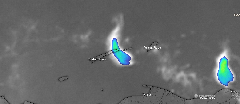
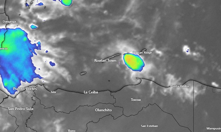
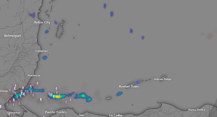
September 11, 2023
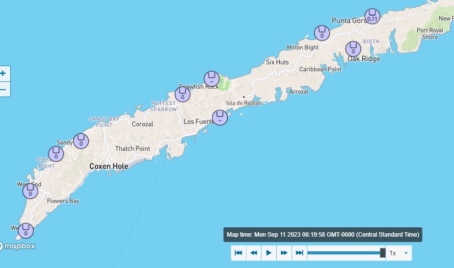
Good morning Bay Islands. There were some showers this morning mostly on the east side and around Guanaja. Among our reporting stations, only Punta Blanca reported rain, about a tenth of an inch. If you got rain, let us know in comments.
Today through Wednesday morning we will all have good chances of scattered showers. Most of the models give us between an inch and an inch and a half during that time period. As always, the chance of rain is greater overnight and in the early morning, but we will also have a decent chance of a daytime shower or thunderstorm during this period. It won’t be raining all the time and we will have periods of sun, but we all should get wet the next 48 hours.
Today winds will be from the northeast at 10-15 mph and seas 2-3 feet, except in squalls when we could get wind bursts and choppy seas. Tomorrow and the rest of the week winds and seas will get very calm.
After Wednesday morning, rain chances will be around 30 percent for the rest of the week and mostly overnight. Have a great week!
September 10, 2023
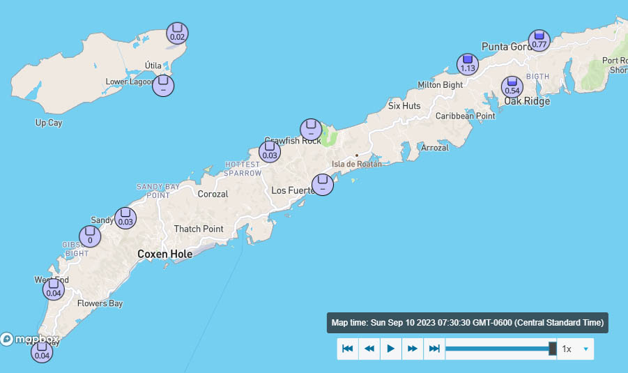
Good morning Bay Islands. Looks like we got a thundershower around 2:30 a.m. though I slept through it. Let me know in comments what you got at your place.
At 9 a.m. we are watching some thundershowers well to our north move to the west and away from us. We should be mostly sunny with east winds around 15 mph and seas 2-3 feet (.6-1 meter) today.
We’ll have another chance of showers or thundershowers overnight, but tomorrow we should see increasing clouds and a better chance of scattered showers from Monday evening through Wednesday morning. Winds starting Tuesday will be calmer, at 5-10 mph and seas 1-2 feet. Have a great Sunday!
September 9, 2023
Sept. 9, 2023: Good morning Bay Islands. At 7 a.m. most of the showers are between Belize and Utila but moving southwest, away from Utila. There is a small shower that may be affecting the east side of Guanaja. If you got a shower, let us know in comments.
We wake up to an east wind around 10 mph and seas at 2 feet. The should calm even more and we may get down to 1 foot seas this afternoon. There will be a small chance of rain overnight tonight but tomorrow will be mostly sunny with east winds 10-15 mph and seas at 2 feet.
Monday we will have increasing clouds and a decent chance of rain by evening. Good chances of scattered showers will be around from Monday evening through Wednesday morning. Tuesday through Thursday winds will be 5-10 mph and seas 1-2 feet. Have a great weekend!
September 8, 2023
Sept. 8, 2023: Good morning Bay Islands. Looks like around 6 a.m. there may have been a thundershower in western Guanaja. If you saw some showers, let me know in comments.
What rain is out there seems to be moving away from us and decreasing. We should be partly cloudy today with east winds 7-12 mph and seas at 2 feet (.6 meters).
We will have another night with low rain chances tonight, but nighttime rain chances are a little better tomorrow night into Sunday morning and Monday and Tuesday rain chances go up, even during the daytime hours. Winds tomorrow through Monday will be 10-15 mph and seas 2-3 feet. Things get very calm again Tuesday through Friday of next week. Have a great Friday!
