Oct. 7, 2023: Good morning Bay Islands. Here on Jonesville Point we got .2 of an inch around 2 a.m., but most of the weather stations were dry overnight.
Our satellite shows mostly clear skies this morning, with a storm northwest of Utila and heading away from the islands.
Our seas are up ever so slightly to about a foot and a half. Winds and seas will remain fairly calm through Monday morning. Monday evening winds will be around 10 mph and seas to 2 feet. next week winds and seas should be up a little, 10-15 mph and 2-3 feet.
Tonight the rain chance is 30 percent and tomorrow night it is a little better at 40 percent. Have a great weekend!
Oct. 6, 2023
Good morning Bay Islands. Our beautiful weather continues into the weekend with east winds 5-10 mph nad seas at 1 foot. Our rain chances at night are going to start to get better, maybe 20 percent tonight, 30 percent Saturday night and 40 percent Sunday night. Next week looks a little windier, especially at night with seas getting to 2-3 feet. Rain chances continue to be small through next week. Have a great Friday!
October 5, 2023
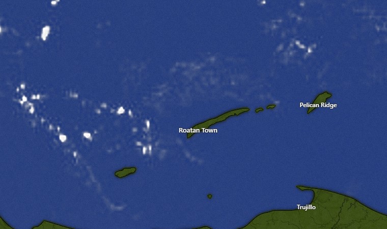
Good morning Bay Islands. The satellite is mostly clear this morning with a few clouds between Utila and Roatan. Skies will be mostly clear and rain chances very low today and tomorrow.
The best chance of rain comes tomorrow night into Saturday morning and Saturday night into Sunday morning.
Winds and seas will remain fairly calm through Sunday. Starting Monday evening winds will pick up to 10-15 mph and seas to 2 feet and maybe even 3 feet. Low tide is 9 a.m. but it won’t be very low. Have a great Thursday!
October 4, 2023
Good morning Bay Islands. There are a few scattered showers, especially out west. There is very little movement in the atmosphere, so these clouds are drifting east very slowly. The sea is almost flat calm.
Winds 5-10 mph and seas at calm to 1 foot are expected to continue through the weekend. Chances of showers continue to be small through Friday, but rain chances should be a little better over the weekend, especially Saturday night into Sunday morning.
I know a lot of you are making plans for the eclipse on the morning of Oct. 14 and that’s still a long way off. There are no major storms in the forecast, so right now it looks likely that the weather will be OK, but we’ll keep an eye on it.
October 3, 2023
This is one of the best forecasts I’ve ever had for an entire week and, fortunately, it is a week when lots of people will beoff of work. We will have mostly clear skies, small chances of rain and any rain we get will be quick. Winds and seas will be calm. It is possible the rain chance will go up a little as we get into the weekend. Have a great Tuesday!
Rainfall for September 2023
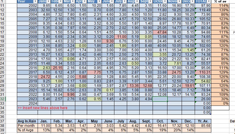
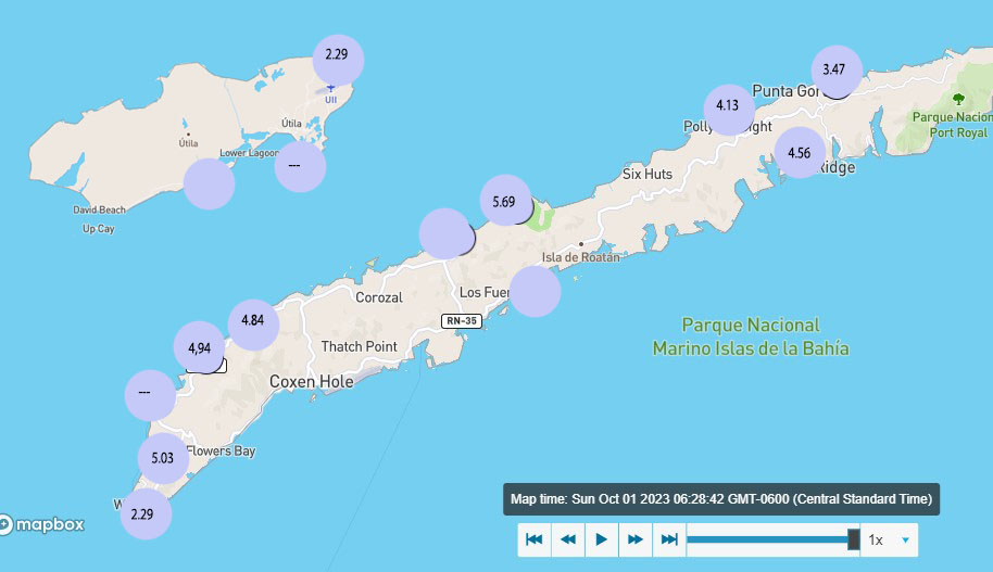
We actually had a pretty average month of rain for a change. After being well below average most of 2023, we got 4-5 inches of rain in September, a number that was pretty consistent across the island. Utila fared worse, with 2.29 inches, thought two of their reporting stations were down part of the month so some locations probably got more. We will go with Sandy Bay’s 4.94 to put in the books.
October is typically the start of rainy season, especially the last two weeks of October, but the rainfall can be wildly different. 2004 had under 3 inches and 2008 had almost 48 inches. I looked it up and there was a tropical depression that caused massive flooding that year.
While the average for October is 16 inches, 10-12 inches is not uncommon. Right now we are not in a wet season pattern yet. That starts when cold fronts from the States make it close enough to push rain down here. The two week forecast on the GFS model has one of those forecast for Oct. 15, so it may start right on time.
October 2, 2023
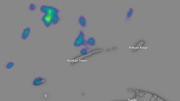
Good morning Bay Islands. At 6:40 a.m. we have a shower midisland that brought about a quarter of an inch to the east end. It may head west out to sea before reaching WB and WE.
There are more showers east of Guanaja. If they hold together they could bring a chance of showers 8-9 a.m.
We will have a good chance of a morning shower and even a few scattered showers during the midday and afternoon.
Winds are around 5 mph and seas a little over 1 foot. Winds and seas will remain quite calm this week. Starting tomorrow and for the rest of the week there will be our normal 30-40 percent chance of a passing shower, mostly at night and early morning. Have a great week, especially if you don’t have to work!
October 1, 2023
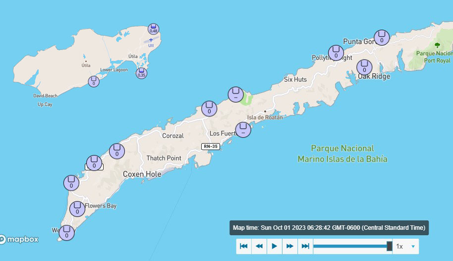
Good morning and welcome to October. No rainfall since midnight for most of us on Roatan. Looks like several locations on Utila got a decent rain around 3 a.m. There was also some rain before midnight on Utila.
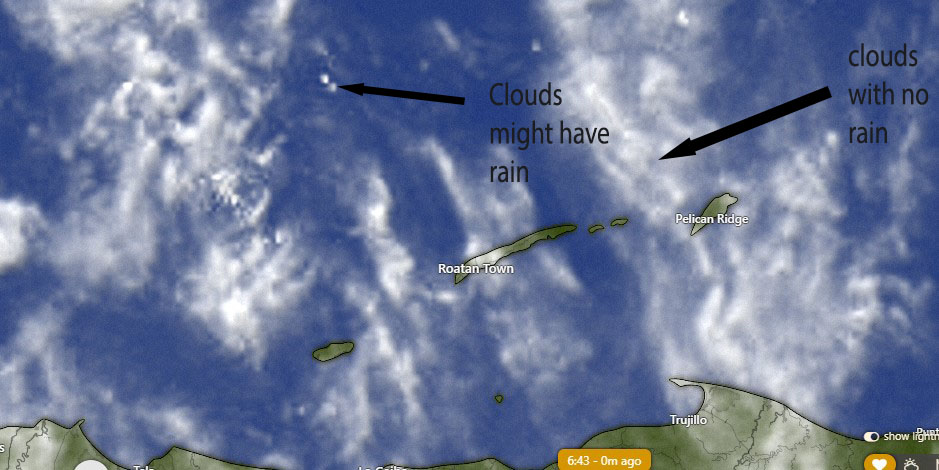
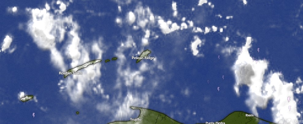
On satellite this morning we see lots of clouds from the north that are very thin, looking like cotton that has been stretched out. These cirrus clouds do not contain rain. But there are small white dots that may contain rain. Those would be very small showers if anyone sees one this morning and they won’t last long.
We have a bit higher seas at 2 feet on the southside, with the northside still at 1 foot.
We will have a partly cloudy day today with east winds 10-15 mph, seas 1-2 feet and an increasing chance of rain toward evening. The chance of rain is pretty good overnight tonight into tomorrow morning. Monday through next week looks quite calm. With east winds 5-10 mph and seas at 1 foot. The chance of rain is lower at about 20 percent each day and 30 percent each night. Low tide is 4:45 p.m. Have a great Sunday!
September 30, 2023
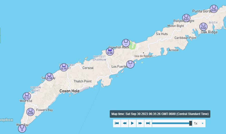
Good morning Bay Islands. These are rain totals since midnight, and much of the rain you see here came just after midnight. Palmetto Bay picked up over a half inch. None of the Utila stations reported rain.
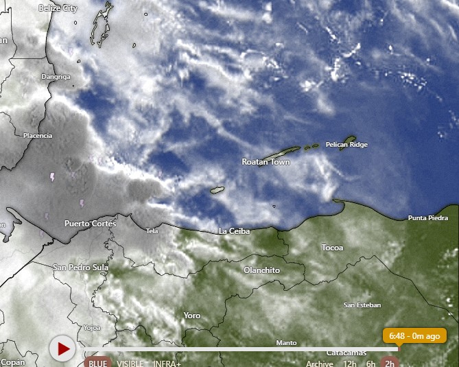
A 6:48 a.m. most of the storminess is over toward Puerto Cortes moving away from us. We have mostly high clouds and maybe one or two that might contain a brief shower this morning.
We will continue to have partly cloudy to mostly sunny skies with scattered showers mostly at night. This weekend will be a little windier with east winds 10-15 mph and seas 1-2 feet.
Starting Monday winds will calm to 5-10 mph and seas will remain mostly 1 foot to flat calm, a perfect week for those crowded Morizanica beaches. We will have a minor low tide at 3:20 pm and a lower one at 3:45 a.m. Have a great weekend.
Sept. 29, 2023
Good morning Bay Islands. We have some storms well to our north. They are drifting south very slowly. Over the next three hours (7-10 a.m.) we will probably see quite a few clouds from this, and possibly a shower here or there.
This afternoon should be mostly sunny with fairly calm winds and seas.
Tonight we will have another 30 percent chance of a shower or thundershower.
This weekend is slightly windier, with east winds 10-15 mph and seas 1-2 feet. We will continue to have small chances of showers, mostly at night.
I know a lot of folks are interested in the forecast for next week, Semana Morizanica. It will be much the same as we’ve had for the past week, with perhaps a little less rain. Winds and seas will be fairly calm, getting slightly windier toward next weekend. Thundershower chances will be small and mostly at night. Any daytime showers will be brief. There are still no tropical storms anywhere close to the Caribbean. Have a great Friday!
