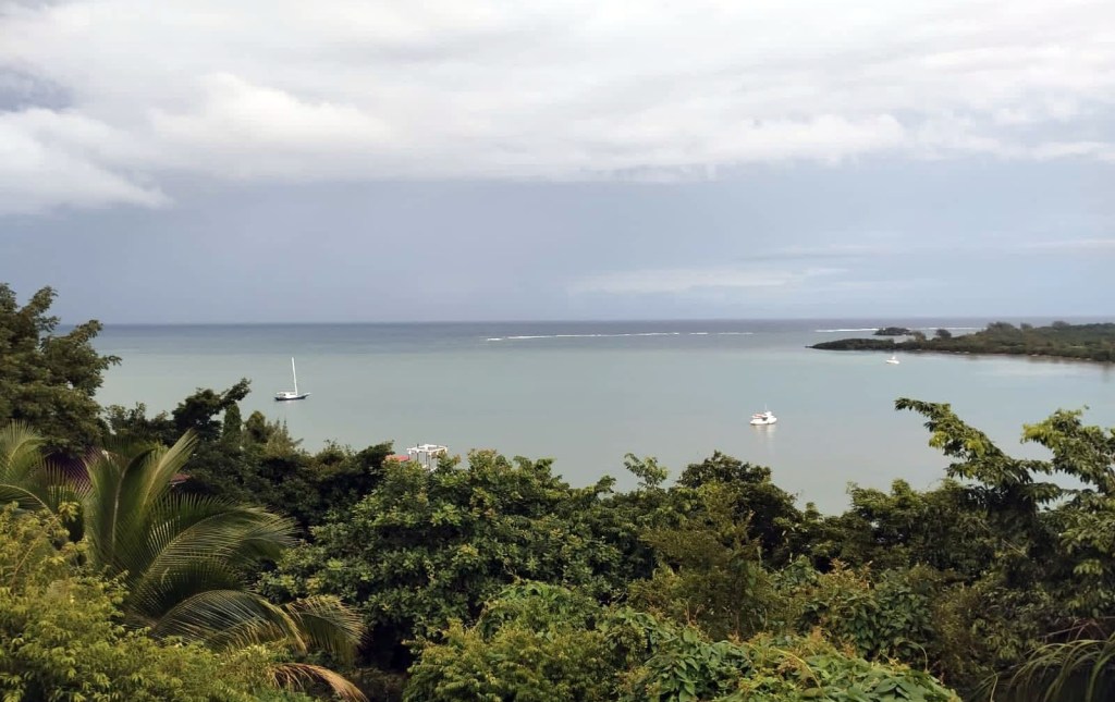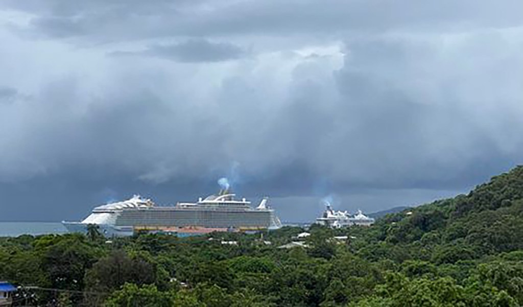
Good morning Bay Islands. Our photo of the day is a familiar sight to all of us — cruise ships in Coxen Hole port. Dave Elmore took this photo from Plaza Mar, you know, the place with the immigration office but also that wonderful souvenir shop on the second floor. Keep the weather photos coming and thanks so much!
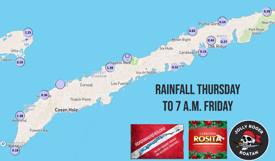
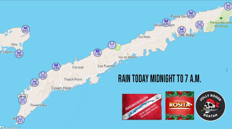
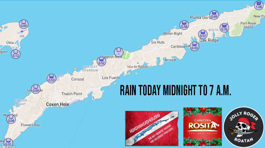
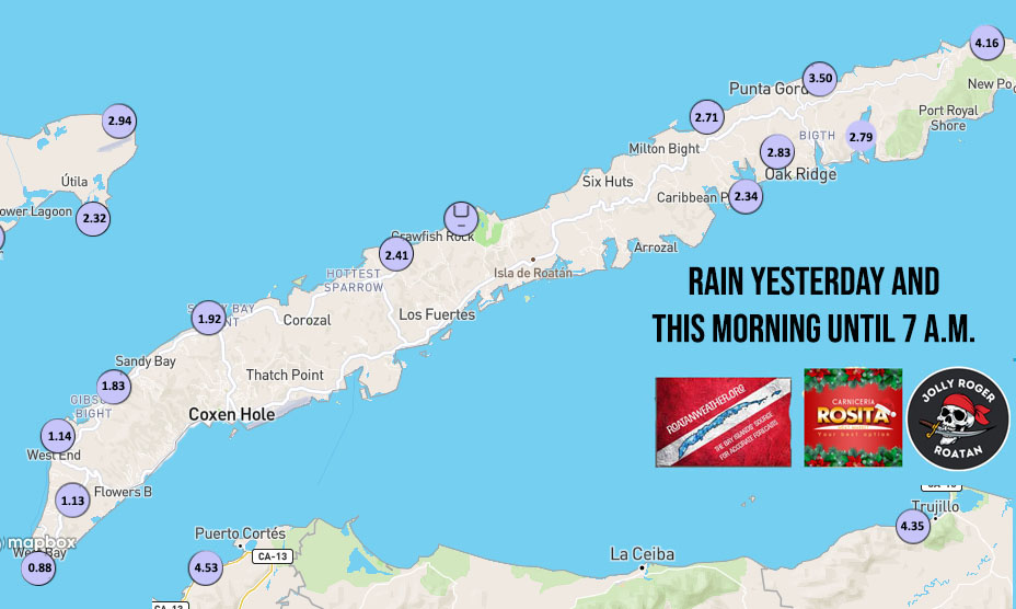
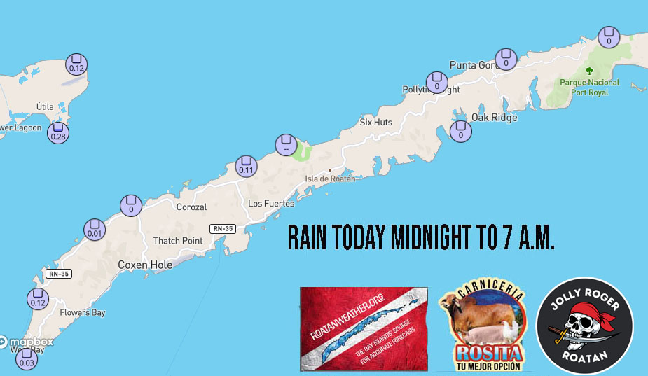
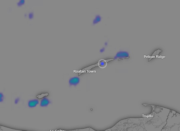
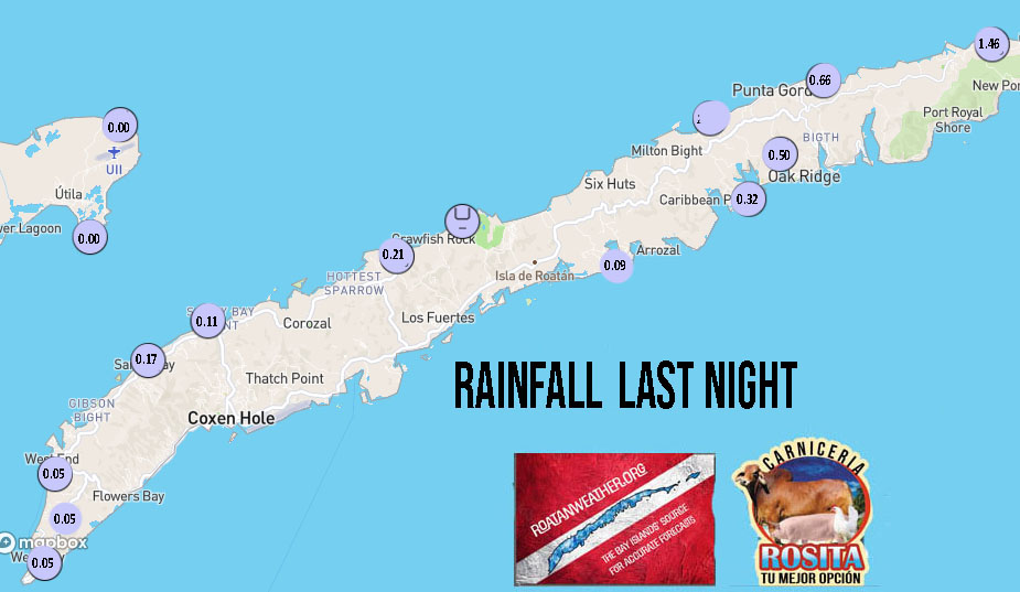
No rainfall this morning since midnight on the big island, but Utila got some rain after midnight. A lot of us got some rain before midnight, so I’m including yesterday in this morning’s rain totals.

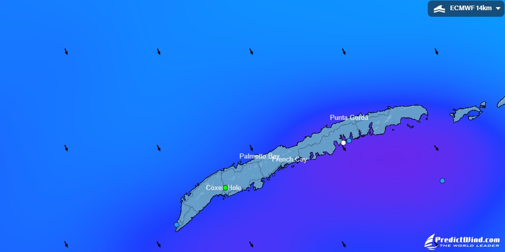
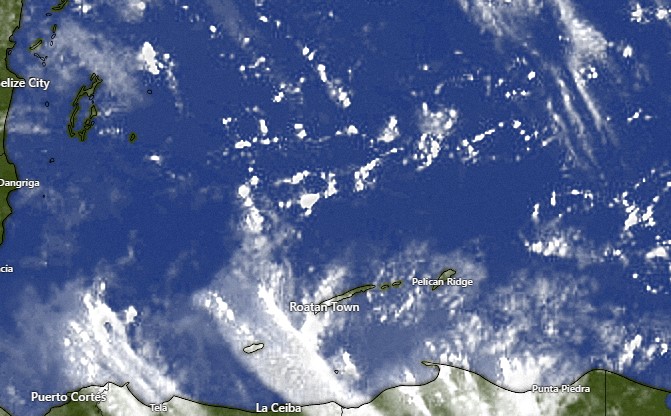
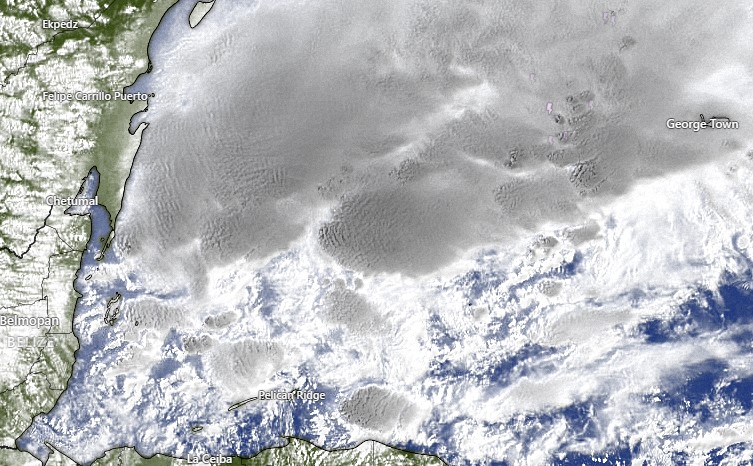
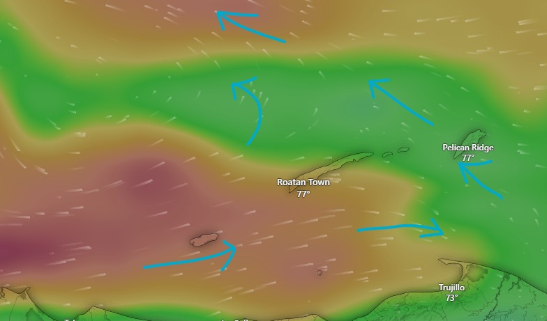
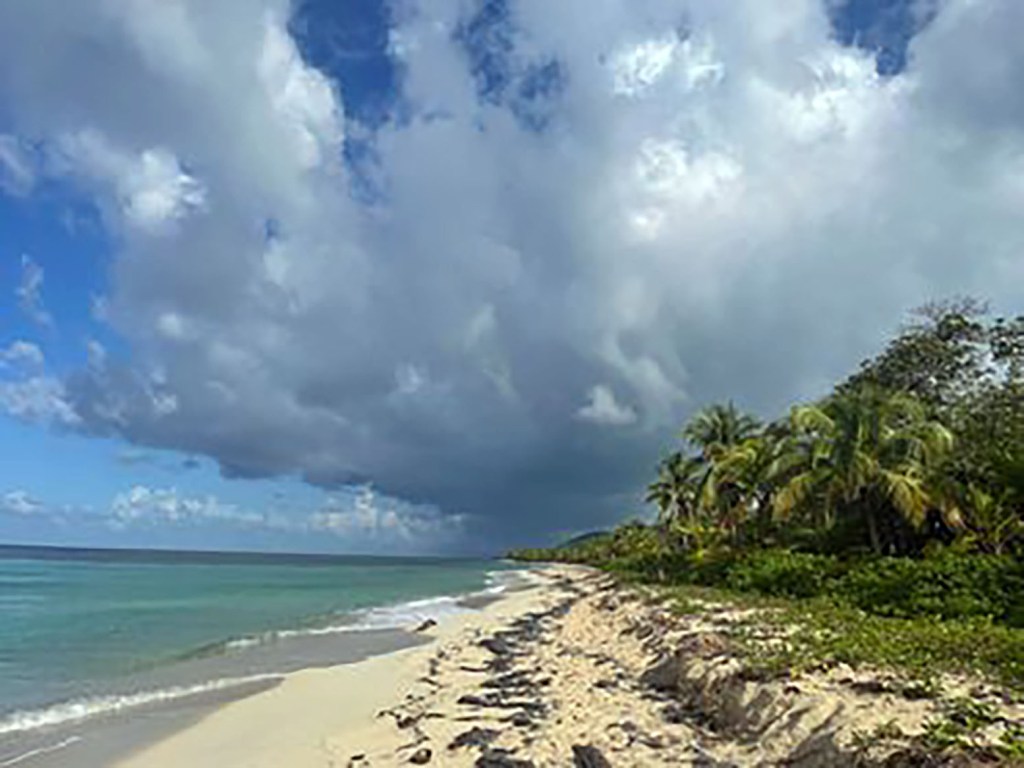
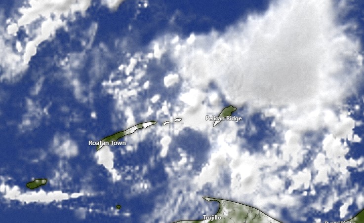
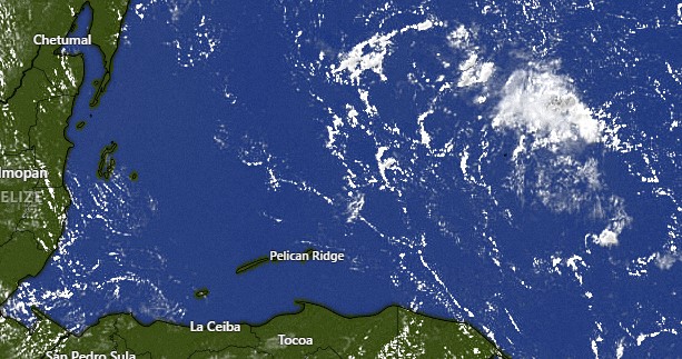
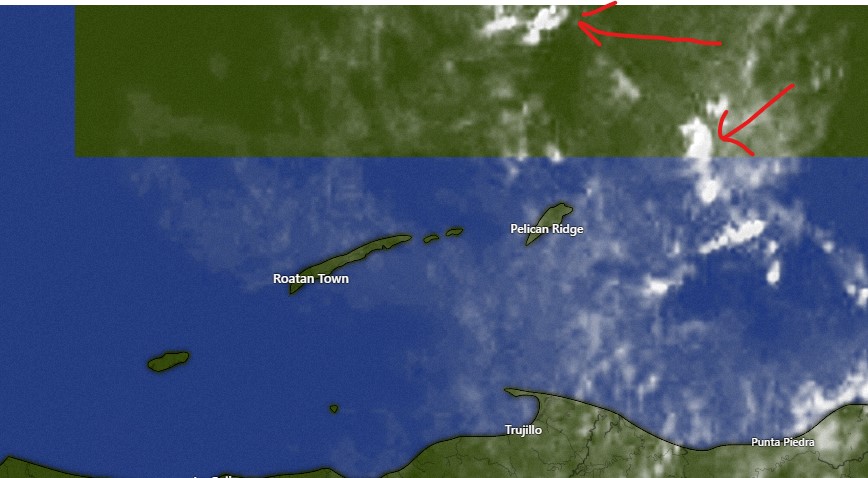
There are just a few “popcorn” clouds on our satellite, so a passing shower is possible today, but we should be mostly sunny for most of today. Clouds increase and rain chances go up tonight into tomorrow as our cold front approaches. Winds Saturday will be from the west 15-20 and seas around 4 feet.
Sunday morning will be very windy from the northwest with winds perhaps as high as 30 mph and seas 6-7 feet. As the day goes on, things should calm a bit. There is surprisingly little rain in the forecast for a norther, because this one is supposed to sweep through so fast and actually bring in drier air behind it. But when colder air comes, we sometimes get a chilly, light rain, so I doubt Sunday and Monday will be completely dry.
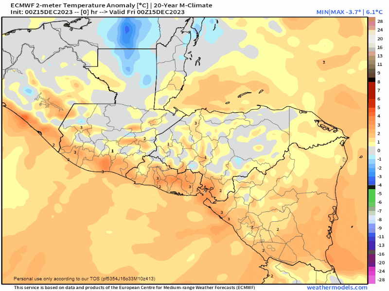
One of the big stories next week is how fresh the air will feel. This map shows the difference between average temperature and forecast temp. Yellow is above average and blue is below average. Look at how blue we are next week according to the Euro model. I imagine when the sun comes out we will be around 80 or 81 (26-27C) but under clouds we will stick in the upper 70s. (25C). Enjoy! Things look pretty dry going into next (holiday) weekend as well.
I understand the boat parade has been moved to Wednesday night. Winds should be mild and the rain chance is quite low, but seas will be 4 feet and because they are from the northeast, those waves will run along the south side of the island as well, perhaps 3-4 feet outside the reef.
For those in the US and Canada you can order your 2024 Roatan Weather Calendar at this link. If you’re interested in getting one on the island (I’m hoping to keep the price at $19.95 depending on cost of printing here) please text me at 94754406.
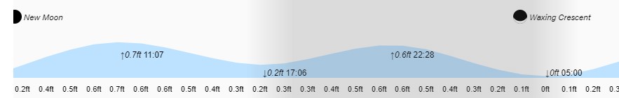
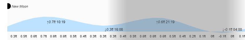
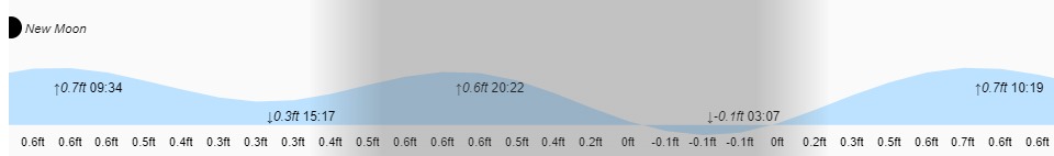
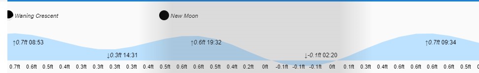
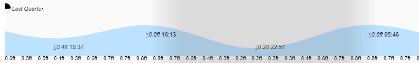
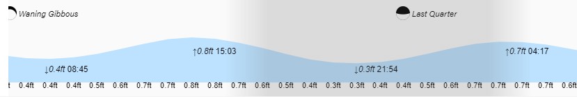
Low tides are 5 p.m. and 5 a.m. Have a great Friday!