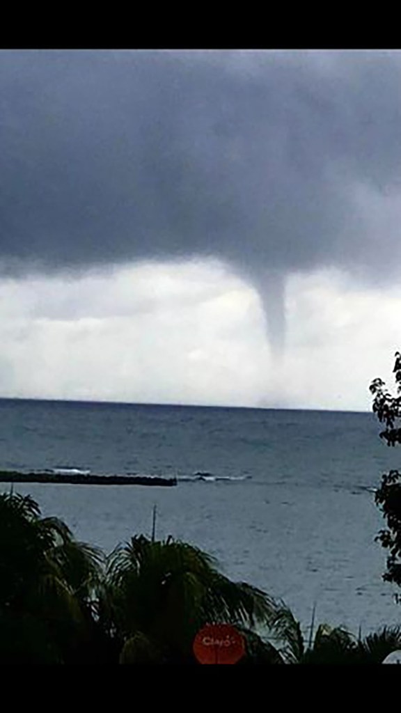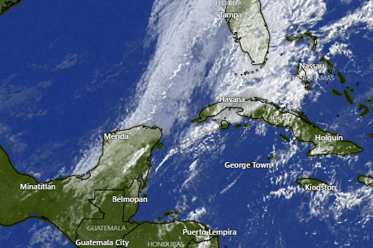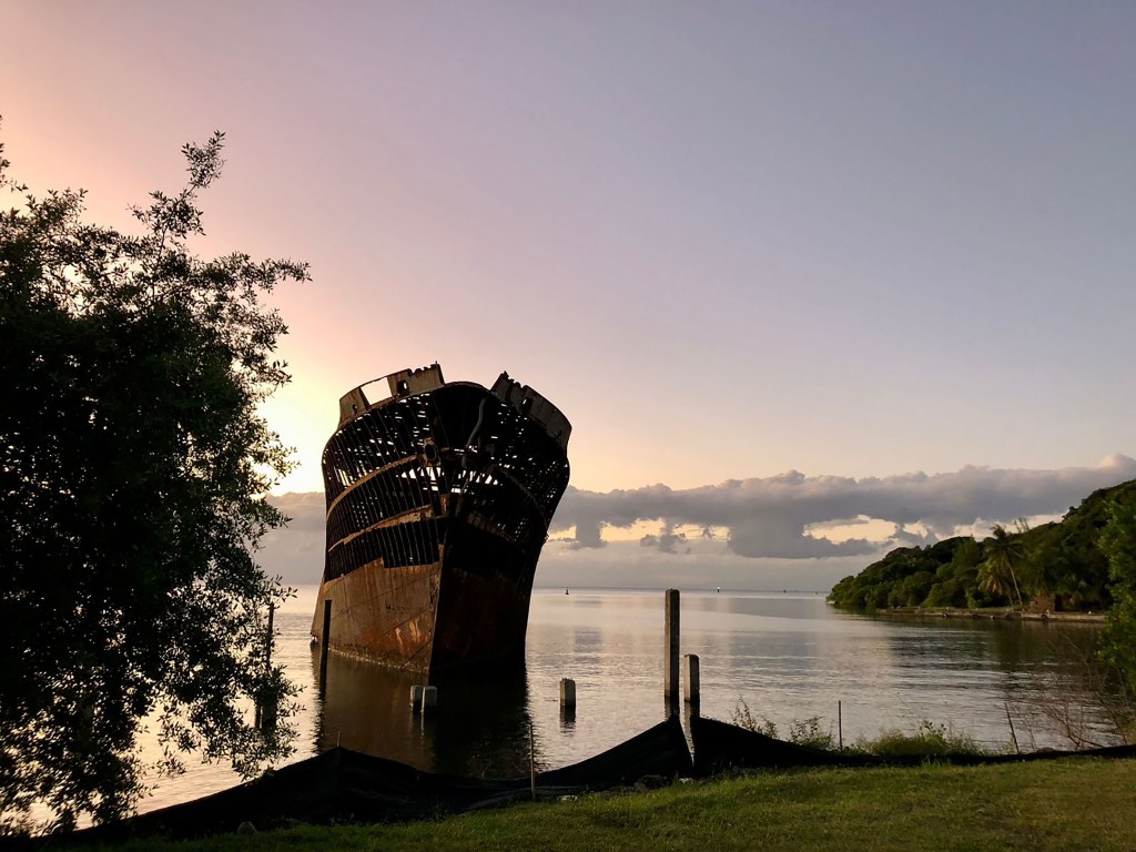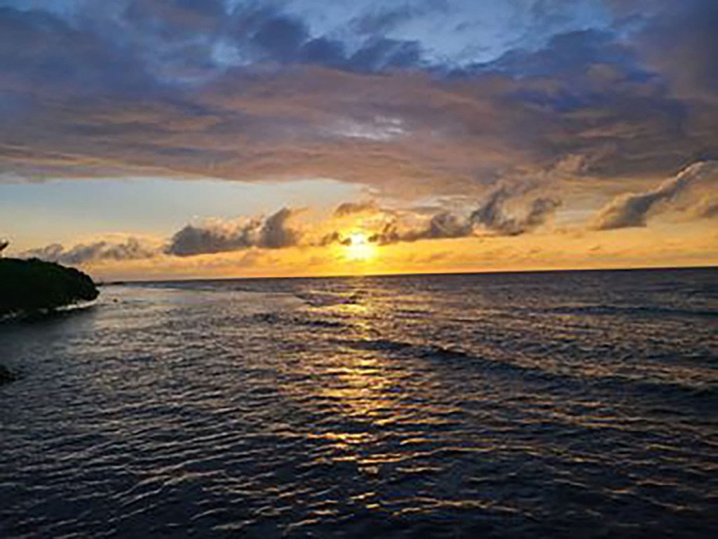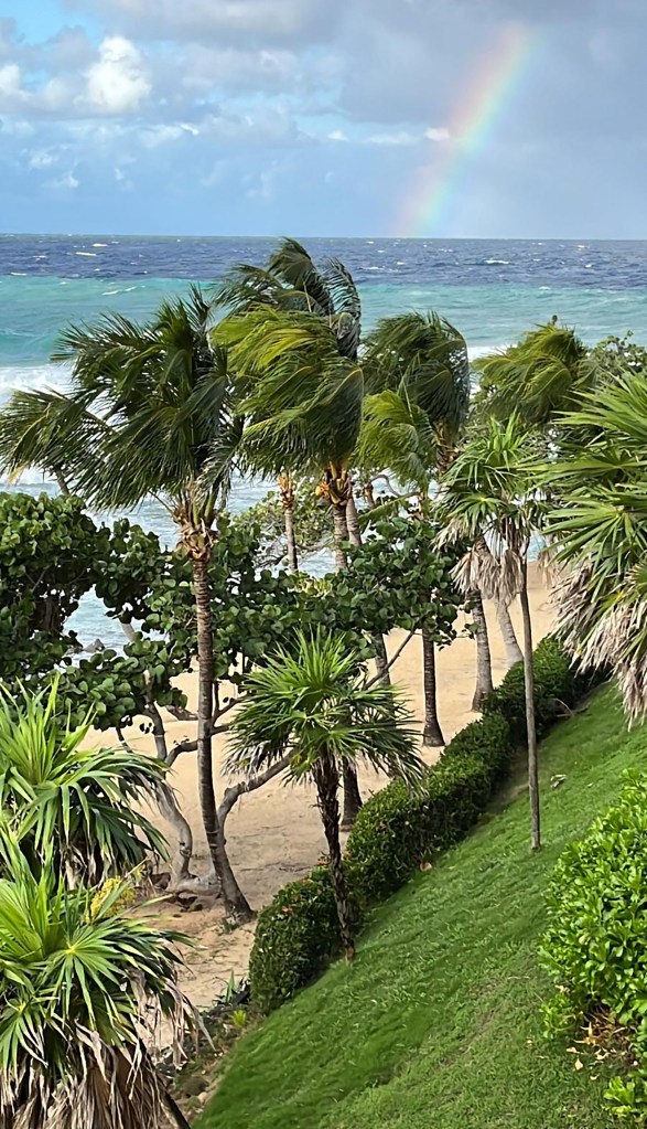
Good morning Bay Islands. Our photo of the day is a reminder of our last norther, taken at the tip of West Bay by Julie Elpus. This morning we getting 20 mph winds and seas at 5 feet on the north side. Conditions are expected to be worse this afternoon before the get a little better tomorrow.

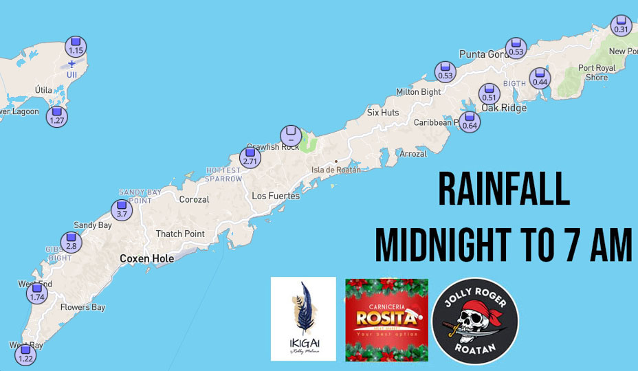
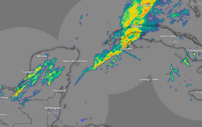
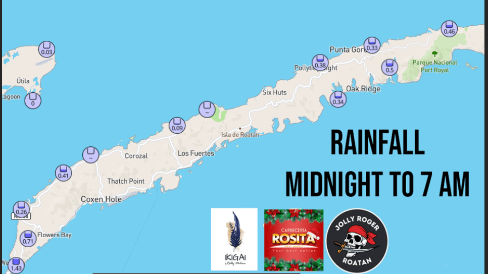
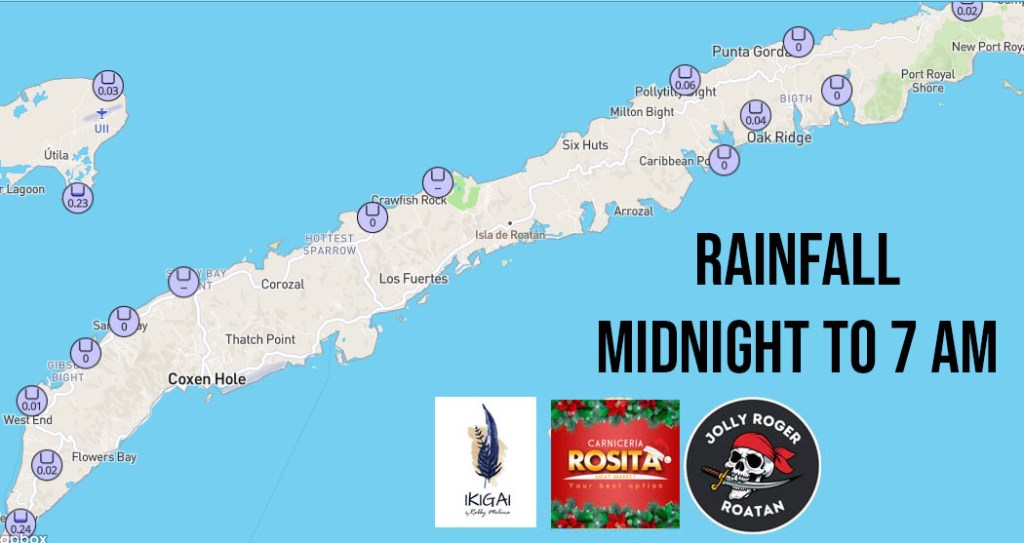
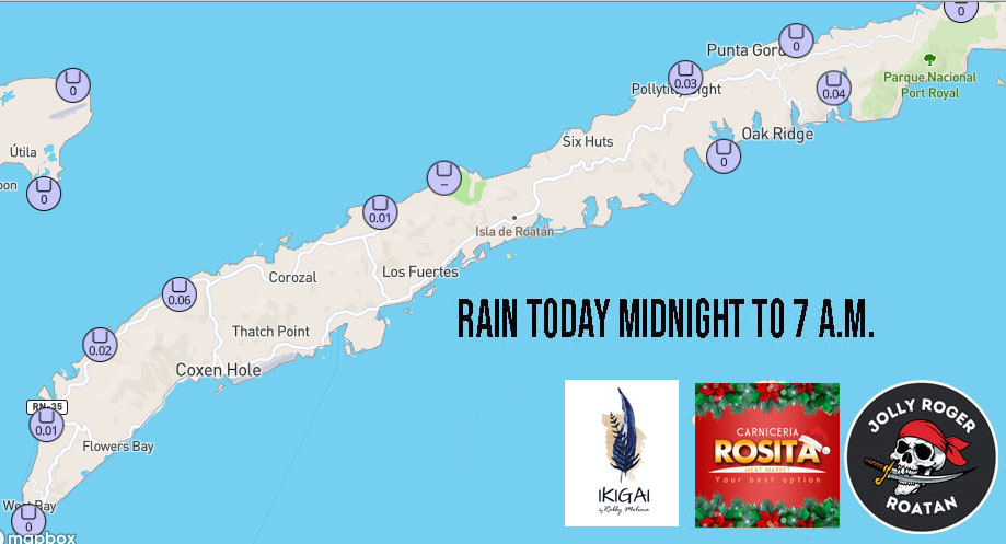
Here are our rainfall totals, with this morning’s rain in purple and rainfall including yesterday in yellow. The west side has already gotten around 5 inches.
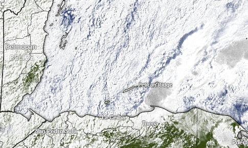
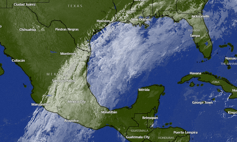
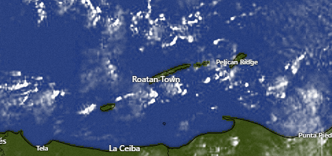
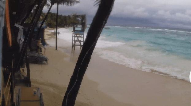
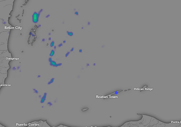
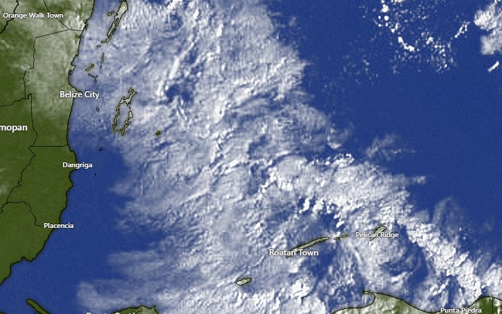
Lots of clouds out there at 9 a.m. This will be quite a cloudy day with steady, sometimes heavy, rain. Another 2 inches is expected.
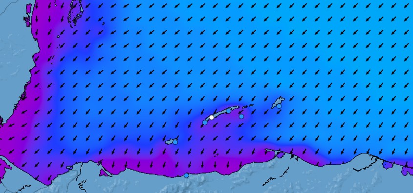
Winds and seas will be the main concern today. This morning winds will be from the north/northeast at 20 mph and seas 5 feet, but as we get into the afternoon winds will pick up 20-30 mph and seas 7-8 feet. Winds will be from the northeast tomorrow 12-17 mph and seas will be 6 feet in the morning and 5 feet in the afternoon, coming from the northeast. Tomorrow there will be periods of light, chilly rain. Rain chances are much lower Monday and Tuesday, but we still keep a brisk northeast breeze 12-17 mph and seas 4-5 feet. Seas should be down to 3 feet Wednesday and 2 feet Tuesday.
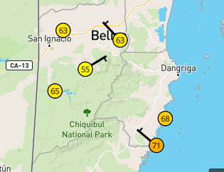
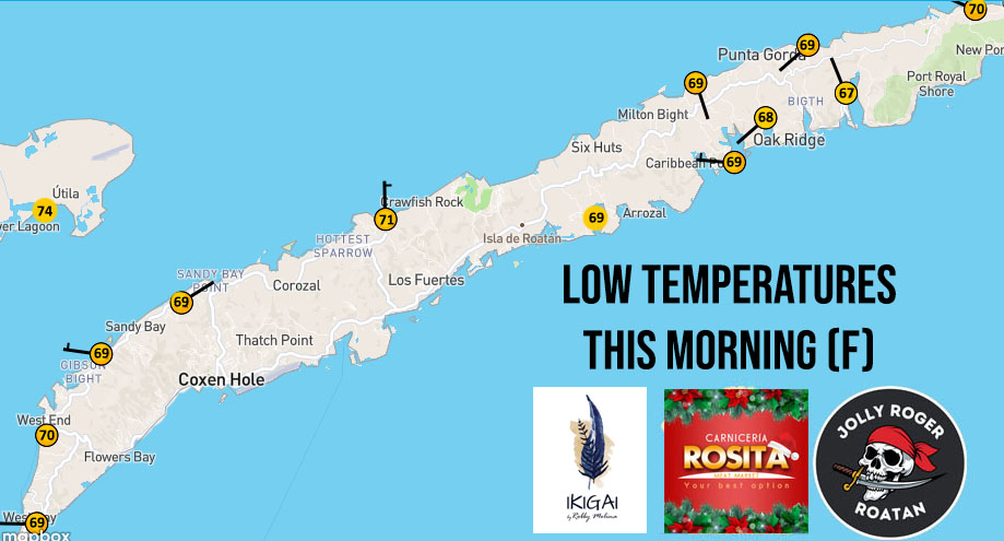
Speaking of chilly, look at these morning lows in Belize. Hopkins on the coast even got down to 68 degrees (20C). We probably won’t get that cool, but look for very cool temperatures tonight and tomorrow night. Folks going out for New Year’s Eve may want to take a jacket.
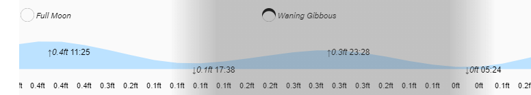
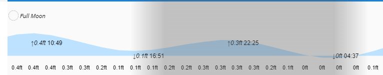
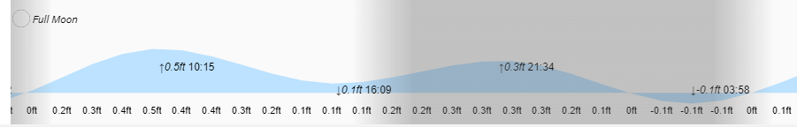
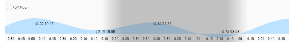
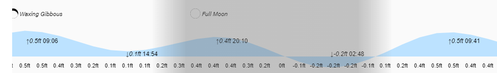
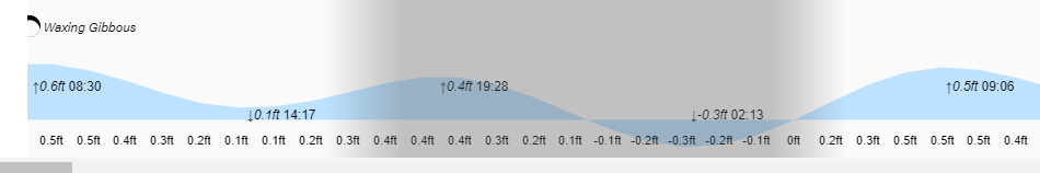
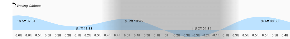
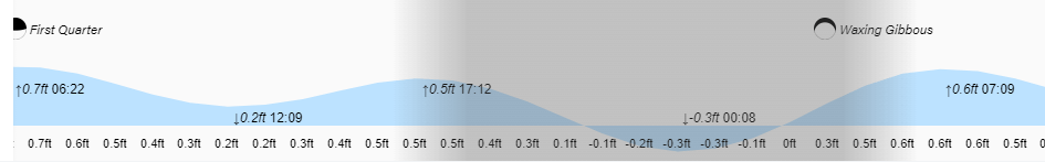
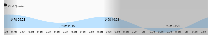
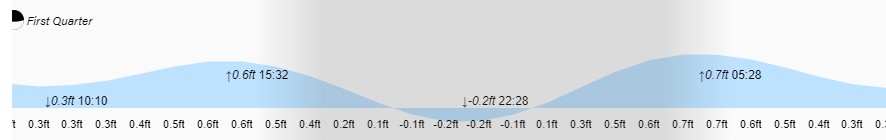
Low tides are around 5:30 p.m. and 5:30 a.m. Be careful out there, especially this afternoon!