October 24, 2024

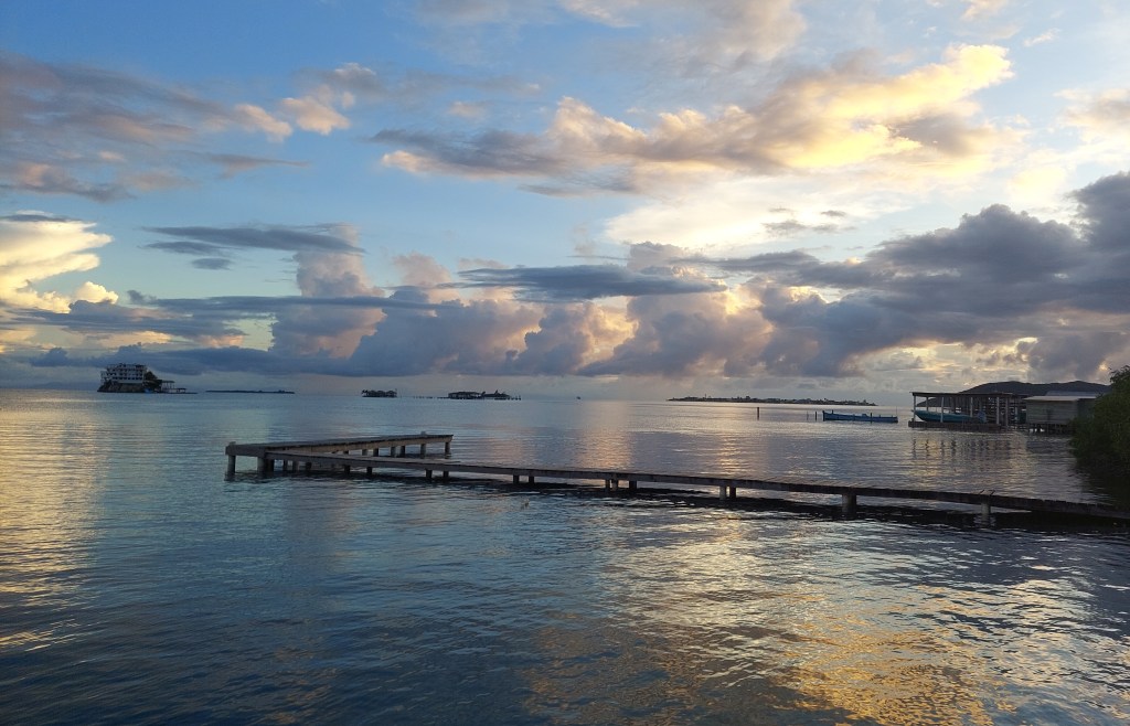
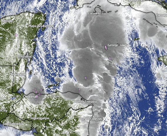
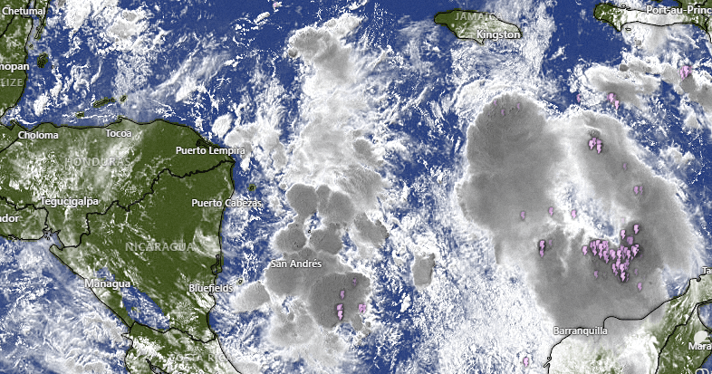
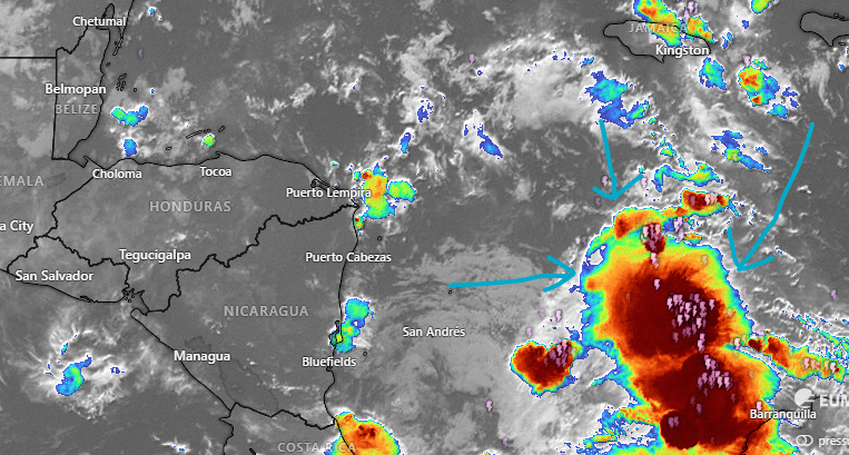
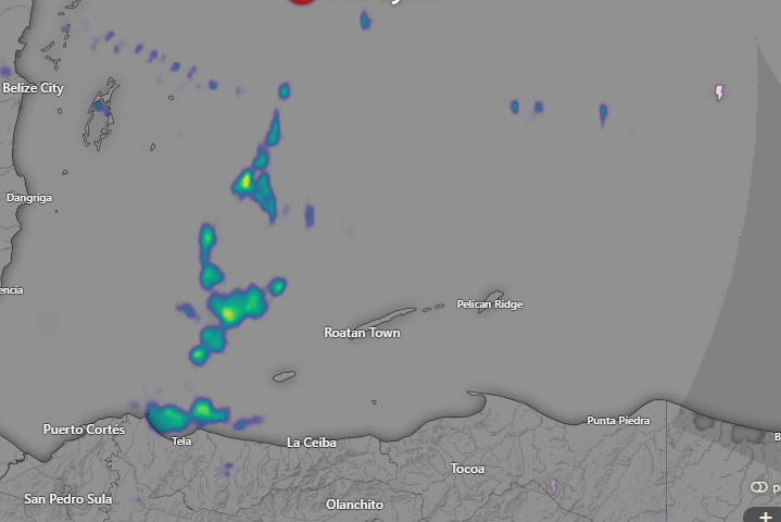
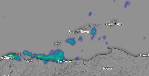
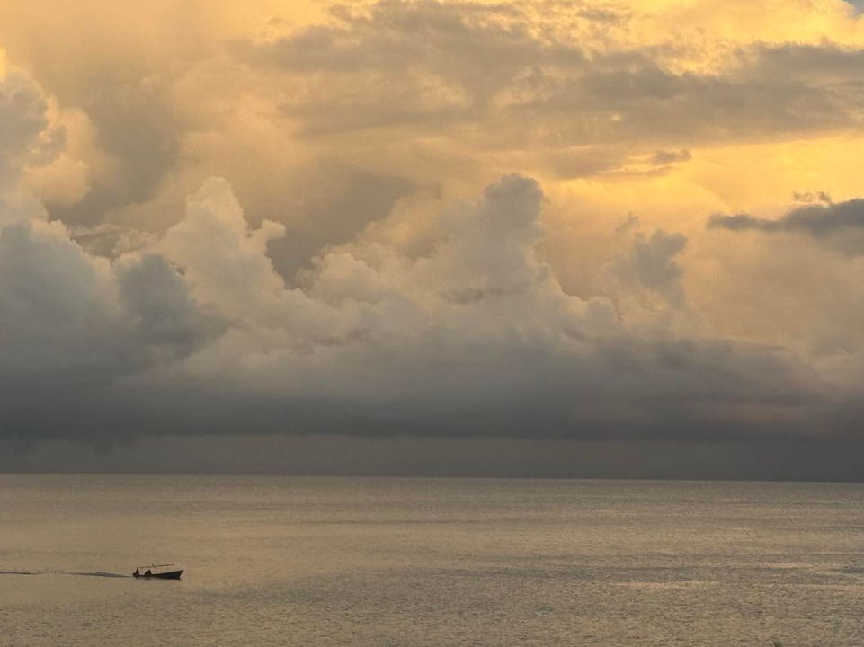
ood morning Bay Islands. Our photo of the day comes from Jonna Louise in Calabash Bight and shows some cumulonimbus clouds bringing rain, which we definitely had last night, with 1.5 to 2 inches recorded on the east side.

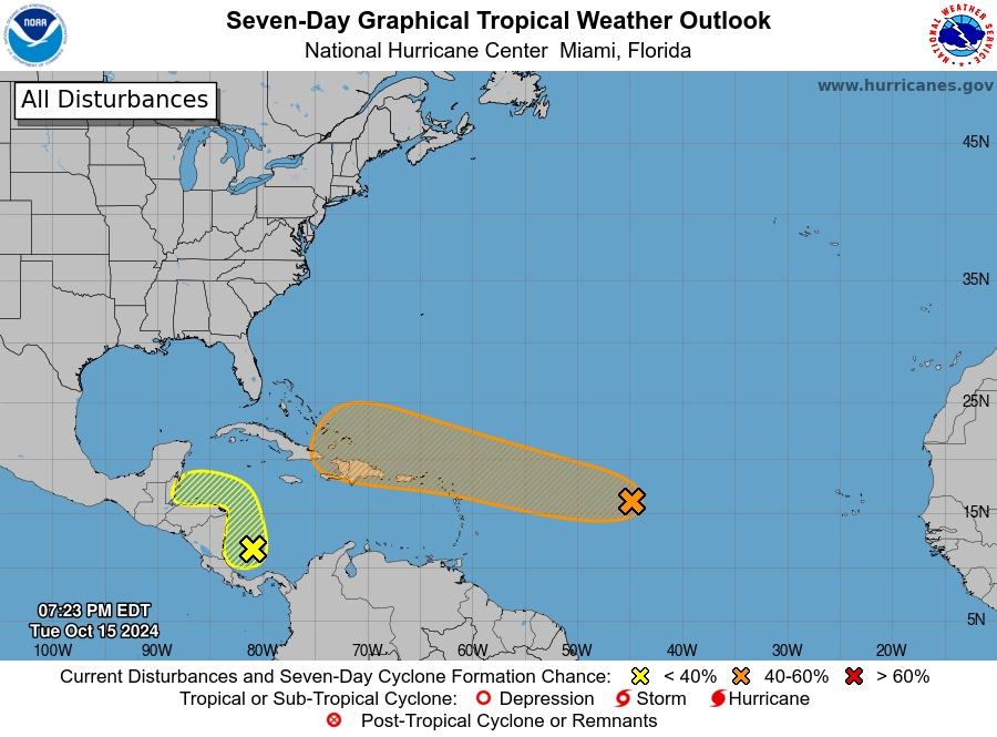
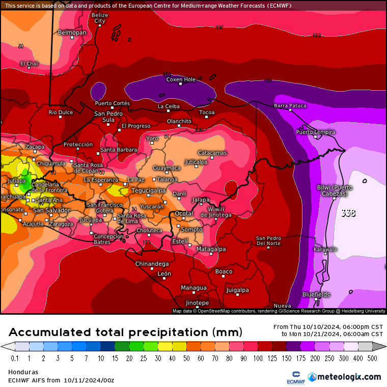
Today and tomorrow rainfall amounts should be moderate, and mostly at night, but good chances for long-lasting downpours return this weekend as a tropical wave passes by.

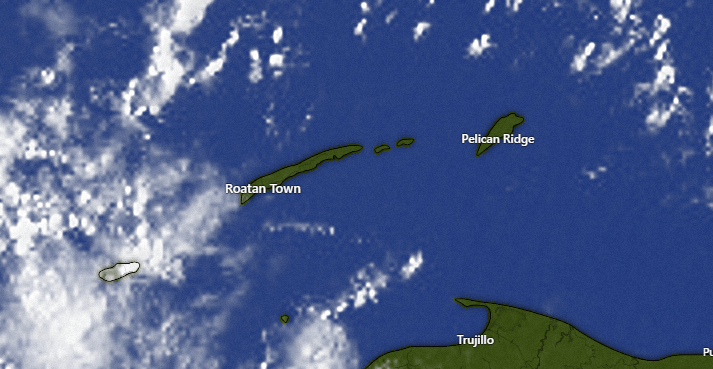
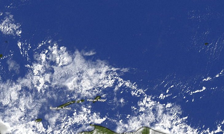
At 7:30 a.m. we have a few cumulus clouds over Utila which could be bringing some rain there. We will keep a chance of showers, especially for the morning and especially for Utila, but we should also see plenty of blue sky midday and afternoon. After a chance of evening showers, tomorrow morning we should see some blue sky, but clouds and rain chances will be increasing tomorrow evening and last through the weekend, with around 3 inches forecast for the islands.
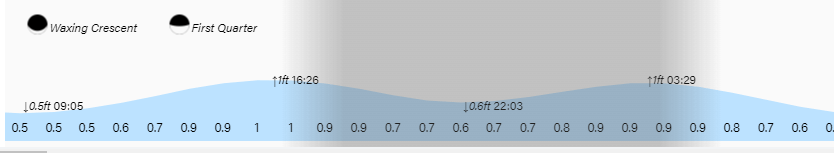
Winds are light and variable but our seas are still around 3 feet due to swell, that is, winds that are outside of our area, well north of us, pushing waves toward us. Those 3 foot waves will last through the weekend.

Roatan Ferry Galaxy Wave is running a great promotion, with tickets to La Ceiba each way only $24, for a total of $48 to go back and forth to the mainland. Get your tickets now online, at the terminal or at the 13 ticket sales locations on the island.

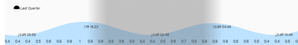
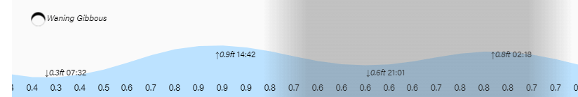
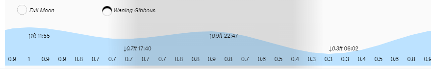
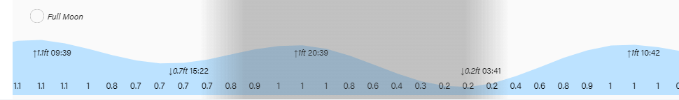
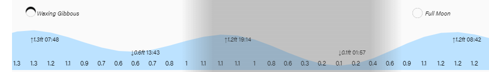
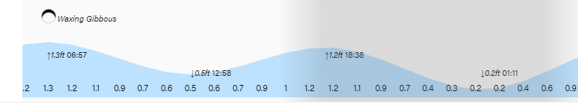
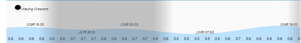
Low tides continue on the high side. Have a great Thursday!

October 22, 2024

Good morning Bay Islands. Our photo of the day comes from Brittany Tynon in West End.
Many of us got a LOT of rain yesterday through last night, with totals midisland and east side 3-4 inches. We’ve really had a wet October. Clouds and showers may hang around today, but rain totals should be less.

On satellite at 8 a.m. we see blue skies sooo close to our northeast. We should see some of that today, but we will probably still have to deal with an occasional shower, especially through the morning. Tomorrow should be drier, with maybe a 30 percent chance of showers. Thursday and Friday rain chances will be around 40 percent before the next tropical wave comes in over the weekend. It still looks a little less strong than the one we had last weekend, but some models still show it getting a little stronger as we get into early next week, but a tropical storm seems unlikely.

Winds remain quite light, though seas remain 2-3 feet, especially on the north side.

I saw a post recently from a tourist who wanted to bring in US beef. Trust me. That is a dicey proposition through customs. I know in some places the steaks on the island are disappointing. But that is because you haven’t gone to Carniceria Rosita. James Thomas can set you up with a prime cut of beef that will leave your mouth watering.

Tides continue to be mild. Have a great Tuesday!

October 20, 2024

Good morning Bay Islands. Our photo of the day comes from Annette Huskin in Guanaja and shows a view looking toward Bonnacca Key from Dunbar Rock.
Tropical Storm Nadine is now out of the way, but we will have lots of scattered showers around this week and a tropical wave over the weekend and perhaps into next Monday.

Here is this morning’s satellite. We have skies that look a lot like Annette’s picture, partly cloudy with maybe a shower here or there. At 7:30 a.m. it looks like a shower is over Morat, moving to the west. There will be a chance of showers through the morning, but today should be mostly dry and we should get a good bit of sun, with temperatures getting back into the upper 80s.
We will have 50/50 rain chances most of this week, with rain chances a little higher Monday night.

Here a look at where Nadine is this morning. Nadine formed as a tropical storm at the last minute and continues a trend toward storms getting a little stronger than most forecasts, though this has been a really good year for the GFS, which in the past had overforecast tropical storms.
This is important because we should have another tropical wave late this weekend. This morning the models are not as strong on this wave and do not show it becoming a tropical storm, but it is too early to tell. I still expect next weekend to be rainy, though perhaps not so much as this past weekend.

This week we will have scattered showers, but it will not be a washout. In fact, winds and seas should get calmer with 4 foot seas today, 3 foot seas tomorrow and 1-2 foot seas Tuesday and Wednesday, with a light northerly breeze. Those calm water conditions are perfect for a ride on the catamaran at Jolly Roger Roatan. They will guarantee you a good time and get you back on ship on time.

Tides continue moderate as we move past the full moon. Have a great Sunday!

October 18, 2024

Good morning Bay Islands. Our photo of the day comes from Tracy Rubottom Kaltenbacher, taken Monday she called it “The Calm Before the Storm.”
The storm will indeed pass by, especially this evening into tomorrow morning.

At 8 a.m. we can see a decent core of storms to our east. If this gets tropical rotation, the worst winds will be to our north, so our winds will only be in the 20-30 mph range with seas perhaps up to 5-6 feet at times, especially late this evening (from the northwest) and tomorrow morning (from the southwest).

Here is the current forecast from the National Hurricane Center: “Environmental conditions appear conducive for some additional development over the next day or so, and a short-lived tropical depression or storm could form before the system moves inland over Belize and the Yucatan Peninsula of Mexico on Saturday.” They give this a 50 percent chance of becoming a tropical depression or storm.

Our big concern is still rainfall. This is the Euro rainfall forecast through noon tomorrow. It gives us anywhere between 4-8 inches of rain. If some of us get closer to 8 inches, than means there will be flooding concerns.
On the bright side, after noon tomorrow rainfall should decrease considerably and we should see some sun. Saturday afternoon through Monday we should only see widely scattered showers. Tuesday we will have a better chance of rain as a cold front stalls to our north.

We will finally have a decent low tide at 3:40 a.m. tonight. Have a safe Friday!

October 16, 2024

Good morning Bay Islands. Our photo of the day comes from Katy Pandy in Flowers Bay and show what I believe to be white herons taking refuge in a tree from the rain. Katy said islanders called these birds long-necked gollens.

The storm we are watching for Friday into Saturday is starting to look a little calmer, but we still anticipate a lot of rain.

On satellite we can see a few scattered showers around our islands at 7:20 a.m. We have only received a few hundredths of an inch at a few locations this morning after getting almost an inch in many locations yesterday. We will keep scattered showers but also periods of sun in the forecast for today. Winds will be light and variable and seas around 1 foot today and tomorrow.

We also see clouds building off the Mosquito Coast over the island of San Andres. That is the rain that will be increasing Friday into Saturday.

The National Hurricane Center only gives us a 20 percent chance of a rotating tropical storm and this is in line with the GFS giving in on its forecast. Yesterday the GFS was giving us 25-35 mph east winds Saturday and today the forecast is down to around 20 mph, mostly on Saturday afternoon. The GFS and Euro now agree on us getting right around 4 inches out of this system, while the ICON is still closer to 8 inches. In any case, we can expecting scattered showers tomorrow, but heavy, long-lasting downpours Friday afternoon and through the day on Saturday. Watch out in flood-prone areas.

Sunday and Monday we go back to scattered showers and we get another norther next Wednesday.

Nothing warms you up on a chilly day like a hot chorizo from Carniceria Rosita. They will custom cut your order to your liking.

15 inches above low tide is about as high a tide as I’ve seen for the islands. Have a great Wednesday.

October 15, 2024

Good morning Bay Islands. Our photo of the day comes from Regina Alpaugh and shows a full moon over Tita’s Pink Seahorse in West End. Don’t forget the most-liked photos will compete Nov. 1 for $50 in Café Rubio coffee. We are moving back into full moon phase, but we might not get to see much of it with all the clouds we will be having.

t’s start with our close up satellite. We have a few scattered showers at 7 a.m., especially between Sandy Bay and Pristine Bay. We will continue to see a few showers around, but also some blue sky today and tomorrow. Winds this morning are from the west at 5-10 mph and seas around 2 feet. Winds and seas should be fairly calm today and tomorrow.

Now let’s back up and look at our tropical wave, right now close to the west coast of South America. We should start seeing rain increase Thursday night and we will have LOTS of rain through Sunday morning. I think flooding is the main threat from this system. On the low end the Euro is forecasting 4-5 inches and on the high end the GFS and ICON are forecasting 8-10 inches. The GFS is also giving us winds from the east 20-30 mph, especially Saturday. The Euro says only 10-15 mph.

I hate to say it, but after this passes, next week will continue rainy, with more cold fronts pushing down from North America.

Explore Roatan real estate with the island’s top experts at Roatan Life Real Estate. Serving clients since 2001, we offer personalized guidance in buying and selling properties. Trust our dedicated team for unparalleled local knowledge. Start your journey at www.roatanlife.com.

Tides continue to be quite high. Have a great Tuesday!


October 11, 2024

Good morning Bay Islands. Our photo of the day comes from Tim Blanton and shows sunrise at CocoView.
Over the next week we will see some peaks of sunshine but a lot more rain. On the bright side, we were only 84 degrees most of the day yesterday with dewpoints around 70. That is quite comfortable and those cooler conditions should accompany clouds and rain for the week ahead.

Let’s start with the radar this morning. There are showers to our west that are drifting southeast. As the day goes on we should see increasing showers and those showers will be off and on through the weekend and into next week. A cold front will stall to our north on Tuesday, pushing more moisture our way.

Here is the Euro forecast of rain for the next 10 days. It is forecasting 6 inches for the entire period. That is an average of about two thirds of an inch each day.

Here is the GFS for the same 10 days. It is forecasting 10 inches, and a lot of that is for the weekend of Oct. 18-20 when the GFS thinks a tropical system will move through.

Wind and Galaxy Wave forecast: We start the day with northwest winds 10-15 mph and seas 4 feet. We should start to see a calming trend in our seas, 3 foot seas tonight, 2-3 feet tomorrow and 1-2 feet Sunday. Winds will be 5-10 mph mostly from the west northwest.

High tides remain quite high. Have a great Friday!

October 10, 2024

Good morning Bay Islands. Our photo of the day comes from Glory Cone in Lucy Point and shows a thundershower a week ago over the mainland. Over the weekend and into next week we will see plenty of rain and perhaps a few thundershowers.
Don’t forget that the winner of photo of the month wins $50 in Café Rubio coffee. Send photos with name and location to bookmybio@gmail.com.

Yesterday we had a mid-morning shower good for about a half inch in several locations.
Our radar this morning shows scattered showers around under mostly cloudy skies. These showers are drifting southeast. We will keep rain chances around this morning, but things should get drier this afternoon. Enjoy it, because starting tomorrow, into the weekend and into next week we should see rain each day and/or night.

Wind and Galaxy Wave forecast: We wake up to northwest winds at 10 mph and seas 3 feet north and west. Winds will get calmer overnight but they will be back up to 10-15 mph tomorrow from the northwest with seas 3-4 feet. Sunday through Wednesday look quite calm. In the long-range forecast the GFS is trying to give us stormy, windy conditions for the weekend of Oct 19-20.

Take advantage of calm seas this weekend to make that trip to Guanaja you’ve always wanted to take and see the island that a lot of Roatanians miss out on. Buy your tickets at roatanferry.com.

Tides continue to be high. Have a great Thursday!

October 8, 2024

Good morning Bay Islands. No photo of the day today because we are watching a lot of activity. Hurricane Milton is about 500 miles to our northwest, but it is packing a punch and pushing our winds from the west around 15-20 mph and seas north and west sides around 4 feet. We will continue to have those winds and seas through tomorrow. After that they should get calmer again.
As for rain, I think there is a pretty good chance for storms tonight as Milton drags a lot of moisture behind it as it rides a cold front. The cold front will not get this far south, but it will pull in a lot of moisture. We will have daytime rain chances around 40 percent and nighttime chances around 60 percent through Saturday.
Sunday through Tuesday look even rainier as we get a second cold front. All of this should cool our temperatures into the mid 80s for highs and upper 70s for lows.

This is the GFS forecast for moisture in the atmosphere. You can see our cold fronts are pushing a lot of moisture over us, giving us good chances of rain throughout the forecast. What is interesting here is you can see a forecast for a spinning system to emerge from the Mosquito Coast around the 18th or 19th.

This is the GFS vorticity forecast, which is like an Xray of the atmosphere. You can see the forecast for some sort of tropical system to emerge from all this moisture around 11 days from now. Eleven days is a long time and these forecasts are very unreliable that far out, but there is definitely the potential for a LOT of rain over the next two weeks and also the potential for some sort of storm to spin up during this time period. We’ll keep an eye on it.

Roatan Weather

I got an exciting message from Mitch Cummins over at Roatan Pets the other day. He is now cooking up two recipes of cat food — chicken and fish. Your feline friend will thank you for letting him sample it.

Low tides continue to be unusually high. Have a great Tuesday!

September 2024 rainfall

We are putting Sandy Bay’s 7.05 inches in the record books for September, which is 2.2 inches above average for September. With a rainy forecast for the next two weeks it looks like October will be a typically wet month to begin rainy season, which goes through January. On a side note, a lot of our weather stations have been acting up lately. Weather stations tend to have a short lifespan in our salty air, but sometimes the fix is just to change the batteries. Please know that we really appreciate all of our weather station owners and they provide a useful service in keeping our islands safe. Thanks so much for your efforts in keeping your stations up and running.