
Good morning Bay Islands. Our photo of the day comes from Glory Cone in Lucy Point and shows a thundershower a week ago over the mainland. Over the weekend and into next week we will see plenty of rain and perhaps a few thundershowers.
Don’t forget that the winner of photo of the month wins $50 in Café Rubio coffee. Send photos with name and location to bookmybio@gmail.com.
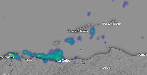
Yesterday we had a mid-morning shower good for about a half inch in several locations.
Our radar this morning shows scattered showers around under mostly cloudy skies. These showers are drifting southeast. We will keep rain chances around this morning, but things should get drier this afternoon. Enjoy it, because starting tomorrow, into the weekend and into next week we should see rain each day and/or night.
Wind and Galaxy Wave forecast: We wake up to northwest winds at 10 mph and seas 3 feet north and west. Winds will get calmer overnight but they will be back up to 10-15 mph tomorrow from the northwest with seas 3-4 feet. Sunday through Wednesday look quite calm. In the long-range forecast the GFS is trying to give us stormy, windy conditions for the weekend of Oct 19-20.

Take advantage of calm seas this weekend to make that trip to Guanaja you’ve always wanted to take and see the island that a lot of Roatanians miss out on. Buy your tickets at roatanferry.com.
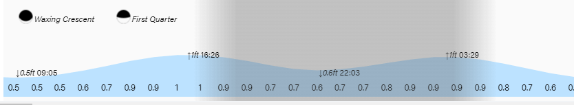
Tides continue to be high. Have a great Thursday!
