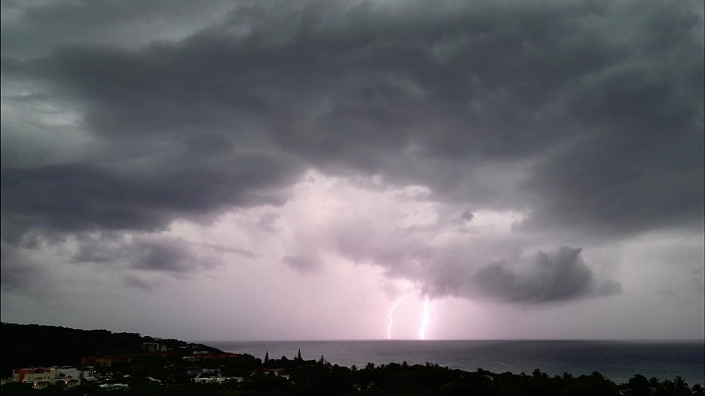
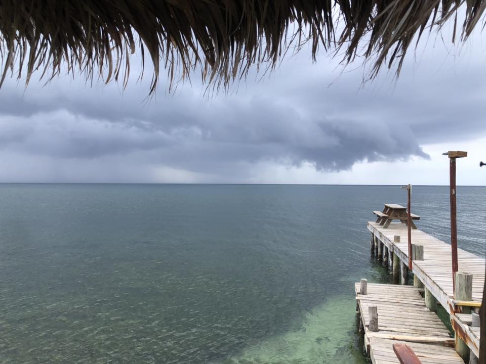
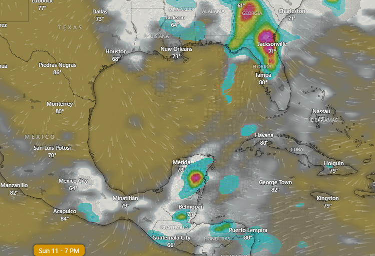
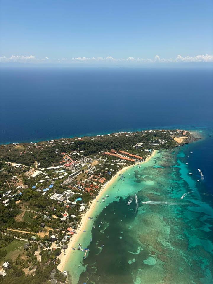
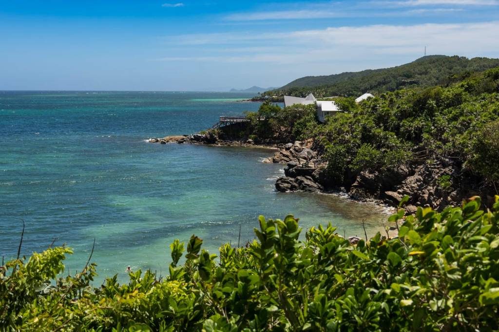
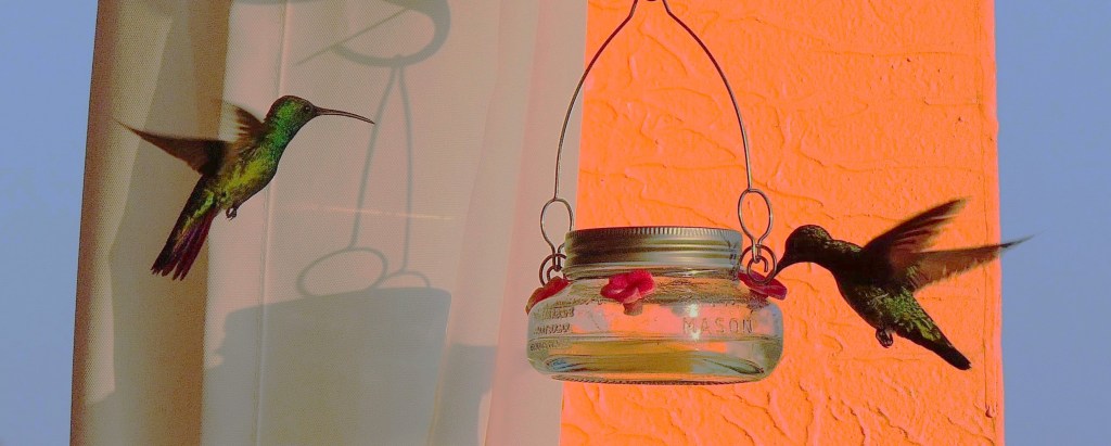
Good morning Bay Islands. Our photo of the day comes from Daun Weiss and shows a bank of clouds moving in over east Roatan and Diamond Rock yesterday morning. That brought us quite a bit of rain. Jeffrey Hill picked up over 5 inches in Terra Chula/Jonesville Point for the entire event. We have a rain shower at 7:30 a.m. over Guanaja and eastside, but it isn’t as strong as yesterday’s rain, and we will get into a drier trend going forward.
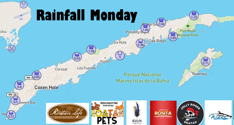
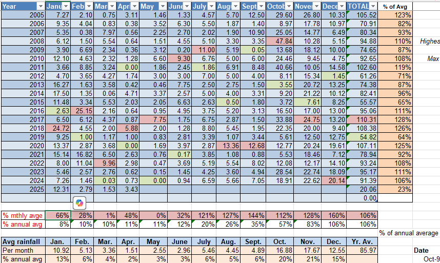
Here are yesterday’s rain totals.
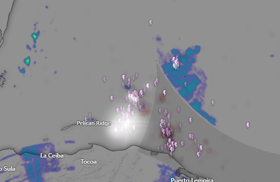
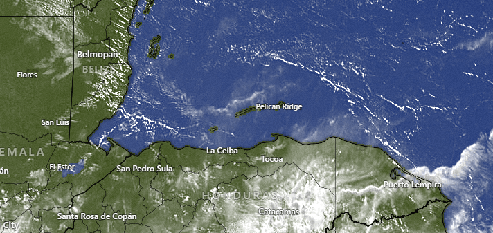
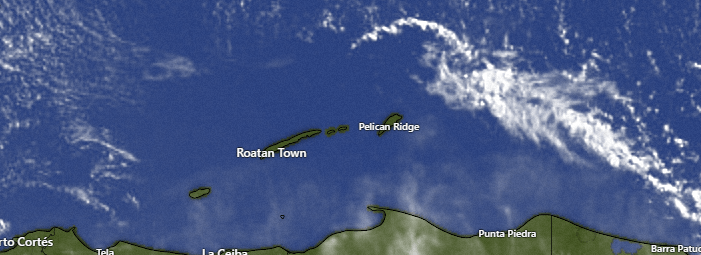
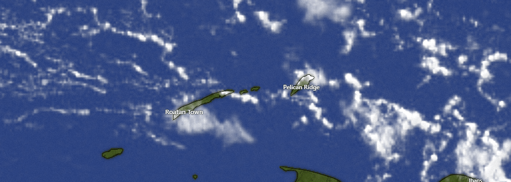
Here is this morning’s satellite from 6:30 to 7:30 a.m. Guanaja picked up some lightning, but the storm looks to be weakening as the morning goes along. We will keep a chance of morning showers, but I’d be surprised if we see much rain this afternoon and should see some peeks of sunshine. Overnight tonight we have a small chance of rain, perhaps lingering into tomorrow morning, but most of tomorrow will be dry, followed by several dry days in a row.
Wind and Galaxy Wave forecast: Winds today are quite calm at 5 mph from the southeast and seas 1-2 feet. Tonight and tomorrow we will have east winds around 15 mph and 3 foot seas. Starting tomorrow night we will return to typical easterly trade winds, 15-20 mph and 3-4 foot seas during the day and 20-25 mph and 4-5 foot seas overnights and early mornings.

Don’t forget the sponsor of the May photo contest is Jolly Roger Roatan. The winner will get one adult tour ticket valued at $100, redeemable for a snorkel trip on a normal cruise day during the week including a rotisserie chicken lunch and, of course, a little something to drink. Winner must arrange the reservation with Jolly Roger in advance. Contact them in North America at +1-561-289-9881 or on the island at 9966-8669.
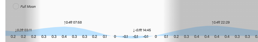
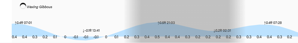
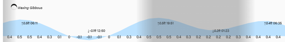
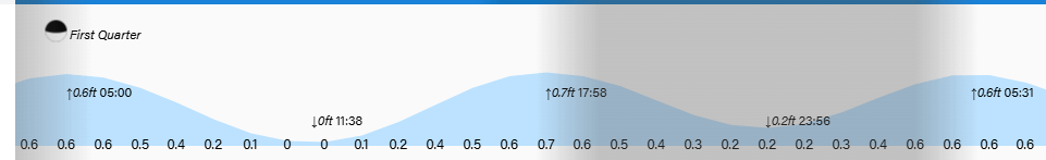
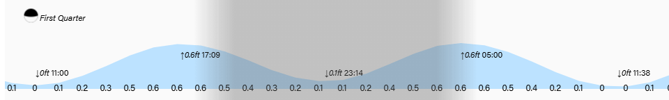
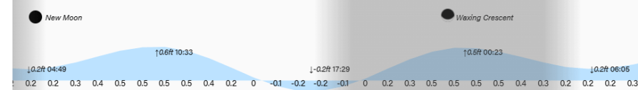
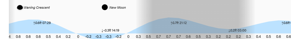
Low tide is 2:45 p.m. and we should start getting a clearer view of our full moon tonight. Have a great Tuesday!