April 29, 2023: Good smoky morning Bay Islands. This morning winds have calmed considerably, which doesn’t move the smoke anywhere. But we have hope starting tonight for some improvement.
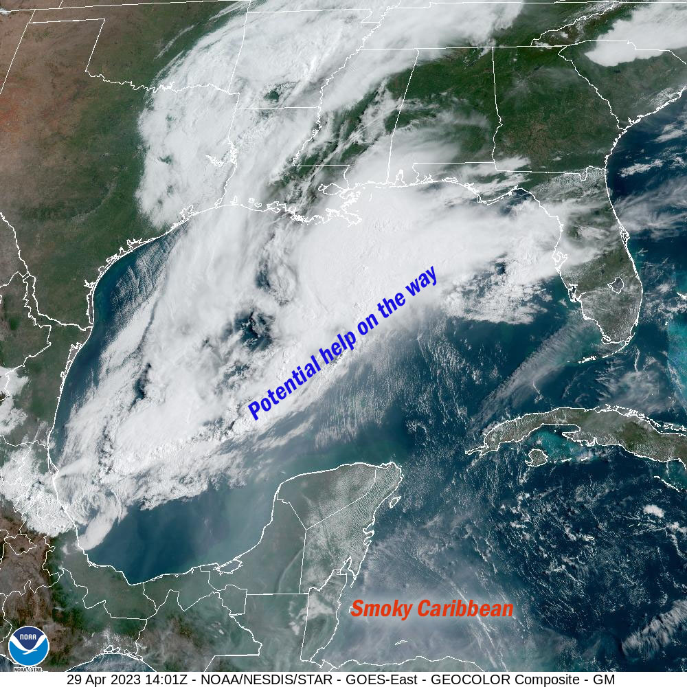
A front is sweeping through the Gulf of Mexico that should do two things. It will bring us a chance of rain, as early as tonight. Perhaps more important for the short term is that starting around midnight it will shift our winds to the west at around 20 mph. That means the wind will no longer be coming from the smoky mainland of Honduras but from less smoky Belize.
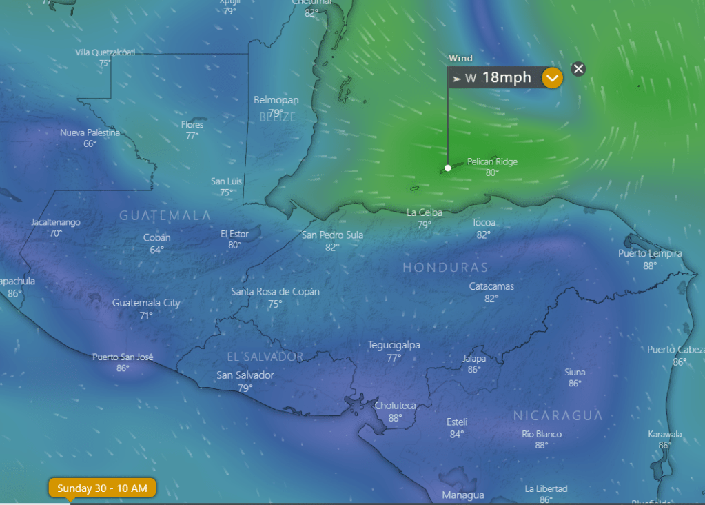
The wind forecast map here is for 10 a.m. tomorrow showing a decent breeze from the west.

The GFS is giving us a chance of rain as well starting tonight between midnight and sunrise. It’s not a lot of rain, and unfortunately it is mostly for the western half of Honduras, but the rain chances return Sunday night when they will be better for the eastern half of Honduras, the source of our smoke.
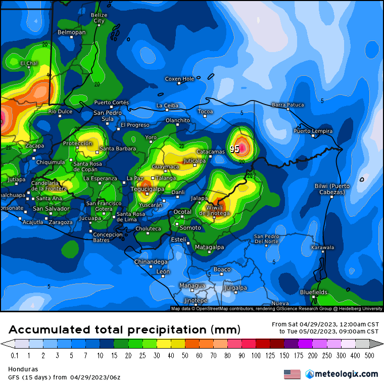
The Euro is a little less hopeful for a lot of rain, especially in the places where we need it. the northern coastal areas of eastern Honduras. If the rain doesn’t knock the flames back enough, we could be right back in the smoke starting Tuesday when the east winds come back pretty strongly and dry conditions return for the rest of the week.
In the meantime tonight and tomorrow we will have that 20 mph west wind meaning 2-3 foot waves, especially on the north and west sides of the island. Monday will be relatively calm, but what wind we have will be from the north. Let’s hope for a strong westerly breeze and good rain, especially in northeastern Honduras. Low tides are 11:12 a.m. and 11:23 p.m. Have a great weekend!
