April 28, 2023: Good smoky morning Bay Islands! The question on everyone’s mind is when will all this smoke go away. The answer is perhaps we will get some relief this weekend, but it isn’t a sure thing.

On the satellite image from this morning you can see the smoke, which is low in the atmosphere, bad for breathing and landing planes. Unfortunately, this time of year we are dominated by high pressure which keep the smoke from getting to the upper levels of the atmosphere and blowing away.
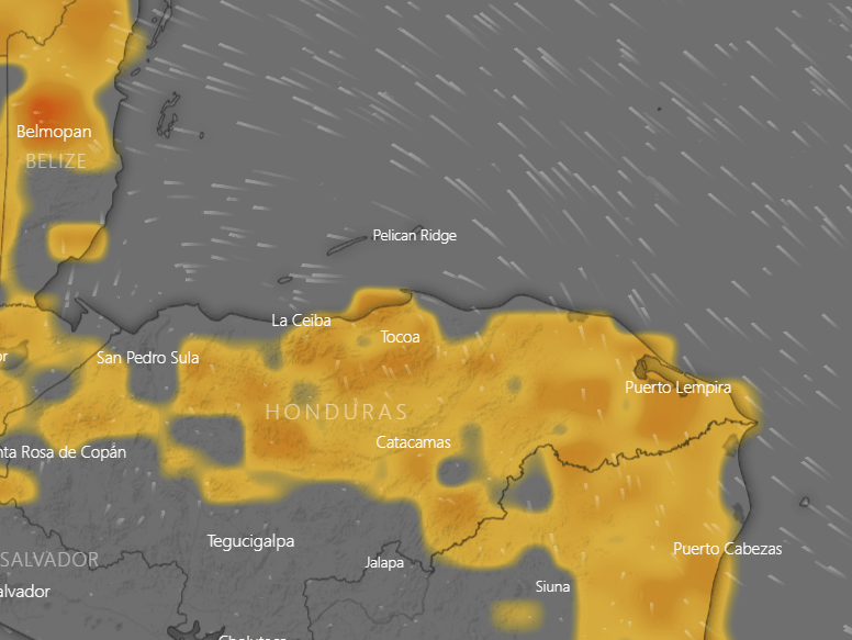
This map shows the concentrations of fires on the mainland, which are mostly to our southeast, which is bad because our dominant winds come from the southeast.
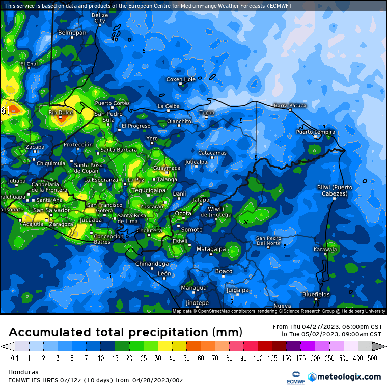
This is the Euro forecast for rainfall through Monday. This is not a good forecast for us.
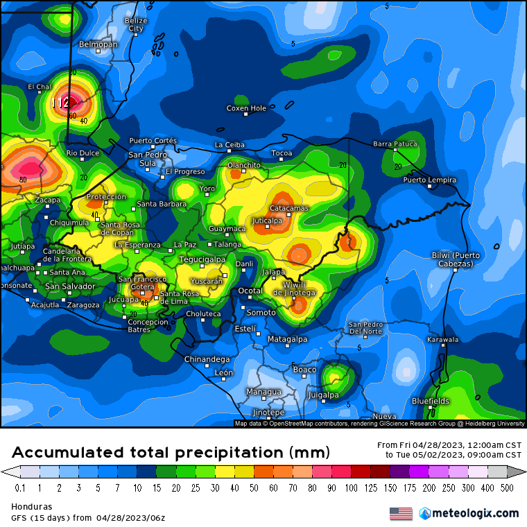
This is the GFS forecast for rainfall through Monday. Let’s hope this is more accurage. The yellows and oranges represent an inch or two of rain, especially in Colon, although we could really use it in Gracias a Dios as well. This would help with the fires if we can get this kind of rain Sunday night.
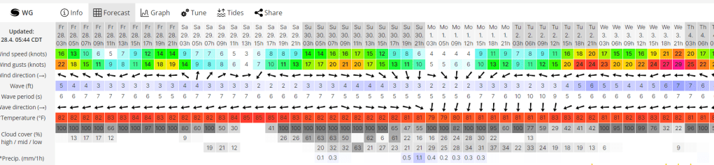
Our winds are calmer this morning and will be calmer through Monday, but what winds we will have will switch to being from the west tomorrow evening. That should give us a little relief. Winds will be fairly calm during the day through Monday, 15-20 mph at night from the west Saturday night and from the north on Sunday night. Sunday night we have a 50/50 chance of rain. Things get dry and windy again, especially starting Tuesday night. Low tides are 10:45 a.m. and 10:48 p.m. Have a great Friday!
