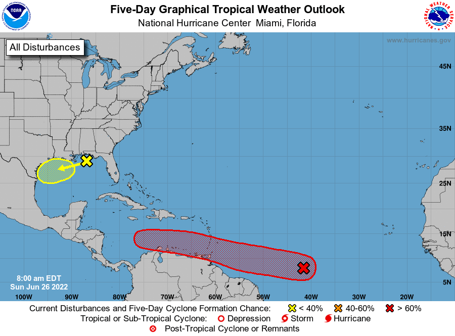
The National Hurricane Center now has our storm near Guyana at a 70 percent chance of becoming at least a tropical depression in the next five days, and chances are good that the next 24 hours could see it actually become a tropical storm. It is entering and environment of low shear (winds that compete with and weaken tropical development at the higher levels of the atmosphere) and deep moisture.
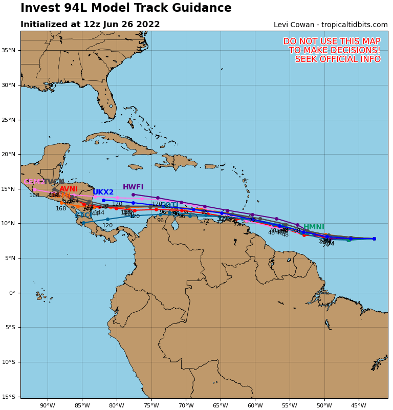
The storm, which could become Bonnie, will hug the Venezuelan and Colombian coastlines, possibly even making landfalls and weakening somewhat in the process. But most models say it will survive into the Caribbean where it will have a rich environment for development.
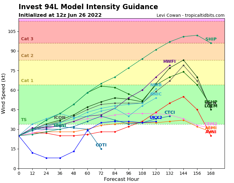
If you look at the model intensity guidance, the important point for us is the 144-hour mark, which is when it would make landfall, likely in Nicaragua. At that point about half the models have it as a tropical storm (39-73 mph sustained winds) and about half have it as a category one hurricane (74-95 mph). Of course, if it makes landfall in Nicaragua, our winds wouldn’t be near that high. We would probably get 35 mph winds and choppy seas. Remember Eta and Iota in 2020 made landfall in the same general area as category 4/5 and we experienced winds that were at the most in the 40 mph range.
This is the Canadian model, and as you can see this predicts a worst-case scenario for us, with the storm hugging the northern coast of Honduras and cutting between us and La Ceiba. Again, this is a week out, so it lots of things can change, but stay weather aware as we get toward Saturday.
