June 30, 2023

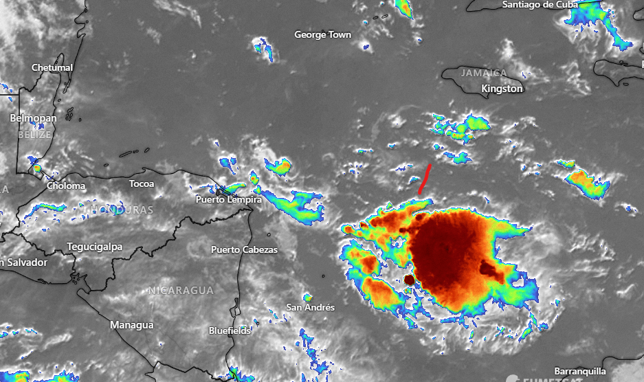
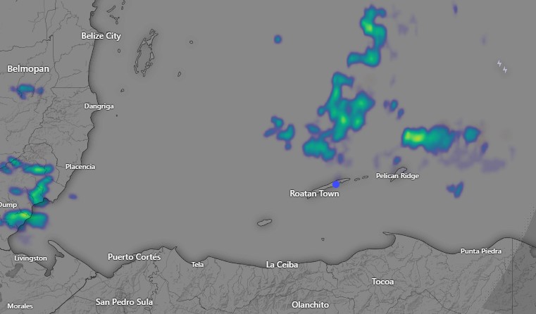
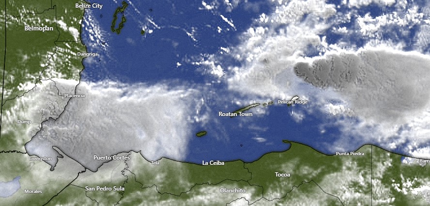
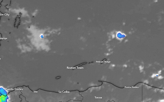
June 30, 2023: Good morning Bay Islands. This morning there is a small shower to our northeast, but it isn’t moving toward us. We wake up to mild winds from the east at 5-10 mph and seas at 2 feet (.6 meters). Winds should continue moderate at 5-15 mph and seas at 2 feet through Sunday morning. Starting Sunday night and into next week our winds will get brisk at 20-30 mph and seas at 4-5 feet (1.3-1.6 meters).
As for rain, we will have a 30 percent chance of an overnight shower. During the day, today and Saturday should be mostly dry. Our best chance of rain comes in the period Sunday through Tuesday morning as another tropical wave passes over. I think most of us should see at least some rain during this period, and some of us may get an inch out of it.
For the rest of the week we will have 20-30 percent rain chances at night and early morning. Low tide will be at 12:20 p.m. Have a great Friday!

June 29, 2023

June 29, 2023: Good morning Bay Islands. I’m back home where I belong. We had quite a windy evening last night with winds up to around 30 mph. Today we will continue windy with winds 20-25 mph and seas 2-3 feet. Winds will be a bit calmer Friday and Saturday at 12-17 mph and seas at 2 feet (.6 meters). We’ll be mostly sunny and dry through Saturday. Clouds will build up on Sunday and there is a good chance of rain Sunday into Monday. Sunday the trade winds come back for next week, blowing from the east at 20-30 mph and seas 4-5 feet (1.3-1.6 meters). Have a great Thursday!

June 28, 2023

June 28, 2023: Good morning Bay Islands. Another short forecast, but I’m halfway home! Just two more flights to go.
There’s been scattered showers around us overnight but I haven’t found a reporting station with measurable rainfall. Today will be partly cloudy with moderate winds 5-15 mph from the east and seas 2-3 feet. Tonight the winds will be higher, 15-25 mph and seas 3-4 feet. There will be another small chance of a shower overnight. Tomorrow we got back to moderate winds at 10-15 mph and seas 2-3 feet. Next decent chance of rain is Sunday morning and Sunday night. Have a great Wednesday!

June 26, 2023

June 26, 2023: Good (rainy) morning Bay Islands. Thank goodness we finally got wet! As of 9 a.m. today, most of us have seen between a quarter and half an inch. The radar also indicates we’ve heard some thunder.

As you can see in radar, the storms are generally moving east to west,

but the clouds aren’t moving much and seem to be reforming over the islands. We will have mostly cloudy skies, but also periods of sun with a good chance of scattered showers today. Winds and seas will be fairly calm through tomorrow morning.
Tonight and tomorrow morning there will be another good chance of showers. Lingering showers should clear out Tuesday and Wednesday through Saturday should be partly cloudy to mostly sunny with only a small chance of an overnight or early morning shower. It looks like another tropical wave, probably Sunday night into Monday morning next week is on the way. Low tide is 9:33 a.m. Have a great week!

June 25, 2023

June 25, 2023: Good morning Bay Islands! Our winds and seas are quite calm this morning, at around 10 mph and seas 1-2 feet. Winds should remain moderate through Wednesday morning at 5-15 mph and seas will be 1-2 feet. The big story is the approach of the moisture of former storm Bret, now just a tropical wave of moisture. Bret will give us about a 30 percent chance of rain tonight, a 40 percent chance of rain during the day tomorrow and a 60 percent chance of rain tomorrow night into Tuesday morning Wednesday and Thursday we should get our trade winds back at 20-25 mph and seas to 4 feet. This weekend we have another tropical wave and good chances of rain. Have a great Sunday!

June 24, 2023

June 24, 2023: Good morning Bay Islands. Sorry, but I can only do a brief forecast today. The internet here in the mountains of Oregon is really bad. Two main points.
1. Winds should calm a bit through Monday. 10-20 mph today, 10-15 mph tomorrow and Monday before getting back to 15-25 mph midweek.
2 We still see some moisture coming from the remnants of Bret Monday and Tuesday. There will be about a 50/50 chance each day.
Have a great weekend!

June 23, 2023

Good morning Bay Islands. Sorry for the late post. We’re in the mountains of Oregon for a nephew-in-law’s wedding. It’s 48 degrees up here (9C) 🥶.
As best as I can tell from weather stations and radar, the islands have stayed mostly dry yesterday and last night. If you got any rain, let me know in comments. Today through Sunday we should continue partly cloudy with winds 15-25 mph and seas 3-4 feet until Monday, when things should calm a bit, but for just one day. We will still have a daily chance of getting a squall.
Tropical Storm Bret is in the Eastern Caribbean and has started to weaken, down to 60 mph max winds. It should continue to weaken and move west.

Unfortunately for us, it is also trending south, as you can see in the GFS forecast map here, which would lessen the amount of rain we can expect Monday and Tuesday. There’s still a decent chance of rain those two days, and we are in a wetter pattern. I still expect to see scattered showers for at least the next week. We will eventually get wet. The question is when. Low tide will not be very low at 7 p.m. Have a great Friday.

June 22, 2023

Radar at 6:30 a.m.

June 22, 2023: Good morning Bay Islands. For days now our tropical wave has been on the Mosquito Coast teasing us. There are no good weather stations over there, but I wouldn’t be surprised if they hadn’t gotten 5 or 6 inches of rain. This morning we got .02 of an inch on Jonesville Point and the same in Politilly. All of our other weather stations have been dry.

Today and tomorrow we will keep about a 1 in 4 chance of a shower as the tropical wave finally lifts and moves north of us.

But the big news is the potential for rain Monday and Tuesday that Tropical Storm Bret will bring us. Right now the storm is near Barbados with winds at 70 mph, only 4 mph from hurricane status, but as it enter the Caribbean it is expected to weaken considerably.

it will no longer be Tropical Storm Bret, just another tropical wave of moisture. You will notice on the intensity chart I circled the period for 120 hours from now, which is Tuesday. By then the winds of this “storm” will be 15-25 knots (17-28 mph) at its center. Outside of the center, winds will be much lower, meaning that Bret could actually LOWER our wind speeds, because it will interfere with the trade winds we’ve been getting.

Most of the storm tracks bring its rain right over us.

That means that our forecast for Monday and Tuesday is currently for rain and winds only around 10 mph. This is our big hope for rain over the next few days, so lets hope it happens. Low tide is 6 p.m., but it isn’t extremely low because the moon is in crescent phase. Have a great Thursday!

June 21, 2023

June 21, 2023: Good morning and Happy Longest Day of the Year! Sunrise is 5:15 a.m. and sunset is 6:21 p.m. giving us 13 hours and 6 minutes of sunlight. On our shortest day of the year, Dec. 21, we will have 11 hours 9 minutes of sun. Being closer to the equator, the difference between longest day and shortest day is shorter than in North America, where today in many places you will have 14 or 15 hours of sunlight today.

Radar at 6:30 a.m.

But the big news of the day is there is some rain out there. Here on Jonesville Point at 6:30 a.m. we have had .03 of an inch, Punta Blanca has had a tenth of an inch and Politilly .08. I imagine Guanaja has had even more.But the big news of the day is there is some rain out there. Here on Jonesville Point at 6:30 a.m. we have had .03 of an inch, Punta Blanca has had a tenth of an inch and Politilly .08. I imagine Guanaja has had even more.

Satellite at 6:30 a.m.

You can see the rain on radar and satellite moving toward the northwest. It’s not very heavy, but it is something and there should be more of it. We have decent chances of rain today and tomorrow as this small tropical waves moves over us.

You will also notice that Tropical Storm Bret, which has winds of 60 mph right now, is headed toward us. That would be scary except for the fact that upper level winds will weaken it into a tropical depression by Sunday morning when it is south of Jamaica. By Monday or Tuesday we hope that moisture gets here and gives us good rain chances, without all the wind. Generally speaking we are entering a period where there will be occasional squalls and partly cloudy skies. That should cool things down a bit. Winds will stay gusty at 15-25 mph and seas at 2-3 feet. Thursday night looks especially windy with winds up to 30 mph and seas up to 6 feet (2 meters). Have a great Wednesday!

June 19, 2023

Good morning Bay Islands. This morning we wake up to some bad news. Overnight our tropical wave weakened considerably as you can see in the satelite video from 6 p.m. last night to 6 a.m. today. That lowers our chances of rain this week considerably. Rain chances today and tomorrow are around 10 percent. Chances go up Wednesday through Friday to the 20-30 percent range. Our east winds will probably last through the week as well. So winds will generally be 15-25 mph from the east and seas will continue along with 3-4 foot seas, at least through Wednesday and possibly longer. On the bright side there will be more clouds this week than we’ve had in the past, and that should help with the heat. Low tide is 3:44 p.m. Have a great week!