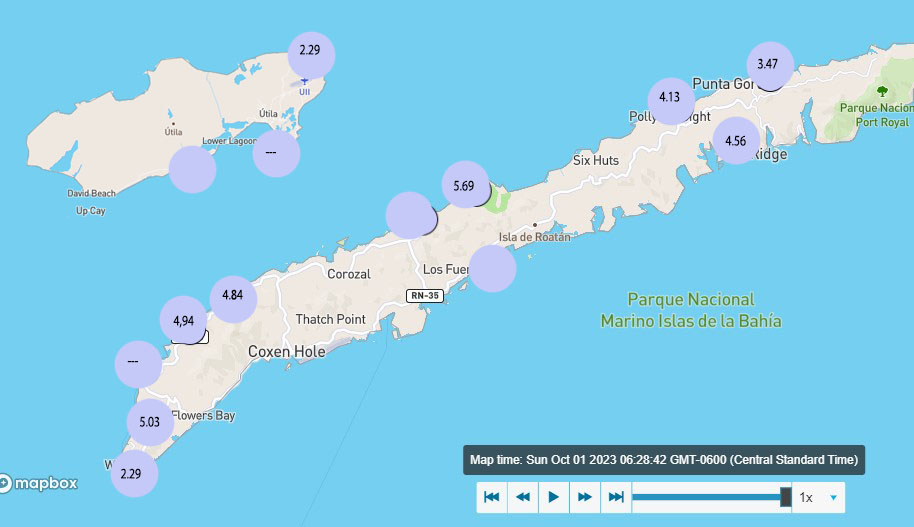
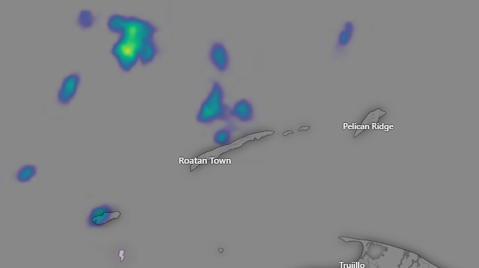
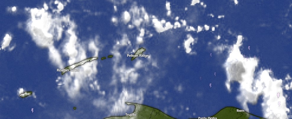
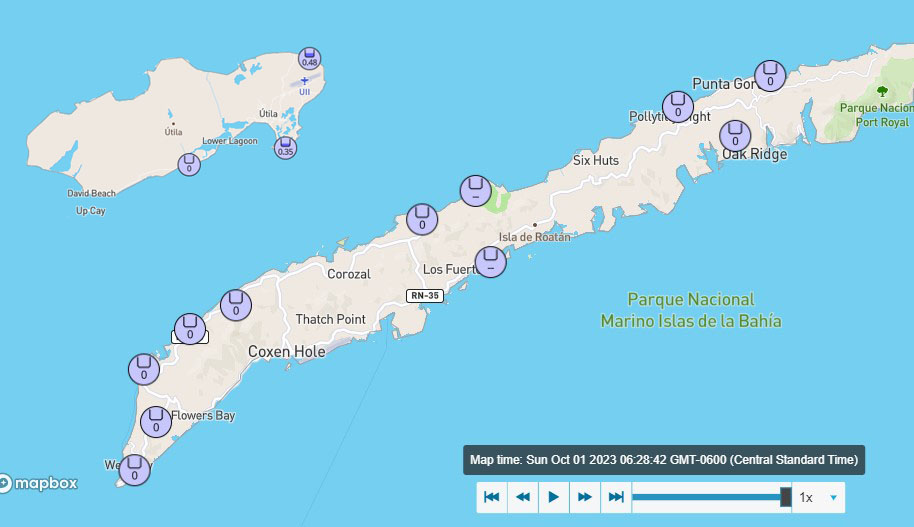
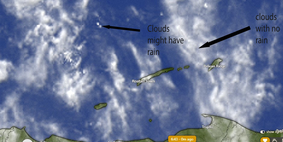
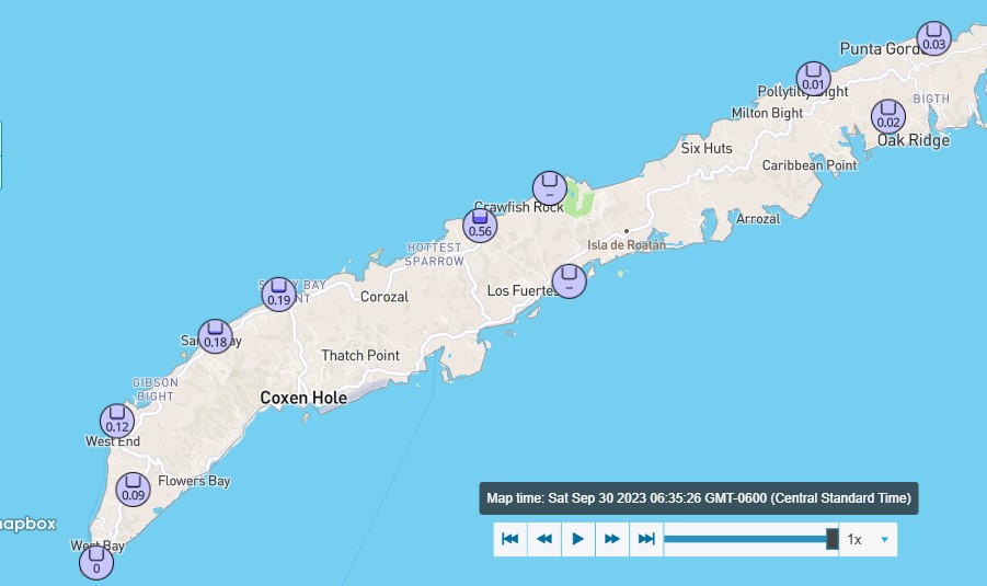
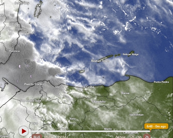
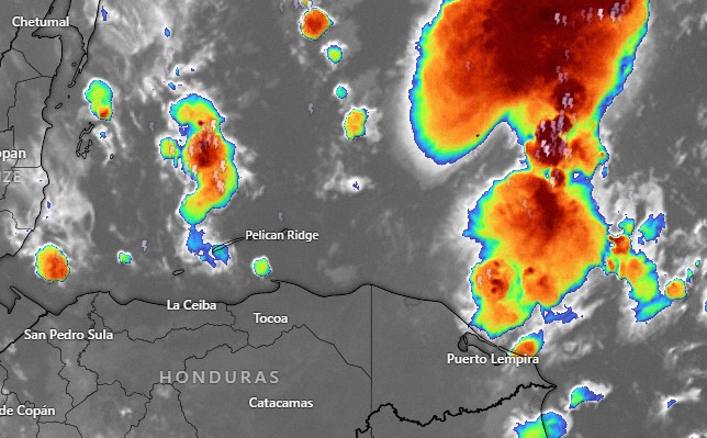
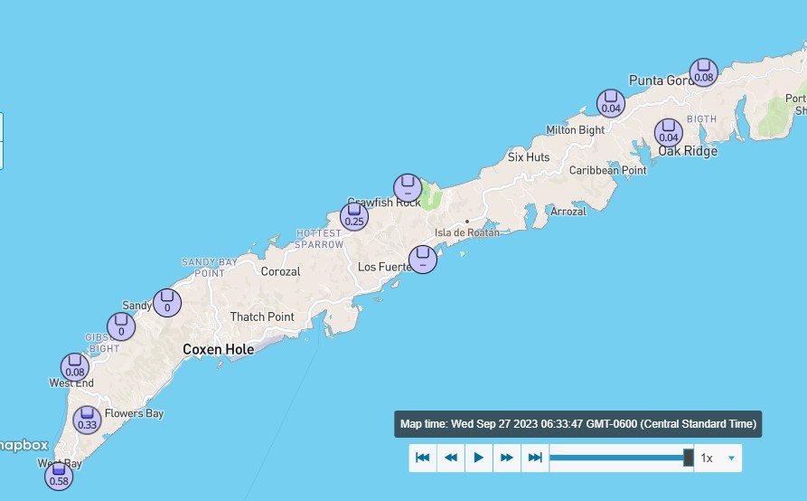
Good morning Bay Islands. Here are some rain totals from last night’s storm. We were out of power most of the night on Jonesville Point and even had a 30 minute outage this morning around 7:30 p.m.
We’ve had a few showers around the island this morning. We will have scattered showers this afternoon and overnight. Winds should calm to 5-10 mph and seas will be 1-2 feet, except in squalls. We will continue to have scattered showers, especially at night, this week. East winds should get a little windier starting Tuesday. Have a great Sunday!
Sept. 2, 2023: Good morning Bay Islands. Our storm system from last night moved quickly across the mainland and is out in the Pacific this morning. Around 5 p.m. yesterday we got a gust of 40 mph on Jonesville Point and a tree fell in a friend’s yard in Lucy Point. West Bay picked up a 35 mph gust. But it was a lot of noise and not a lot of rain. All reporting stations reported between a tenth and a third of an inch of rain. Today we will have east winds 15 mph and seas around 3 feet. Tomorrow and Monday should be calmer at 5-10 mph and seas 1-2 feet. Starting Tuesday we should have fairly calm days with east winds 7-12 mph and seas 1-2 feet and nights with winds 10-15 mph and seas 2-3 feet. We will also be in a typical September weather pattern, with a fairly low chance of rain during the day, and a better chance of rain overnight and in the early mornings. But any showers we get will be scattered and should pass quickly. High tides are 11 a.m. and 10 p.m. and low tide is tomorrow morning at 5:15 a.m. Have a great weekend.
Rainfall for August 2023: We’re putting 3.8 inches in the books for August and that is a little above average across the island. Most locations got a little under 3 inches, but we will stay with Sandy Bay’s total for consistency. Even that is still below average for the month and we are two-thirds of the way through the year with only a quarter of the total expected rainfall for the year. We are well on our way for having a worse drought year than 2019 was. September is another 4 inch average month and is our last month before the wet season should start, halfway through the month of October. If anyone ever asks what is the best month to visit Roatan, I ALWAYS say September. We have generally calm seas and not a lot of rain and not a lot of crowds. But, of course, who listens to me? 😉
Good morning Bay Islands and welcome to September. The tropical wave we’ve been talking about for the last week will make it here today, mostly this afternoon.
Some pieces of energy from the Mosquito Coast actually made it here this morning and gave some showers to West Bay and West End. These rain totals are as of 7:42 a.m. We start the day windier and wavier than we’ve been for quite awhile, with east winds 15 mph and seas at 3 mph. Those winds and seas will last through the day tomorrow and will get gustier in squalls. While we expect rain this afternoon, it will be weaker and more scattered than what we see on the Mosquito Coast. So expect a 60 percent chance of showers and thundershowers this afternoon, some of them heavy. The 60 percent chance of rain continues overnight into early Saturday morning, but goes down to 30 percent during the middle of the day and afternoon Saturday. Saturday night look for a 40 percent chance of rain. Sunday and Monday should be calmer, but winds go back up to 15-20 mph Tuesday and into next week.
BTW, our super moon low tides haven’t been that bad, but our high tides have been pretty high. High tide today is 9:45 a.m. and 9:30 p.m.
The Atlantic is pretty crowded today, with four named storms, but there is only one area of interest to us. It is the area in orange, with a 50 percent chance of tropical development in the next week. Most models show it forming a tropical storm or hurricane, but turning to the north before entering the Caribbean. It is far enough south for us to keep an eye on, though. Have a great Friday!
Good morning, Roatan. We had a thundershower move through about 2 a.m. Most of us got about a tenth of an inch, but West Bay and West End recorded no rain, but Sandy Bay got almost an inch.
This morning we have quite a few clouds around but we should get sunnier as the day goes on. Winds today will be light and variable with seas 1-2 feet (.3 to .6 meters). Tonight through Saturday winds will pick up to 15-20 mph from the east and seas will be 2-3 feet (.6-1 meter). Clouds will increase Friday and Friday evening into Saturday morning we will have a 60 percent chance of showers and thundershowers. Saturday and Sunday will continue mostly cloudy with 40 percent chances of rain during the day and 60 percent at night. Winds and seas will be calmer Sunday into the first part of next week. Have a great Thursday!
Aug. 30, 2023: Good morning, Bay Islands! We wake up to thin clouds and calm conditions. Those calm conditions should last through the day tomorrow. Tomorrow evening through Saturday, we will have a little breezier conditions, with east winds 15-20 mph and seas 2-3 feet (.6-1 meter). Rain chances will be low through Friday, but Friday evening into Saturday morning we will have a wave of moisture come over us. That moisture has a good chance of becoming a tropical storm when it makes it into the Pacific, but when it passes over us, it will be fairly weak. It will give us cloudy skies and about a 40 percent chance of rain. Low tide is 2 p.m. Have a great Wednesday!
Good morning Bay Islands. We wake up to mostly cloudy skies and calm winds and seas. Those calm winds and seas should last through Thursday, with perhaps a little breeze and a 1 to 2 foot wave here or there. We will also have fairly low chances of showers overnight and in the mornings until we get to Friday.
On Friday evening into Saturday morning a tropical wave will pass over. The computer models have decreased the amount of rain we should see from this system, but that can change as the system gets closer. It should give us 15-20 mph winds Friday and Saturday and seas at 3 feet. After it passes over us, to should go across Central America into the Pacific and perhaps become a tropical storm. If that happens, it will be the third time this year a tropical wave passed over us and became a tropical storm or hurricane. You may remember the first one was Hurricane Dora, that fed the Maui fire as it passed south of Hawaii. The second is the current Hurricane Idalia about to hit Florida. It definitely won’t be a dangerous storm when it gets here, but hopefully this new tropical wave brings us more rain. Low tide is 1:20 p.m. Have a great Tuesday.
August 28, 2023. Good morning Bay Islands. Tropical Storm Idalia will become Hurricane Idalia any minute now, but it is moving away from us. Last night most of us got around a quarter of an inch of rain around midnight and we have winds this morning from the southwest around 15 mph and seas around 3 feet. Skies will be mostly cloudy today but as the day goes on those clouds will get thinner and we’ll see more sun. Actually the chance of rain is pretty low today, around 20 percent. Tonight into tomorrow and through Thursday we will have light and variable winds and fairly calm seas around 1 foot. Friday and Saturday look windier and wavier. We will have moderate overnight and early morning rain chances, especially Tuesday night into Wednesday morning. We are also watching a wave of moisture set to hit us this coming weekend. We’ll keep an eye on it. Low tide is 12:30 pm. Have a great week!
August 26, 2023. Good morning Bay Islands. Our tropical system has moved north of the islands and is headed north away from us. We will have partly cloudy skies and continued calm winds, though tomorrow morning will be an exception, with east winds 15-20 mph and seas around 3 feet (1 meter). We will continue to have rain chances overnight tonight into tomorrow morning and Sunday night into Monday morning. As we look into next week things look a little drier, but with continued low winds 5-10 mph until Friday. Have a great weekend!
August 25, 2023. Good morning Bay Islands. We got a soaking rain last night with many totals 1 to 2 inches and some reports more than that. This morning the National Hurricane Center places the storm just off the northern coast of eastern Honduras.
It is honestly hard to see anything specific on the satellite and we have a lot of partly sunny skies. This thing is going to spend the weekend getting organized. We’ll have good chances of rain especially Sunday and especially in the evenings but also periods of sun. Winds and seas will continue mild except in squalls. Have a great Friday.