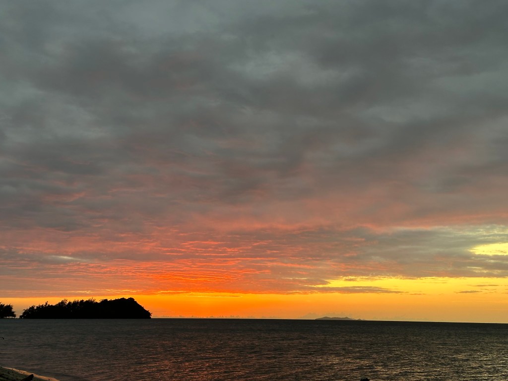
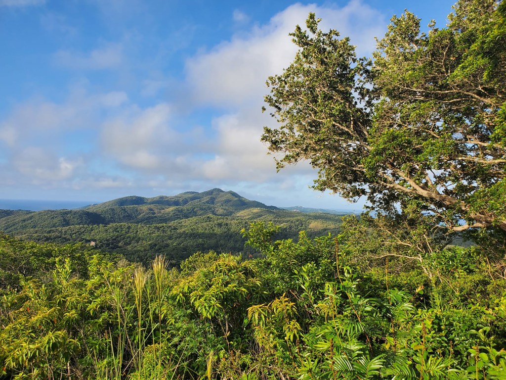
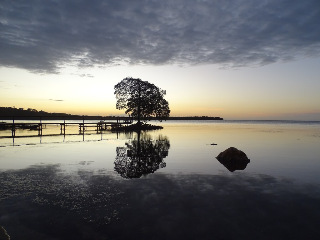
Good morning Bay Islands. We don’t get many sunrise landscapes as photos of the day, but I love that this photo, taken by Audrey Imfeld at Brass Hill near Dixon Cove, shows the mist rising with the sun. We get mist at sunrise because of dew, which occurs when the air temperature gets down to the dewpoint, the temperature at which humidity is 100 percent. This causes water to condense on colder surfaces like leaves and grass. Then the sun comes up and burns it off, creating steam or mist. We’ll see some of this with cooler temps next week.
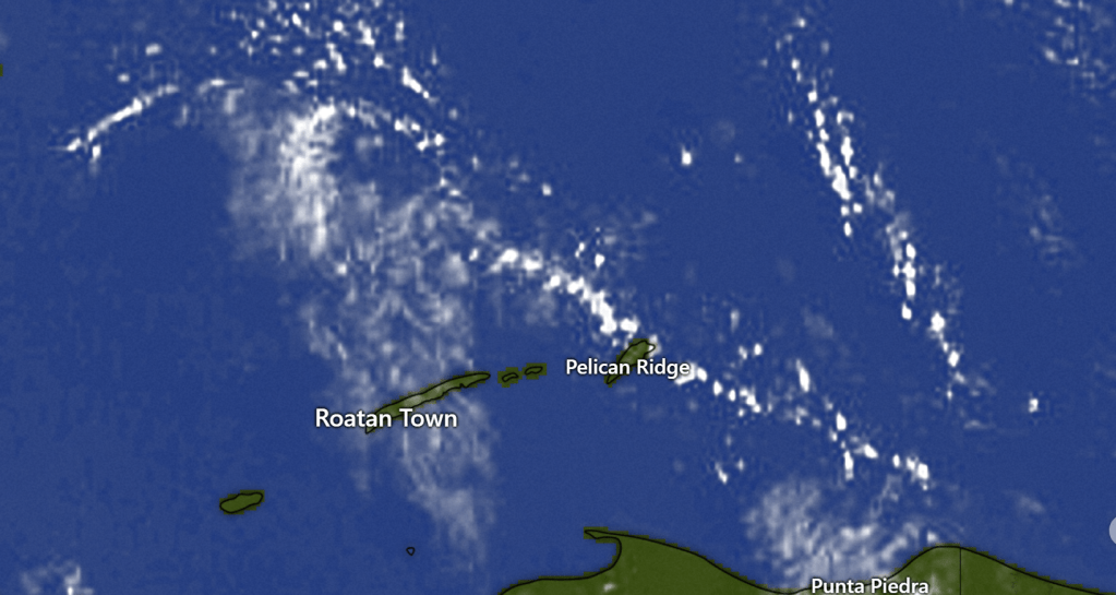
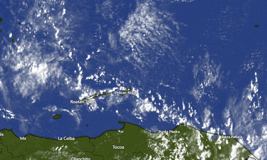
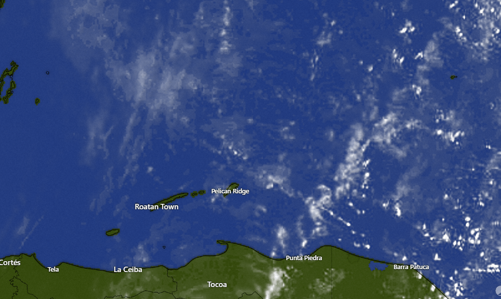
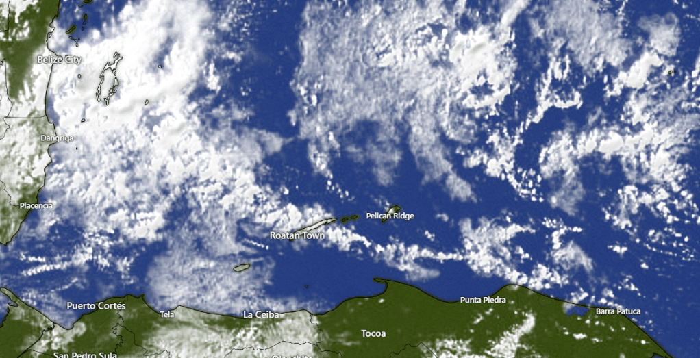
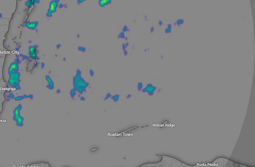
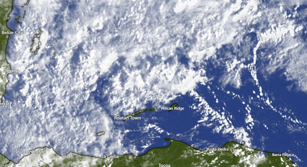
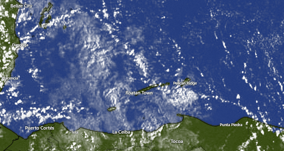
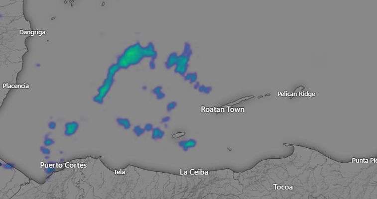
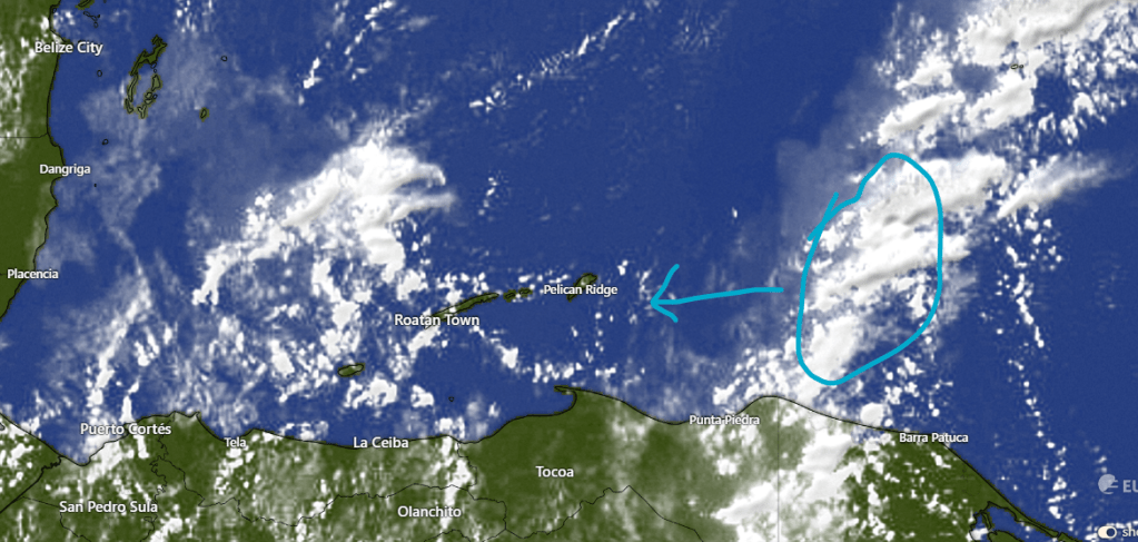
Here are this morning’s clouds. You can see we have some clouds coming in from the east. A similar setup yesterday gave Guanaja a couple of showers. The same may be true today, with a 20 percent chance of a shower, especially for the east side and Guanaja.
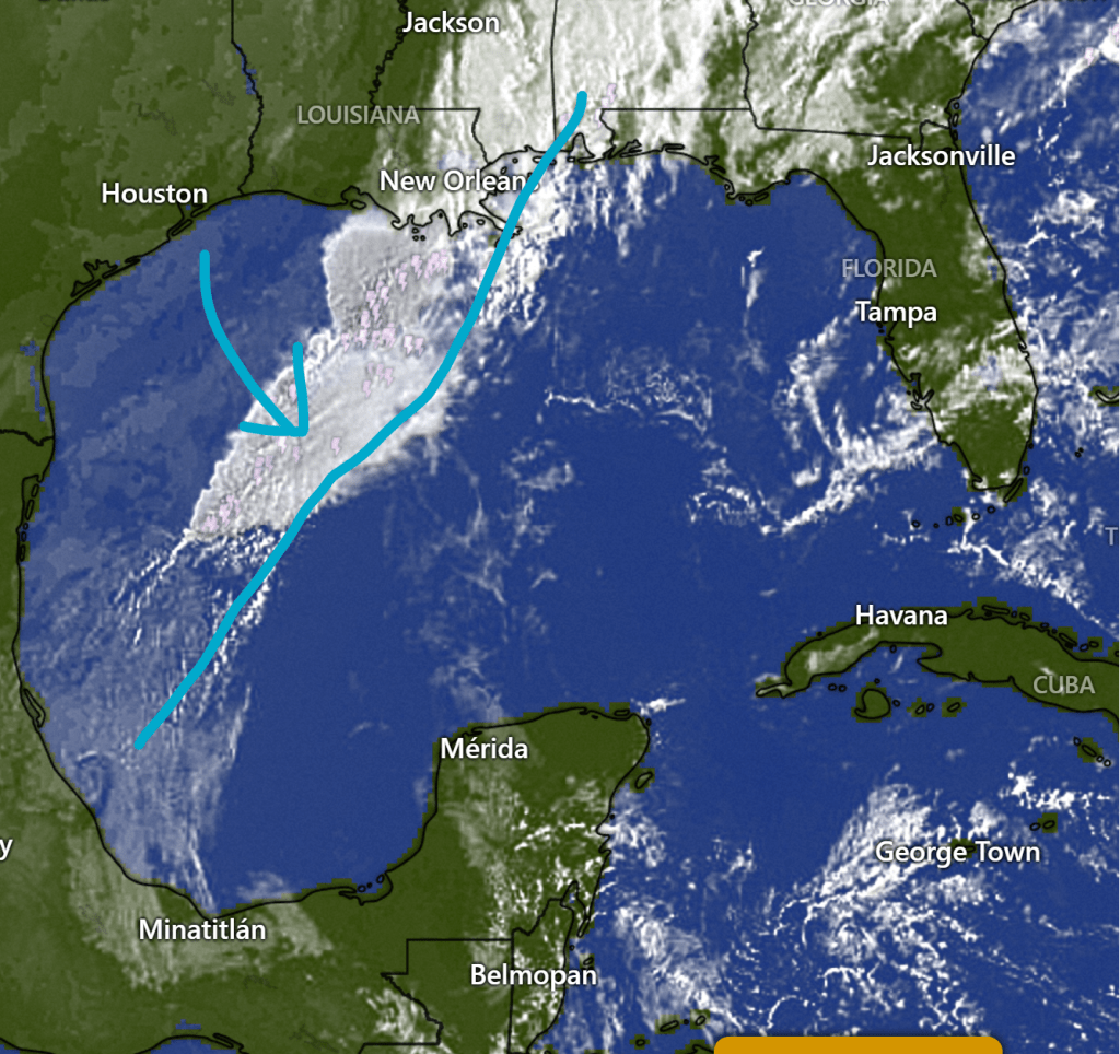
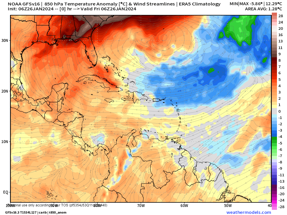
You can see on the long view of the satellite our cold front stretching through the southeast US into the Gulf of Mexico. This will bring periods of heavy rain perhaps starting tomorrow night, through the day Monday into Tuesday morning. Best estimate for rainfall is 2-3 inches, but rain should be more the further south you are, so Utila will likely get more rain than Guanaja. after the norther passes, we’ll still have chances for light rain Tuesday into Wednesday.
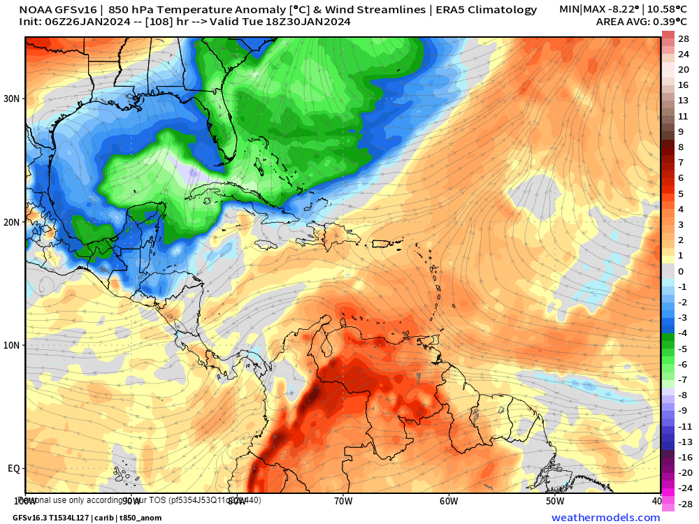
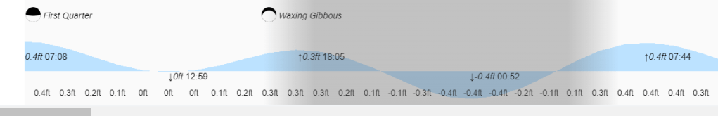
Wind and wave forecast: We start the day with 4 foot seas on the southside and 2-3 foot seas northside with 20 mph east winds. Those winds should calm a bit during the day and be even more calm tomorrow morning. Tomorrow afternoon we will see winds shift to the north, but as you can see in this Euro wind forecast, they really get strong midmorning on Monday, with north winds gusting to 35 mph and seas 7-8 feet. Winds calm on Tuesday morning to 15-20 mph and seas 4-5 feet. Wednesday through the end of the week we will keep light north winds and seas 1-2 feet.

Friday and Saturday nights are always great nights to get together with friends and enjoy the best food on the island at Ikigai by Robby Molina. He’s one of the best 100 chefs in the world for a reason. If you don’t try it, you’re depriving yourself and if you try it, you’ll have to go back for more.
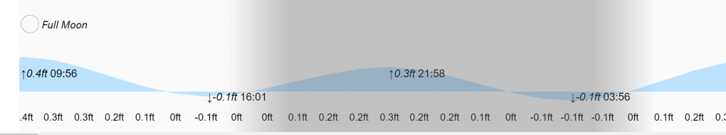
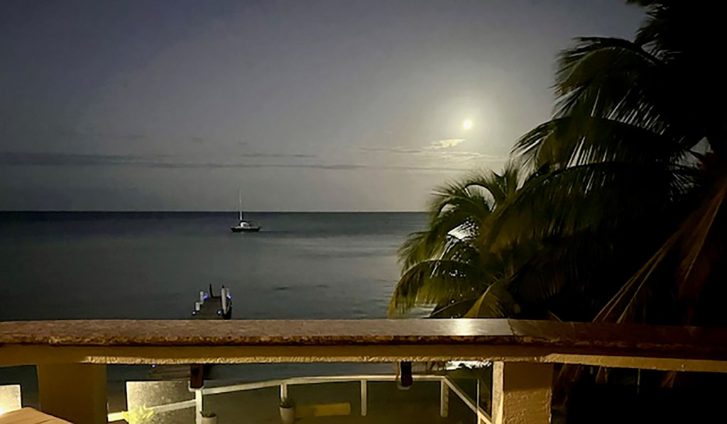
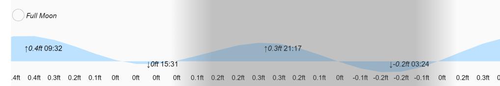
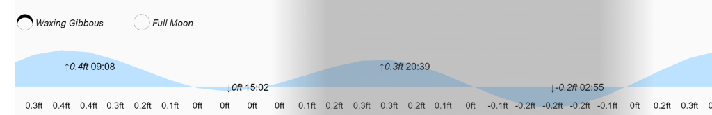
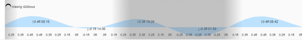
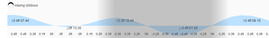
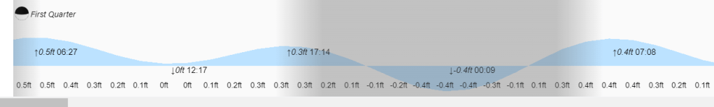
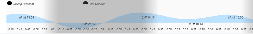
4 p.m. and 4 a.m. are low tides under a full moon. Have a great weekend!