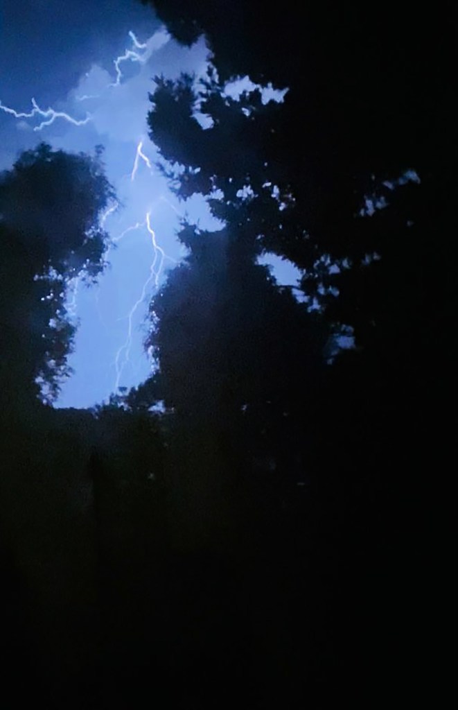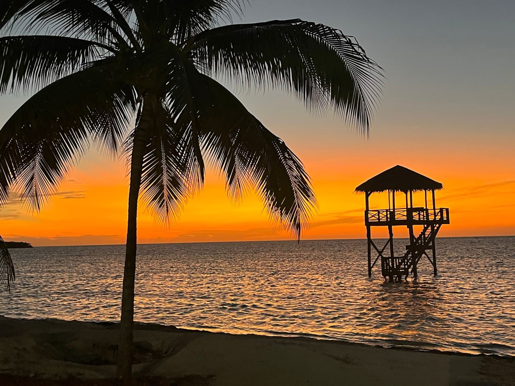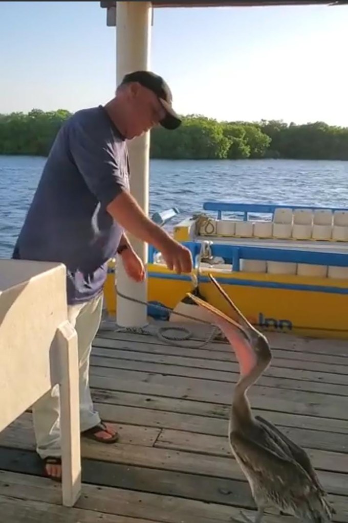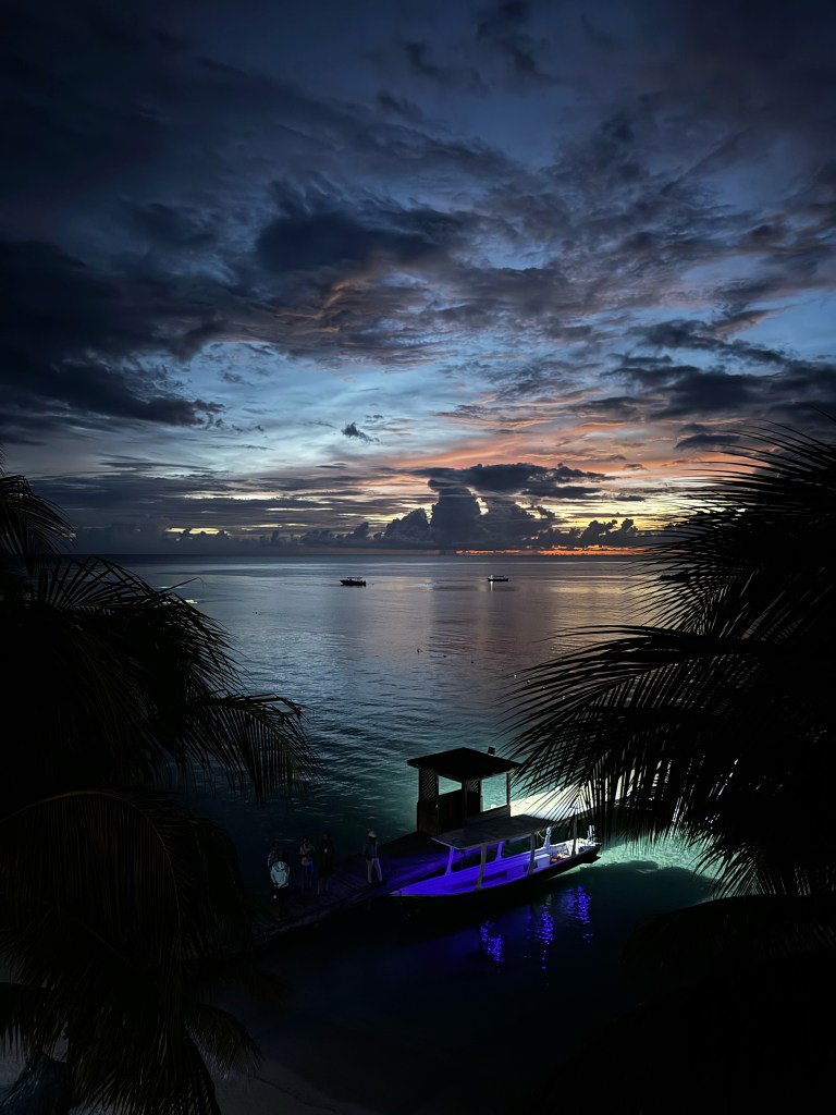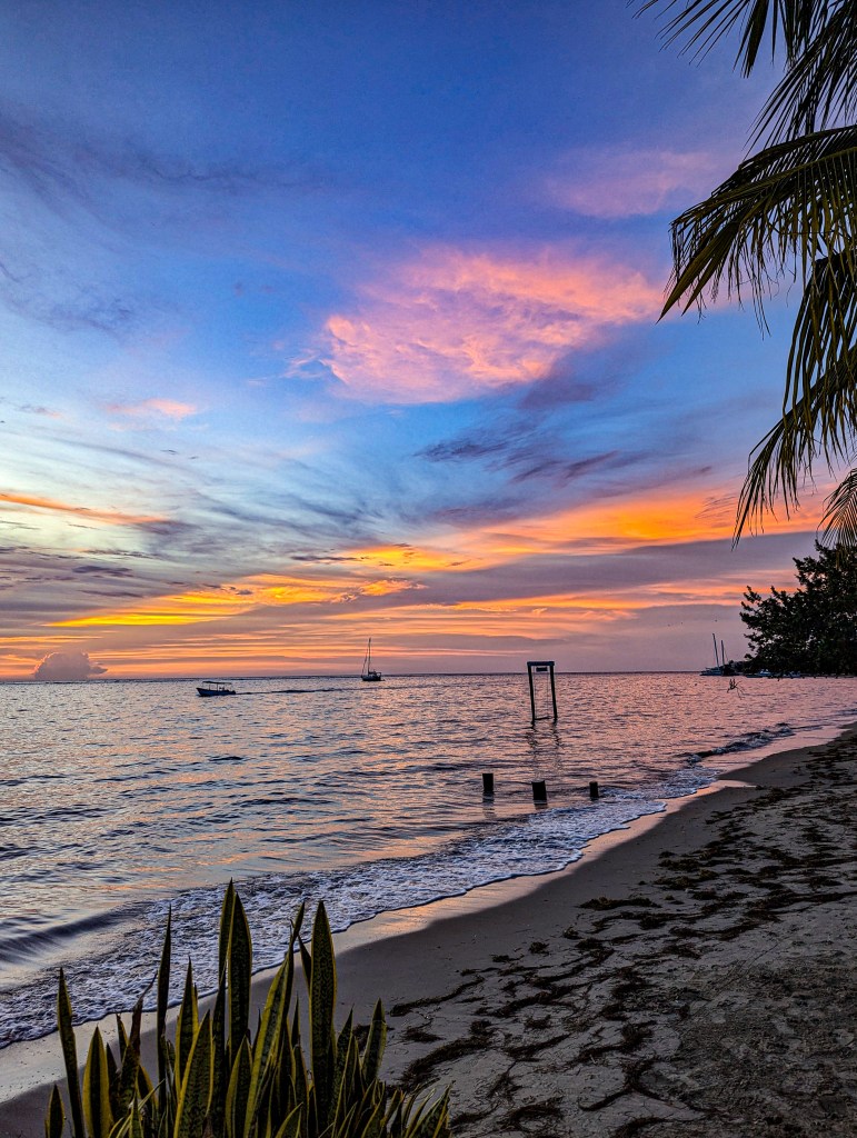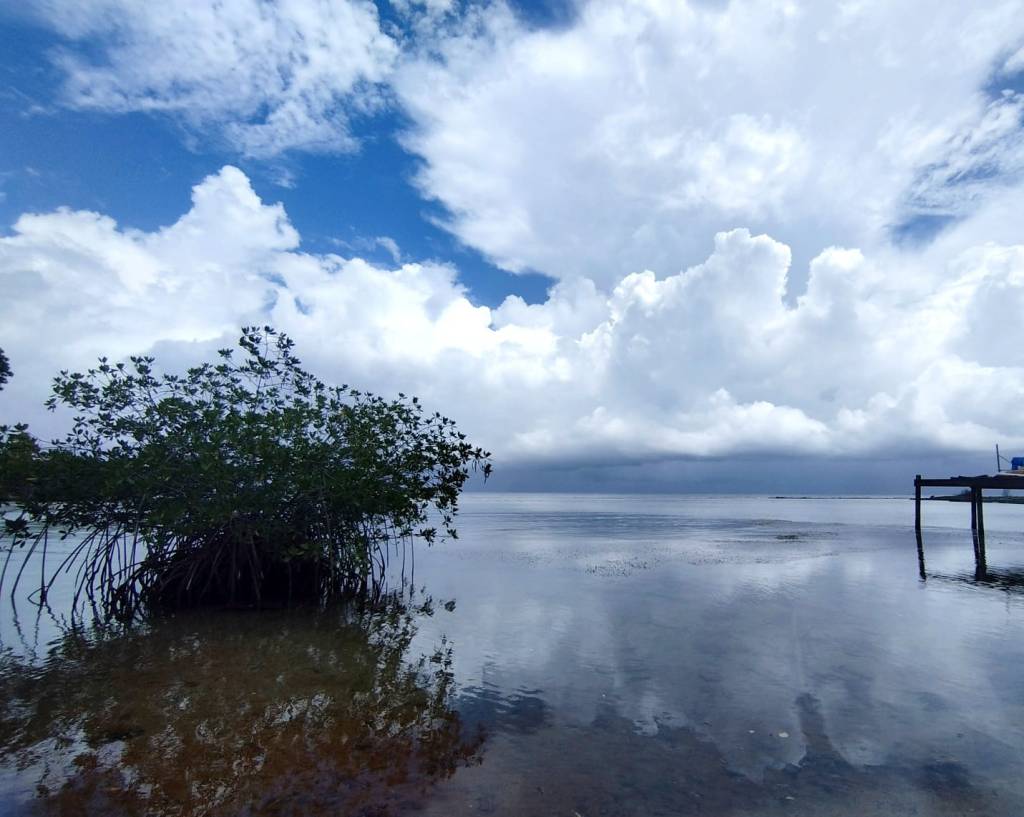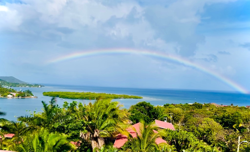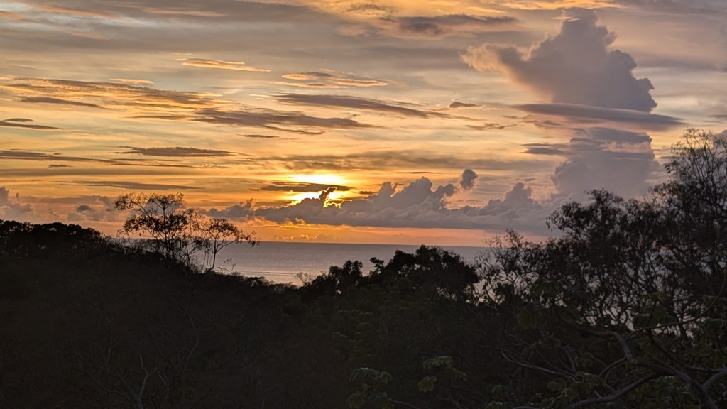
Good morning Bay Islands. Our photo of the day is from Gianni De Santis and shows sunset at Hottest Sparrow and has an awesome towering cumulus cloud on the right. Last night was the west sides turn to get some good rains. The east side and Guanaja missed out. We will continue to have rain chances, especially overnight and in the mornings.
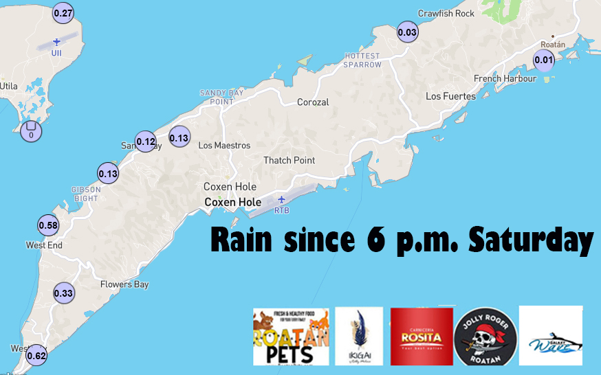
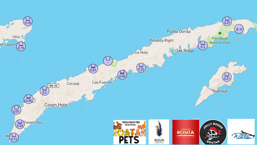
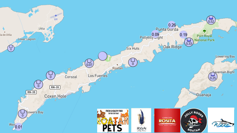
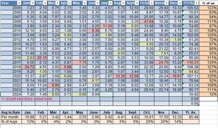
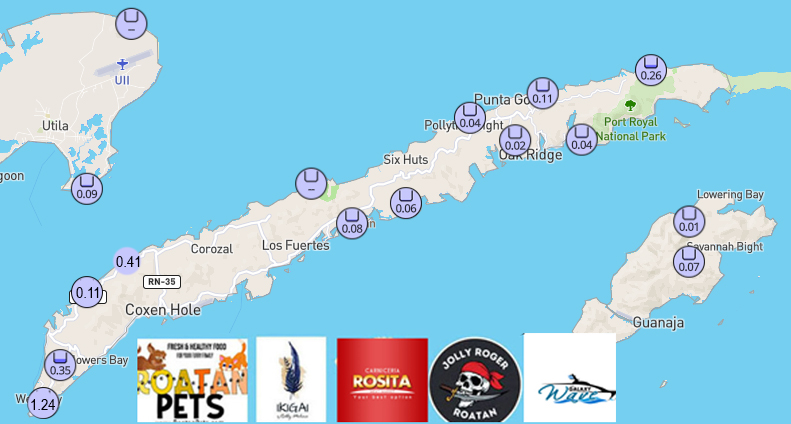
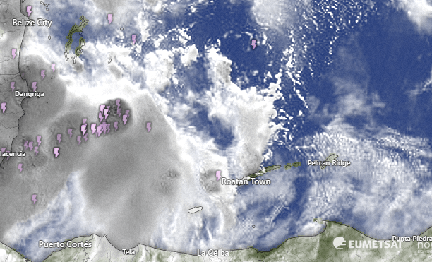
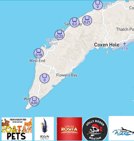
Here are last night’s rain totals. We only show the west end because the east end recorded no rain.
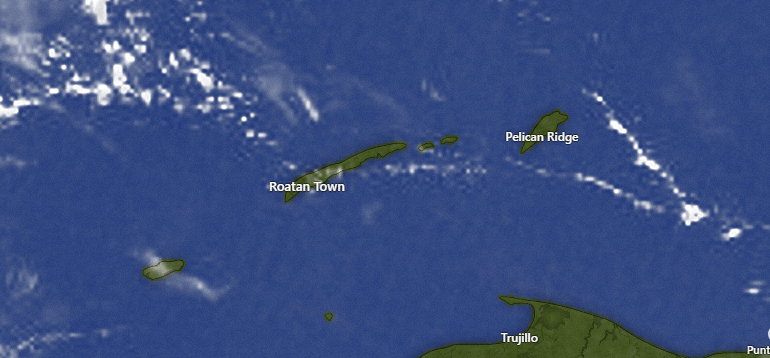
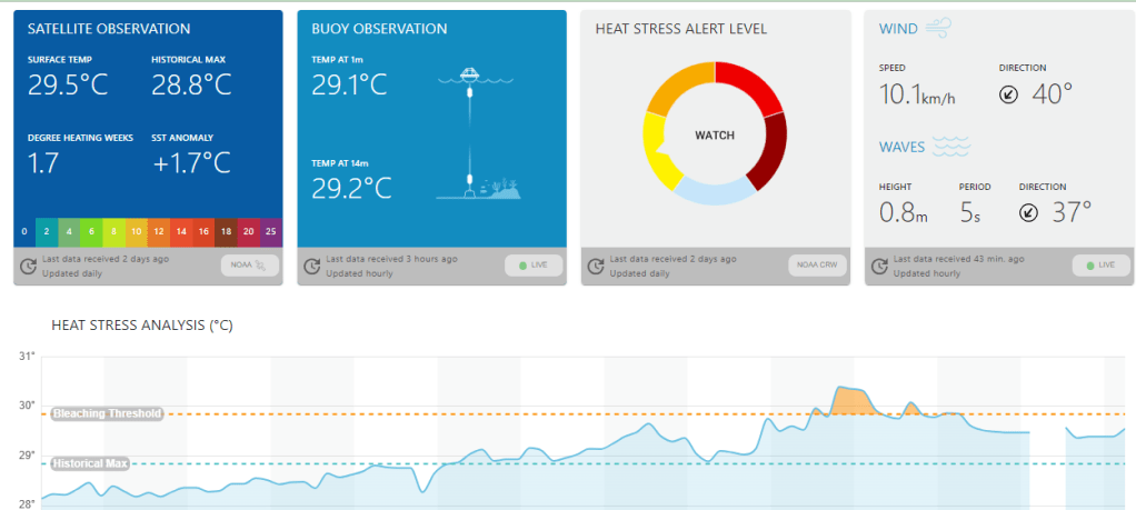
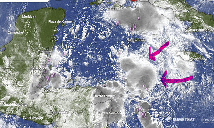
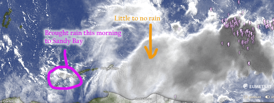
The satellite at 7 a.m. is mostly clear with only a few popcorn clouds around. That means a very small chance of a shower this morning, maybe 20 percent. We will continue to have about a 60 percent chance of rain overnight and in the mornings and 30 percent chances midday into the afternoon.
Wind and Galaxy Wave forecast: Our winds are only 10 mph from the east but our seas are coming from the northeast around 3 feet, so the north side is a little wavier than normal. Tomorrow looks calmer, with east winds 5-10 mph and seas around 2 feet. Starting Monday we go back to 15 mph east winds and 2-3 foot seas, especially south side.

If it is Sunday, that means it is Lobster Day at Ikigai by Robby Molina. It is the best lobster deal on the island, with sides and drink for $18.
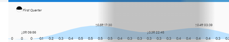
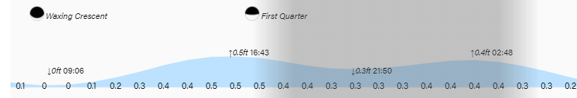
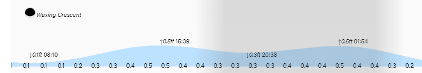
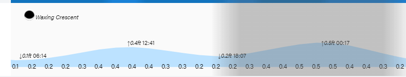
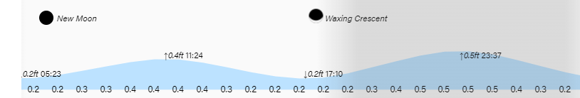
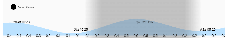
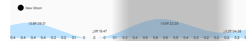
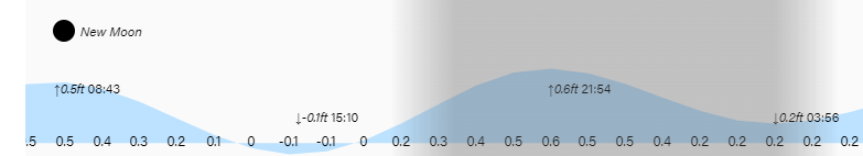
Low tide is 10 a.m. Have a great Sunday!