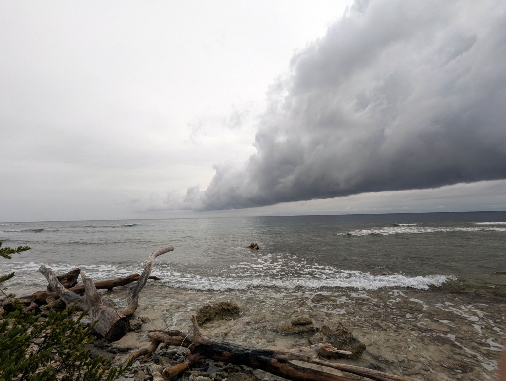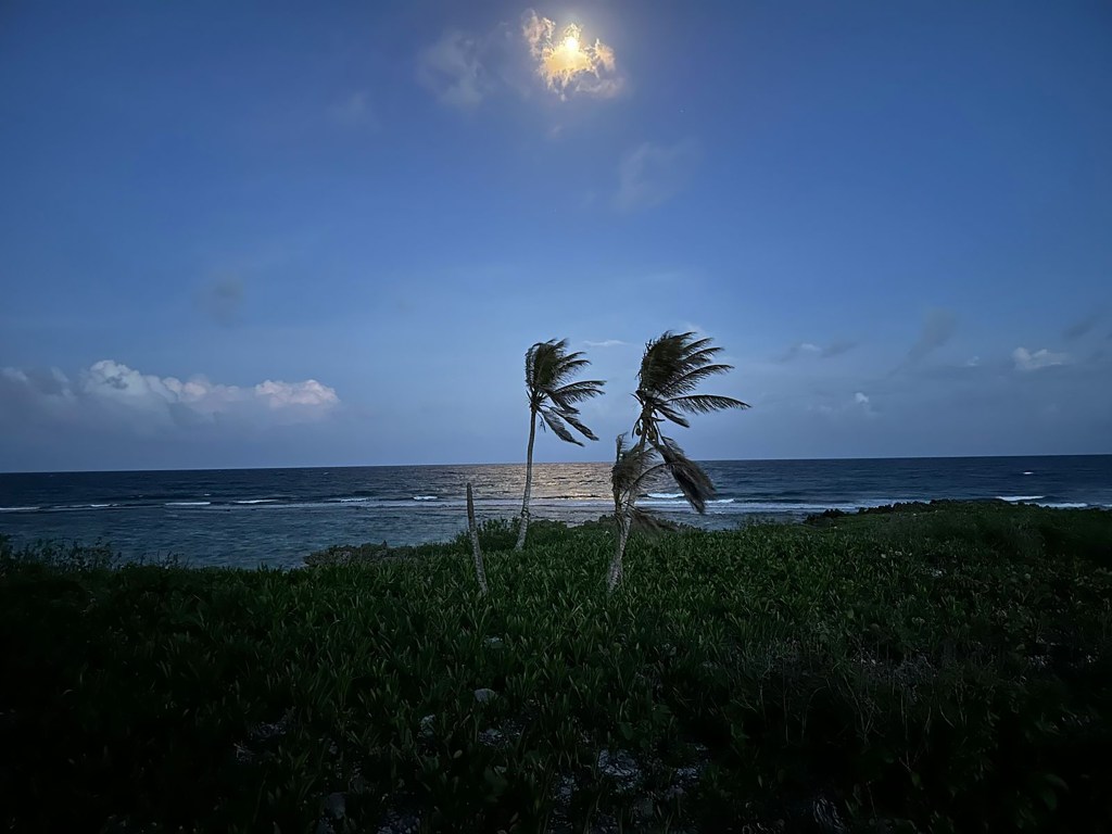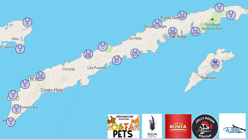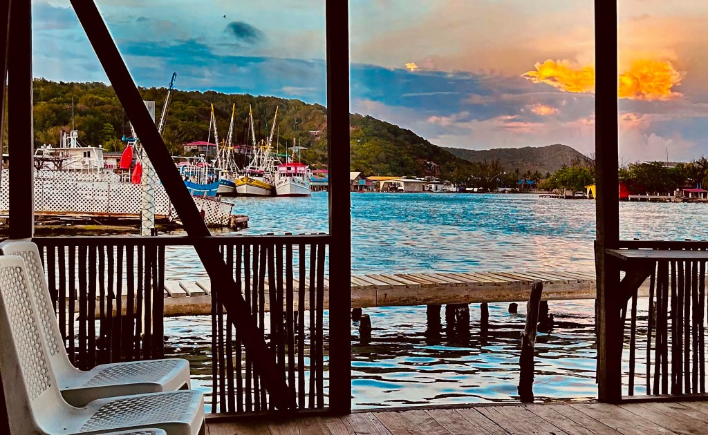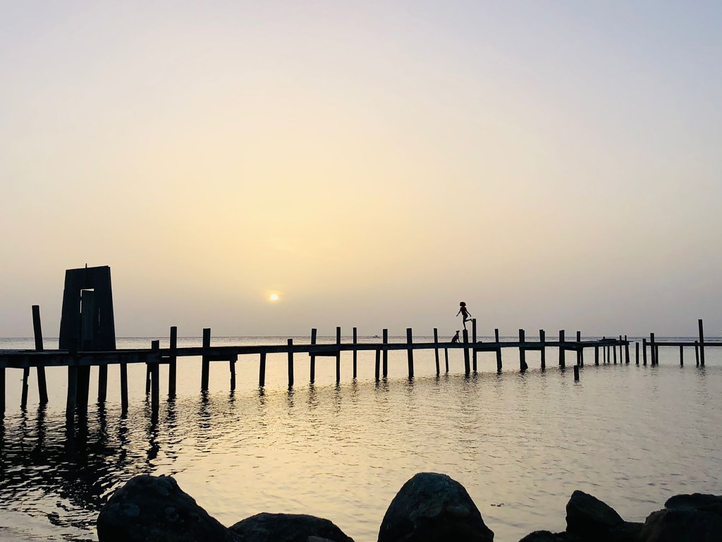
Good morning Bay Islands. Our photo of the day comes from Marcela Avila and shows a boy balancing on a beam that supports a dock in Sandy Bay while his dog looks on. Don’t forget you can enter your photo and the one voted Photo of the Month wins a round trip Galaxy Wave ferry ride to Guanaja. Email them with name and location to bookmybio@gmail.com. We will enjoy sunny skies today, but rain re-enters the forecast overnight.
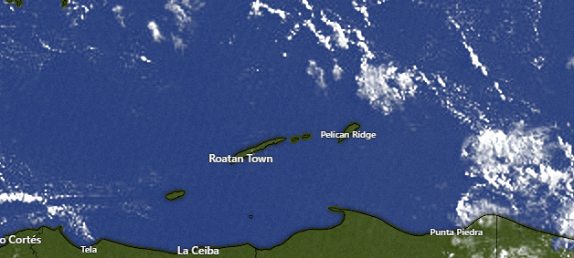
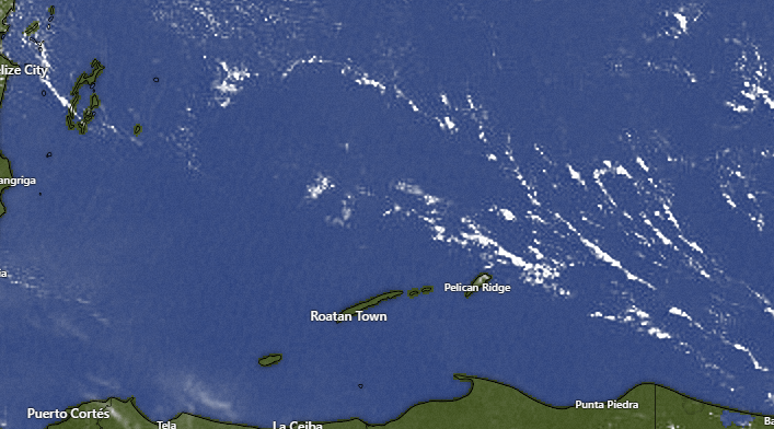
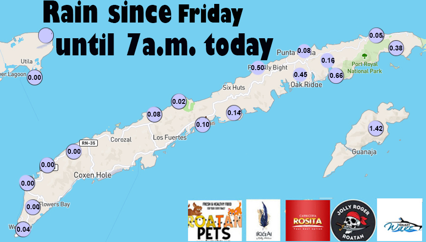
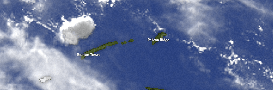
On our close up satellite, we can see a few popcorn clouds to the east of Guanaja moving westward. It is not impossible that someone might see a shower this morning, especially in Guanaja or east Roatan, but it is unlikely.
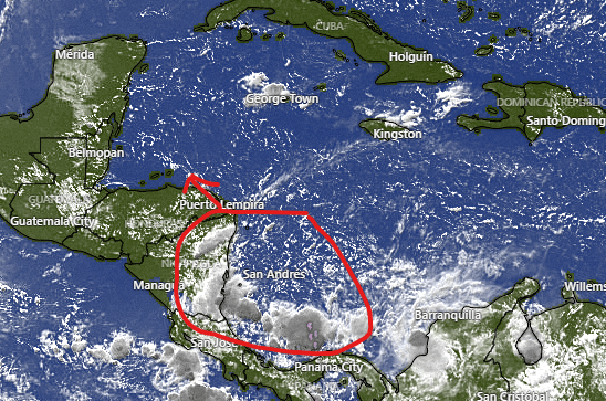
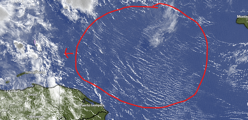
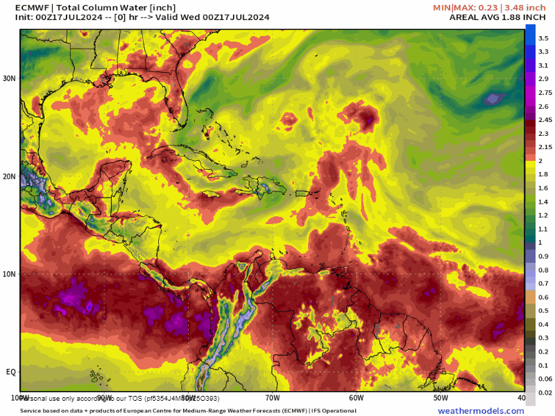
On the wide satellite view we can see moisture to our southeast that will move toward us and increase our rain chances after midnight tonight. Tomorrow during the day there will be a 40 percent chance of seeing a shower and a 60 percent chance tomorrow night. Friday and Saturday we will have a 30 percent chance of rain and Saturday night into Sunday the chance goes up to 50 percent.
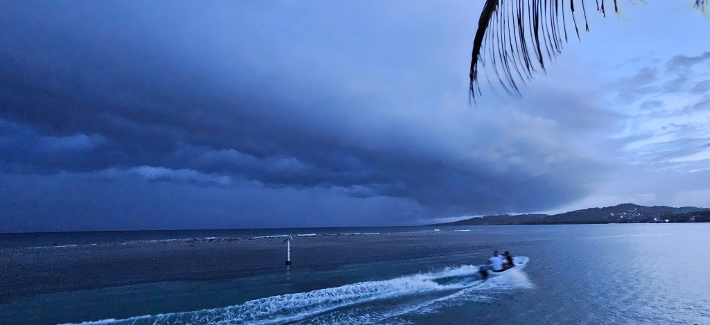
Wind and Galaxy Wave forecast: We wake up to east winds 15-20 mph and seas 3 feet southside. Midday we should be 15 mph east winds and 2-3 foot seas. Overnight into tomorrow we will have 15-20 mph east winds and seas around 3 feet. Into the weekend winds and seas look similar, though Sunday night looks a little windier, with east winds 20-25 mph. Don’t forget, the seas can get wavier in squalls.

If you’re headed to La Ceiba you will want to get in on the Galaxy Wave special of $25 tickets each way. Head over to roatanferry.com and purchase your tickets today.
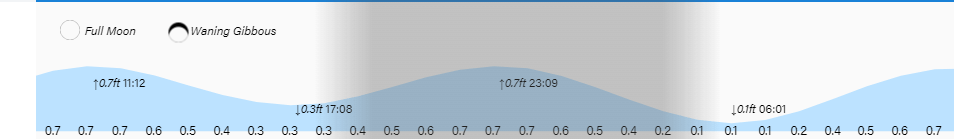
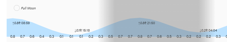
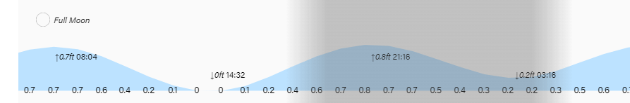
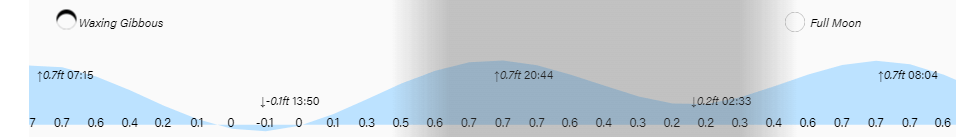
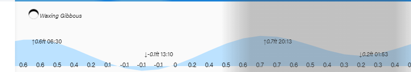
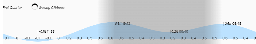
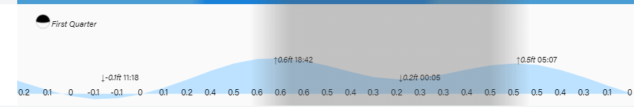
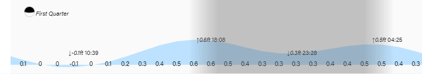
Low tides are 5 p.m. and 6 a.m. Have a great Wednesday!