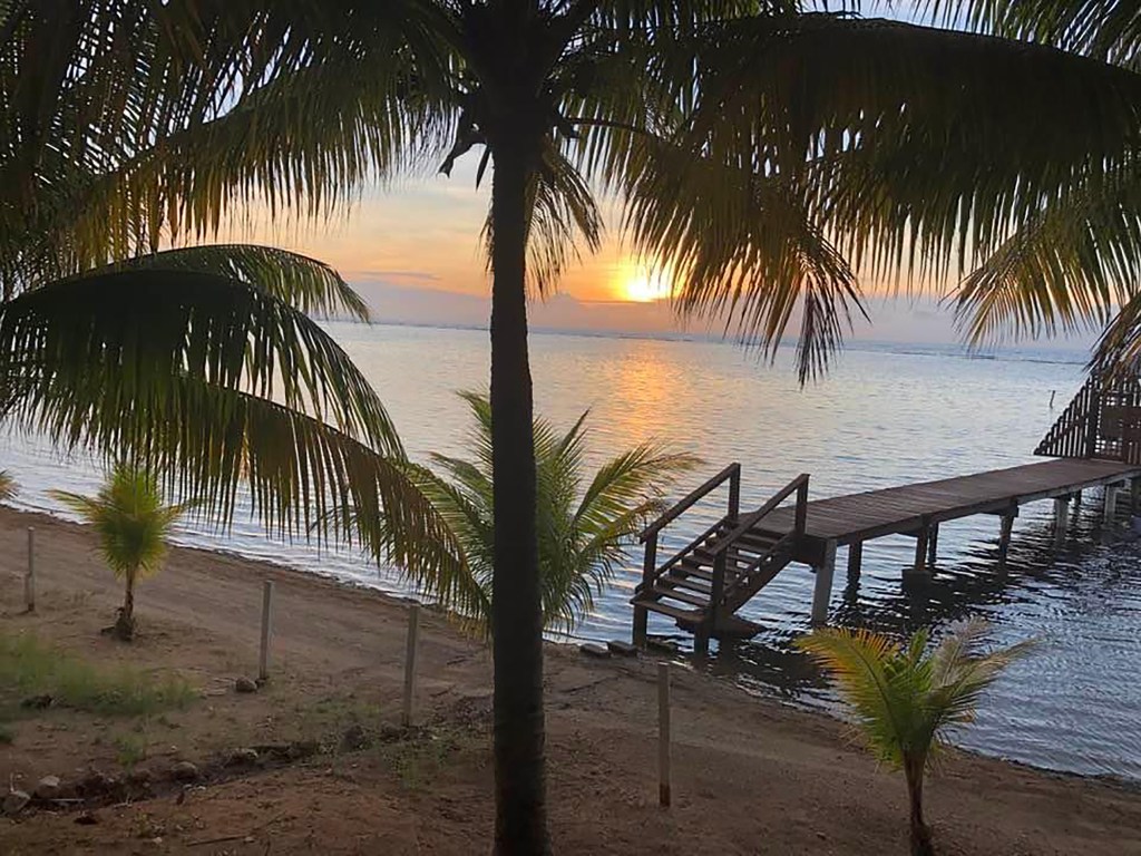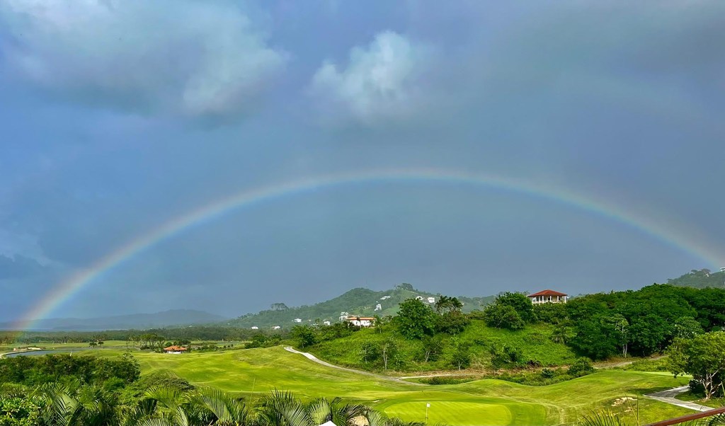
Good morning Bay Islands. This morning’s photo of the day comes from Josh Gravitt and shows a full rainbow over the Black Pearl Golf Course in Pristine Bay. Josh assures me that he didn’t find a hole in one at the end of the rainbow. Our rain chances are a bit lower today, but come back tonight and tomorrow morning.
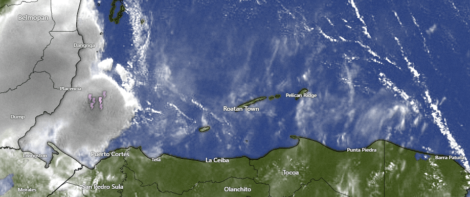
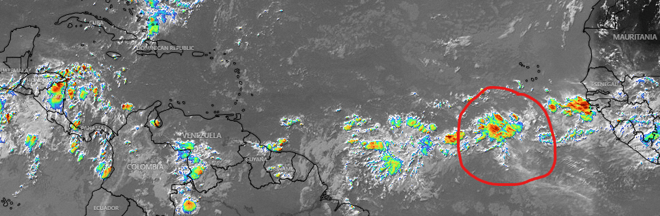
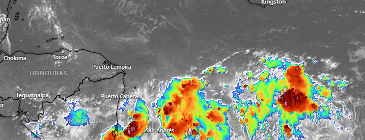
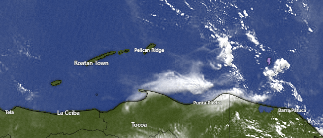
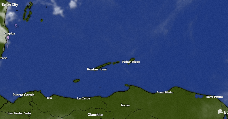
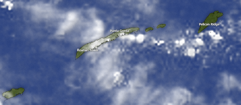
This morning’s satellite shows a big complex of storms over Belize, but nothing much here. Today looks mostly sunny and dry. Tonight and tomorrow morning scattered showers and storms return and we will have that cycle most of this week, with a low chance of an isolated shower during the daytime and better chances overnight and in the early morning.
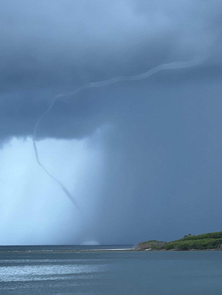
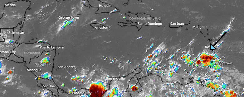
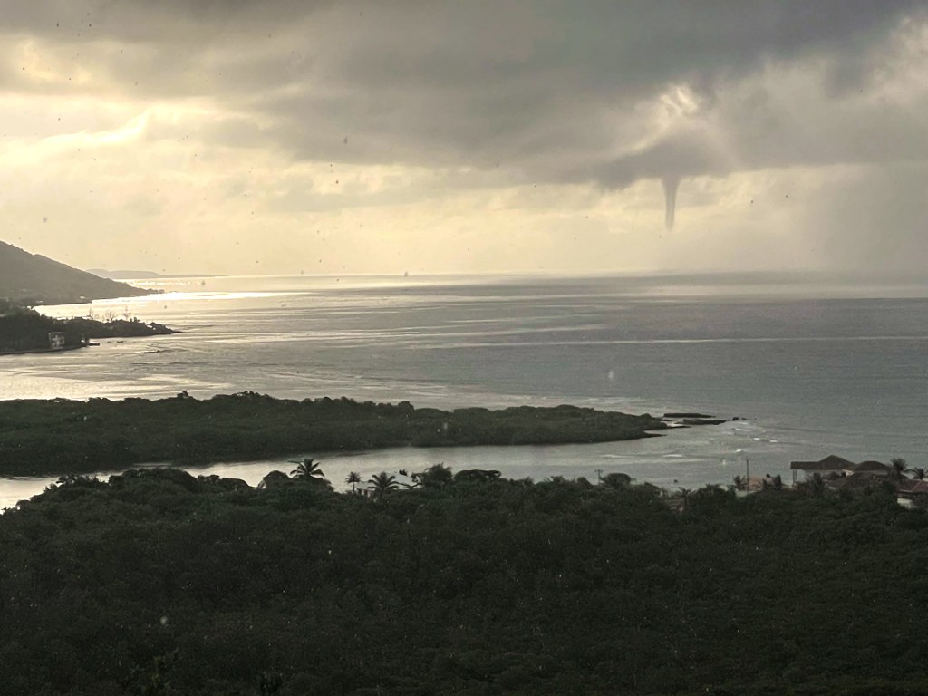
I want to talk a little about the nature of tropical weather. This satellite image is throughout the day on Wednesday. You will remember Wednesday produced the storm that created the waterspout that was our photo of the day Thursday. It was produced on a day that was clear almost everywhere in our part of the Caribbean, but around midday you can see one burst of yellowish orange that was this storm that also poured between 1-2 inches of rain on the west side.
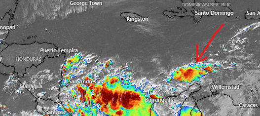
Compare that with Thursday night’s satellite. There are lots of storm clouds around, but especially to the east of Guanaja. In the end, the islands got no rain from these storms. We see these storms moving west and weakening as they go, then reforming to the east of Guanaja and continuing the pattern. One thing I’ve learned about large complexes of storms is that unless you are right in the strongest part, where the cloud tops are the highest (represented by red on infrared satellite) you probably aren’t getting any rain.
Wind and Galaxy Wave forecast: This morning we are having one of the windier mornings we’ve had in awhile, with 15-20 mph east winds and seas around 3 feet southside. We will keep those winds and seas today, even a little breezier this evening with east winds 17-22 mph. Tomorrow and the week ahead look calmer, with east winds 10-15 mph and seas 2 feet southside.
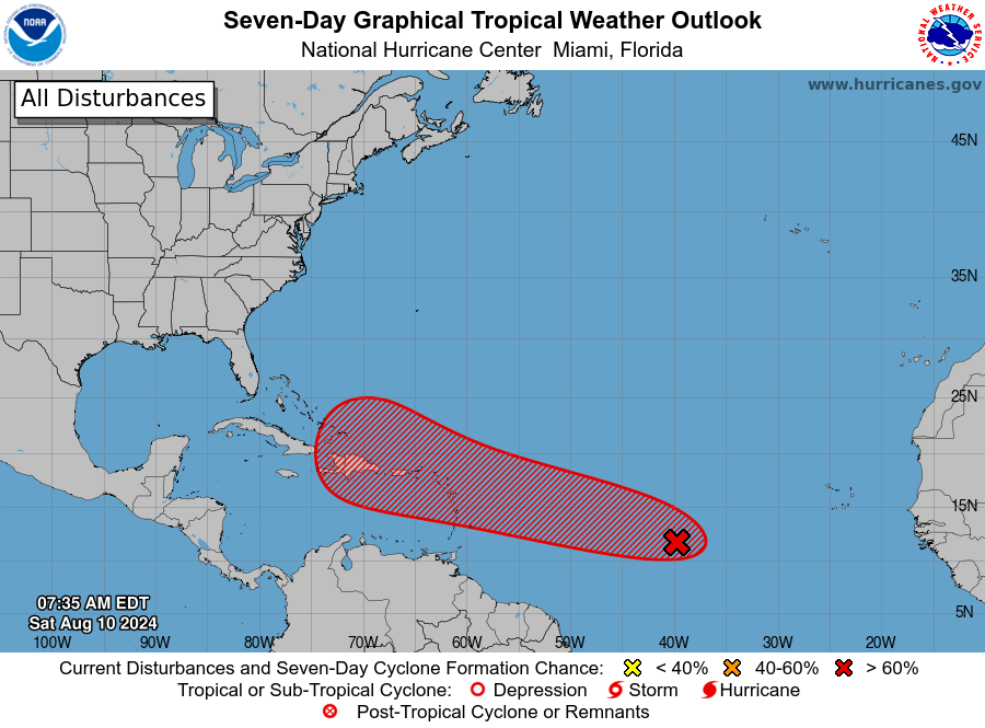
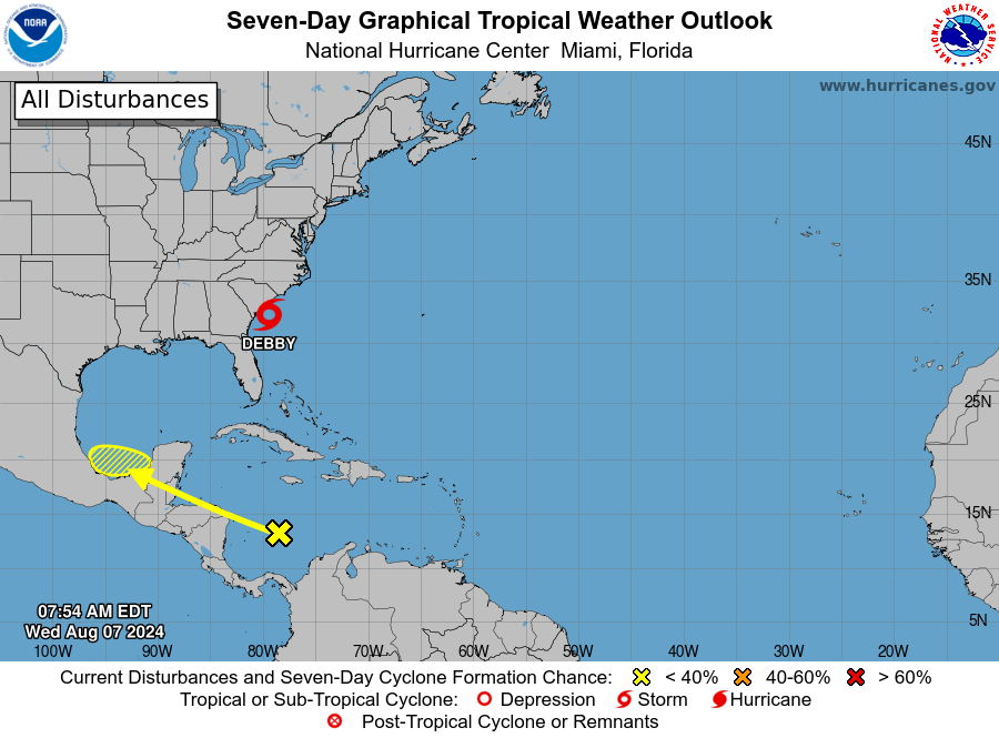
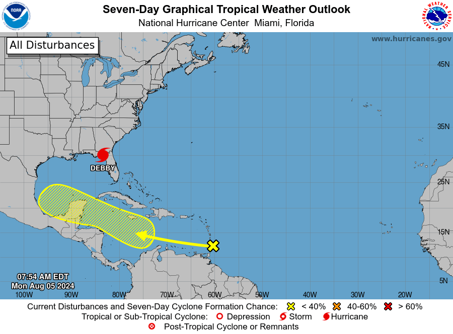
It’s looking pretty certain that a tropical storm will threaten Puerto Rico midweek, but most of the models say this system will then turn out to sea. This is no threat to us.
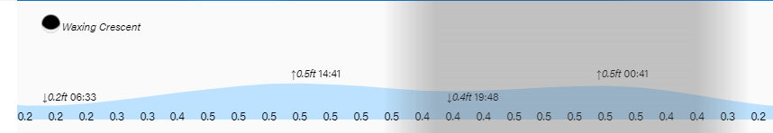
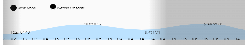
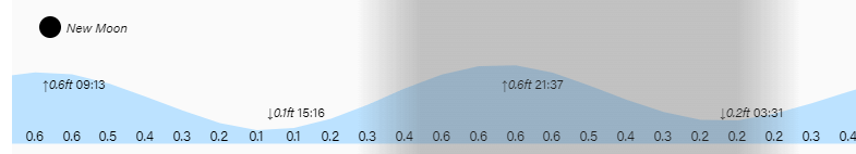
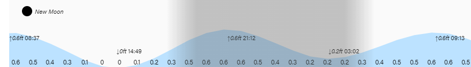
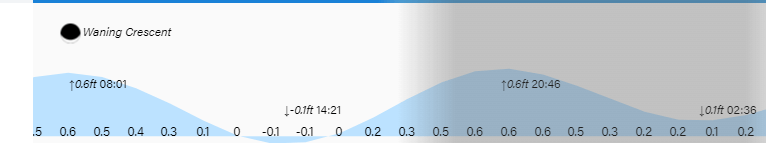
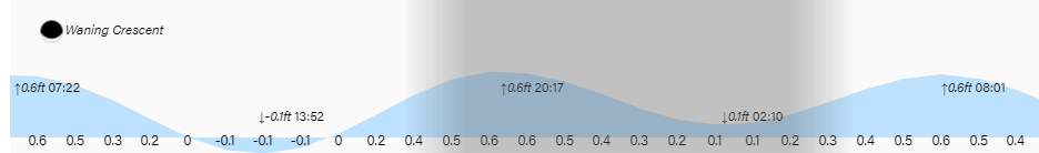
High and low tides are hardly noticeable. Have a great weekend!