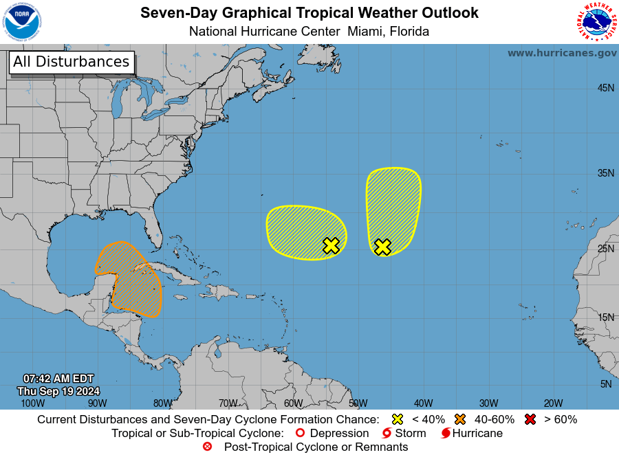
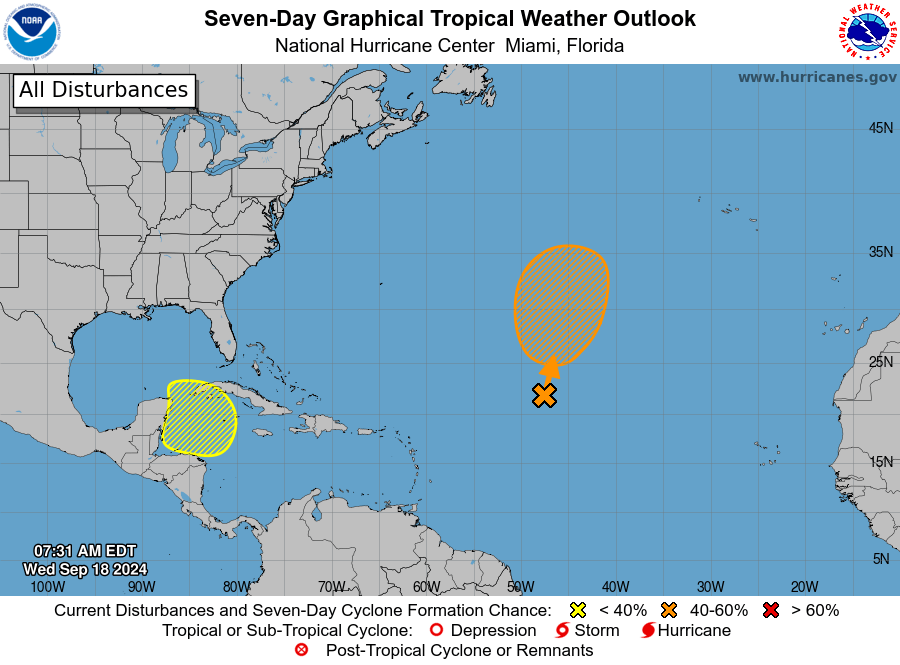
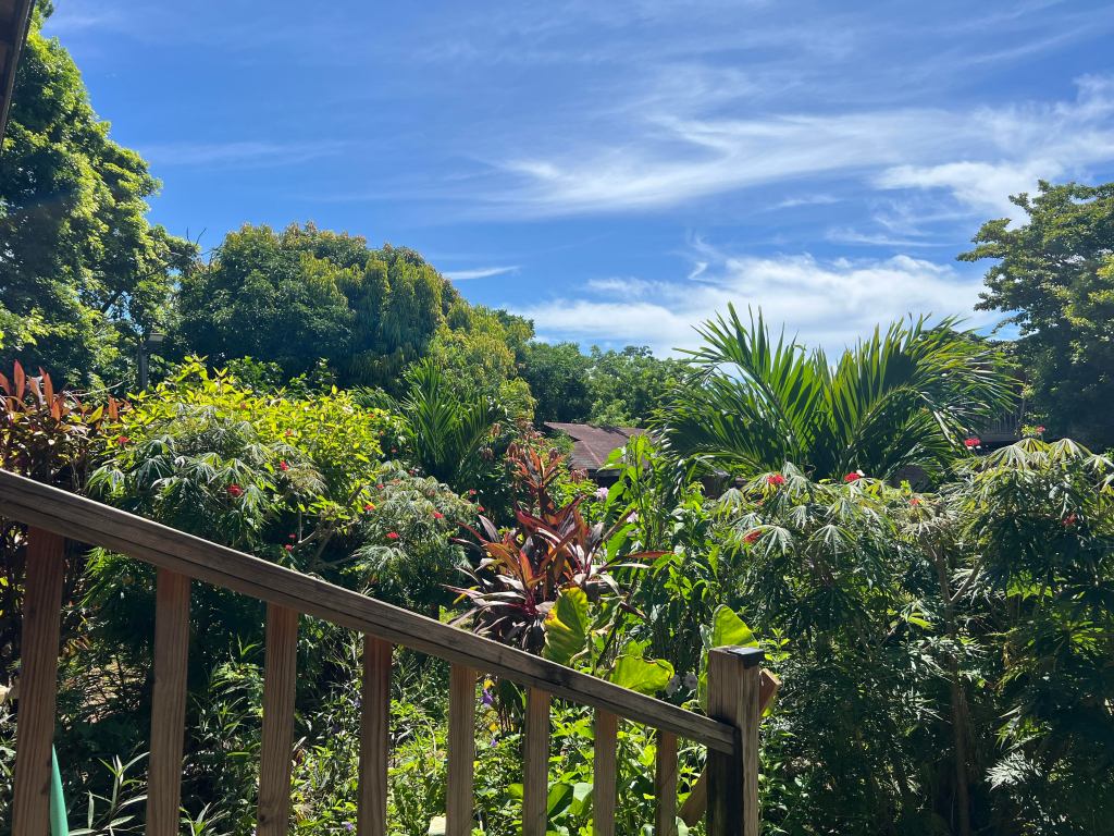
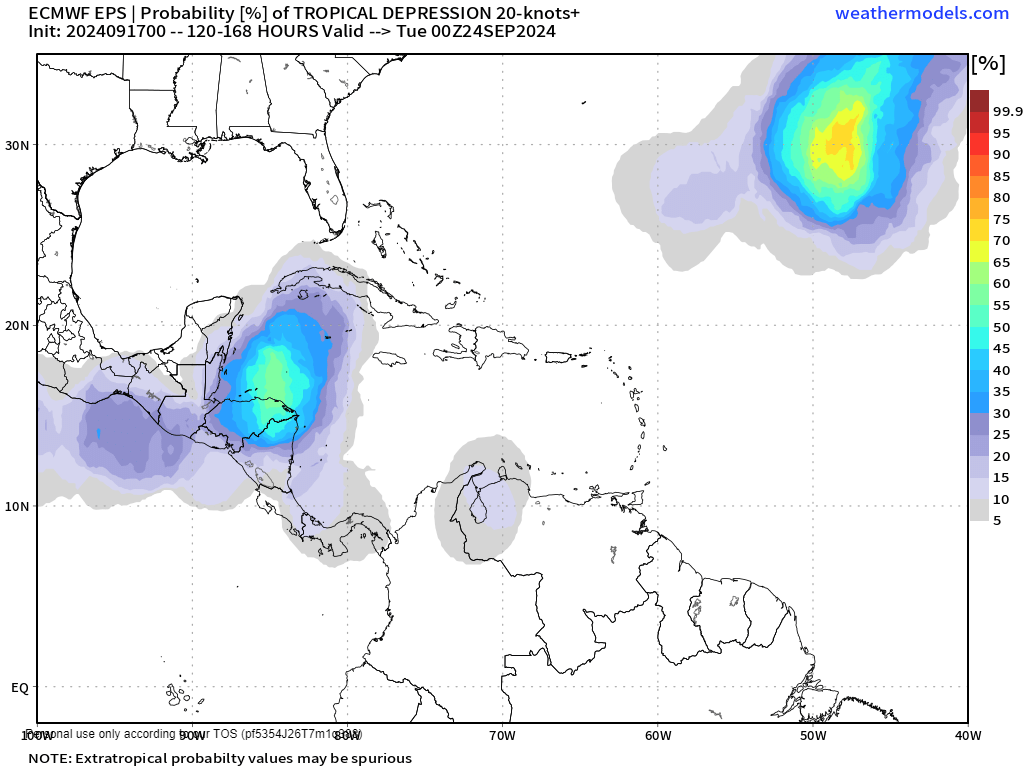
Good morning Bay Islands. No photo of the day today because we have Potential Tropical Storm Helene to our west this morning. The good news is that this storm will move to our east and to our north, leaving us on the calmer southwest side of the storm. The models all expect this storm to intensify fairly rapidly, which could be bad news for northern Yucatan, western Cuba and especially the Florida Panhandle, but we will just have to deal with some rain today and tomorrow.
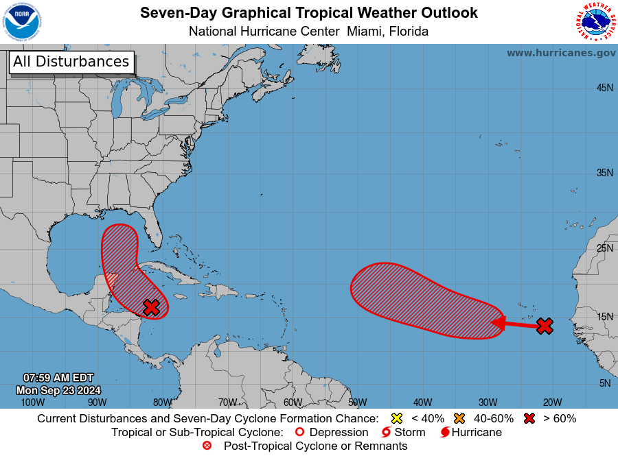
Here is the outlook from the National Hurricane Center. Potential Tropical Storm Helene doesn’t have enough circulation to even be a tropical disturbance but there is a 70 percent chance that happens in the next 48 hours. By that time it will be past us. You will also notice there is an area of storms off the coast of Africa, but those should move northwest and will be no danger to us.

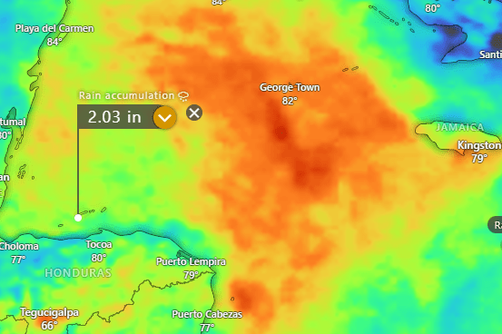
Here is our rainfall since midnight.
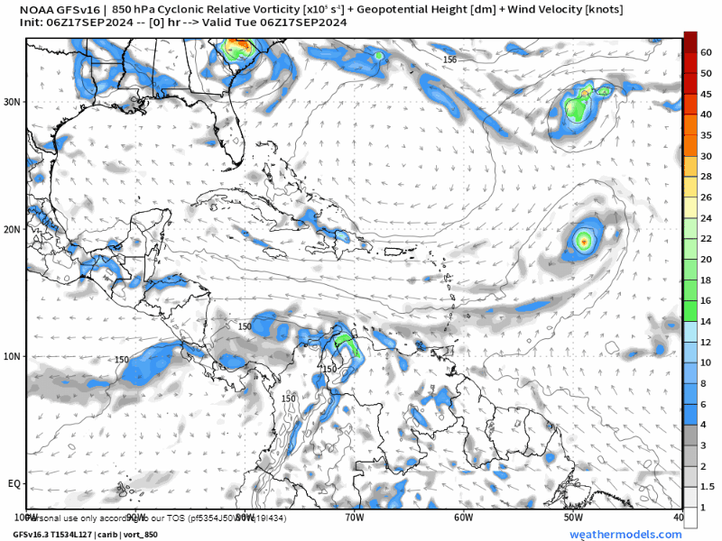
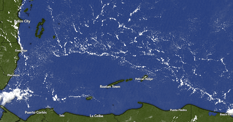
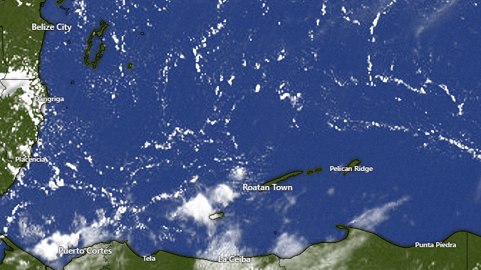
Here is our satellite image at 7 a.m. There’s lots of clouds and rain to our northwest. The clouds are moving west, but midlevel winds are from the northeast so most of the rain is pretty much stationary. Nevertheless, look for rain and storms to pop up off and on today, tonight and tomorrow. We may get a little clearing tomorrow afternoon. After this storm clears out of here on Wednesday, we will continue ot have good chances of rain, especially overnights and early mornings.
Wind and Galaxy Wave forecast: Our winds this morning are from the northwest at 5-10 mph and seas around 2 feet. Winds and seas should stay fairly calm today. Tomorrow through Wednesday morning we should see winds pick up from the west around 15 mph and seas 3-4 feet. It may get a little stronger depending on how fast Potential Tropical Storm Helene gets.
Wednesday afternoon through the weekend looks much calmer.
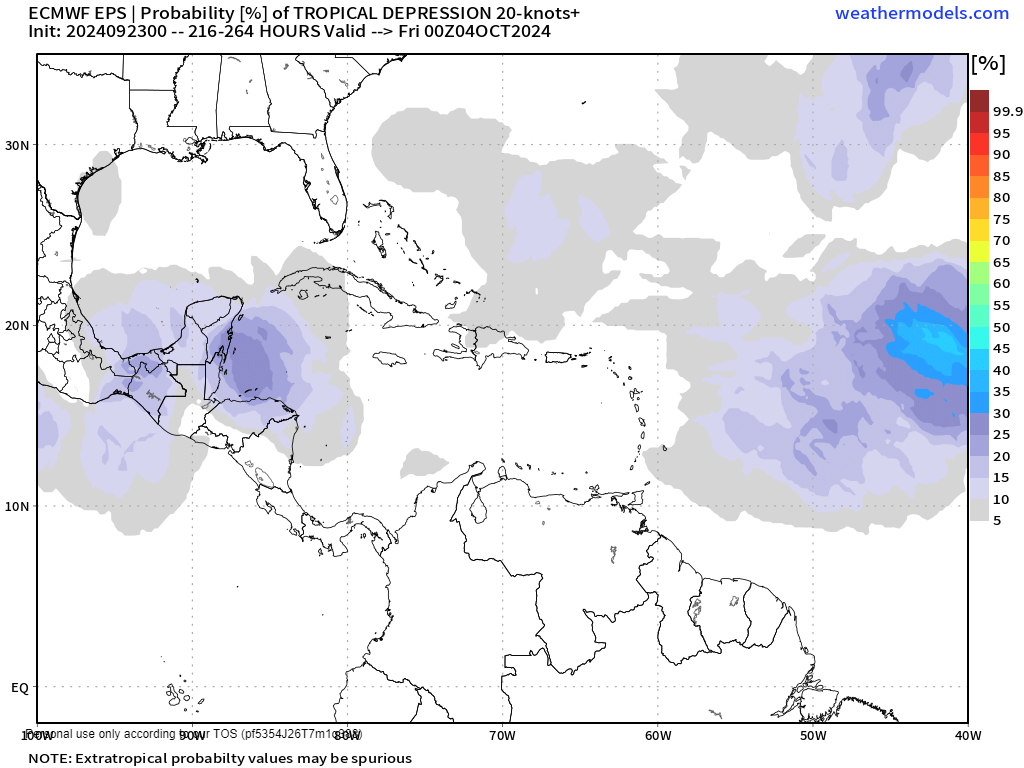
Several of the computers are giving us a chance at another tropical wave around Oct. 3. That is still a long way off. We will keep an eye on it.
If you are watching the forecast because you have a cruise scheduled to visit our islands, you will be in good hands if you schedule your excursion with Jolly Roger Roatan. They know how to stay in calm waters and get you back on board your ship safely and on time.

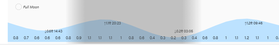
It’s a good thing that we aren’t going to be hit with a tropical storm surge, because our tides continue high. Have a great week!