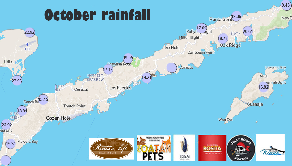
Rainfall for October 2024: We have had quite a rainy period. If I asked you if October was well above average or close to average, which would you pick?
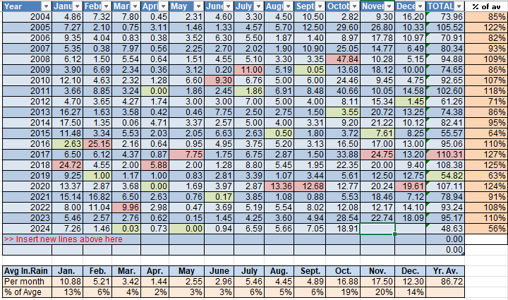
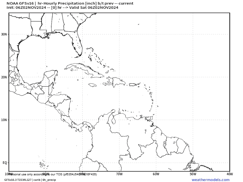
Well, guess what? October was only 2 inches above our average October rainfall. We put nearly 19 inches in the record book and that was about average throughout the islands, just under 20 inches. On average, November is our rainiest month with 17.5 inches on average. We are well on our way to that number, though I think this coming week will be below average.
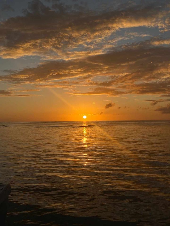
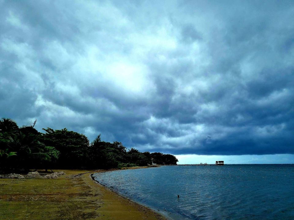
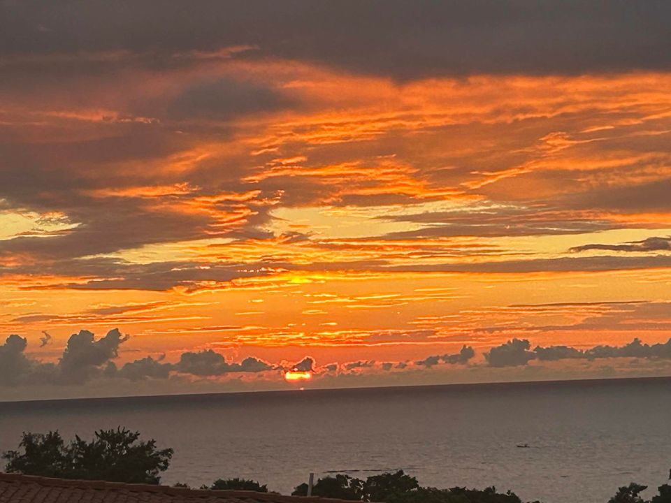
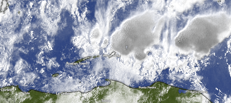
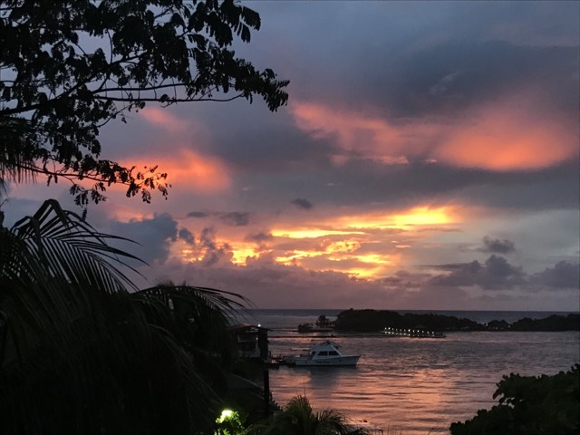
Good morning Bay Islands. Our photo of the day comes from Dethyra Ebanks and shows sunrise at Flowers Bay. We had quite a bit of rain overnight, especially Guanaja and Utila, which each got over an inch. The week ahead looks less rainy.
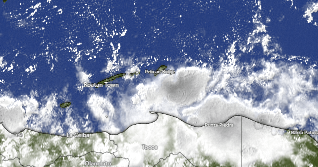
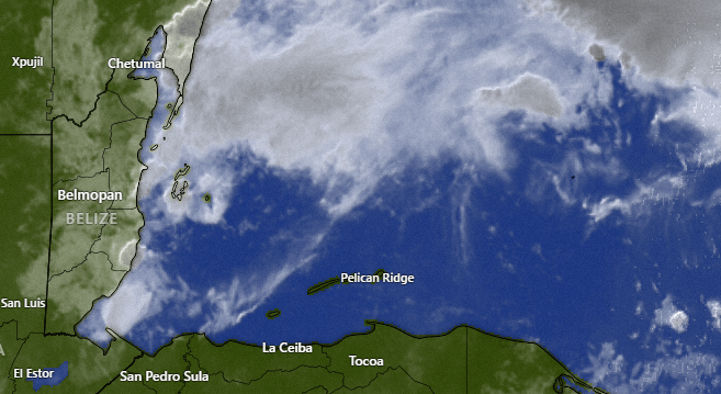
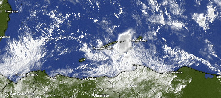
First let’s take a look at our satellite at 7:40 a.m. Most of the rain is now to our south, with a few popcorn clouds, especially over Helene and Barbarat. We will keep a chance of showers around through the morning, but we should stay mostly dry midday and afternoon. Best chances of showers will continue to be overnights and early mornings. As we get to the end of the week, even those should be less and I think Wednesday through Friday we have a good chance of staying dry. A weak norther should bring us rain and west/northwest winds 10-15 mph next weekend.
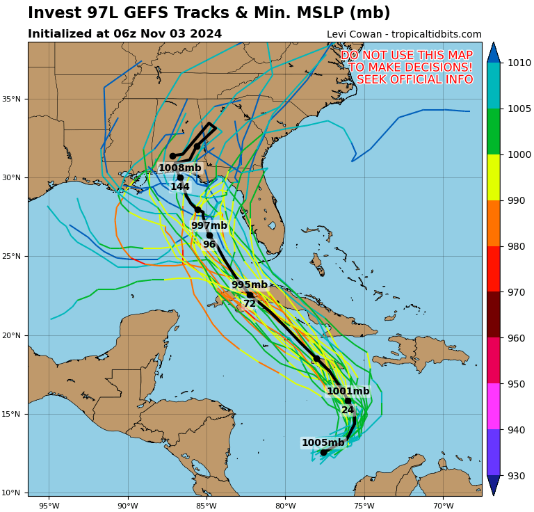
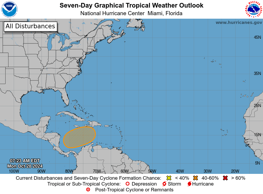
We still have an 80 percent chance of a tropical cyclone forming but the models all agree that it will move well to our northeast. In fact, it may keep us drier than normal by drawing in all the moisture. We will keep scattered showers in the forecast Monday and Tuesday morning, but I don’t expect a whole lot of rain and, as mentioned earlier, the end of the week looks quite dry.
Wind and Galaxy Wave forecast: This morning we have mostly northeast winds 5-10 mph, but we are still dealing with swell that keeps our seas 2-3 feet. As the storm passes north of us, we will keep those 3 foot seasa as the winds turn to the west, but still only around 5-10 mph. Toward the end of the week we will see quite calm sea conditions.
This coming week, especially Wednesday through Friday, will be perfect days for a seaside barbecue with the best meats on the island, custom cut at Carniceria Rosita.
Good morning Bay Islands. Our photo of the day comes from Guido Bertea in Lawson Rock. Our November winner gets a $50 gift certificate to Umbul Umbul.
Many of us midisland have already gotten over an inch of rain. This weekend we will continue to mostly overnight and early morning showers, but things should get drier as we get into next week.
A reminder for your TV watching and scheduling Zoom meetings with North Americans. North America will fall back tonight one hours (except Arizona, Hawaii and Saskatchewan). So the US Central Time zone (Chicago, Dallas) will be back on our time zone.
There is now an 80 percent chance of tropical cyclone development, but you will notice we are outside of the red box. The storm may actually make us DRIER as it pulls in all the moisture closer to Cayman and Cuba.
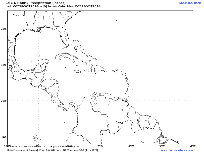
Here is the US GFS and you can see the storm moving well to our north. You can also see there is a lot less green (rain) on top of us starting Monday.
Wind and Galaxy Wave forecast: Winds continue to be light and mostly from the northeast, but because of swell (winds in other places) we continue to have 3 foot seas. Those conditions will continue until Tuesday when the storm give us a west/northwest wind that will still be light, but seas may get up to 4 feet northside.
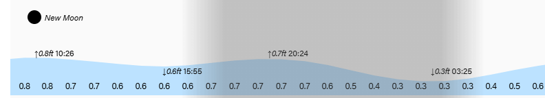
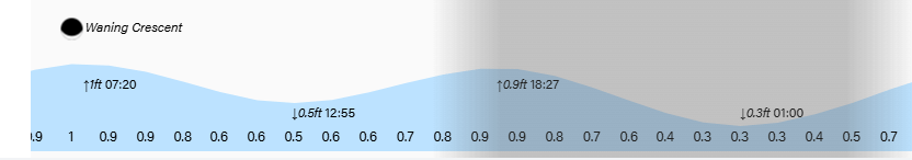
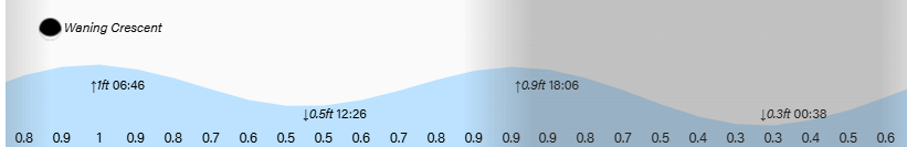
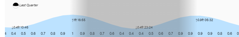
Low tides continue to run high. Have a great weekend.
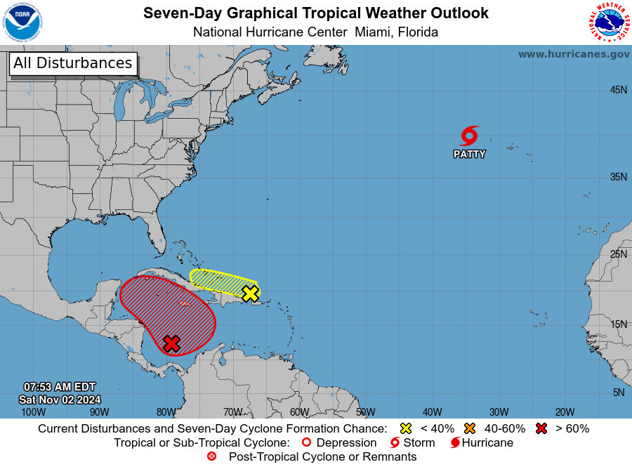
Good morning Bay Islands. Our photo of the day comes from Daniela Ciatto and shows a cruise ship heading back out to sea as the sun sets. Today is the first day of the November contest. The five most-liked photos compete for a $50 gift certificate at Umbul Umbul.* As we start a new month, all eyes are on the area north of Panama to see what storm may stir there this weekend. *No cash value. Certificate expires after six months.
Let’s start with the satellite at 8:30 a.m. Though most of the activity looks like it is to our west, Utila has picked up the most rain this morning, almost half an inch since midnight. Today and over the weekend we will still be dealing with scattered showers, but I think we will be seeing more midday sun and we will be more in the typical island cycle of rain coming overnight and in the early mornings.
Our weather early next week depends a lot on what happens with the storm system brewing north of Panama, which now has a 70 percent chance of becoming a tropical cyclone according to the National Hurricane Center. One of the thing that you can imagine when looking at this map is a big High pressure system over the northeast US, which should steer the storm to the northwest.
Here is the Canadian model forecast. I picked it because it makes the storm bigger and closer to us than any other model. But EVEN if this happens, it isn’t too bad for us. The storm would pass to our north sometime Tuesday, and we might get some showers on the south side of the storm and some westerly winds, it is probably still less rain than we’ve gotten this past week. Most other models show it weaker or (GFS) going much further north, which gives us even drier conditions next week. All in all, I think the weather next week will be better than the weather has been this past week, regardless of what this storm does.
Wind and Galaxy Wave forecast: Our winds continue to be from the northeast at 5-10 mph and seas around 2 feet. Our waves are coming from the northeast, so they may be a little wavier, to 3 feet, on the northeast side toward Diamond Rock and Camp Bay.
I don’t think the potential storm will be much of a factor early next week, but after it passes, late next week looks almost dead calm. These will be perfect days to purchase your Roatan Ferry Galaxy Wave tickets for only 600 lempira each way.
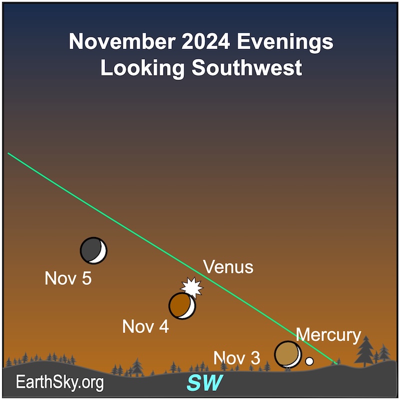
We’re in new moon phase, a great time for stargazing if we can avoid the clouds. In early evening twilight on November 3, 4 and 5, people across the face of the Earth can see the brightest planet, Venus, near the waxing crescent moon. Also nearby is the elusive planet Mercury. The lit portion of the slender crescent moon points to Mercury on November 3. And then, the moon will float close to Venus on the evening of November 4. Have a great Friday!
Good morning Bay Islands. Our photo of the day comes from Robert Rhorer, who captured this classic storm creating a waterspout near Big Bight on the first day of the month. It is a classic look at an updraft creating a waterspout that feeds the storm cloud. The top five most-liked photos will compete tomorrow for $50 in Café Rubio coffee. Next month, the prize will be a $50 gift certificate to Umbul Umbul.
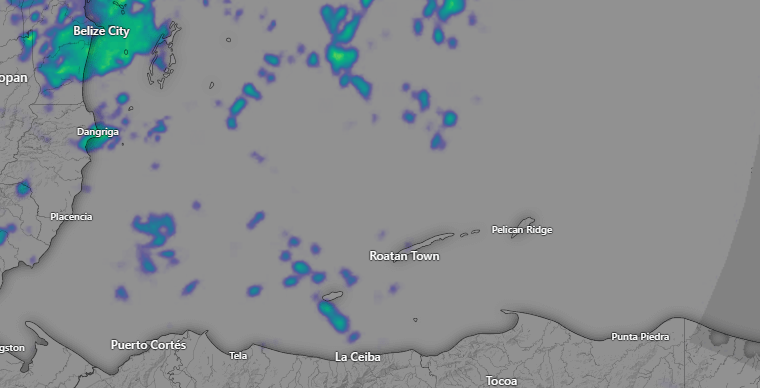
Here is the radar at 7:30 a.m. There are plenty of showers around and they are drifting to the west very slowly. We will keep a good chance of showers around today and into the weekend. Rain will be off-and-on and we will have periods of sunshine. Winds this morning are from the northeast at 5-10 mph and seas 2-3 feet. This evening we may see winds get up to 10-15 mph with 3 foot seas, but winds tomorrow into the weekend should be very light and seas remain 2-3 feet.
Here is the box for development of some sort of tropical storm. There is a 50 percent chance over the next week. The Canadian still has a storm developing and moving to our north. The GFS has a storm developing and moving well to our east. The Euro has a very weak storm moving north of us. In any case, all them say that next week will likely be less rainy than this week. That doesn’t mean no rain, it just means less rain.
Mitch Cummins is bringing his innovative, locally sourced pet food to cats, so get in touch with him at Roatan Pets if you want him to create a specially designed food for your feline friend.
Lowest tide is around 2 a.m. Have a great Thursday!
Good morning Bay Islands. Our photo of the day comes from Jenifer Mitchell looking back toward the southeast end of the island at sunset. We had a relatively dry day yesterday and it was nice while it lasted. We are back in the off and on rain showers today through the weekend but we have hopes of a little less rain next week, but also watching the tropics.
We had a round of showers around sunrise and those clouds are still building to our north, but we also have blue sky to our south, so we will keep a chance of showers through the day, but we also should see some sun. Rain chances will remain good through the weekend, but of course it won’t be constant and we will have periods of dry weather, especially middays and early afternoons.
We still have a 40 percent chance of some sort of tropical storm development this weekend or early next week north of Panama. The models are all over the place and many give us drier conditions next week with the storm moving well away from us.
The Canadian is the only model to forecast a tropical storm/hurricane, but even the Canadian has it going well north of us next week.
During my trips to the States I find myself missing my chorizo, so imagine my surprise when I walked into an international grocery and found a package labeled “Honduran chorizo.” It really is world famous, and you can get the real deal at Carniceria Rosita. Low tides continue to be not very low. Have a great Wednesday!
Good morning Bay Islands. Our photo of the day comes from Keri Weitz Meyer on Calabash Key. Just a reminder that on Friday our five most-liked photos will compete for $50 in free Café Rubio Roatan coffee. We are hoping to have one dry day, and maybe night, and maybe even tomorrow morning.
There are quite a few storms to our north, but they should stay north of us and we should stay mostly sunny and dry. That should continue tonight and, perhaps, into tomorrow morning before scattered showers return tomorrow afternoon and for the rest of the week.
Wind and Galaxy Wave forecast: Our winds are very light and mostly from the southeast this morning, with 2 foot seas. Winds will remain quite calm through the week and seas will remain around 2 feet.
Our area of concern for this weekend stays mostly unchanged from the National Hurricane Center. Most models say this will become some sort of tropical cyclone. The GFS and German ICON say it will move north away from us. The Euro and the Canadian say it will move north then turn west, but still miss us to our north as it moves along the southern coast of Cuba.
Explore Roatan real estate with the island’s top experts at Roatan Life Real Estate. Serving clients since 2001, we offer personalized guidance in buying and selling properties. Trust our dedicated team for unparalleled local knowledge. Start your journey at http://www.roatanlife.com.
Low tides continue to be quite high. Have a great Tuesday!
Good morning Bay Islands. Our photo of the day comes from Nana Paluch and shows the view from West End above Sunset Villas. Yesterday most of us picked up 1-2 inches of rain. Most of us this morning have already picked up a quarter to half an inch as of 7:40 a.m. but Guanaja already has 1.5 inches!
Here is our satellite at 7:45 a.m. and you can see the heavier storm near Guanaja. These are slowly moving from east to west. We will have a good chance of showers through the day with a few peaks of sunshine. Tonight we will also have a good chance of showers, but we should get a break tomorrow, perhaps into Wednesday morning. Wednesday midday and afternoon the showers pick back up, but perhaps not as much as we’ve had the past two days. Good chances of showers last through the weekend. There is still hope that next week might be drier, depending on what our tropical system does.
The National Hurricane Center has raised the chances of a tropical depression to 40 percent just north of Panama. If this develops, it would start this weekend. Most of the computer models have this storm moving north/northeast away from us but …
Here is the Canadian model, the one model that has the system rebounding closer to us. The end of this forecast is Nov. 6, so that is a long way away and I wouldn’t get too worried, but we will keep an eye on the possibility.
Wind and Galaxy Wave forecast: We wake up to north winds around 5 mph and seas around 3 feet. Winds will remain fairly calm and seas should calm to around 2 feet today and stay there for awhile.
Oct. 26, 2024: Good morning Bay Islands. Our photo of the day comes from Heather MacNaughtan and was taken at Anthony’s Key. Remember, our top five most-liked photos compete Nov. 1 for $50 in Café Rubio coffee.
This morning we have showers and thundershowers. Those will continue off and on today, with even more rain and clouds in the forecast for Sunday and Monday. Tuesday is our best bet next week for some dry weather, but we will have scattered showers all next week. The extended forecast gives us hope for drier weather the week of Nov. 3.
Winds will be light and variable today with seas 2-3 feet, but tomorrow we will have northeast winds 15-20 mph and seas 4-5 feet. Starting Monday we get calmer, with light and variable winds and seas 2-3 feet most of the week. Have a great weekend!
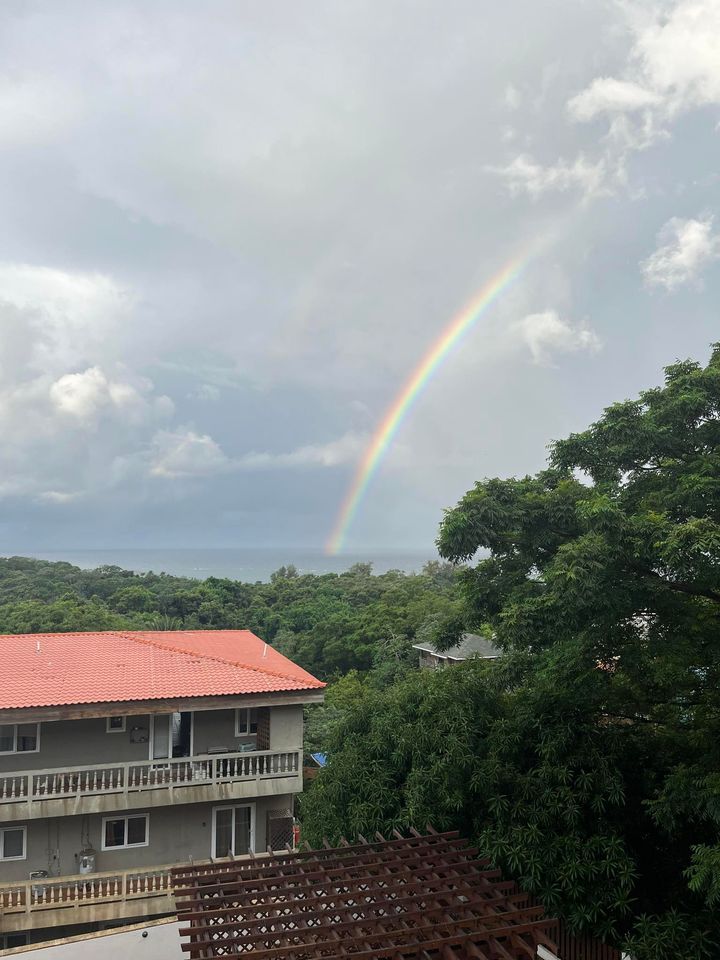
Good morning Bay Islands. Our photo of the day comes from Daniel Rice and if you want the pot of gold at the end of this rainbow between West Bay and West End you have put on your diving gear. We’re looking at a pretty wet weekend ahead, but also fairly calm winds and seas with the exception of Sunday.
At 8 a.m. we have lots of cloudiness and rain likely, especially over Barbarat and Morat this morning. We will continue to deal with scattered showers, but also periods of sun today and tomorrow. Sunday is the day that we may see cloudy skies and extended downpours. Overall we’re looking for 2-3 inches today through the weekend. Winds are light and variable, but we are still dealing with some swell, causing 2-3 foot seas, especially north side. Sunday evening and night we might get some brisker conditions, with northeast winds 15-20 mph and seas up to 5 feet northside.
I know if you’re in the States watching these forecasts it can seem like it is raining all the time, but most days showers pass by and the sun comes back out. If you want a tour that will help you dodge the rain and chase the sun, look up Jolly Roger Roatan. They will keep the good times rolling, even during our tropical showers.
High tide is 5 p.m. and 5 a.m. Have a great Friday!