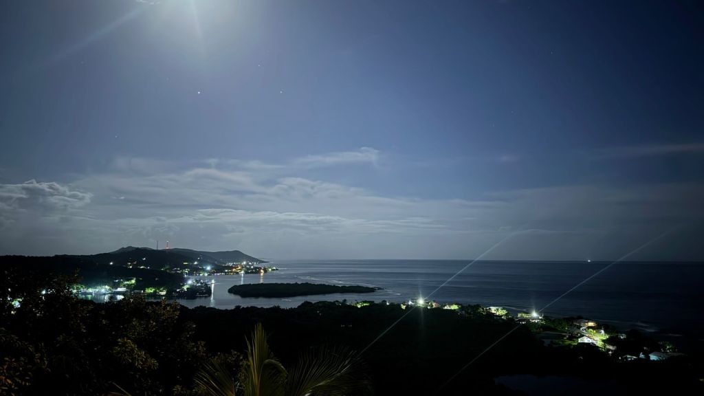
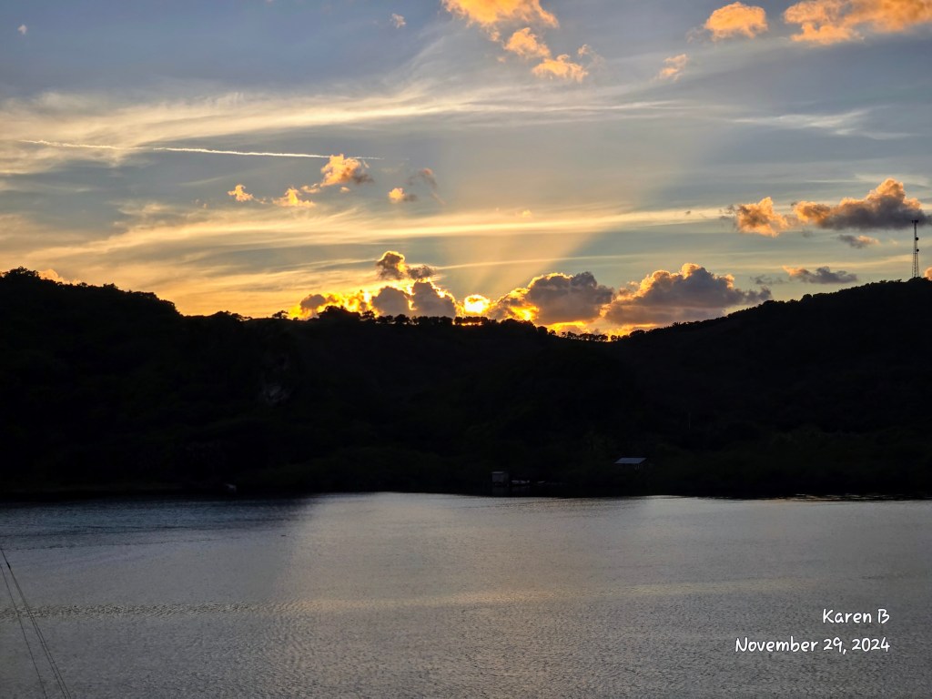
Good morning Bay Islands. Our photo of the day comes from Pamela Darby who brings us this lovely cloud formation against blue sky yesterday on the east end.
Sorry for the late update but today is the day Mrs. Roatan Weather gets her ankle surgery. We’ve had a rainy morning, especially mid island west. The west end also seems to be dealing with a power outage until 1 pm.
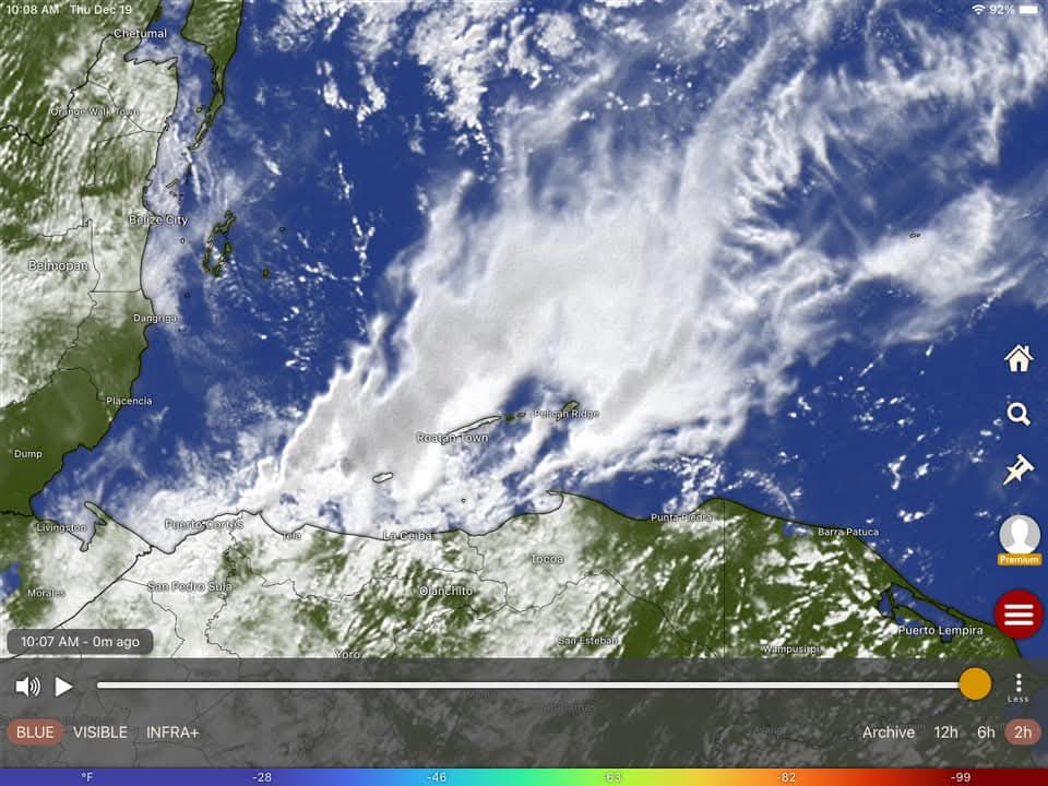
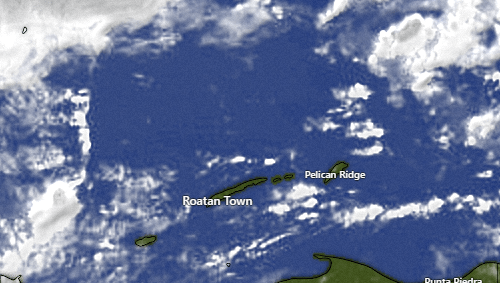
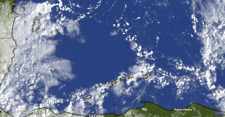
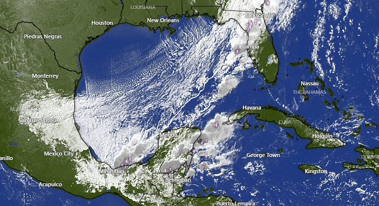
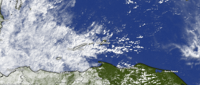
Our 10 am satellite shows that the worst of the rain has moved to our north. The west end got a bit more than an inch, while the east end has only gotten a few hundredths of an inch.
We will have scattered showers today and tomorrow with perhaps a few peaks of sun midday and afternoons. Friday into Saturday we should have some stronger, steadier rains with a fairly weak norther coming in.
Wind and Galaxy wave forecast: quite calm today and tomorrow with northwest winds 3-8 mph and seas 1-2 mph. Friday night through Monday morning we will have northerly winds 10-15 mph and seas 3-4 feet. After that winds and seas get quite calm. It should be a fairly nice holiday week. We will even get trade winds back for New Years for the first time in awhile.

If you need holiday meats, you need Carniceria Rosita. Keep in mind they will close at 5 pm today for their company holiday dinner.
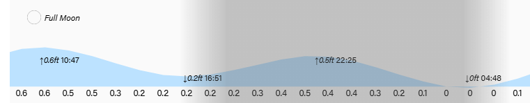
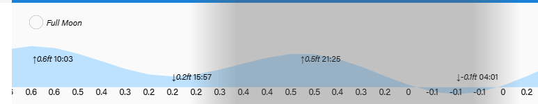
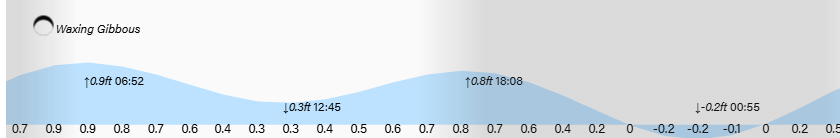
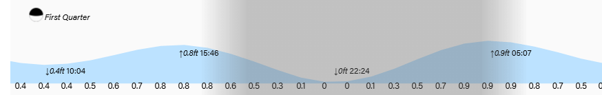
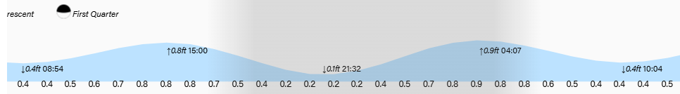
Low tides are 7 pm and 6:30 am. Have a great Thursday!