February 23, 2025

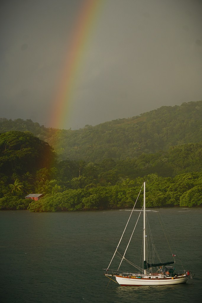
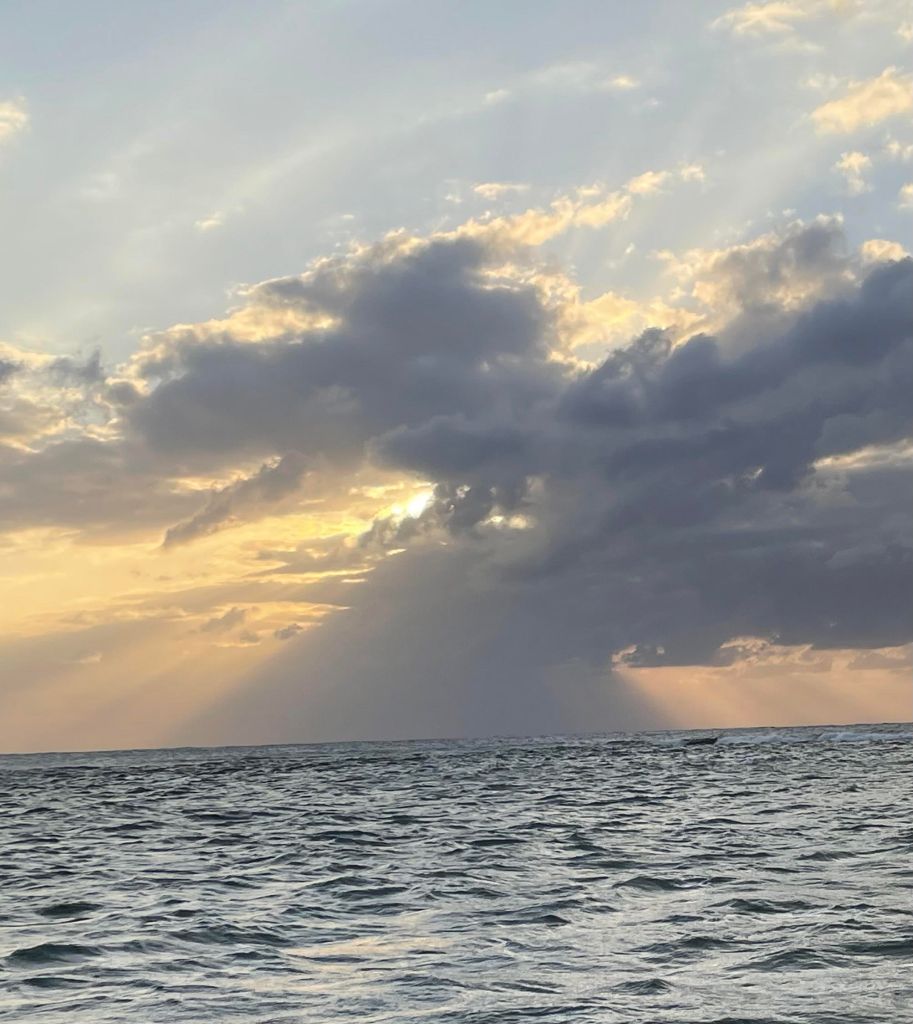
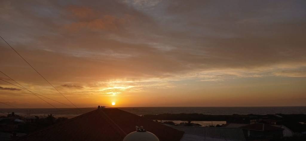
Good morning Bay Islands. Our photo of the day comes from Yoel Mendez in Los Fuertes.
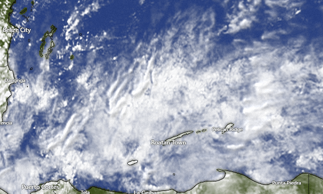
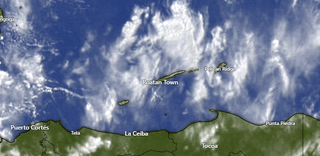
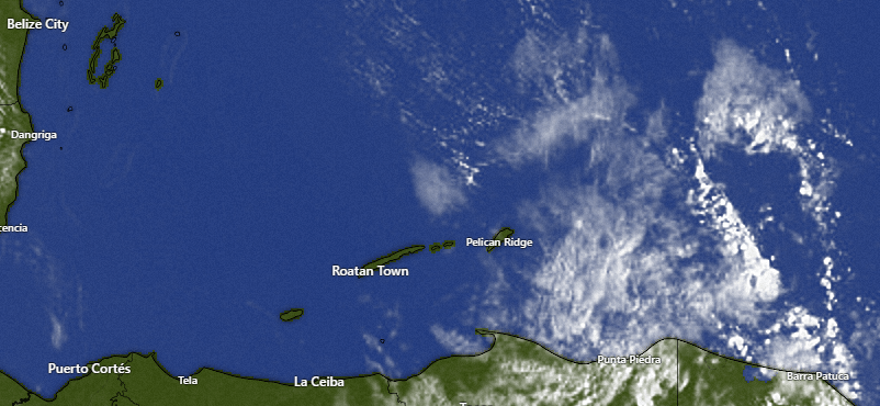
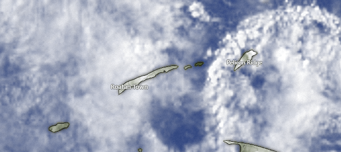
We have scattered showers across our islands this morning. Those should decrease as the day goes on.
By the way, we are still looking for advice on a good weather station that doesn’t require batteries in the external unit if anyone knows of a station like that. Thanks in advance.

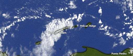
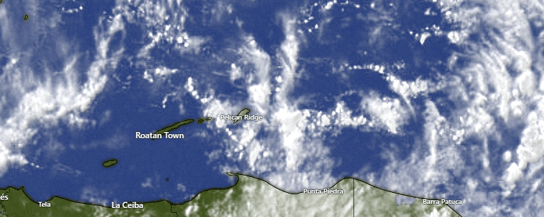
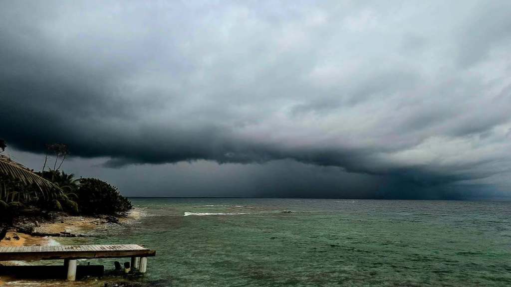
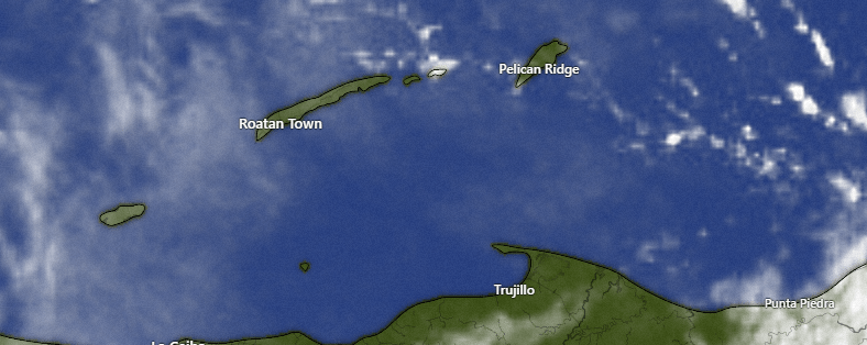
We have some clouds passing over the islands bringing some showers here and there this morning. Most of us have gotten between a tenth and a quarter of an inch. Our rain chances will continue this morning, but the midday and afternoon look dry. Overnight doesn’t look rainy, but there will be a small chance of a morning shower with most of Monday being dry. Tuesday we have a small cold front coming, perhaps the last one of the season, that will bring scattered showers. Wednesday and Thursday should be mostly dry then Friday we will have another decent chance of rain.

Wind and Galaxy Wave forecast: This morning we have east winds 10-15 mph and seas still around 3 feet. We should see those winds calm to 7-12 mph this afternoon and seas 2-3 feet. Tomorrow will be quite calm with light and variable winds and seas 2 feet. Tuesday winds turn to the north around 10 mph and seas 2-3 feet. Wednesday and Thursday winds will be from the east around 10 mph and, perhaps for one last time this season, they turn from the north around 10 mph on Friday.

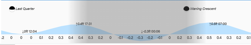
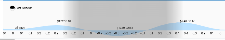
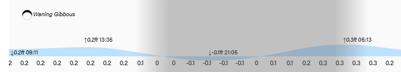
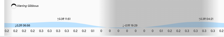
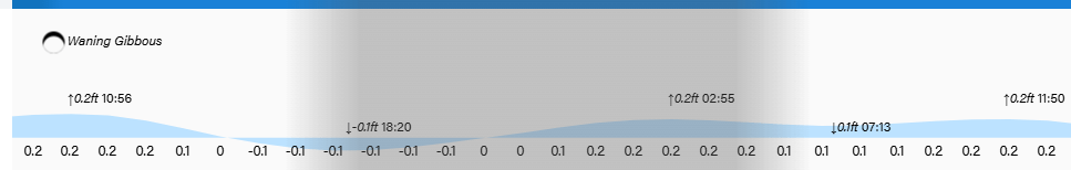
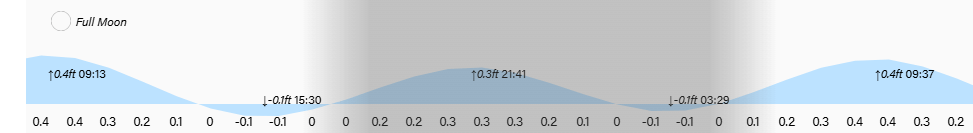
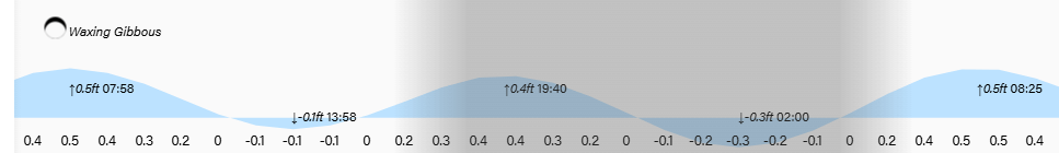
Low tides are noon and midnight. Have a great Sunday!

February 21, 2025

Good morning Bay Islands. Our photo of the day comes from Theresa Nelson in Johnson Bight. We can get more rainbows today if we can get enough sunshine.

We have quite a bit of clouds this morning and scattered showers around. It hasn’t amounted to much for most of us, just a few hundredths of an inch, though Punta Blanca and Politilly have gotten around a quarter of an inch. We will have rain chances throughout today, tonight and tomorrow, but it won’t be washout, just periods of showers. Sunday morning has a chance of showers, but most of the day Sunday should be dry. Drier weather continues into Monday, but scattered showers return for Tuesday.

Wind and Galaxy Wave forecast: This morning we have east/northeast winds 10-15 mph and 3 foot seas. We will stay around there today with one more night of 15-20 mph northeast winds. Tomorrow the northeast winds calm to 10 mph and seas 2-3 feet. Starting Sunday and into next week we will have light and variable winds and seas 1-2 feet. All in all a great week to be out to sea.

I wanted to take a moment to ask if any of you have had a good experience with a weather station that is all-solar energy. The reason I ask is many of us mount the exterior weather station on a roof, making it difficult to change the batteries. If you know of a good solution, please email me at bookmybio@gmail.com.

Just a reminder that the winner of this month’s photo contest wins a $100 gift certificate to Prime 504 resto & bar. Send photos to bookmybio@gmail.com with name and location! You’d be surprised how many photos I get without name and/or location.

Lowest tides are 11 a.m. and 11 p.m. Have a great Friday!

February 20, 2025

Good morning Bay Islands. Our photo of the day comes from Joyann Villalta Sanders who has been observing this hummingbird momma raising her young in this nest. Hummingbirds are among my favorite of God’s creations. Humans are OK, but I really like hummingbirds.
Humans and hummingbirds are probably going to have to deal with scattered showers tomorrow.

On the broad satellite view we can see the cold front coming down through The Gulf toward us. After a mostly sunny day today we will see increasing clouds tonight into tomorrow. Best chances of rain are tonight into tomorrow morning and tomorrow night into Saturday morning, but we will also have rain chances during the day tomorrow. Rain totals don’t look to be much more than half an inch to an inch for most of us.
Rain chances return for Monday night into Tuesday, though the models are pushing most of that rain to our east.

Wind and Galaxy Wave forecast: Winds this morning are from the east at 15 mph with 3 foot seas mostly south side. Winds this evening will turn more to the northeast at 15 mph, which should give us a bit more surf on the north side. We’ll keep those northeast winds through tomorrow night. Sunday we see much more calm winds and seas and those will continue into next week.

Thursday is a good time to start thinking about that weekend trip you’ve been promising yourself to see Guanaja for the first time. You can leave at noon Friday and return Sunday morning and have a quick two-night vacation on the island that retains an old-Bay Islands feel.

Tides remain low. Have a great Thursday!

February 19, 2025

Good morning Bay Islands. Our photo of the day comes from Elizabeth Sherry in Punta Gorda. Our next best chance for seeing a rainbow comes Friday morning into Saturday morning.

Our satellite is clear this morning, so I thought instead I would show you the German ICON prediction for the next few days. We should be mostly sunny today and tomorrow.
Friday into Saturday morning is our next good chance of rain, as a weak cold front comes toward us. Saturday afternoon, Sunday and Monday look dry, and our next rain system comes in Monday night into Tuesday morning.

Wind and Galaxy Wave forecast: Today and tomorrow we will continue to have easterly winds around 15 mph and seas 3 feet. Thursday night into Friday morning, winds should shift to the northeast 10-15 mph and seas calming to 2 feet. Winds will get quite calm Sunday into next week and seas will calm to 1-2 feet for much of that period.

All Roatan Pets products are certified 100% pure, all-natural and have a money back guarantee. If you are unsatisfied with any product, simply return the opened product within 30 days of purchase for a full refund. They can also provide another recipe/flavor in place of refund should you choose to do so.

Tides continue to be quite low. Have a great Wednesday!

February 18, 2025

Good morning Bay Islands. Our photo of the day comes from Nancy Sikora in Carib Bight. We had some rain on the east side around 4 a.m. with Diamond Rock getting the most, about a third of an inch. We have a small chance of a shower the rest of the day.

On satellite at 7:30 a.m. we see quite a bit of clouds near Guanaja and to the east. These are moving north/northwest. The GFS wants to give us a midday shower, so we will keep a chance of rain in the forecast today. After that we should be dry until Friday, when another system comes in and gives us good chances of rain Friday, Friday night and Saturday morning. After that another system comes in for Monday.

Wind and Galaxy Wave forecast: We start out the day with east winds 15 mph and seas 3 feet. Tonight will be the windiest night of the week with east winds 20-25 mph and seas 4-5 feet. Tomorrow through Thursday we should be around 15 mph and starting Friday and into next week winds and seas get much calmer, as cold fronts interrupt our easterly trade winds.

Here’s what one recent customer said about Jolly Roger Roatan: I was on the Jolly Roger Roatan last week, and I cannot say enough great things about this excursion! The staff went above and beyond for me. I am a below-the-knee amputee that was very excited to snorkel. I was assisted on board by numerous crew members who wanted to help me. Once I had my leg back on the party really began! A delicious lunch was served in a very orderly manner, and the rum punch, (and other beverages) started to flow freely!

Tides continue to run low. Have a great Tuesday!

February 17, 2025

Good morning Bay Islands. Our photo of the day comes from Deanna Jones in Parrot Tree. It might be titled “What the Surf Leaves Behind.” One of my peeves is folks who treat the ocean as their personal trash can.
We will have midday calm before getting back to some consistent easterly winds with rain chances before and after this weekend.

Our 8 a.m. satellite has the kind of high cirrus clouds that generally don’t contain rain. We will be mostly dry this week, with a very small chance of rain tonight and tomorrow night. Friday the tail end of a very weak norther may bring us better rain chances. The weekend looks dry again before rain chances go up for Monday.

Wind and Galaxy Wave forecast: Our early morning easterly winds of 20 mph have already calmed a bit to 10-15 mph and will calm even more around midday to 5-10 mph and 2 foot seas. Winds will get back up to 15-20 mph tonight and will generally be 10-15 mph during daytimes this week with 3 foot seas, especially southside.

If you’re in the market for your island dream home, head over to http://www.roatanlife.com and check out their many great offerings in all parts of the island.

Tides continue to run low. Have a great week!

February 13, 2025

Good morning Bay Islands. Our photo of the day comes from Jorge Guevara at West Bay.
Wind continues to be the story, with gusts to 30 mph last night. Winds will calm this weekend and we are watching for a chance of rain Friday evening

On satellite at 8:30 a.m. we see some high clouds to our east moving northwest. We may see a few clouds, especially east side, but rain is very unlikely today. We are watching a small disturbance that could give us a chance of rain tomorrow, especially late afternoon or evening, but it shouldn’t be much. After that the weekend and early next week looks dry. A cold front we were watching for the end of next week looks like it will die before it gets here, which is common for mid- to late-February.

The weather story has been these easterly trade winds. They will be 15-20 mph today with 3-4 foot seas southside today and 20-30 mph with 4-5 foot seas tonight. Tomorrow will be similar, then this weekend things will calm a little, with Monday being the calmest day of the week, with midday winds perhaps 7-12 mph.

To celebrate us achieving 10,000 followers, we welcome our newest sponsor, Paya Bay Resort. Susan and I have spent many a pleasant evening watching the sunset there with a great meal. Paya Bay Resort is running some great specials for a special day tomorrow.

Low tide is 3:30 p.m. and 3:30 a.m. Have a great Wednesday!

February 11, 2025

Good morning Bay Islands. Our photo of the day comes from Wendy Ousley and it is what she calls “a pyramid of rain on West Bay.” West Bay got about a quarter of an inch around 2 a.m., but the rain winner this morning has been the east side and Guanaja with over a half inch in Camp Bay and Guanaja.
We will have a shower here or there this morning, but we will get drier and sunnier this afternoon.

On satellite this morning we see a lot of clouds around at 8:30 a.m. and maybe a break in the clouds over the east side, with more clouds coming in over Guanaja. Theses clouds are moving to the west so we will keep a chance of a morning shower, but drier midday and afternoon. A chance of a shower comes back this evening and overnight, but we still look for a dry trend, especially Wednesday, Thursday and Friday morning, with a better chance of a shower Friday night into Saturday morning.
In the long range forecast we’re looking at the possibility of a weak norther toward the end of the 10-day forecast.

Wind and Galaxy Wave forecast: Winds continue steady at 15 mph from the east and 3 foot waves, especially southside. Tomorrow evening is when we will see those winds strengthen to 30 mph and 4-5 foot waves overnights and 20 mph and 3-4 foot waves daytimes. Winds will calm back down to 15-20 mph as we get into the weekend.

I know how stressful it can be going on a shore excursion on a cruise and worrying about getting back to the boat on time and whether you can trust your guide. Leave those cares behind with a guaranteed stress-free excursion from Jolly Roger Roatan.

Lowest tides are 2:30 p.m. and 2:30 a.m. as we move into full moon period. Have a great Tuesday!

February 10, 2025

Good morning Bay Islands. Our photo of the day comes from Brad Ryon at Little Bight in Utila and shows a rainstorm. Locations midisland and east got some rain this morning, but rain will become increasingly rare this week.

We have quite a bit of cloud cover at 7:30 a.m. Locations midisland and east got about a quarter of an inch of rain between 3 and 4 a.m. while Guanaja picked up .05 around 7 a.m. So there is still a chance of a shower this morning, but most of us should stay dry. The afternoon will be dry and tonight there is a small chance of a shower. After that there is very little chance of rain through the end of the week.

Wind and Galaxy Wave forecast: Today and tomorrow we continue with the 15 mph east winds and 3 foot seas we’ve seen for quite some time now. Wednesday through the end of the week trade winds pick up, 20 mph and 3-4 feet during the day and 30 mph and 4-5 feet at night.

Explore Roatan real estate with the island’s top experts at Roatan Life Real Estate. Serving clients since 2001, we offer personalized guidance in buying and selling properties. Trust our dedicated team for unparalleled local knowledge. Start your journey at http://www.roatanlife.com.

Low tides are 2 p.m. and 2 a.m. Have a great week!

February 9, 2025

Good morning Bay Islands. Our photo of the day comes from Tricia Power in West Bay.
That was some excitement last night wasn’t it?

Last night’s 7.6 earthquake occurred about halfway between Guanaja and Grand Cayman at 5:23 p.m. local time. If there had been tsunami waves it would have taken about an hour to get here. A little over an inch of abnormal wave activity was recorded at Isla Mujeres off the Yucatan Peninsula. My first reaction was that that was an odd place for a quake, but it was on the fault between the Caribbean Plate and the North American Plate. This is a strike-slip fault, meaning that the plates are moving in opposite directions as opposed to crashing into each other. Tsunamis are rare in such faults, but rare doesn’t mean impossible, so it is good to be quake-aware. It is fortunate that a 7.6 happened so far out to sea. If one happened closer to us there would no doubt be damage.

At 7:45 a.m. our satellite is mostly clear with some high cirrus clouds overhead and one cloud over Barbarat that might have a light shower in it. Midisland got a shower around 2 a.m. good for about a quarter of an inch, with lighter amounts east side. Now begins our dry week, with very small chances of overnight showers and dry days.

Wind and Galaxy Wave forecast: We continue steady with east winds around 15 mph and seas 3 feet. The period Wednesday through Friday winds kick up to 20 mph days and 30 mph nights.

Happy Super Bowl Sunday to those who celebrate, but if you’re like me and you couldn’t care less about the Chiefs or Eagles, head over to Ikigai by Robby Molina for their Sunday lobster deal. And if you do care about the Chiefs and Eagles, head over for a pregame lobster lunch!

Low tides are 1:30 p.m. and 1:30 a.m. Have a great Sunday!