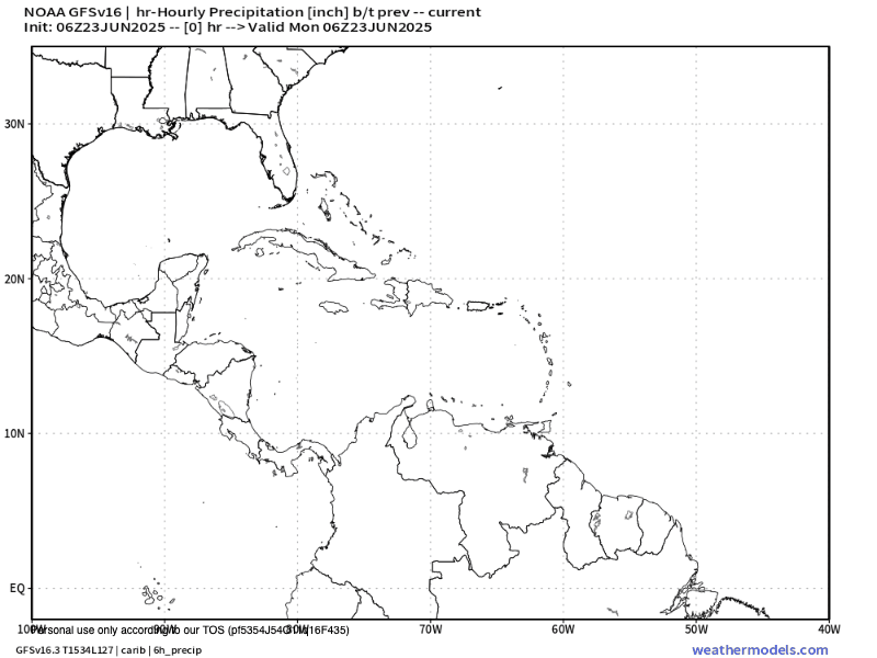
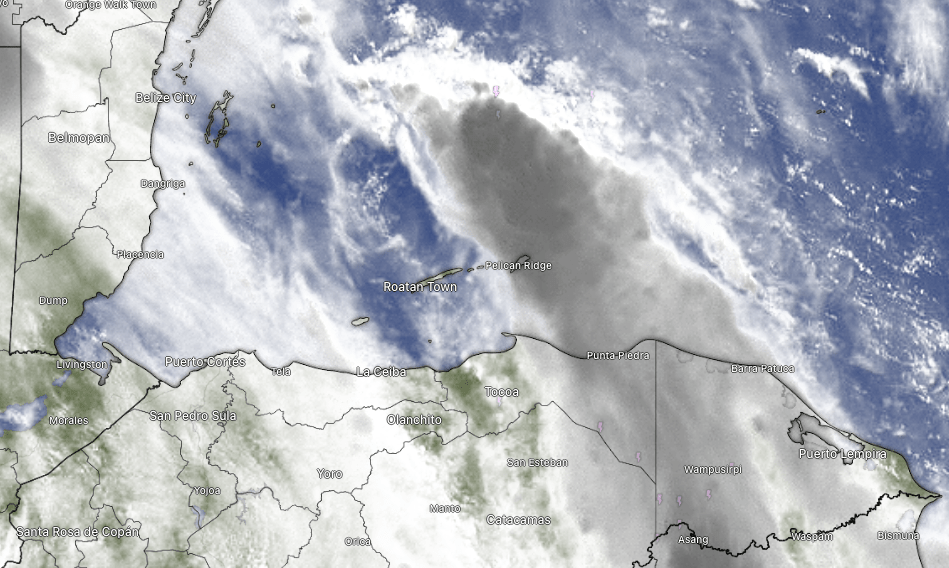
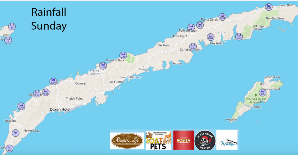
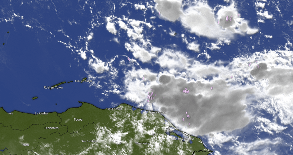
Good morning Bay Islands. We have a storm system moving across the islands this morning. Some locations midisland as of 7 a.m. have picked up an inch. As of 7 a.m. West Bay and West End hadn’t gotten any rain, but they might catch some as this thing passes over.
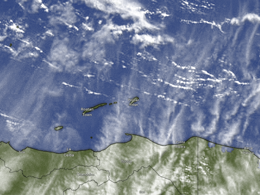
Here is the radar from 6 a.m. to 7 a.m. Radar is pretty weak because it comes from Belize City, but you can see some intensification in the storm as it approaches the east side with several lightning strikes around 7 a.m. We should see this pass over the island in the next couple of hours. It is possible Utila and maybe even West Bay may miss most of the rain. From midday into the afternoon we will be back to our low chances of isolated showers with partly cloudy skies. As we go through the week, rain chances continue fairly low, but better chances overnights and mornings.
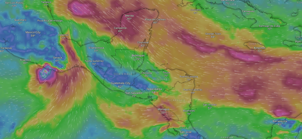
Wind and Galaxy Wave forecast: We wake up to east winds 20 mph and seas 3 feet. Today and tomorrow our daytime winds will be right around there, but nighttime winds will increase to 25 mph and seas 4 feet. Thursday and Friday winds will calm slightly to 15 mph and 2 feet daytime and 20 mph and 3 feet nights.

Guanaja Conch Festival commemorates the discovery of the island by Christopher Columbus. It runs from July 26 to August 3. Roatan Ferry Galaxy Wave is offering extra runs to the island from Roatan for the festival. Now is your chance to see the Bay Islands’ hidden gem.
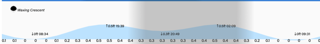
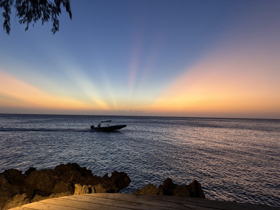
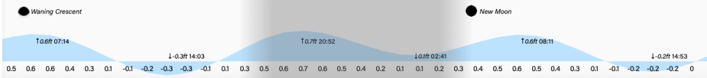
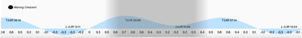
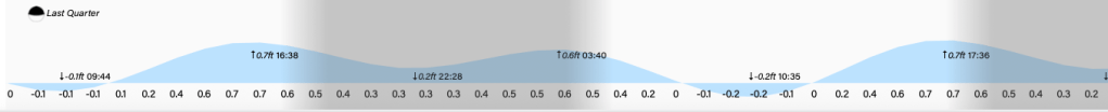
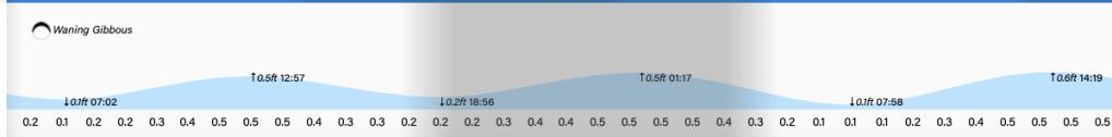
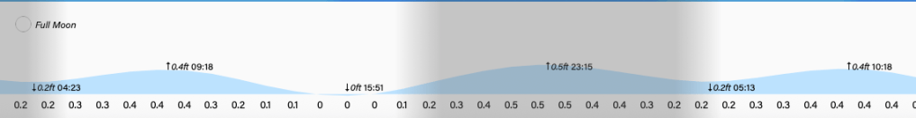
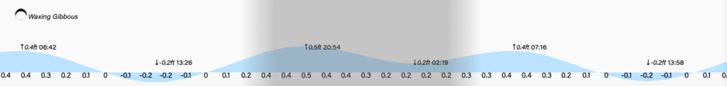
Low tide is 8:30 a.m. Have a great Tuesday!