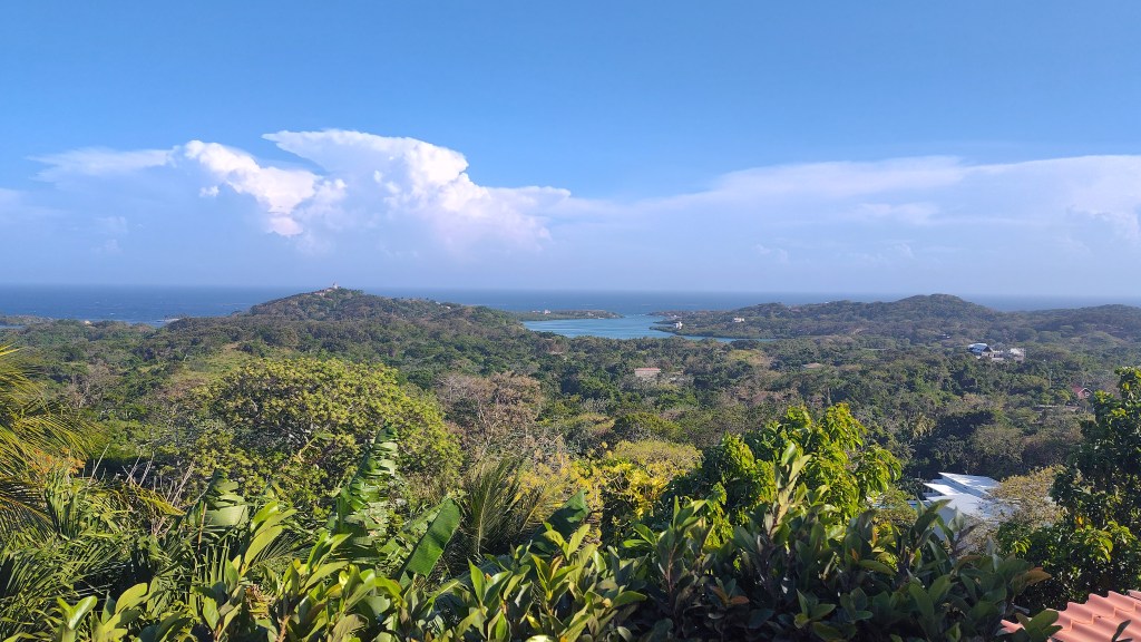
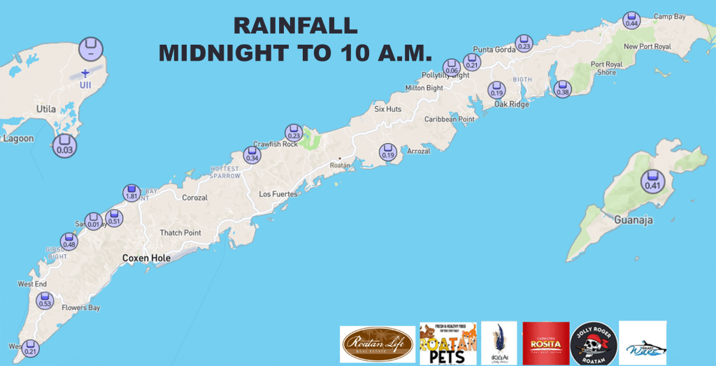
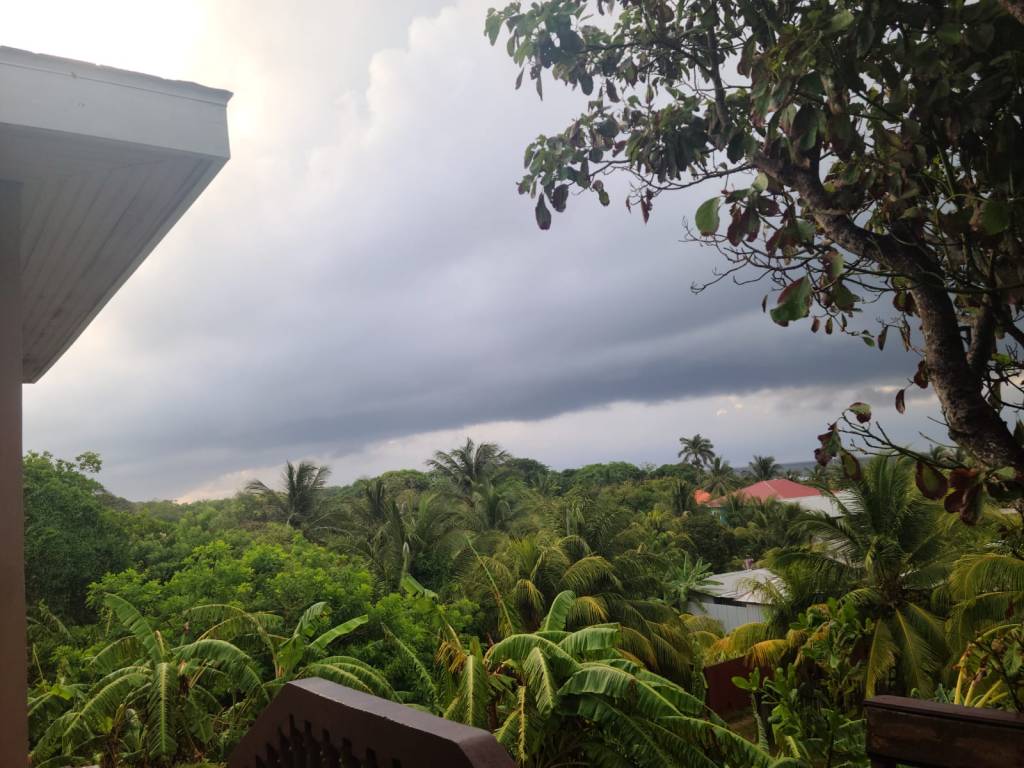
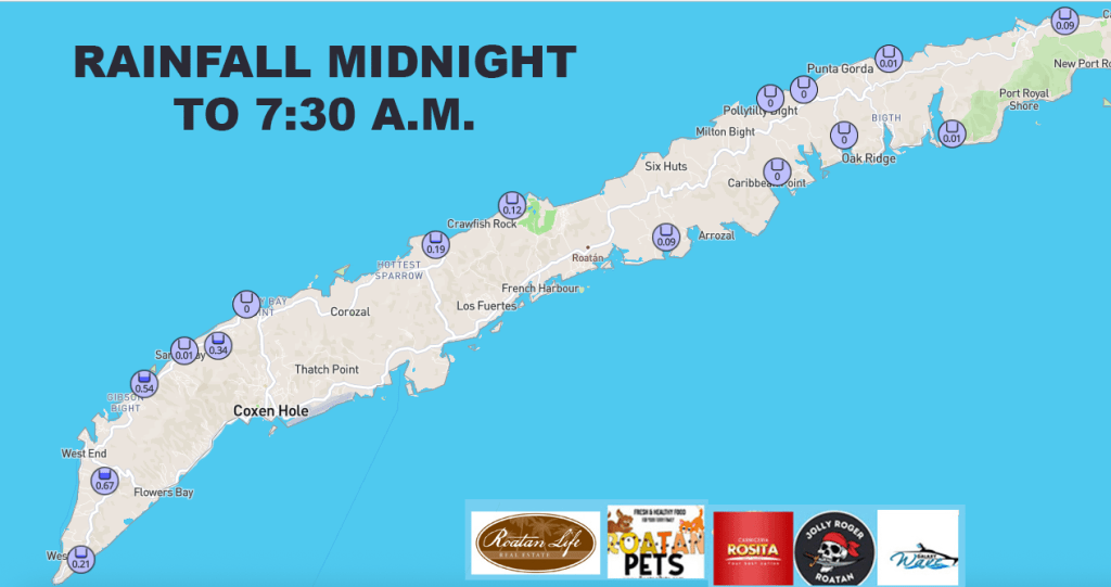
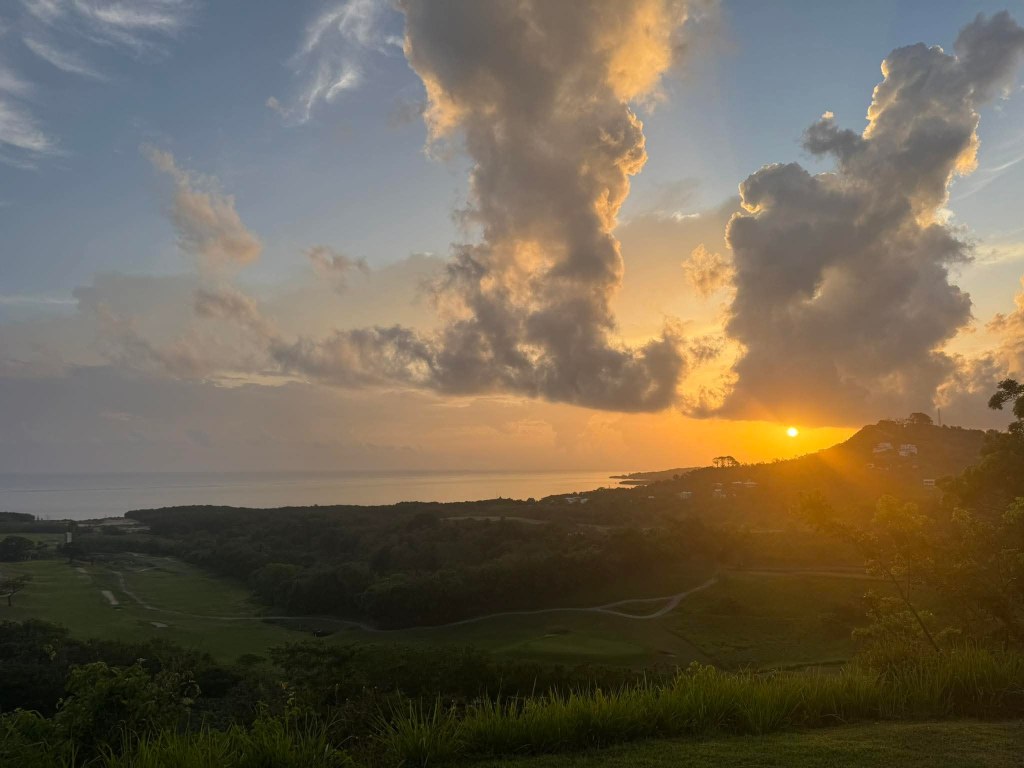
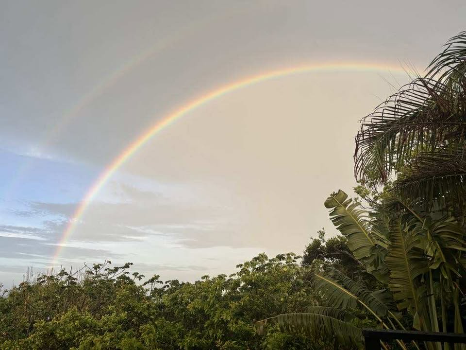
Good morning Bay Islands. Our photo of the day comes from Nicol Huff near Parrot Tree midisland. It shows the rising sun peeking through the clouds. We have a few clouds around and some showers here and there, but totals since midnight are only a few hundredths of an inch. Better chances for heavier rain come tonight into tomorrow morning.
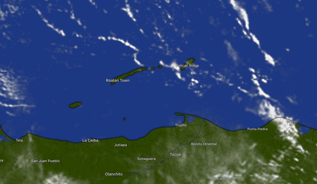
Our satellite for the hour from 6:30 to 7:30 a.m. shows some popcorn clouds moving across the islands. These generally have quick downpours in them if they have any rain at all, thus keeping totals low. We should be fairly dry through midday, but as we get toward evening we should see an increase in clouds toward evening and a good chance of heavy rain tonight into tomorrow morning and a decent chance of rain through the day tomorrow. Starting Wednesday we will be back to 40 percent chances of rain, mostly overnights and mornings for the rest of the week.
Wind and Galaxy Wave forecast: We wake up to quite calm conditions, with east winds 5-10 mph and seas 1-2 feet. We should stay right around there today and tomorrow, getting slightly windier overnight. Starting Wednesday we will be back to 15 mph winds and seas 2-3 feet.

Explore Roatan real estate with the island’s top experts at Roatan Life Real Estate. Serving clients since 2001, we offer personalized guidance in buying and selling properties. Trust our dedicated team for unparalleled local knowledge. Start your journey at http://www.roatanlife.com.
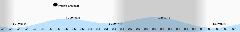
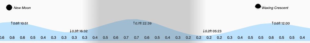
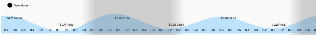
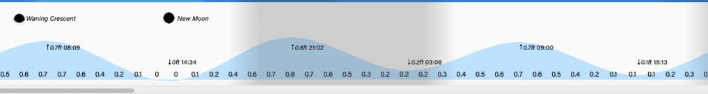
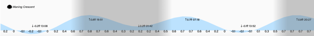
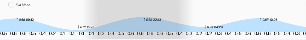
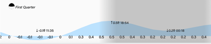
Tides will be fairly mild. Have a great week!