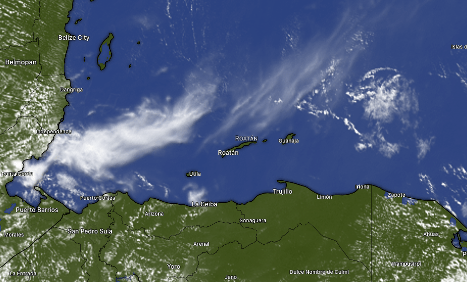
Good morning Bay Islands. At 9 a.m. we likely don’t have rain anywhere in the southern Caribbean, only some high clouds that aren’t going to keep our temperature away from 90 (32C). We will continue to have strong east winds and seas around 4 feet Southside.
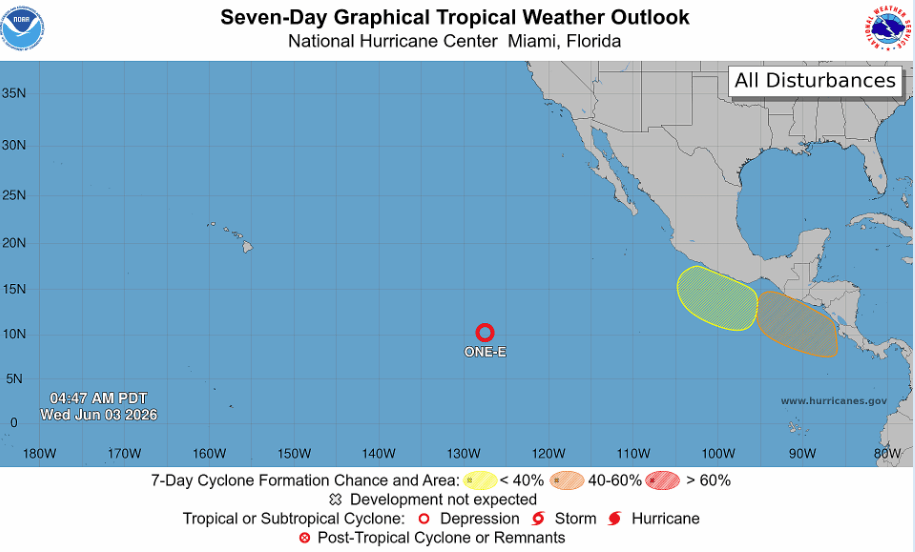
Here’s the NOAA NWS National Hurricane Center outlook for the next week in the eastern Pacific. You will notice a 40 to 60 percent chance of a tropical cyclone forming off the southern coast of mainland Honduras. This is where storms often form this time of year and bring rain to the Pacific Coast, not our coast.
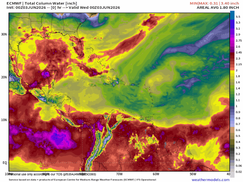
Here is the Euro forecast for moisture in the upper atmosphere. Currently we are in the dry yellow, and over the next few day we will get into the even dryer greens, so very little chance of rain this week. As we get into next week we will see an increase in moisture and better chances of June squalls. You will also note that at the end of this loop, something that looks like a tropical cyclone forms in the Gulf that lies between the US and Mexico. This is another area that often gets June tropical development. Right now, nothing in the short- or long-range forecast threatening our islands, but we’ll keep an eye on it. Have a great Wednesday!
