
Good morning Bay Islands. Our photo of the day comes from Tim Blanton and shows sunrise at CocoView.
Over the next week we will see some peaks of sunshine but a lot more rain. On the bright side, we were only 84 degrees most of the day yesterday with dewpoints around 70. That is quite comfortable and those cooler conditions should accompany clouds and rain for the week ahead.
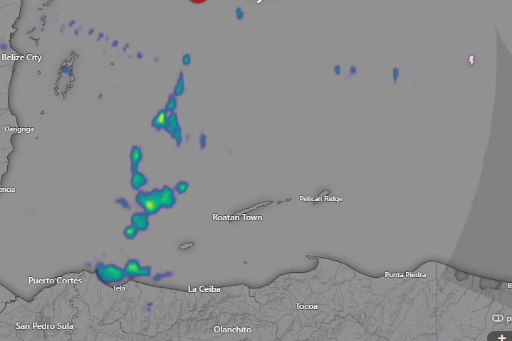
Let’s start with the radar this morning. There are showers to our west that are drifting southeast. As the day goes on we should see increasing showers and those showers will be off and on through the weekend and into next week. A cold front will stall to our north on Tuesday, pushing more moisture our way.
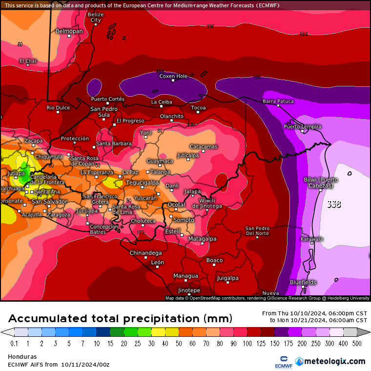
Here is the Euro forecast of rain for the next 10 days. It is forecasting 6 inches for the entire period. That is an average of about two thirds of an inch each day.

Here is the GFS for the same 10 days. It is forecasting 10 inches, and a lot of that is for the weekend of Oct. 18-20 when the GFS thinks a tropical system will move through.
Wind and Galaxy Wave forecast: We start the day with northwest winds 10-15 mph and seas 4 feet. We should start to see a calming trend in our seas, 3 foot seas tonight, 2-3 feet tomorrow and 1-2 feet Sunday. Winds will be 5-10 mph mostly from the west northwest.
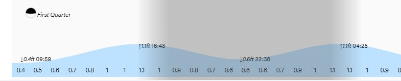
High tides remain quite high. Have a great Friday!
