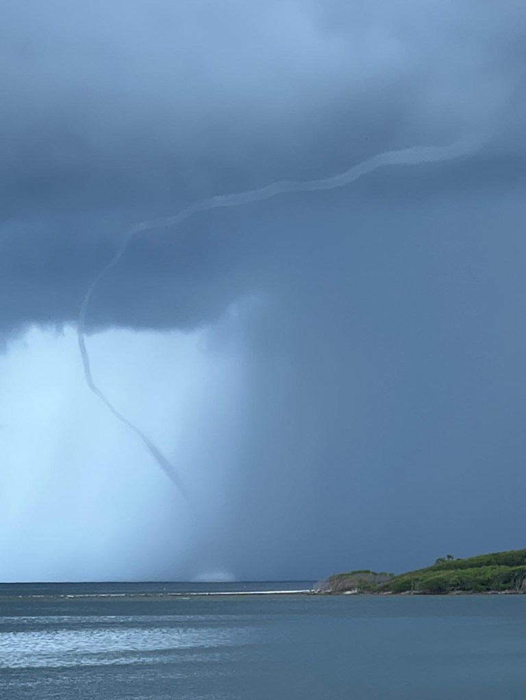
Good morning Bay Islands. Our photo of the day comes from Clyde Meyer, who captured this impressive waterspout yesterday afternoon in Brick Bay. I was actually driving by at the moment and saw my second waterspout in six years here. This was a rogue storm that formed suddenly yesterday afternoon, the kind of thing that can happen in the tropics. I always say waterspouts are generally harmless, but I guess if you were right under this one you would have gotten shaken up a little, judging from the way it stirred up the water at its base.
Here’s the rain totals from yesterday. Very little rain fell on the east side. The north side of the big island of Guanaja got .18 of an inch and no rain was recorded on Utila.
Here is the satellite from 6:30 a.m. We see a lot of showers and storms to our east moving toward us as our tropical wave nears. We should expect to see storms increase in the afternoon and evening, so keep an eye out for lightning and locally windy conditions in squalls.
Rain may linger into tomorrow morning, but the rain chances during the day tomorrow look a little less, around 30 percent with mostly cloudy skies.
Tomorrow night into Saturday morning rain chances are 50 percent, but go back down to 20 percent midday and afternoon on Saturday.
Sunday into next week there will be scattered showers around, 40 percent chances each day.
Wind and Galaxy Wave forecast: We wake up to a 7 mph east breeze and seas 1-2 feet southside. Today looks like a quite calm day, except that squalls and quickly create gusty winds and stormy seas, so keep an eye open.
Tomorrow winds will generally be from the east 10-15 mph and seas 2-3 feet southside.
Sunday will be a bit breezier, with east winds 15-20 mph and seas around 3 feet southside.
Next week looks quite calm for the most part, so a great time to be on the sea if you can dodge the showers.
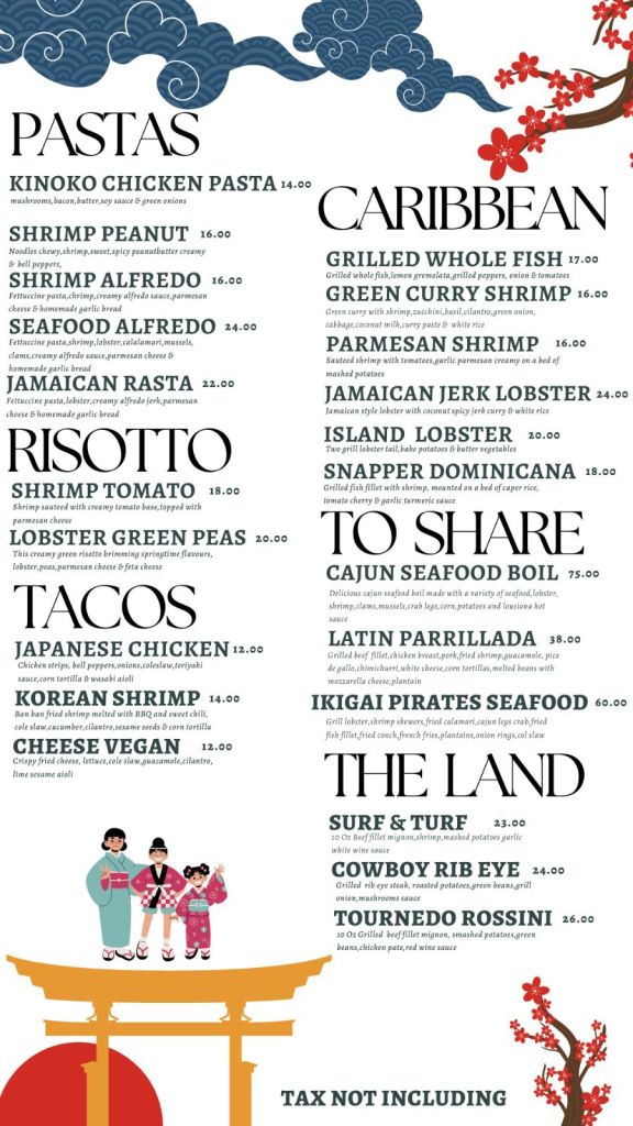
I don’t know about you, but I get excited just looking at the menu at Ikigai by Robby Molina in French Harbour. Between the risottos and pad thai dishes, Jamaican pasta and Korean and Japanese tacos, I don’t think I’ve been in a fusion restaurant this good in Atlanta or Dallas.
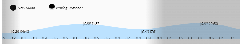
High and low tides continue to be mild.
Wind and Galaxy Wave forecast: We wake up to a 7 mph east breeze and seas 1-2 feet southside. Today looks like a quite calm day, except that squalls and quickly create gusty winds and stormy seas, so keep an eye open.
Tomorrow winds will generally be from the east 10-15 mph and seas 2-3 feet southside.
Sunday will be a bit breezier, with east winds 15-20 mph and seas around 3 feet southside.
Next week looks quite calm for the most part, so a great time to be on the sea if you can dodge the showers.
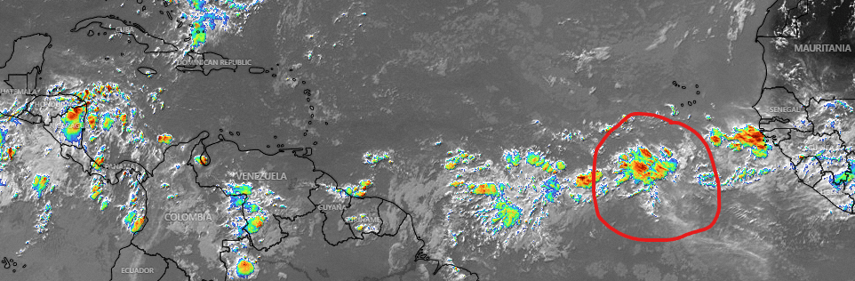
I wanted to say something very briefly. There is a tropical wave coming off the west coast of Africa that all three computers (GFS, Euro and ICON) turn into a tropical storm/hurricane next week. The National Hurricane Center hasn’t identified it yet, but all three models have it going well north of us. We will keep an eye on it.
