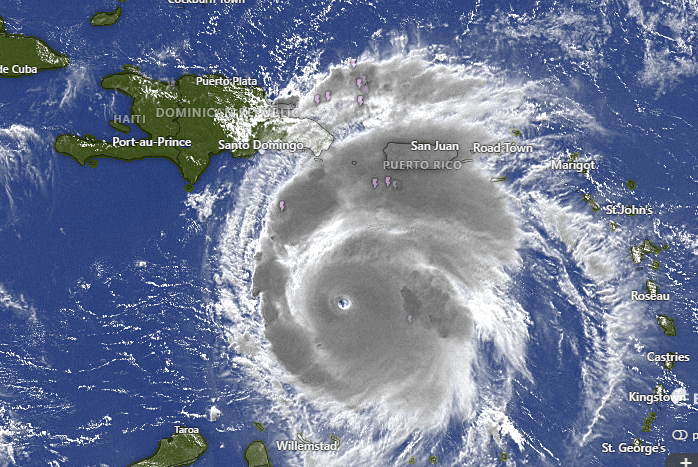
Good morning Bay Islands. We are at a very strange moment in our relationship with Hurricane Beryl. It is a Category 5 monster south of Puerto Rico, heading into our section of the Western Caribbean, but it is also forecast to go north of us and weaken considerably.
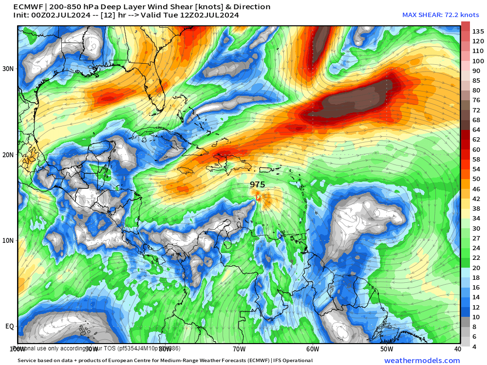
In a lot of ways it is hard to believe the forecasts of weakening, but the reason has to do with this map. There is a solid line of wind shear (winds blowing the opposite direction) that promise to try to tear this storm apart. Can it beat back the shear? Maybe.
As it stands, here are the headlines for us.
- Any effects on us should come overnight Thursday into early Friday morning.
- The main effects should be some scattered showers Thursday night, mild westerly winds and seas on the north and west sides around 5-6 feet.
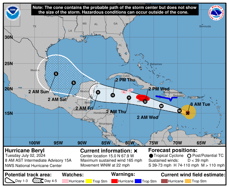
Here is the current forecast cone. We are safely south of it. We currently have a 20 percent chance of seeing tropical storm force winds (39 mph) and only a 2 percent chance of hurricane force (74 mph).
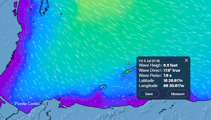
This is the Euro wave map for around 7 a.m. Friday. This would be the time of the first ferry to the mainland and we’re seeing 6-7 foot waves north side, so there is a real possibility the morning ferries are canceled that day. I would imagine most flights except the ones to Belize can make it, they will just have to fly around the storm.
The potential storm behind Beryl no longer looks like it will make it to a tropical system. It MAY bring us a better chance of rain on Sunday.

This morning a storm has brought about a half inch to Guanaja. It doesn’t look like it has a lot of juice left, so we will keep a small chance of rain this morning, but it isn’t likely. Rain chance will remain fairly low until we get to Thursday night Friday morning, and even then we may be disappointed. Right now the Euro is giving us about an inch.
Wind and Galaxy Wave forecast: Winds today will remain from the east around 20 mph and seas around 3 feet. Tomorrow they will be 10-15 mph and seas 2 feet, and winds will take a turn to the northeast in the afternoon. Thursday is the calm before the storm with northeast winds around 10 mph and seas around 2 feet northside.

We’re still hoping for some rain Friday morning, and there’s nothing that goes better on a cool, rainy day than stewing meat from Carniceria Rosita in a nice beef stew.
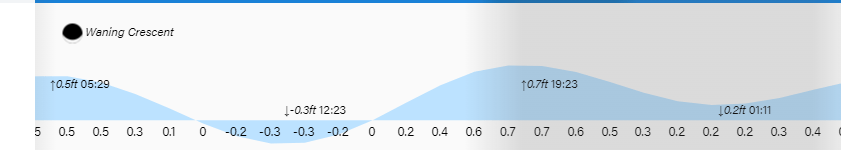
Low tide is 12:30 p.m. If you enjoy these forecasts, please support us at patreon.com/roatanweather and buymeacoffee.com/roatan.

My wife and I are flying into Roatan from Miami for the first time. It’s my wife’s 50th birthday and unfortunately I’m not a fan of flying. That being said, your factual, non sensationalist expertise has made me confident enough to fly into Roatan tomorrow. Thank you for providing such a wonderful service, I can’t tell you how much it’s appreciated. Without your brilliant information, I would’ve been tempted to avoid the flight to Roatan. For what it’s worth, I can’t respect you enough for providing such brilliant information. Thank you sir.
LikeLike