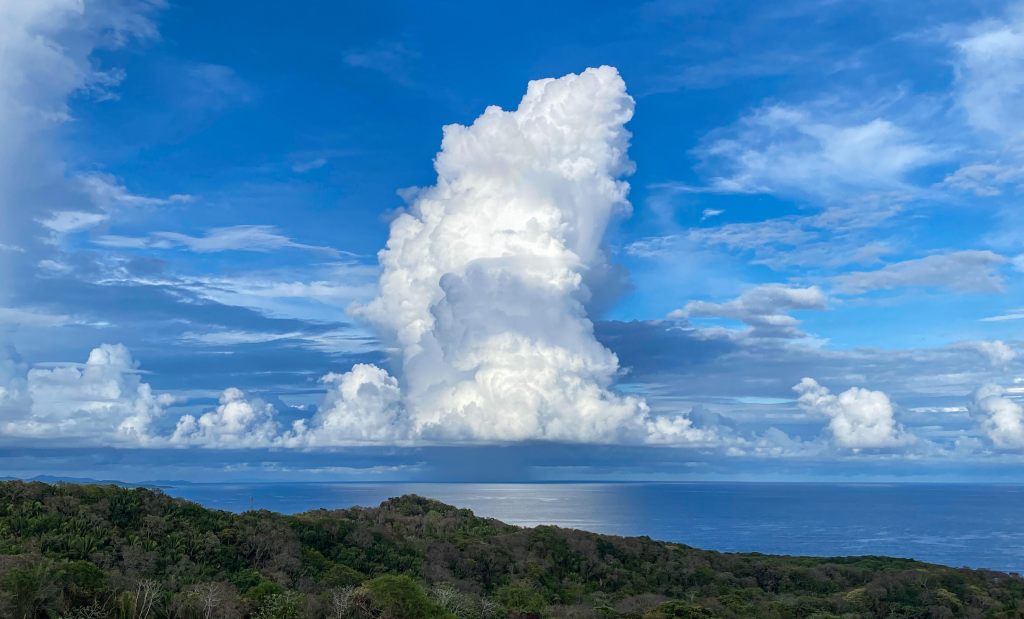
Good morning Bay Islands. Our photo of they day comes from Ignacio Zapata, taken from a window at Arihini Tower on West Bay Road. It shows a classic cumulus cloud along with the downpour underneath. We had some of these downpours yesterday as our tropical wave passed over. We should have decreasing clouds today as the wave moves over the Yucatan.
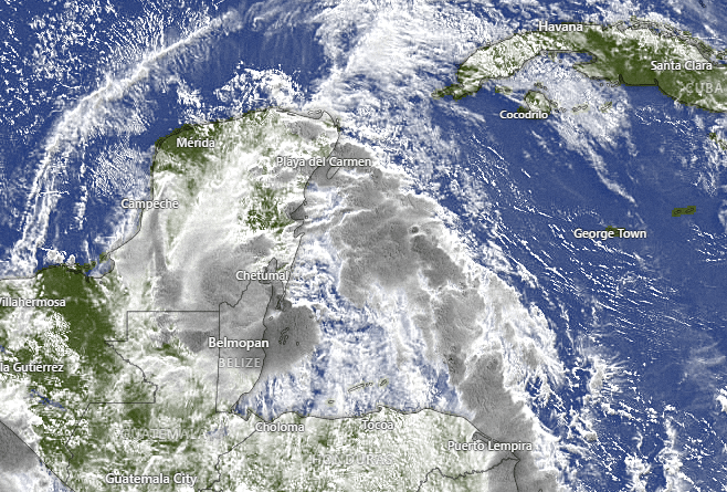
Here is the satellite view this morning. We have clouds over our islands and possibly a few sprinkles here or there, but as the day goes along we should see fewer clouds, more sun, and very little threat of rain midday into the afternoon. Tomorrow and Monday looks mostly dry as well.
Wind and Galaxy Wave forecast: The east end of the island woke up to 20 mph southeast winds and 3 foot seas. The west end of the island is around 10 mph and Utila has light west winds, but we should all see 20-25 mph east winds by afternoon and south side seas 3-4 feet. Those winds will continue into tomorrow. Monday east winds will be 15-20 mph and seas still around 3 feet.
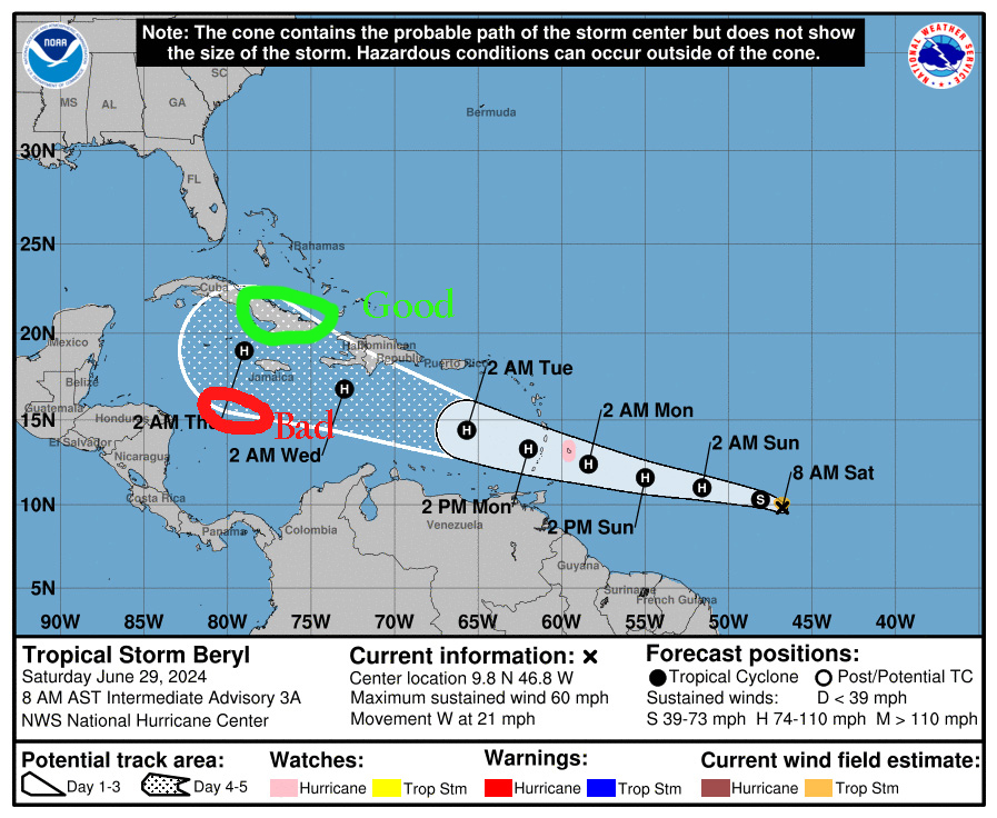
Here’s the latest map for Tropical Storm Beryl. Keep in mind the cone (the white area and the area with white dots) is the possible future CENTER of the storm, not the size of the storm. If the storm center is on the southern side of this cone, it is bad for us. If the center is on the northern side of the cone, it will be good for us, and possibly we might not have any effects at all.
Another thing to keep in mind is that the projections say “H” for hurricane and not “M” for major hurricane. That means right now it is forecast to have winds less than 110 mph near the eye. 70-100 mph can still do a lot of damage, though.
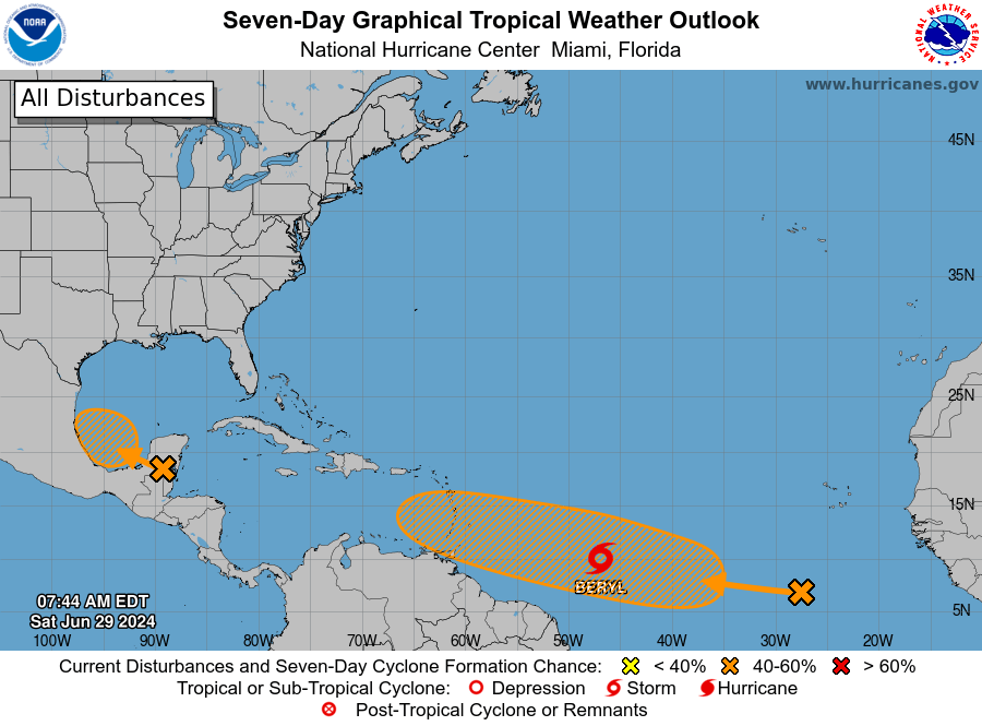
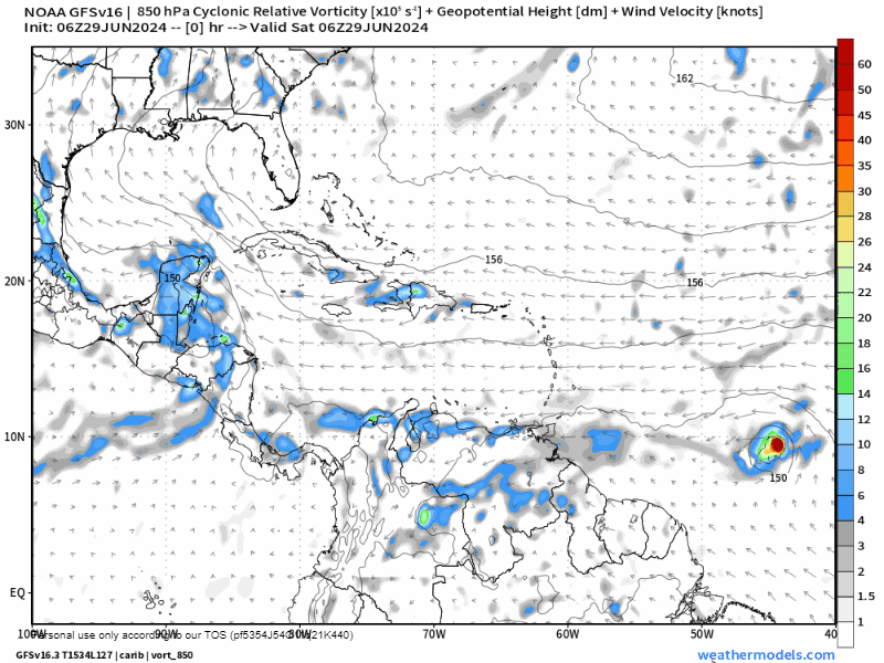
One thing to keep in mind is that there is a storm behind Beryl and that could also prove to be a threat to us. As you look at the predicted paths, you will see this second storm following it and perhaps becoming as strong or stronger than Beryl.
Here is the GFS forecast and it continues to be the best for us, pushing the storm south of Cuba, but I will also say the trend on the GFS is to the south, because yesterday it was forecasting the storm to go into Cuba.
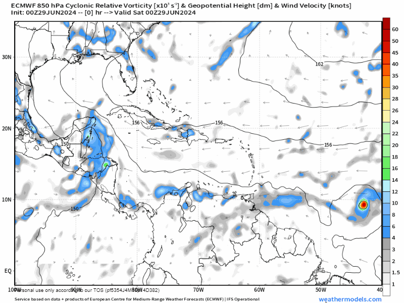
Here is the Euro which forecasts the storm to come in a bad place for us, between us and the mainland. The reason who this is bad for us, is that the northern half of a storm is the stronger half, so this is perhaps the worst possible path for a hurricane as far as the Bay Islands are concerned.
Here is the German ICON. It has Beryl passing to our north, but is also interesting because it grows the second storm into a strong hurricane that could threaten us late next weekend.

I often get questions about whether flights or ferries will happen and I can tell you that your safety is a priority for the airlines and for Galaxy Wave. Decisions will be made on a daily basis based on the position of the storm and the height of the seas between here and your destination. There will be no reason to worry until around Thursday and we will know more about this storm early next week.
Please continue to monitor this situation, but don’t panic. We will know much more as we get to Monday.
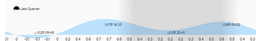
Low tide is 9:45 a.m. Have a great weekend!

Thank you for this great info. Thanks, RoatanBeachRentals.com at The Sanctuary in Sandy Bay Roatan
LikeLike