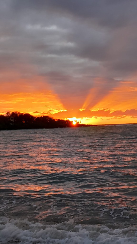
Good morning Bay Islands. Our photo of the day comes from Dian Lynn and was taken from Sundowner’s in West End. We got a little rain yesterday evening, especially in West Bay, which picked up .13 of an inch around 5:30. We’re not seeing as much rain as we hoped for this morning.
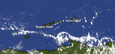
On our satellite we see some popcorns clouds, especially north of Puerto Castillo and Trujillo and a few near Utila. Our station in Utila picked up .01 of an inch this morning. All of this is moving west, but there’s not a whole lot to our east.
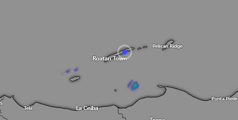
Here is the radar image showing that shower just north of the mainland moving to the west. We will keep a small chance of a passing shower, especially this morning.
For the next week or so, we will continue to only have very small chances of a passing shower, but the long-range forecast shows more moisture in the atmosphere midweek next week and a bit of a higher chance of a shower. Let’s hope so.
Wind and Galaxy Wave forecast: We have been holding steady with east winds at 10-15 mph and seas 2-3 feet. That will continue until Friday night, when our winds pick up to 25-30 mph. Saturday night and Sunday night also look windy, after which next week we should be back to mostly 15 mph east winds.
I have been planning to go to Guanaja, but my accommodations fell through. I’d still like to go. I thought I would throw it out there that if you know of a reasonably-priced place in Guanaja for a few days in early May let me know. Also I would need to know how best to get between the accommodations and Bonacca Key. Thanks!
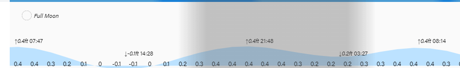
Low tide is 2:30 p.m. Have a great Wednesday!
