
Good morning Bay Islands. Our first photo of the day for 2024 is our last photo from Saturday’s storm. Thanks to Kelly Kosmin for sharing this monster waves from West End. Things are calmer now, though still choppy. We are in for some much drier weather in the week ahead.

Low temperatures were not as cool as yesterday morning. Most of us saw a low of 71 (21.7C). We will keep a northeast breeze 12-17 mph today and tomorrow giving us seas at 4-5 feet. Seas will be from the northeast and because our island runs southwest to northeast, that will keep us kind of choppy on both sides. Winds turn to the east on Wednesday, get calm on Thursday and get windy on Friday from the east.
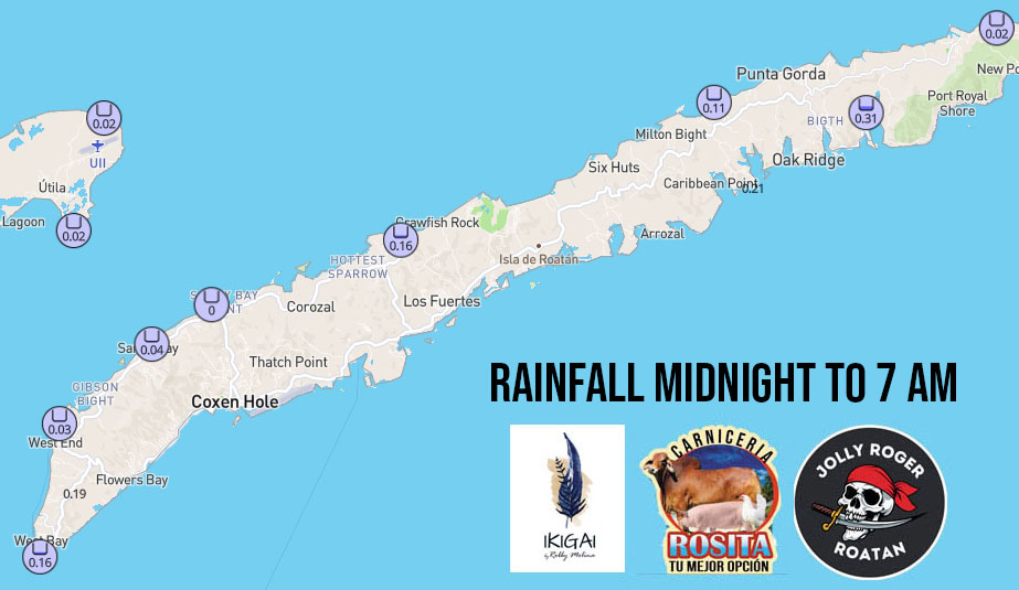
We picked up some light rainfall early this morning.
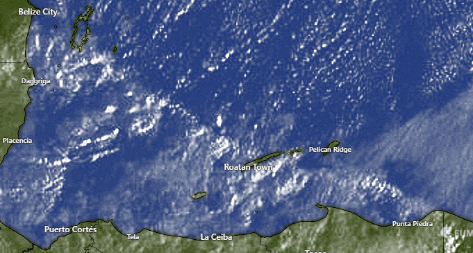
We have some clouds around that will give us a chance of rain this morning. This is actually the best chance of rain until Friday. Starting this afternoon and running through tomorrow and Wednesday rain chances are very low. Thursday we’ll have some scattered showers and Friday and Saturday look dry.

Here is what January looks like on our new Roatan Weather calendar. Average high is 82 (27.7C) and average low is 73 (23C) and average rainfall is 11 inches. Several of you have already reserved your copy and I’ll be in touch about delivery. They should be printed tomorrow. If you want to reserve yours, please message me or if you’re in the States or Canada go to http://tinyurl.com/roatanweather
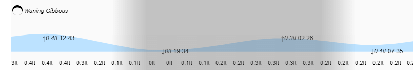
High tides continue to be quite low. Low tides are 7:30 p.m. and 7:30 a.m.
In my video forecast I talk about why we’re going to get some strong east winds end of this week into next week and why we can look for drier weather. Also see a really big wave at West End from Saturday’s storm. Have a great week and a great 2024!
