Dec. 23, 2022: Good morning, Roatan. Trying to forecast what the weather will be in a few days is difficult. But guess what? Knowing what the weather is right now is also difficult. Our current cold front illustrates that point. It is important to know how strong it is right now to know how strong it might be when (and if) it reaches us. And the fact is we don’t know exactly how strong it is right now. To illustrate, I am posting the current wind conditions from three different weather models:
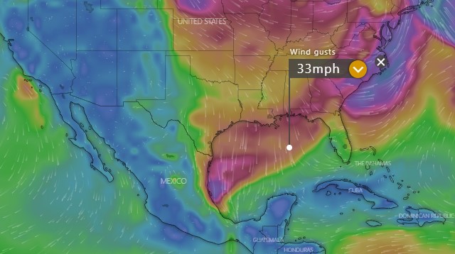
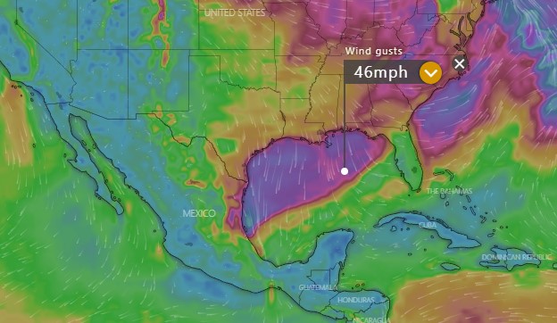
Notice how at the same location in the Gulf of Mexico, there is a 10 mph difference in how strong these models believe the winds is RIGHT NOW! That has big implications for how strong the winds will be when they get here. As you probably know, cold front weaken the further south they go. That is why it is never much below 65 (18C) degrees here. Notice how big a difference that makes in our winds when the front arrives Monday morning.
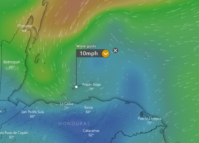
Note that the GFS has the front basically stalling to our north on Monday morning and bringing us only wind gusts of 10 mph, really a pretty calm day. There is some wind to our north which would probably give the north side seas of 2-3 feet (.6-1 meters), but definitely nothing out of the ordinary.
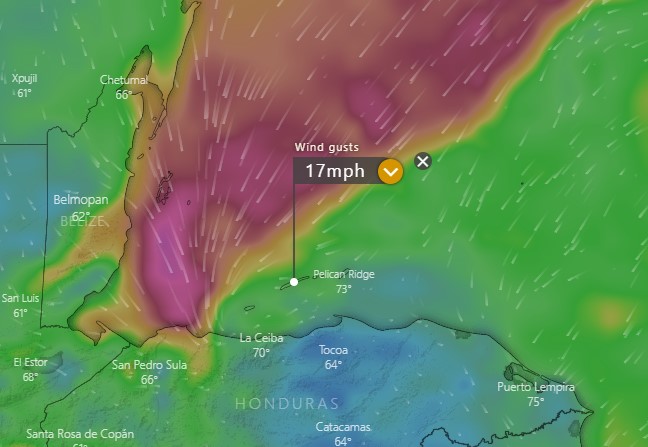
The Euro shows the front stalling just barely to our north, which brings a little gustier winds here at 17 mph, but also brings the winds closer, giving the north side heavier seas, probably around 5 feet (1.6 meters) if this were to happen.
The ICON gets the cold front all the way here, with gusts near 30 mph. This would probably also mean much cooler temperatures and heavier rain for us, if this were to happen.
So there you have three scenarios. The GFS and the Euro are generally the most reliable models and they have been showing the front weakening more, so if I had to lean one way, I’d say this norther will probably not be as bad as we thought it might be. I’ll do the best I can to post a forecast in the next posting.
