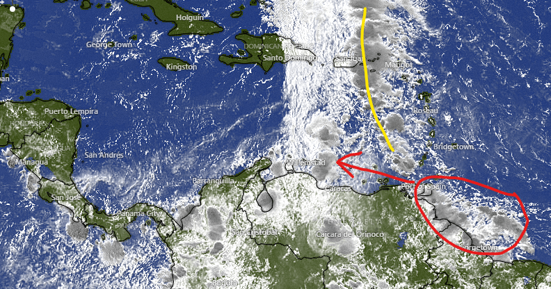
On our satellite this morning, we can see tropical moisture in a familiar place, off the coast of northern South America, very similar to where Hurricane Ian and so many other hurricanes we have to worry about come from. This time there is a front drawn in yellow that these storms are going to merge with. Most computers show this storm gathering strength and moving west along the northern coast of South America. By Monday it should be entering the eastern Caribbean. By then we will have a better idea as to how strong and where this storm is heading. If it effects us, Tuesday and Wednesday of next week are the days to worry about. Again, nothing is certain, but there is a growing belief that some sort of tropical storm or hurricane will be entering the Caribbean by the end of this weekend. The US GFS that yesterday said it would turn north, now has it heading generally toward Nicaragua and Honduras. As always we need to remain watchful.

