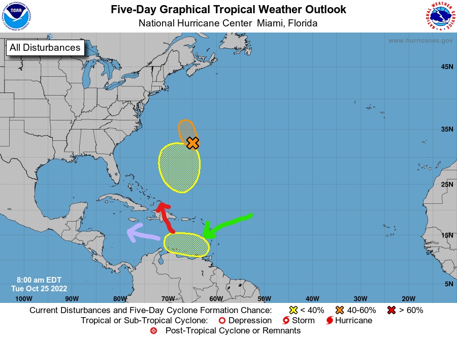
The National Hurricane Center has marked out an area where tropical development is possible off the north coast of Venezuela, shown by the green arrow. There is a lot of disagreement among the computers as to what will happen with this system, or if anything at all will happen. The US GFS shows rapid development, but also a strong turn to the north, shown by the red arrow. The European and Canadian models show movement more to the west, shown by the pink arrow, but the Euro doesn’t show it developing much, and only bringing us showers the middle of next week, while the Canadian shows it forming into a storm through the Caribbean. If we get any effects from this, it will be about a week from now, and nothing is certain. We will keep an eye on it.