Sept. 26, 2022: Want to see the birth of a hurricane? It happened last night just northeast of us. This morning we awoke to Hurricane Ian. It life expectancy is less than a week, but it will probably do a lot of damage in that week. Fortunately for us we are very much out of the way and only going to get side effects.
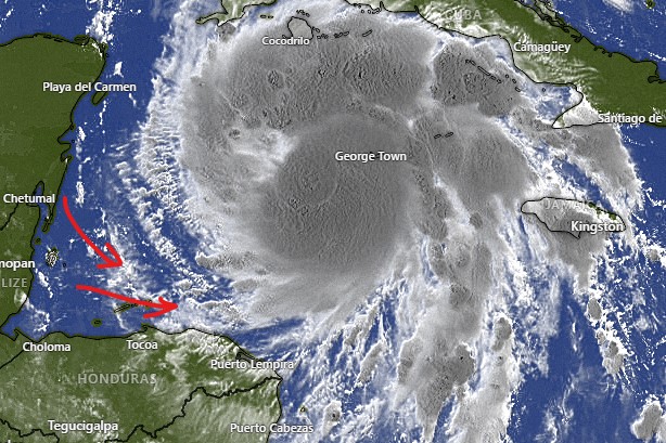
In this satellite image from 6:30 a.m., you can see we are getting some of the very outer bands from Ian. Radar indicates there are a few showers in these bands, but nothing heavy. We will keep a chance of rain in the forecast this morning. This afternoon and overnight looks mostly clear, with a chance of a morning shower tomorrow. We were forecast to get 10-15 mph westerlies today. That hasn’t happened and I don’t expect it will. Winds will remain relatively calm with seas at 1 foot.
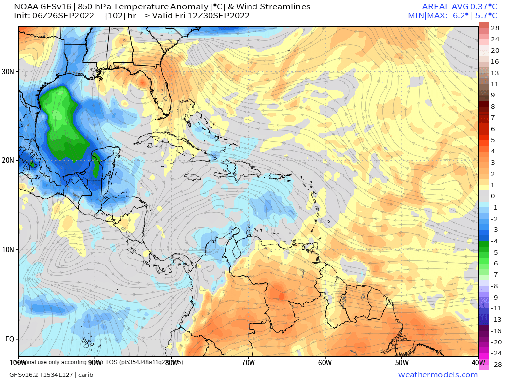
The real effect for us comes Thursday into Friday. This map shows temperature anomalies (how different the temperature is from what it should be this time of year) for Thursday night/Friday morning. You can see cool air invading the western Gulf of Mexico and making it down here, giving us temperature 3-4 degrees below normal. That is pretty significant for Roatan, because our temperature doesn’t change much. This will feel quite cool.
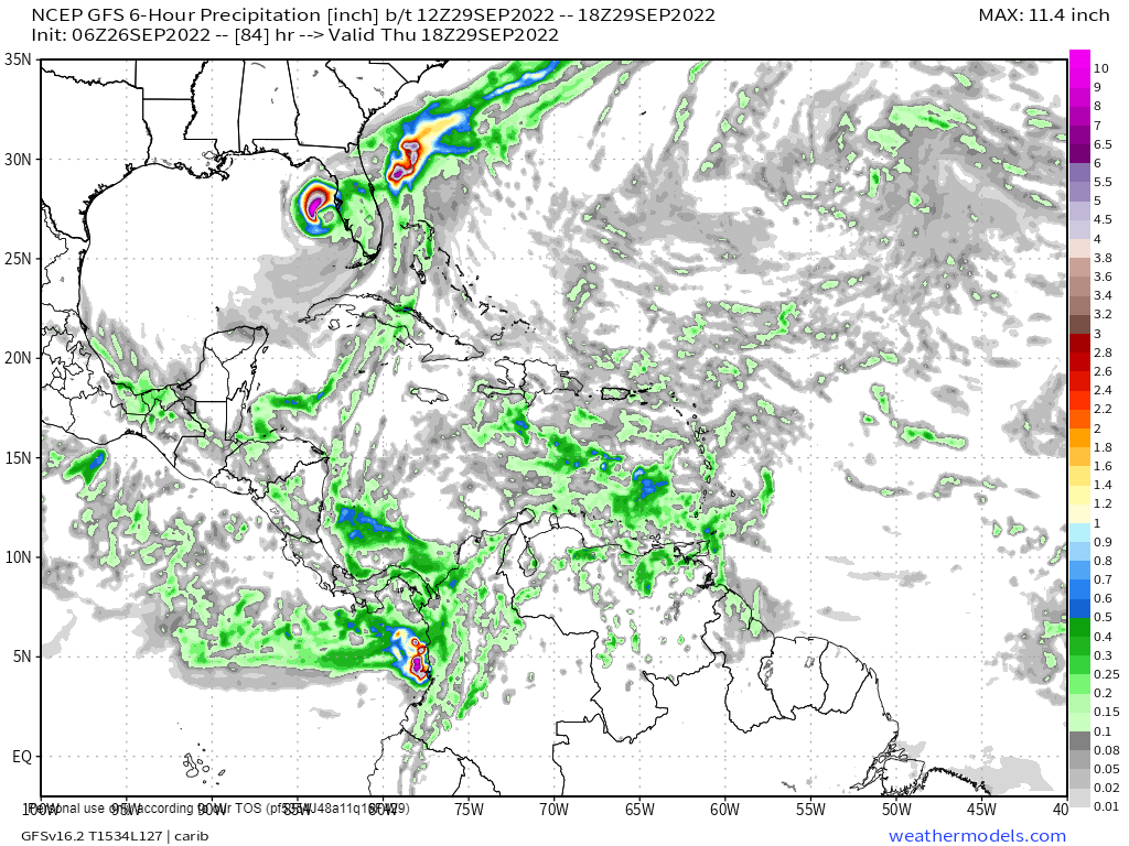
We should also get waves of showers. In this map forecasting early Thursday morning, you can see how Ian look like he has a tail, the trails rain across Cuba and down toward us. That is the result of northerly winds pulled down on the west side of the storm. So we still have a fairly windy, rainy and cool forecast Thursday into Friday. There is also a concern about high surf these days on the north side. Have a great week!
